Georgia’s outline connects the Appalachian mountains with the Atlantic coast, but Atlanta alone does not explain the state. Understanding the difference between its physical regions, cities and statistical boundaries gives a clearer picture than a list of familiar names.
One state, from the Appalachians to the Atlantic
Georgia is a state in the southeastern United States, with Atlanta as its capital and an Atlantic coastline. Its landscapes range from Appalachian mountain country through the rolling Piedmont to the Coastal Plain. It is a different place from Georgia, the sovereign country in the South Caucasus.
How to use this article: Start with the five physical regions, separate city from metropolitan population, or check what the state figures measure.
1. Where Georgia sits in the United States
Georgia borders Tennessee and North Carolina to the north, South Carolina to the northeast, Florida to the south and Alabama to the west. Its southeastern edge faces the Atlantic Ocean. The postal abbreviation is GA; Atlanta is the state capital. The U.S. states map places it within the wider national picture.
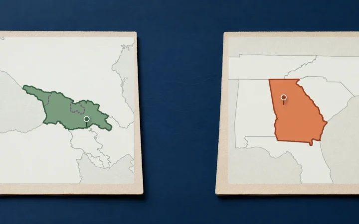
The shared name can be misleading in a search, an address or a map label. Georgia here is part of the United States, not the independent country whose capital is Tbilisi. For the side-by-side distinction, see Georgia country versus Georgia state. That comparison answers the naming question; this profile focuses on the American state.
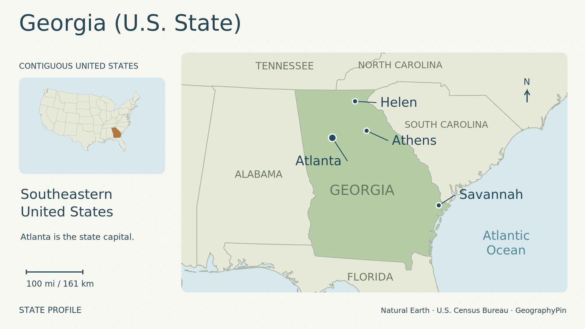
This locator shows the state and selected cities, not physical-region or municipal boundaries. Enlarge map.
Georgia’s government has executive, legislative and judicial branches. The General Assembly contains a Senate and House of Representatives; it makes state laws and determines the operating budget. The governor leads the executive branch, while the Supreme Court of Georgia and Court of Appeals are the state’s appellate courts. This is state government within the federal United States, not the government of a separate country.
2. Five regions, from mountain ridges to coastal lowlands
The five provinces explain the changing terrain
University of Georgia researchers distinguish five physiographic provinces, meaning broad areas with related landforms and geological character. They are not five administrative districts.
- Appalachian Plateau: also called the Cumberland Plateau, this occupies the far northwest, including Lookout Mountain.
- Ridge and Valley: much of the northwest has long, roughly parallel ridges and intervening valleys shaped by folded and faulted rocks.
- Blue Ridge: northeastern Georgia contains the state’s highest mountain country.
- Piedmont: rolling hills form a transition between the mountains and the lower country to the south.
- Coastal Plain: below the Fall Line, lower terrain includes gently rolling areas, flatwoods and wetlands such as the Okefenokee Swamp.
Georgia’s highest point is Brasstown Bald, at 4,784 feet (about 1,458 meters). The contrast with sea level on the coast helps explain why “Georgia landscape” cannot mean a single kind of terrain. The Fall Line separates the Piedmont from the Coastal Plain, rather than marking a state or county border.
Elevation changes the climate as well as the view
Long, hot, humid summers and generally short, mild winters characterize much of Georgia, but elevation creates substantial differences. The 2025 state climate summary reports cooler summers in the Appalachian mountains than in low-elevation places such as Macon and Columbus. Winter cold spells interrupt the mild periods; mountain conditions are not interchangeable with the coast.
Rain falls throughout the year. Using 1991–2020 averages, the climate summary places annual precipitation above 70 inches (178 centimeters) in the mountainous northeast and below 45 inches (114 centimeters) in some central areas. Abundant average rainfall does not eliminate drought: extended dry spells and heat can still strain water supplies. Coastal flooding presents a different problem, intensified by rising sea levels.
3. Atlanta and the roles of other Georgia cities
Atlanta city is not the whole metropolitan area
Atlanta combines its role as state capital with major air-cargo and distribution connections. Its wider metropolitan area extends beyond the city’s own limits: metropolitan population, city population and the statewide total should not be used interchangeably.
Savannah’s port gives the eastern side of Georgia an international trading role. Garden City Terminal handles containerized cargo, from consumer products to food and manufactured goods. Its connections with I-16, I-95 and on-terminal rail link ships with inland markets. The port is therefore more than a waterfront landmark: it is a working connection between the coast and production and distribution farther inland.
Athens has a different institutional anchor: the University of Georgia. Chartered in 1785, the university selected its site beside the Oconee River in 1801. Its teaching, research and public-service work connects the city with the rest of the state through activities including cooperative extension and experiment stations. The charter date and the establishment of the campus are distinct milestones.
In the northern mountains, Helen illustrates a different city role: a small Chattahoochee River municipality whose Alpine-style business district supports a tourism economy.
Augusta lies in east-central Georgia beside the Savannah River, across from South Carolina’s Aiken County. Established as a colonial trading outpost in 1736, it remains a regional center with medicine, manufacturing and military activity. The river gives Augusta a cross-border setting: its surrounding region includes communities in both Georgia and South Carolina.
The state also contains consolidated local governments. The Census Bureau’s geographic guide describes examples involving Athens and Clarke County, Augusta and Richmond County, and Columbus and Muscogee County. These combined administrations do not make every statistical label interchangeable.
4. A history shaped by land, labor and civil rights
Georgia’s history begins long before its colonial name. Archaeological evidence includes ancient settlements, farming communities and mound-building societies; sites at Etowah and Ocmulgee are part of that longer record. Indigenous societies were not simply a preface to European settlement, and the later expansion of the state came at their expense.
The British colony was established in 1732, with settlement at Savannah in 1733. Those dates describe different events, not competing answers to the same question. Georgia was the last of the thirteen colonies to be founded.
After independence, Georgia ratified the U.S. Constitution on January 2, 1788, becoming the fourth state. Its early claims extended much farther west than today’s boundary. The 1802 cession of those western claims helped establish the state’s generally present-day extent.
Growth also involved forced displacement. Beginning in 1838, U.S. troops and state militia removed Cherokee people from homelands across Georgia and neighboring states. The Trail of Tears brought devastating losses, with relocation continuing into 1839.
Plantation agriculture expanded under slavery, while railroads connected inland towns with markets. Georgia seceded from the Union on January 19, 1861, and became part of the Confederacy. The Civil War brought fighting and destruction within the state, including Sherman’s 1864 March to the Sea.
Reconstruction concerned both the return of former Confederate states to the United States and the rights of formerly enslaved people. The Thirteenth, Fourteenth and Fifteenth Amendments transformed the constitutional framework through abolition, citizenship and equal protection, and voting protections. Those promises did not prevent the later imposition of discriminatory laws and the exclusion of Black Americans from political power.
The twentieth-century civil rights movement challenged that exclusion. Martin Luther King Jr., born in Atlanta in 1929, became a leading figure in nonviolent campaigns against segregation and discrimination. His work linked Georgia’s history to a national struggle whose effects cannot be understood solely through changes in population or industrial growth.
5. People, coastal culture and a connected economy
The Census Bureau estimated 11,302,748 residents on July 1, 2025. That statewide estimate is different from the April 1, 2020 census count of 10,711,908. Both are useful, but they describe different dates and methods; neither is a live population counter.
Population figures describe residents, not one shared background. The 2020–2024 American Community Survey estimated that 11.2% of Georgia’s residents were foreign-born. This is a birthplace measure, not a count of noncitizens. The same survey period is different from the single-date July 2025 population estimate.
Transport helps explain how the state’s economy works across regions. Georgia’s economic-development agency identifies the ports at Savannah and Brunswick, Atlanta’s air-cargo connections, and road and rail networks as parts of its logistics system. These connect inland production and distribution with coastal shipping rather than operating as separate economic worlds.
Agriculture and food processing remain part of that picture, with peanuts and poultry among the important examples. Growing food is only one stage: processing, storage and movement to markets connect farms with industrial facilities and transport networks. Georgia’s economic-development agency treats those activities as linked sectors.
Coastal Georgia also has a cultural geography that extends beyond state lines. Gullah Geechee communities descend from Africans enslaved on southeastern coastal plantations. Language, storytelling, foodways, basketry and the ring shout are among the traditions maintained and adapted across generations. The heritage corridor includes coastal Georgia alongside parts of the Carolinas and Florida, reflecting a living regional culture rather than a category that describes all Georgians.
6. State government and dated reference facts
Population, land area and the serving governor
| Item | Reference |
|---|---|
| Capital | Atlanta |
| Statehood | January 2, 1788; fourth state |
| Counties | 159 |
| Population estimate | 11,302,748; July 1, 2025, Vintage 2025 |
| Land area | 57,717 square miles (149,486 square kilometers), rounded; 2020 Census measurement |
| Governor | Brian P. Kemp; verified November 18, 2026 |
The area shown is land only, not land and water combined. Using that label prevents an apparently precise comparison from mixing incompatible measurements. A state’s mapped outline, land area and total area are related, but they are not interchangeable quantities.
Brian P. Kemp is the serving governor at the November 18, 2026 check. Georgia’s governor is elected for a four-year term, with a limit of two consecutive terms. Other executive offices, including secretary of state, attorney general and state school superintendent, are also elected.
For sights, overnight bases, routes and transport, use the Georgia (U.S. State) travel guide. This profile provides the geographic background; the guide helps turn it into a practical trip.
What Did We Learn Today?
Georgia is easier to understand when its political boundary, physical regions and settlement patterns are read separately. Atlanta is its capital, not a substitute for the whole state. The five-region landscape, the history of displacement and civil rights, and the connections between farms, cities and ports explain more than a list of attractions. Dated, clearly labeled figures keep that picture accurate.
Sources & Data Notes
View reference sources and measurement notes
Population is the July 1, 2025 Census Bureau estimate, Vintage 2025; land area uses the 2020 measurement of 57,716.96 square miles, rounded with its metric conversion. The foreign-born figure is an ACS 2020–2024 estimate. Governor checked November 18, 2026. Older geographic references support stable history and landforms, not current municipal counts or economic rankings.
- U.S. Census Bureau: Georgia QuickFacts
- U.S. Census Bureau: Georgia geographic reference
- University of Georgia: physical-region overview
- Georgia.gov: Brian Kemp
- Library of Congress: Georgia state resource guide
- National Park Service: Trail of Tears history
- Georgia DOT: cultural history of Georgia
- National Park Service: Reconstruction overview
- National Park Service: Martin Luther King Jr.
- Georgia Department of Economic Development: logistics
- Georgia Department of Economic Development: agribusiness
- NCICS: 2025 Georgia State Climate Summary
- University of Georgia: history and statewide mission
- Augusta government: city history and setting
- Georgia Ports Authority: Garden City Terminal
- Georgia.gov: three branches of state government
- National Park Service: Gullah Geechee culture
- Original GeographyPin locator: Natural Earth v5.1.1 and 2026 U.S. Census Gazetteer, public-domain data. Generalized boundaries and representative place points; the scale applies to the main panel, not the inset.
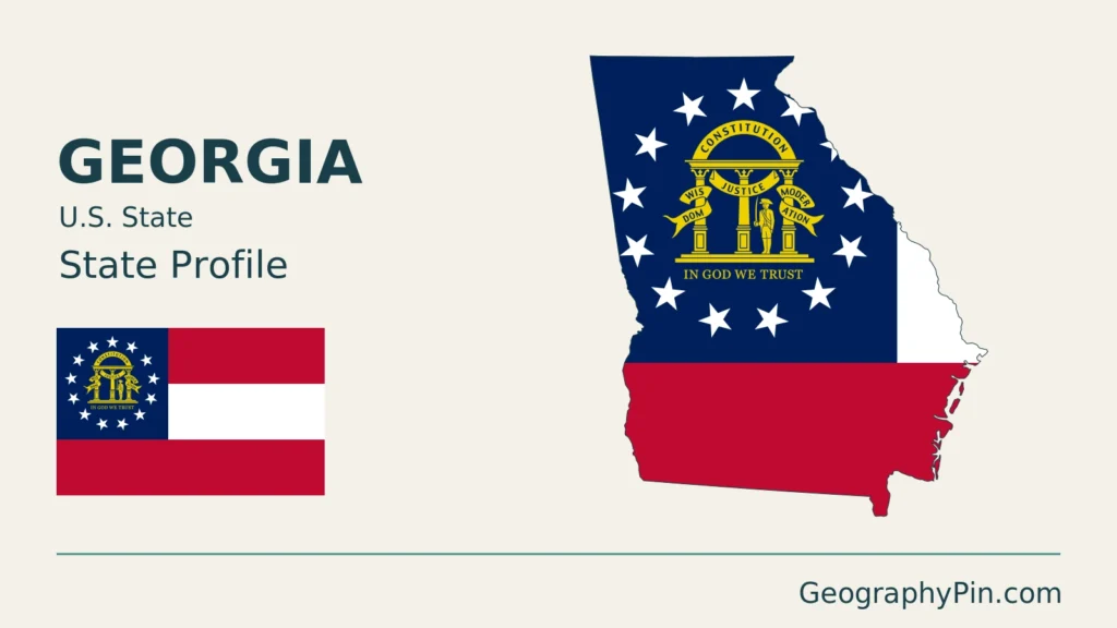
- Original GeographyPin cover using public-domain Natural Earth state geometry and the public-domain Xrmap Georgia state flag via Wikimedia Commons. The complete flag is shown beside a decorative flag-filled state outline.