Landforms & Water
What Is a Strait?
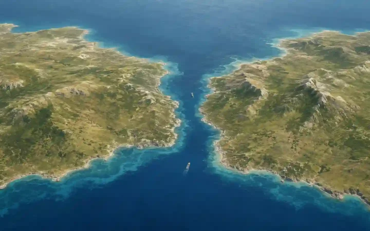
On a map, a strait can look like a thin gap in the land, but its geographic role is more specific than its shape. The key is not…
Learn geography
Rivers, lakes, seas, coasts, mountains, valleys, deserts, and more—concise explainers and case studies with maps, cross-sections, and quick facts.
On a map, a strait can look like a thin gap in the land, but its geographic role is more specific than its shape. The key is not…
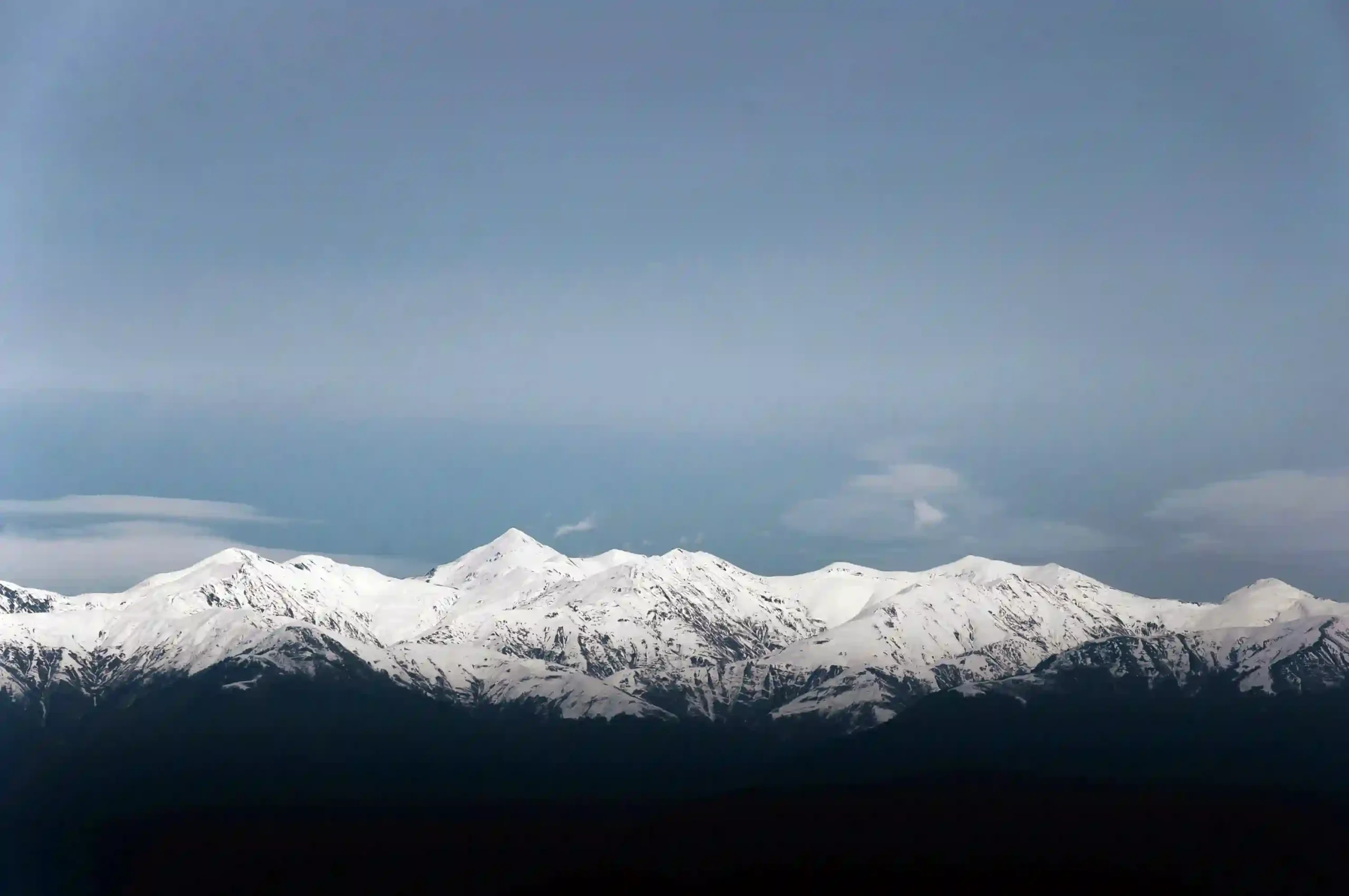
The Caucasus is one of those mountain regions many readers recognize immediately but place only vaguely. The usual confusion is not just about location; it is also about…
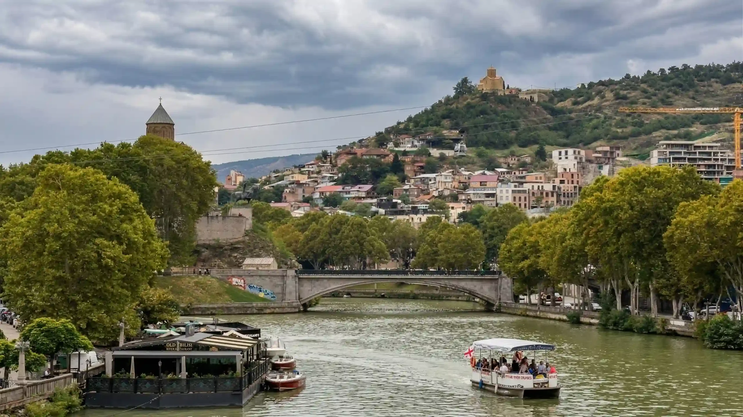
Many readers meet this river under two different names and assume they are looking at two different waterways. They are not. The confusion comes from language, mapping habits,…
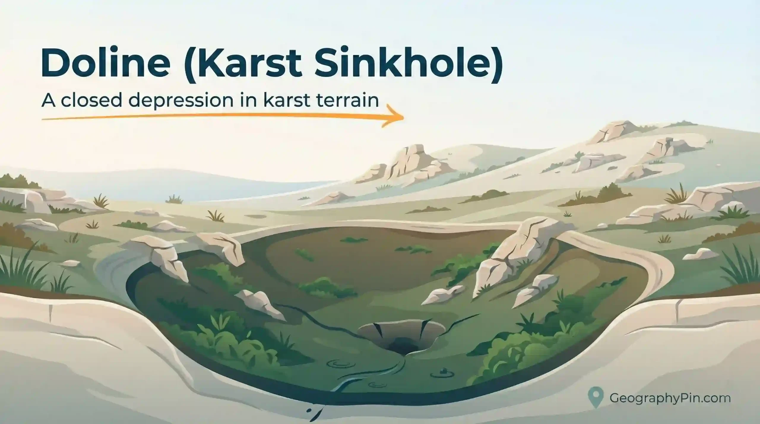
A doline (also seen as “dolina”) is one of the most recognizable features of karst terrain: a closed depression that pulls water inward and often sends it underground.…
A ventifact is one of the clearest “signatures” of wind erosion: a rock face worn smooth, faceted, or pitted by airborne sand. They’re common in dry, open landscapes…
A deflation hollow is a shallow ground depression formed when wind lifts and carries away loose sediment from the surface (a process called deflation). You’ll see them most…
Glacial erosion landforms are bedrock shapes carved by moving glacier ice. The trick is that ice erodes valley floors and walls at the same time, leaving signatures that…
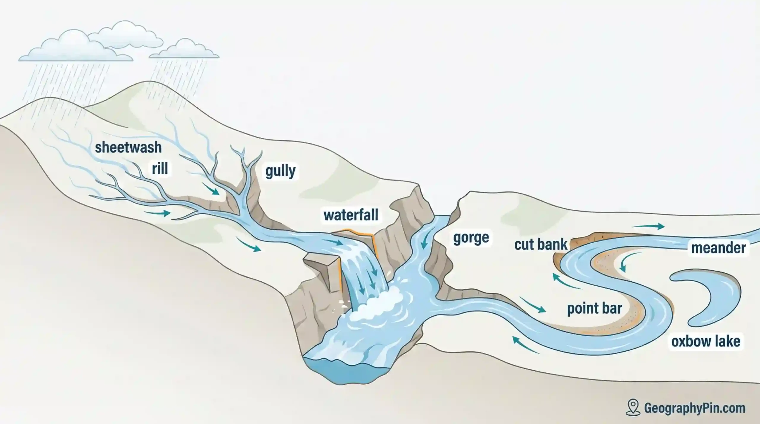
Water erosion landforms are the shapes made when moving water removes rock or soil and carries it away. Rivers carve valleys and gorges. Storm runoff cuts rills and…
Wind erosion landforms are the shapes left behind when moving air becomes a cutting tool—sand as sandpaper, dust as cargo, and bare ground as the workbench. This is…
A cliff face that looks freshly cut, a valley narrowed into a gorge, a desert ridge shaped like it’s been sanded into alignment—erosion leaves signatures you can read…