Geography is one of the broadest subjects people learn, which is exactly why it is so often misunderstood. Many readers think it starts and ends with maps, capitals, or place names, but the real subject is much wider: it explains how locations, landscapes, people, movement, and systems fit together.
A good geography answer does more than point to a place. It explains why that place looks the way it does, why people use it the way they do, and what changes because it is there rather than somewhere else.
Geography is the study of places, spatial patterns, and the relationships between people and environments. In plain terms, it asks where things are, why they are there, how places connect, and what those locations change in real life, from rivers and climate to cities, trade, transport, and risk.
How to use this article: If you want the shortest useful answer, start with the fast definition; if you want the core framework, jump to the three questions that define geography; if you want concrete examples, go to everyday geography; and if you want the boundaries of the subject, check what geography is and is not.
What Geography Means
At its core, geography turns location into explanation. It does not stop at saying that a mountain range, delta, city, port, or border exists. It asks why that feature is there, what surrounds it, how it connects to other places, and how its position changes what people can do.
That is why geography can cover such different topics without losing its identity. A river basin, a desert farming zone, a container port, a migration route, a suburban growth belt, and a flood-prone neighborhood may look unrelated at first glance, but geography links them through place, pattern, scale, and connection.
The shortest useful definition
Geography is the study of where things are, why they are there, and what that location changes. That one sentence is more useful than the old idea that geography is just maps or memorizing capitals, because it captures both the physical world and the human world at the same time.
More than maps, but not less than maps
Maps still matter. Geography would be impossible without them. But maps are not the whole subject; they are one of its main tools. Geography also deals with climate, landforms, water, ecosystems, population, culture, cities, borders, trade routes, hazards, and the way human decisions reshape landscapes over time.
Put simply, geography is not only about what a place is called. It is about how a place works.
The Questions at the Heart of Geography
The subject becomes much easier once you stop treating it as a pile of topics and start treating it as a way of thinking. Good geographers keep returning to a small set of questions, no matter whether they are studying a coastline, a city, a drought, or a transport network.
The three questions that define geography
- Where is it? Location matters. A place on a coast, a plateau, a river plain, or a mountain pass starts with different advantages and limits.
- Why is it there? Geography looks for causes: relief, climate, water access, transport links, soils, political decisions, trade networks, settlement history, and more.
- What does that location change? Once something is in a place, it has effects. A deep-water port can pull industry and trade toward it. A steep slope can shape road design, housing cost, and hazard risk. A dry climate can change crops, settlement density, and water policy.
These questions are what make geography so powerful. They turn a place name into a real explanation.
Five core ideas that keep appearing
| Idea | What it means in plain language | Simple example |
|---|---|---|
| Place | The character of a location | A coastal city and an inland desert town do not work the same way |
| Space | How things are arranged across the surface of Earth | Population may cluster near roads, rivers, and jobs |
| Scale | The level at which you study a problem | Flood risk can look different at neighborhood, city, and river-basin scale |
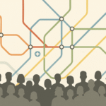
| Movement | The flow of people, goods, ideas, and water | Trade routes, migration, commuting, and shipping lanes |
| Human-environment interaction | How people shape environments and are shaped by them | Irrigation expands farming, but water limits still matter |
Main Branches of Geography
The easiest way to see the range of geography is to look at its main branches. These branches help organize the field, but in real places they often overlap. A wildfire, a drought, a port city, or a fast-growing suburb rarely belongs to just one box.
The main branches at a glance
| Branch | Main focus | Typical example |
|---|---|---|
| Physical geography | Landforms, climate, rivers, coasts, soils, ecosystems | Why a river cuts a valley, why a coastline erodes, or why a region is dry |
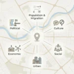
| Human geography | Population, migration, culture, economy, cities, politics | Why people cluster in one corridor, commute in certain patterns, or build dense urban regions |
| Environmental geography | Relationships between societies and environments | How farming, water use, forest loss, or flood control reshape a landscape |
| Geospatial science | Spatial data, mapping, measurement, location analysis | Using GIS and satellite imagery to map risk, access, land use, or change over time |

Why the branches overlap in real life
Take one floodplain. Physical geography studies rainfall, slope, soil, river behavior, and drainage. Human geography studies settlement, land value, infrastructure, and evacuation routes. Environmental geography studies how land use changes runoff and risk. Geospatial science maps the whole pattern so it can be measured and compared. One place, several lenses, one geography problem.
Where Geography Shows Up in Real Life
Geography matters because daily life is full of location-based decisions, whether people notice that or not. The subject becomes easier to respect once you see how often it appears in ordinary systems rather than only in classrooms or atlases.
Six everyday things that are geography
- Your weather app: Weather is not just time-based; it is place-based. Coastlines, elevation, wind patterns, and land cover all affect local conditions.
- Your delivery route: The fastest route depends on road networks, traffic patterns, distance, and how a city is laid out in space.
- House prices: Value changes by location, access, school catchments, views, hazard exposure, and transport connections.
- Flood and wildfire maps: Risk is never spread evenly. Slope, vegetation, drainage, building density, and infrastructure all change who is most exposed.
- Where ports and airports are built: Transport hubs work because of position, not only engineering. Access to sea lanes, hinterlands, roads, rail, and markets matters.
- How cities grow: New roads, ring roads, stations, and industrial zones can pull housing and business toward one side of a city while leaving another behind.
Why geography matters beyond school
Geography is one of the few subjects that naturally connects physical settings with human decisions. A drought is not only about rainfall. It can affect crops, migration, water prices, energy demand, and political pressure. A new highway is not only a transport project. It can change commuting time, land value, logistics corridors, and the shape of urban growth.
That is why geography is useful in planning, education, logistics, mapping, hazard management, environment work, and public policy. It teaches people to see that location is not background information. It is part of the explanation.
Tools and Methods of Modern Geography
Modern geography is much stronger than the stereotype of map-reading alone. Geographers use visual, digital, field-based, and analytical tools to compare places and measure spatial patterns more clearly.
How geographers read places
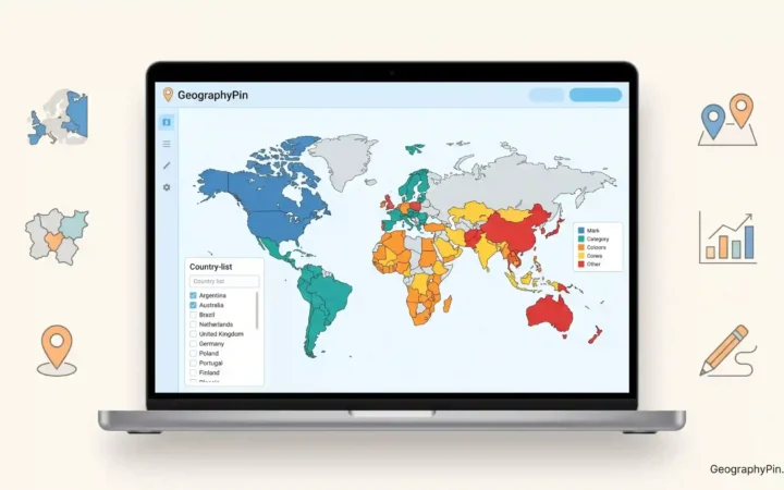
Maps and cartography remain the foundation because they show arrangement, distance, distribution, and relationship quickly. A good map can reveal a pattern that would stay hidden in plain text.
GIS, or geographic information systems, lets geographers stack layers such as roads, elevation, rainfall, land use, or population and then ask questions about overlap and access. That is how one can compare service gaps, hazard zones, or transport catchments with much more precision.
Remote sensing uses aircraft and satellites to track change across large areas. It is useful for land cover change, shoreline change, fire scars, crop patterns, snow cover, urban expansion, and other forms of surface change.
GPS and the broader family of GNSS systems help position people, vehicles, sensors, and observations accurately on Earth. These tools matter for navigation, surveying, logistics, emergency response, and field research.
Why scale changes the answer
One of the most important habits in geography is checking scale before jumping to conclusions. A housing problem may look local when you study one street, urban when you study commuting and transit, and national when you study wages, supply, and policy. The same issue can look different depending on whether you are looking at a neighborhood, a city, a region, or a whole country.
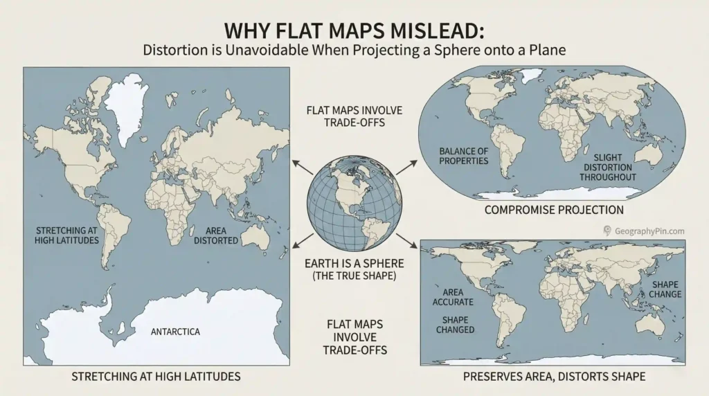
Why some maps can mislead
Maps are powerful, but they are not neutral mirrors of reality. A round Earth cannot be shown on a flat surface without distortion, so some maps stretch area, some alter shape, and some preserve certain properties at the expense of others. Part of geography is learning to read those choices instead of treating every map as equally truthful for every purpose.
Common Confusions: Geography, Geology, and History
Broad readers often understand parts of geography, but not the borders of the subject. That confusion is normal because geography sits close to several other disciplines. The cleanest fix is to compare their main lenses directly.
What geography is, and what it is not
Geography is not just memorizing places. It is not only physical landscapes, and it is not only human society either. It is the study of how places are structured, connected, used, changed, and experienced across Earth’s surface.
That means geography can overlap with geology, history, economics, environmental science, urban planning, and political science without being reduced to any one of them.
A quick comparison
| Subject | Main lens | Typical question |
|---|---|---|
| Geography | Place, space, pattern, scale, connection | Why is this here, how is it linked to other places, and what does that location change? |
| Geology | Earth materials and Earth processes | How did this rock, landform, fault, or crustal process form? |
| History | Time, sequence, cause through time | What happened, when did it happen, and how did events unfold? |
A Short History of Geographic Thinking
Geographic thinking is much older than satellites, GIS, and digital maps. People have long tried to describe routes, compare regions, measure Earth, and understand how landscapes shape movement and settlement. What changed over time was not the basic curiosity about place, but the precision of the tools and methods used to answer it.
| Period | What became stronger | Why it matters |
|---|---|---|
| Early geographic thought | Route knowledge, regional description, early measurement | Shows that geography began as a serious attempt to explain the world, not just name it |
| Age of navigation and mapping | Better maps, projection systems, wider world description | Made long-distance movement and comparison more reliable |
| Modern academic geography | Formal branches, fieldwork, regional and human analysis | Turned geography into a structured discipline in schools and universities |
| Digital and satellite era | GIS, Earth observation, spatial data analysis | Allowed geography to measure change, compare risk, and analyze patterns at much larger scale |
That long arc helps explain why geography feels both old and modern at once. Its main questions are ancient, but the tools for answering them are far sharper today.
FAQ
Is geography just memorizing maps, countries, and capitals?
No. That is only the surface layer. Geography is mainly about explaining locations, spatial patterns, environments, movement, and the way places connect to one another.
What is the difference between physical geography and human geography?
Physical geography studies natural systems such as landforms, climate, rivers, coasts, soils, and ecosystems. Human geography studies people, settlement, migration, culture, economy, politics, and the organization of space. Most real places involve both at once.
Why is geography important today?
Because modern life runs through location. Geography helps explain transport, risk, urban growth, resource use, environmental pressure, trade corridors, service access, and how physical settings affect human choices.
How is geography different from geology?
Geology focuses more narrowly on Earth materials, rock structure, and physical processes inside and on Earth. Geography is broader and is organized around place, pattern, scale, and connection across Earth’s surface.
What careers can geography lead to?
Geography can lead into GIS, cartography, urban and regional planning, teaching, logistics, environmental analysis, hazard assessment, transport analysis, remote sensing, and other work that depends on understanding space and location well.
What Did We Learn Today?
Geography is the study of where things are, why they are there, and what those locations change. It is wider than map memorization, stronger than a simple definition, and more practical than many people assume because it connects physical landscapes, human activity, and spatial decision-making in one clear framework.
Sources & Data Notes
This article was prepared with editorial review using standard educational and institutional references for geography, including materials on geographic concepts, mapping, Earth observation, and spatial analysis. Because this is a broad conceptual topic rather than a statistical profile, the article focuses on stable definitions and widely accepted explanations. AI assistance was limited to drafting support, structure cleanup, and language refinement.