This list brings together the 14 countries in Australia and Oceania and their capitals for quick reference. It keeps the country names and capital entries together, with notes on the places where an island, state or government district can be mistaken for a capital city.
The table covers the 14 United Nations member states within Oceania, using the UN’s M49 geographic grouping. Australia is included in Oceania under this convention. Territories and states outside UN membership are not counted. Most entries name a capital, but Naoero, formerly Nauru, has no official capital; its government offices are in Yaren District.
List of 14 Countries in Australia and Oceania and Their Capitals
This is an alphabetical reference list, not a ranking. The count combines the UN M49 Oceania grouping with the UN member-state list. M49 also includes other countries and areas, so it does not by itself provide a 14-country total. The Cook Islands and Niue are outside this membership-based selection; they should not simply be grouped with dependent territories.
The 14 entries comprise two countries in the Australia and New Zealand subregion, four in Melanesia, five in Micronesia and three in Polynesia. These are geographic groupings, not extra countries. Names and membership can change.
| Country | Capital or government seat |
|---|---|
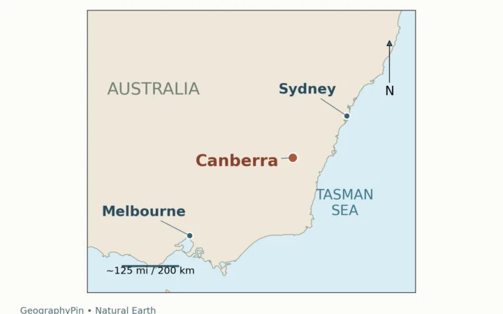
| Australia | Canberra |
| Federated States of Micronesia | Palikir |
| Fiji | Suva |
| Kiribati | South Tarawa |
| Marshall Islands | Majuro |
| Naoero (formerly Nauru) | No official capital; government offices in Yaren District |
| New Zealand | Wellington |
| Palau | Ngerulmud |
| Papua New Guinea | Port Moresby |
| Samoa | Apia |
| Solomon Islands | Honiara |
| Tonga | Nukuʻalofa |
| Tuvalu | Funafuti |
| Vanuatu | Port Vila |
The CSV download contains the same two fields as the table: country and capital or government seat. Keep the full Naoero entry when reusing the data, because shortening it to “Yaren” would lose the distinction explained below.
Capital Names That Need a Closer Look
Naoero, Nauru and Yaren District
Current government constitutional text and UN listings use Naoero. A September 2026 report from the President’s office describes the restoration of this name. The table retains “formerly Nauru” to help readers connect the current name with older maps and reference books.
The UN’s country overview explicitly states that Naoero has no official capital. Yaren is a district associated with government functions: the Department of Justice and Border Control gives its address as Government Building, Yaren District. This explains why many short capital lists use Yaren, but it should not be presented as a formally designated capital city.
Kiribati: South Tarawa
Kiribati’s Finance Ministry identifies South Tarawa as the capital. Some references use the broader name Tarawa. The table uses South Tarawa to be more precise; it does not substitute the name of one settlement for the wider capital area.
Palau: Ngerulmud in Melekeok State
Ngerulmud is Palau’s capital. The Australian Bureau of Meteorology’s Palau profile locates it in Melekeok State. Ngerulmud and Melekeok State therefore identify different geographic units.
Tuvalu: Funafuti Is an Atoll
Funafuti is Tuvalu’s capital. It is also an atoll, as the Australian government’s Tuvalu brief explains. Capital references do not always describe the same kind of geographic unit, so the list should not imply that every entry is a single city.
Explore Other Country and Capital Lists
What Did We Learn Today?
The 14-country total follows a specific rule: UN member states in the UN’s Oceania grouping. Naoero, formerly Nauru, is included, but it has no official capital; Yaren District houses government offices. South Tarawa, Ngerulmud and Funafuti remain useful capital names when their geographic context is clear. A reliable country-and-capital list therefore needs both a counting rule and enough detail to distinguish cities, states, atolls and seats of government.
Sources & Data Notes
The table combines UN membership with the UN M49 geographic grouping. Official government and UN references support the capital entries; some profiles are undated. English names and conventional spellings are used, with Nukuʻalofa’s glottal-stop character retained.
- UN M49 geographic groups and UN current-member list: inclusion method. M49 classifications are for statistical use, not determinations of sovereignty.
- UN in Micronesia: Naoero, government Constitution and Justice Department address: name, absence of an official capital and Yaren office location. The President’s office report of September 24, 2026 discusses the restored name; no legal effective date is asserted here.
- Australia and New Zealand: Australian Home Affairs; Te Ara, New Zealand’s government encyclopedia.
- Melanesia: Fiji’s embassy; Papua New Guinea’s National Capital District Commission; Solomon Islands’ Provincial Government Ministry; Vanuatu’s government.
- Micronesia: Australian DFAT profiles for the Federated States of Micronesia, Marshall Islands and Palau; Kiribati’s Finance Ministry. The Australian Bureau of Meteorology locates Ngerulmud in Melekeok State.
- Polynesia: Samoa Tourism Authority; Tonga’s government investment site; UNdata’s Tuvalu profile and DFAT’s Tuvalu brief, which identifies Funafuti as an atoll.
The CSV follows the table’s wording and membership scope. The existing featured photograph is a thematic image of a printed map, not the capital dataset.