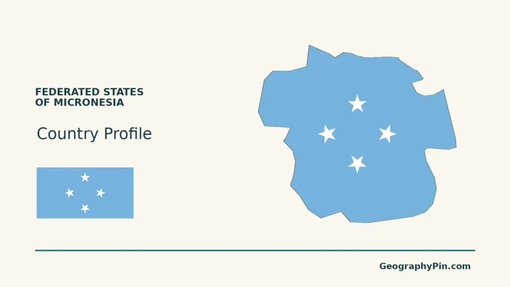
Micronesia names both a Pacific region and a country within it. The Federated States of Micronesia, or FSM, is the country: its four states are not four separate sovereign nations.
The Federated States of Micronesia is a sovereign Pacific country comprising Yap, Chuuk, Pohnpei and Kosrae. Palikir, on Pohnpei island, is its capital. Its scattered islands include hilly and mountainous land as well as low coral settings. FSM is only part of the wider Micronesia region, and free association with the United States does not make it a U.S. territory.
How to use this article: Locate the country on the map, read the physical map, explore seasonal climate, or check the population reference.
1. Locate the Country, Not the Whole Region
A federal country within the wider Micronesia region
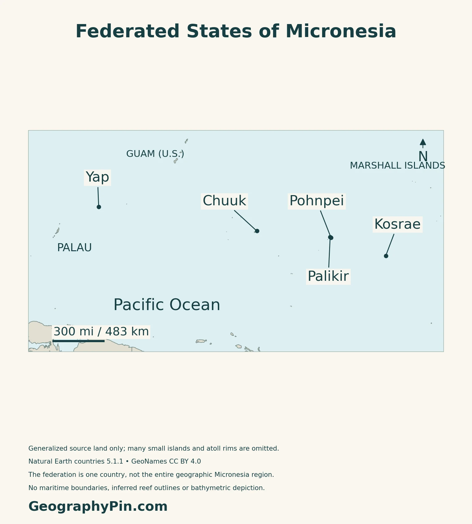
The Federated States of Micronesia, usually shortened to FSM, is a sovereign country in the western Pacific. It comprises four states, running broadly west to east: Yap, Chuuk, Pohnpei, and Kosrae. The country occupies part of the Caroline Islands; the wider geographic region called Micronesia also includes other countries and territories.
FSM is not a United States territory. Its relationship with the United States is governed by a Compact of Free Association. Updated economic and related agreements entered into force through an exchange of diplomatic notes in March 2024, while the country retained its own government and international relations.
Palikir and Kolonia have different roles
Palikir, on Pohnpei island, is the national capital and permanent seat of the federal government. Kolonia is a separate town on the same island and is identified by the FSM government as Pohnpei’s state capital.
2. Compare Four States and Their Island Settings
One federation, contrasting landforms
| State | Main physical setting | Reading the map |
|---|---|---|
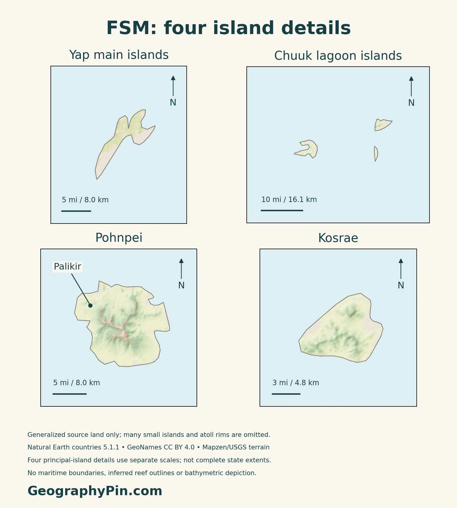
| Yap | Closely grouped hilly main islands, plus distant outer islands | The main group does not represent the whole state |
| Chuuk | Rugged islands within a lagoon, plus outer islands | Lagoon water is not continuous dry land |
| Pohnpei | Mountainous main island with lower coastal terrain and outer islands | Palikir is on the main island |
| Kosrae | Steep interior, foot slopes and coastal lowlands | Its compact main island contrasts with dispersed neighboring states |
The U.S. Forest Service’s 2025 report describes Yap’s main islands as geologically complex, including weathered volcanic and metamorphic rocks. Pohnpei and Kosrae have steep interiors, while Chuuk’s lagoon encloses multiple rugged islands.
Reef, lagoon and island are different features
FAO’s historical forestry account distinguishes higher islands from low coral atolls, with reefs and mangroves around many high-island coasts. An atoll’s reef system can contain several islands and extensive water. The atoll formation guide explains that distinction without treating every ring-shaped feature as a continuous island.
3. Understand Rainfall and Freshwater Storage
Rainfall is not uniform across the federation
The joint FSM weather-service, Australian Bureau of Meteorology and CSIRO climate assessment describes little seasonal temperature change, but substantial variation in rainfall. The Intertropical Convergence Zone, a belt where converging winds encourage rising air and thunderstorms, and the western Pacific monsoon help shape the seasonal pattern.
The monsoon affects western Yap and Chuuk more strongly than eastern Pohnpei and Kosrae. El Niño and La Niña also shift rainfall from year to year, so a single wet-season label cannot describe every island or every year. Drought, typhoons, flooding and landslides are among the documented hazards.
Heavy rain does not guarantee a dependable supply
FSM’s Second National Communication to the UN climate convention explains that water availability depends on rainfall, storage and island geology. Larger high islands have stream catchments; low coral islands have much more restricted groundwater storage. Roof-water collection and tanks are important in outer-island settings.
Fresh groundwater in an atoll can form a lens above denser salt water. Its usable supply depends on recharge and local conditions. Dry periods and saltwater intrusion can therefore create water problems even in a generally rainy tropical country.
4. Connect Island Settlements Across the Ocean
Sea routes connect more than cargo markets
The World Bank’s April 2019 maritime appraisal describes domestic shipping as a link to employment, schools and health services, particularly among the islands of Yap, Chuuk and Pohnpei. It distinguishes international port calls from smaller journeys between a state’s main hub and its outer communities.
That appraisal identifies a recurring access problem: some outer islands lack a channel or landing facility suitable for larger vessels, requiring passengers and cargo to transfer in smaller boats.
Pohnpei illustrates the importance of a port hub
In September 2024, JICA signed a grant agreement for an expansion of Pohnpei Port. The stated aim was to reduce congestion and improve safety through a new quay and related facilities. The agreement documents a planned investment, not completed construction.
5. Dated Country Facts and Population Scope
| Item | Reference | Date or scope |
|---|---|---|
| Capital | Palikir | Federal government seat on Pohnpei island |
| Population | 75,817 | Published national 2023 Population and Housing Census total |
| Surface area | About 271 sq mi (702 km²) | UNData reference year 2023; not the ocean area between islands |
| Language | English, official | Local languages remain important across the states |
| Currency | United States dollar (USD) | Currency use does not make FSM a U.S. territory |
| Government | Federal republic | National and state governments |
| States | Yap, Chuuk, Pohnpei, Kosrae | Four constituent states, not four individual islands |
The census year is not the release year
The Statistics Division’s 2023 census factsheet and basic tables report 75,817 people. The United States Government Accountability Office records that these results were released in March 2026. The figure therefore describes the 2023 census, not a fresh count taken in 2026.
International population projections can differ substantially from the published national census. This profile uses the census total rather than combining it with a later projection from a different statistical series.
English and the country’s local languages
The national education department’s language policy identifies English as official while emphasizing competence in local languages as well. English is not a substitute for the distinct languages and cultural identities of the island communities.
What Did We Learn Today?
FSM is a four-state country within the larger Micronesia region. Its main islands and outer coral settings differ in relief, water storage and connections. Palikir identifies the national capital, not the whole island of Pohnpei. Reading the country well requires both a map of the scattered islands and facts with explicit dates and coverage.
Sources & Data Notes
The 2023 census is a dated national count, not a 2026 estimate. No precise reference day or usual-residence rule is asserted without accessible methodological support. FSM is distinguished from the wider Micronesia region and from U.S. territories. The climate brochure and national communication support geographic processes, not current forecasts. Forest research published in 2025 reports a 2016 inventory; no forest percentage is presented as current. Maritime examples retain their 2019 and 2024 evidence dates, with planned construction not described as completed.
- FSM Legal Information System: national government and four states
- FSM Code, Title 1, Chapter 4: national capital and government seat
- FSM Government: Pohnpei and Kolonia
- FSM Embassy: Compact updates, March 20, 2024
- FSM Statistics: 2023 census factsheet
- FSM Statistics: 2023 census national basic tables
- GAO, May 2026: census release timing, page 13, footnote 24
- UNData: 2023 surface area and currency
- FSM education department: Language Policy, official-language and multilingual context
- U.S. Forest Service: FSM forest inventory and analysis, 2016 (published 2025)
- FAO: historical FSM forestry and landform account
- FSM Weather Service, Australian Bureau of Meteorology and CSIRO: climate assessment
- FSM: Second National Communication, freshwater assessment
- World Bank: Maritime Investment Project appraisal, April 2019
- JICA: Pohnpei Port expansion grant agreement, September 2024
Map method: Original GeographyPin maps use public-domain Natural Earth countries 5.1.1. The locator retains all 20 supplied FSM land components, not all of the country’s islands; state labels locate principal island areas rather than boundaries. Four separate-scale terrain panels show principal-island details, not entire state territories. Omitted atoll rims and small islands are not reconstructed. GeoNames coordinates are credited under CC BY 4.0. Real Mapzen Terrain Tiles provide relief with Mapzen/USGS and upstream credits; invalid coastal samples are transparent, not replaced by invented heights. WGS84 scales apply locally. The cover shows only Pohnpei’s main-island source outline, not the federation or all of Pohnpei State, with the public-domain simple-geometry Commons flag rendition and a complete separate flag.

