Australia is often introduced with a desert photograph or a map of its mainland. Both leave important geography out. Tasmania, tropical northern landscapes, eastern uplands and large coastal cities are part of the same country, while the words “Australia,” “continent” and “Oceania” describe different kinds of geographic units.
Australia is a country in the Southern Hemisphere whose main landmass lies between the Indian and Pacific oceans. Its geography contrasts broad western uplands and a largely dry interior with eastern highlands, varied coasts and Tasmania. Canberra is the national capital. The country, its mainland and the wider region of Oceania are not interchangeable.
1. Where is Australia?
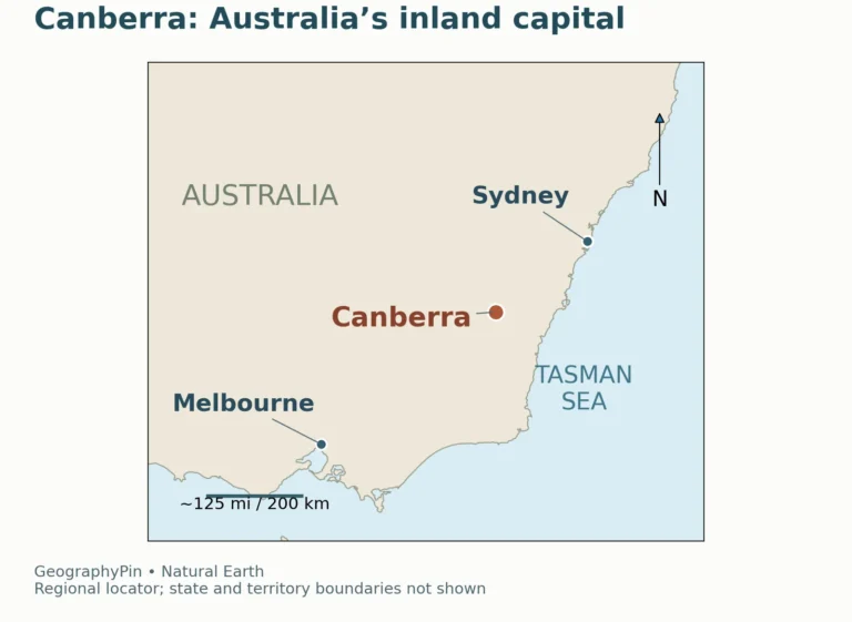
The main Australian landmass lies south of Indonesia and Papua New Guinea, with Timor-Leste to its northwest and New Zealand across the Tasman Sea to the southeast. These are neighboring places across water, not countries joined to the Australian mainland by a land boundary.
Locate the mainland, Tasmania and nearby countries
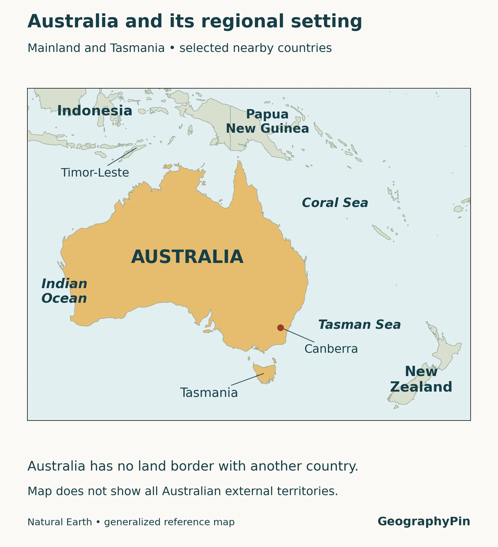
Tasmania lies south of the mainland across Bass Strait. It is one of Australia’s six states, not a foreign country or an external territory. The locator focuses on the mainland, Tasmania and regional context. Remote external territories are outside its displayed coverage, so the map should not be interpreted as a complete inventory of Australian jurisdiction.
Canberra is inland in the Australian Capital Territory. Sydney and Melbourne are major cities, but neither is the federal capital. A country map and a city map answer different questions: a dot can locate Canberra without showing the full administrative boundary of its territory.
2. Country, continent and Oceania
In this article, Australia as a country means the Commonwealth of Australia. “Mainland Australia” excludes Tasmania and other islands. The familiar seven-continent convention uses Australia as a continental name, but regional and geological classifications can group land differently. A continent label is not a statement that neighboring independent countries belong to Australia.
For Oceania, this guide uses the United Nations M49 statistical-region convention. It includes Australia and New Zealand as one subregion, alongside Melanesia, Micronesia and Polynesia. This is a named statistical framework, not a universally mandatory way to count continents.
These distinctions matter when comparing facts. A figure for the Australian country’s population cannot be described as the population of all Oceania. Likewise, a map of the mainland alone is not a map of every Australian state and territory. Keeping the unit visible prevents a broad regional term from quietly changing the meaning of a statistic.
3. Key facts with dates and geographic scope
| Item | Figure or description | Date or scope |
|---|---|---|
| Capital | Canberra | National capital, in the Australian Capital Territory. |
| Area | About 2.97 million square miles (7,688,287 km²) | Geoscience Australia’s table for the six states, Northern Territory, ACT and Jervis Bay Territory; not the Australian Antarctic claim or all remote external territories. |
| Population | 27,921,150 estimated residents | ABS estimate at March 31, 2026, released September 17, 2026; not a census-night count. |
| Highest mainland mountain | Mount Kosciuszko, 7,310 feet (2,228 m) | Mainland Australia only; do not extend this superlative to every external territory. |
| Regional convention | Oceania | United Nations M49 statistical grouping, as explained above. |
The area page was updated in November 2026, but its coastline calculation uses an earlier geographic dataset. An updated webpage is not necessarily a new land survey. The population estimate has its own reference date and method, based on census information adjusted through demographic estimates.
The ABS population scope includes the “Other Territories” category: Jervis Bay, Christmas Island, the Cocos (Keeling) Islands and Norfolk Island. That is not exactly the scope of the area table. Population density comparisons require population and area figures with matching territorial coverage.
4. Western uplands, central lowlands and eastern highlands
Read the relief before the labels
A useful broad framework divides Australia into the Western Plateau, Central Lowlands and Eastern Highlands. These are large-scale physiographic divisions, not three uniform surfaces. Detailed scientific classifications subdivide the terrain further; a generalized label does not supply an exact boundary.
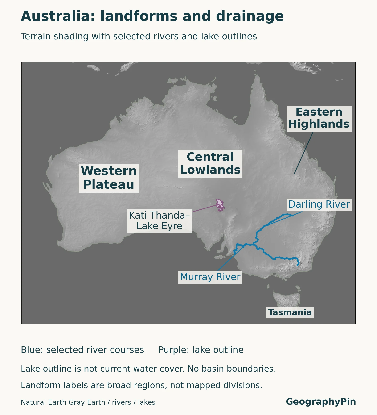
The western portion includes extensive old landscapes, individual plateaus and ranges. Calling it a plateau should not suggest one level tabletop. The Central Lowlands extend across interior basins, while the east contains elevated plateaus, escarpments and mountain country. Tasmania adds another substantial island landscape beyond the mainland framework.
The map’s shaded relief shows differences in terrain. Its river lines show selected drainage routes. Neither layer is a map of population density, vegetation or today’s rainfall. Reading these layers separately is more useful than assuming that every pale interior area is empty sand or that every shaded slope is forest.
The Eastern Highlands include the Australian Alps and Snowy Mountains. Mount Kosciuszko’s mainland summit height is significant, but it does not mean that the entire Great Dividing Range is a chain of sharp alpine peaks. Highlands can include broad tablelands as well as rugged slopes.
5. Rivers that reach the sea and drainage that stays inland
Compare the Murray–Darling system with Lake Eyre
The Murray and Darling belong to a major southeastern river system. Its downstream route leads toward the Murray Mouth in South Australia. “Drains toward the sea” describes the river network’s outlet, not a promise that every rainfall event or every tributary’s water reaches that outlet.
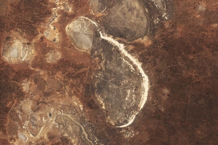
The Lake Eyre Basin provides a different pattern. Queensland’s official catchment description identifies it as an internal drainage system with highly variable flows. It spans parts of Queensland, New South Wales, South Australia and the Northern Territory. Floodplains, waterholes, dunes and stony country are all part of that landscape.
Kati Thanda–Lake Eyre can receive episodic inflows, but the lake is not a permanently full freshwater body. The lake outline shown on a geographic map must not be mistaken for the area covered by water on a particular day. Nor is the outline of the lake the boundary of its much larger drainage basin.
These two examples show why “interior Australia” is not a single hydrological unit. Some river networks connect to the coast; others terminate inland. An aquifer, a surface-water catchment and a topographic lowland also describe different things, even where they overlap on a map.
6. Climate and the concentration of settlement
Australia spans tropical, subtropical, arid and temperate environments. The Bureau of Meteorology emphasizes latitude, distance from the sea and terrain as influences on regional climate. Tropical northern seasonal patterns differ from those of temperate southern cities; the dry interior cannot stand in for the whole country.
Climate categories summarize patterns rather than today’s conditions. A dry region can experience major floods, and a temperate city can experience extreme heat. Neither the locator nor the relief map is a current hazard, rainfall or travel forecast.
Major population centers include Sydney, Melbourne and Brisbane in the east, Perth in the west and Adelaide in the south. This distribution should not be reduced to a single rule that people live only where rainfall is high. Economic activity, infrastructure, historical settlement and administrative functions also matter.
The ABS capital-city population release for June 30, 2025 lists about 5.64 million people for Greater Sydney and 5.44 million for Greater Melbourne. Those are broad statistical metropolitan areas, not the populations of individual city councils. Changing the geographic boundary can change a city comparison even when the people themselves have not moved.
7. People, languages and city geography
Australia’s cultural geography includes Aboriginal and Torres Strait Islander peoples and many communities with connections across the world. It cannot be represented by one language, one migration history or one city. National totals are useful for orientation but do not describe every local community.
In the 2021 Census, 72.0% of people reported using only English at home. Mandarin, Arabic, Vietnamese, Cantonese and Punjabi were among the leading other home-language responses. This is a dated measure of language use at home, not a finding that only 72% could speak English, and not a 2026 language survey.
For more detailed urban examples, the geography of Brisbane and Melbourne shows why a city needs its own map and boundary definitions.
8. The economy in its geographic setting
Natural resources are important, but Australia’s economy is not simply a map of mines. The Department of Foreign Affairs and Trade also identifies substantial services activity, including education, finance and tourism. The location of a resource deposit and the location of the people and firms providing services are different economic geographies.
ABARES explains agricultural patterns through climate, water, soils and access to markets. Grazing is widespread, while cropping and horticulture are more concentrated. Land devoted to agriculture is not the same measure as its contribution to employment or national output.
For example, the 2026 agricultural snapshot reports agricultural land use at 57.1% in December 2023, while its value-added measure is 2.2% of GDP for 2024–25. These figures have different dates and denominators. A large land footprint does not imply an equally large share of the economy.
Together, the contrast between interior landscapes, eastern drainage and major urban centers gives a more useful picture than a single national stereotype. Maps explain where activities occur; dated statistics explain what has been measured. Neither should silently substitute for the other.
What Did We Learn Today?
Australia is more than its dry interior: western uplands, central basins, eastern highlands, varied coasts and Tasmania create distinct geographic settings. Some drainage reaches the sea while other systems terminate inland. Country, mainland and Oceania refer to different units, and reliable comparisons of population, area or cities require dates and consistent boundaries.
Sources & Data Notes
National population is the ABS estimated resident population at March 31, 2026; city figures refer to June 30, 2025 and broad capital-city statistical areas. Language responses are from the 2021 Census. The area table and population estimates have slightly different territorial coverage. Relief and river mapping is generalized, not a current lake-water, flood or rainfall map. Broad physical-region labels do not define exact boundaries.
- Geoscience Australia: areas of Australia and largest, longest and highest features, area scope and mainland summit.
- ABS: population, March 2026 and methodology, national population and coverage.
- ABS: capital-city population release, June 2025 figures; 2021 Census QuickStats, home-language measures.
- UN M49, Oceania statistical convention.
- ABS Year Book 2005: geography, stable broad landform context only, not contemporary population or economic statistics; CSIRO ASRIS physiographic regions, detailed classification context.
- Queensland Government: Lake Eyre Basin; NSW Government: Murray–Darling Basin; South Australia: Murray Mouth.
- Bureau of Meteorology: climate zones, regional context rather than a forecast.
- DFAT: About Australia, country and economic context; ABARES: Snapshot of Australian Agriculture 2026, dated agricultural measures and spatial patterns.
- Natural Earth public-domain data, generalized locator, shaded relief, lake outline and selected river geometry.
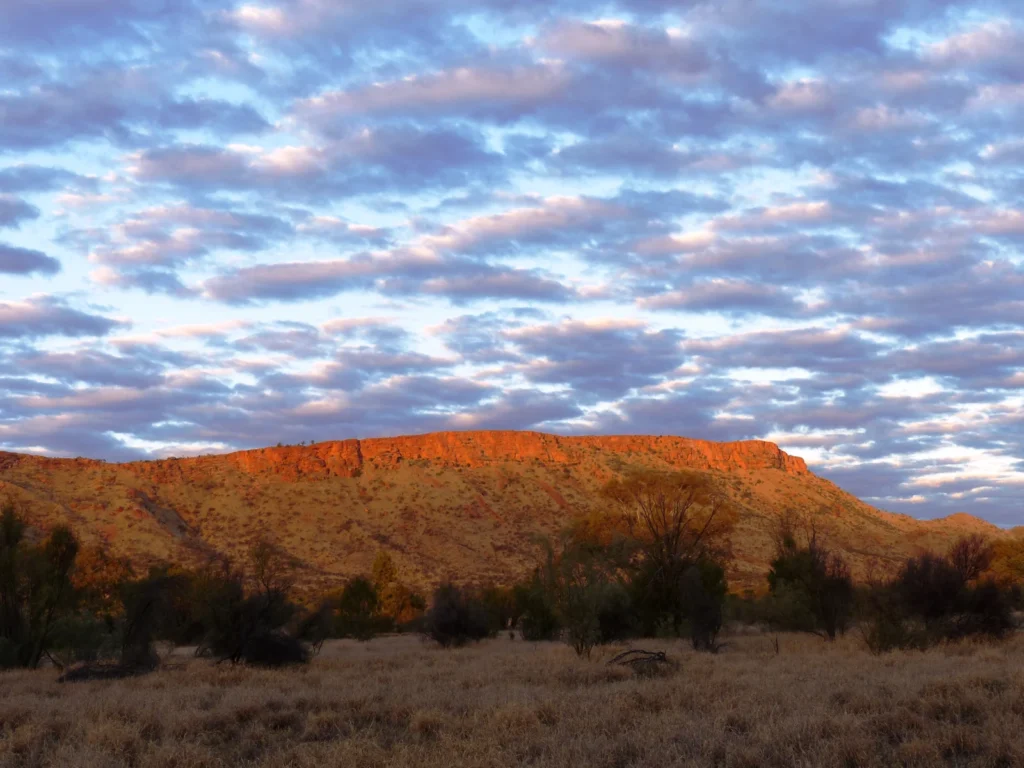
- Featured photo: Johannes Ammerschlaeger / Wikimedia Commons, CC BY-SA 4.0; resized and converted to WebP, with the adapted photograph shared under the same license.