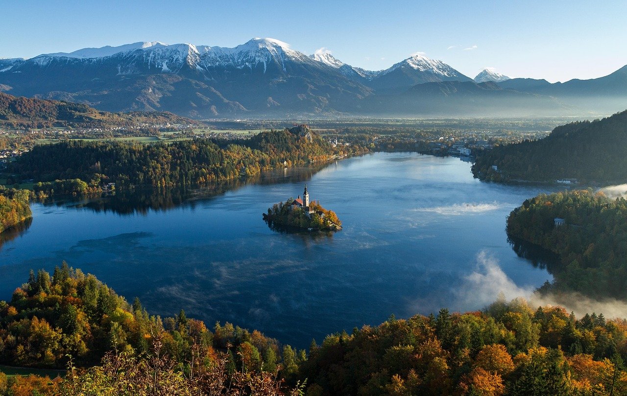
A lake looks simple until you try to define it precisely. The basic idea is easy enough, but the moment you compare lakes with ponds, wetlands, reservoirs, and inland seas, the edges get less tidy.
That is why good geography writing needs both the short answer and the careful version. The short answer comes first, then the science, the classifications, and the real-world examples that make the term useful rather than vague.
A lake is an inland body of standing water that occupies a basin and is surrounded by land. Some lakes are fresh, some brackish or salty, and some are natural while others are heavily managed, but the core idea is the same: relatively still water collected in a basin rather than flowing like a river.
How to use this article: Start with the working definition if you want the cleanest answer, jump to lake vs. pond for the most common confusion, use formation types to see where lakes come from, or go straight to the record table for the fast factual benchmarks.
What makes a lake a lake?
A solid working definition is this: a lake is a relatively large inland body of standing or very slowly moving water that occupies a basin. That wording matters because it distinguishes lakes from rivers and streams, which are defined mainly by flow, while also leaving room for the fact that not every lake looks the same. Britannica also notes that the boundaries between lakes, ponds, swamps, and related water bodies are not sharply standardized.
A practical working definition
In everyday geography, the safest plain-English version is that a lake is water collected in a landlocked basin and surrounded by land. That simple description works well for most school, map, and encyclopedia use, even though specialists may still debate edge cases and naming traditions.
Lake vs. pond
There is no universal global cut-off that says a water body becomes a lake at one exact size or depth. In practice, lakes are usually understood as larger and often deeper than ponds, while ponds are more likely to be shallow enough for light to reach much of the bottom and for the water column to mix more easily. The important point is that the distinction is useful, but not mathematically fixed everywhere.
Lake vs. wetland
A wetland is defined less by open-water shape and more by waterlogged conditions, wet soils, and the plant and animal communities that develop there. Some lake margins grade naturally into marshy or swampy zones, which is why lake edges and wetlands often overlap in the real world rather than sitting in completely separate boxes. Wetland classification systems commonly use the term lacustrine for wetlands associated with lakes.
Lake vs. reservoir
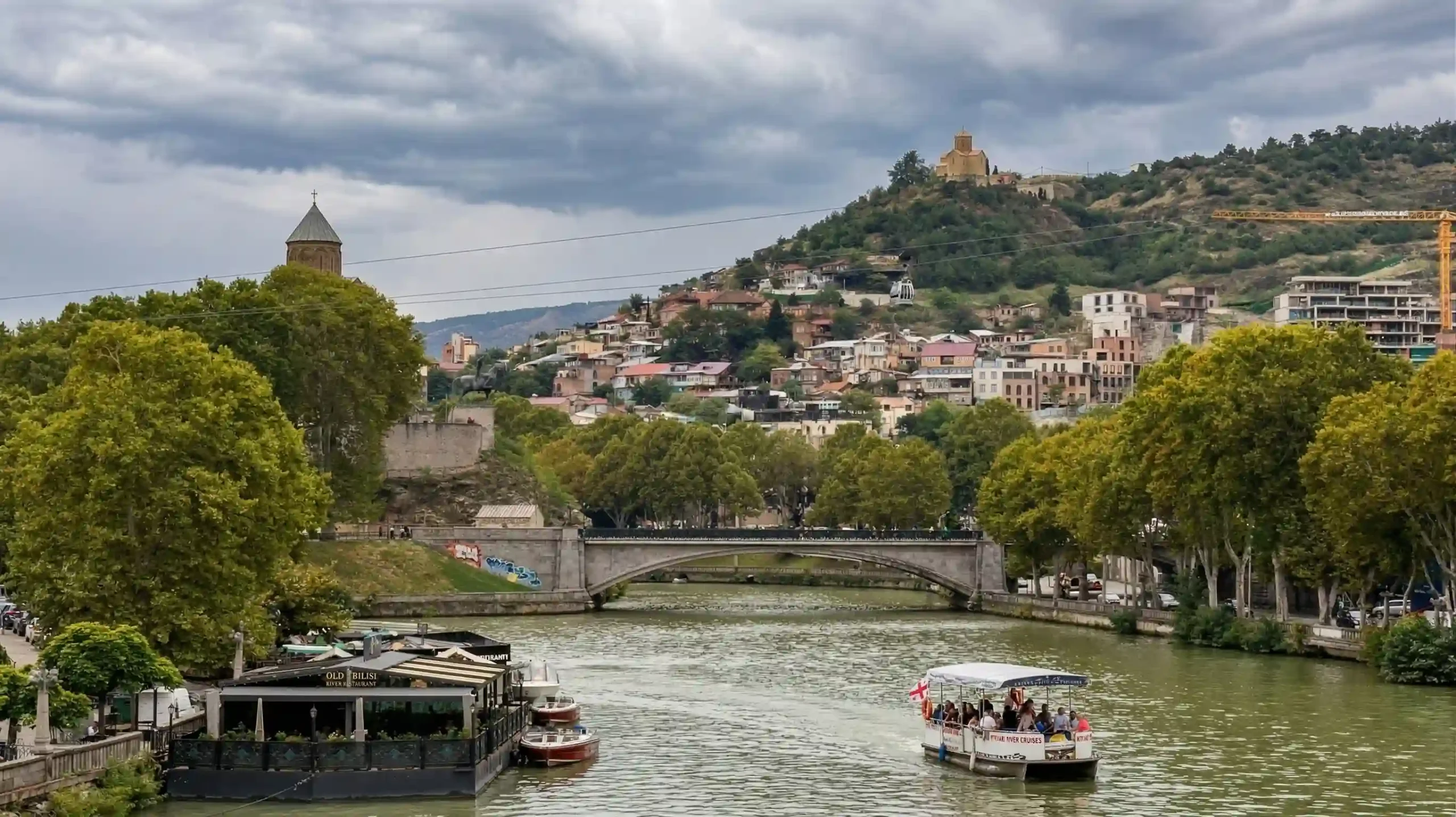
A reservoir is usually best understood as a human-made or heavily controlled lake, often created by damming a river or modifying a natural basin for storage, irrigation, flood control, power generation, or water supply. On a map, a reservoir may look lake-like, and many people casually call it a lake, but its origin and management are what set it apart.
How lakes form
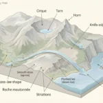
Lakes exist because a basin forms first and water fills it afterward. That basin can be carved by ice, opened by tectonic movement, blasted or collapsed by volcanism, cut off by river action, hollowed in soluble rock, or shaped by wind and coastal barriers. Once the basin exists, precipitation, streams, snowmelt, and groundwater determine whether it stays wet, shrinks, or disappears.
The main basin-making processes
- Glacial lakes: glaciers carve hollows and depressions, then meltwater fills them after the ice retreats.
- Tectonic lakes: crustal movement opens basins or rift zones that later collect water.
- Volcanic lakes: craters and calderas can fill with rain, snowmelt, or groundwater.
- River-made lakes: abandoned meanders form oxbow lakes, while floodplain processes can isolate water bodies.
- Karst lakes: groundwater dissolves limestone or other soluble rock, producing sinkholes and enclosed depressions.
- Coastal and wind-shaped lakes: sandbars, dunes, or deflation basins can trap water near coasts or in dry landscapes.
Some of the best-known examples make these processes easy to picture. Lake Baikal sits in an active rift system and is the deepest lake on Earth, while many North American lakes owe their shape to glacial carving and retreat. Volcanic crater lakes, by contrast, often stand out because their steep walls make the basin shape unusually obvious. (UNESCO; Britannica)
How lakes are classified
Geographers and limnologists do not sort lakes by one single rule. Instead, lakes are usually classified by a few practical traits that explain how they behave: salinity, drainage, nutrient status, and permanence. This matters because two lakes can look similar on a map and still function very differently in climate, ecology, and human use.
Four classifications that actually help
| Type of classification | Main categories | What it tells you |
|---|---|---|
| Salinity | Fresh, brackish, saline, hypersaline | How much dissolved salt the lake contains |
| Drainage | Open-drainage or closed-basin | Whether water leaves through rivers or mainly through evaporation and seepage |
| Nutrient status | Oligotrophic, mesotrophic, eutrophic | How productive, clear, oxygen-rich, or algae-prone the system tends to be |
| Permanence | Permanent or seasonal | Whether the lake is stable year-round or appears only under certain conditions |
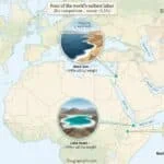
These labels become easier to understand once you attach them to familiar examples. The Dead Sea is a classic closed-basin hypersaline lake, while the Caspian is a vast inland water body that is usually treated as the world’s largest lake by area even though its name includes “sea.” Its classification causes some public confusion, but geographically it is still an inland basin rather than an oceanic sea.
Why some lake numbers vary
Readers often notice that different sources give slightly different lake areas, salinity figures, or shoreline lengths. That usually does not mean one source is careless. It often reflects changing water levels, different mapping dates, different ways of drawing boundaries, or the fact that some named “seas” are inland lakes in geographic terms. For that reason, rounded figures and cautious wording are often the most honest editorial choice.
How a lake changes through the year
A lake is not a motionless bowl of water. In many temperate settings, warmer months create a layered structure, with lighter warm water near the surface and colder denser water below. When cooling and wind break that layering down, the lake mixes again, redistributing oxygen and nutrients. That annual rhythm helps explain why lake ecology changes so much from season to season.
A quick record table
| Benchmark | Example | Rounded figure | Source note |
|---|---|---|---|
| Largest inland water body by area | Caspian Sea | About 371,000 to 386,400 km² | NASA and Britannica use slightly different rounded totals |
| Largest freshwater lake by area | Lake Superior | About 82,100 km² | EPA physical features table |
| Deepest lake | Lake Baikal | About 1,642 m | UNESCO and Britannica |
| Famous hypersaline lake | Dead Sea | Roughly one-third salt | Britannica summary figure |
| Combined Great Lakes water area | Great Lakes | About 244,160 km² | EPA physical features table |
The Great Lakes are also useful because they show how big seasonal shifts can be. EPA describes them as one of the world’s largest surface freshwater systems and says they hold about 21% of the world’s surface fresh water, while NOAA reported that average Great Lakes ice cover in 2024 fell to a record low of 4.3% since records began in 1973. That combination of size and climate sensitivity is one reason lakes matter so much in environmental geography.
Why lakes matter and what pressures they face
Lakes matter because they store water, regulate local climates, support fisheries, receive river inflow, buffer flood systems, shape transport routes, and anchor human settlement. Around the world, they also carry historical, religious, and cultural weight that far exceeds their size on the map. In other words, a lake is not just a landform; it is often part of a whole regional system.
Why lakes are so useful
Some lakes are drinking-water reserves. Others support irrigation, hydropower, shipping, recreation, tourism, or biodiversity hotspots with exceptional endemic species. Lake Baikal, for example, is not only deep; UNESCO also highlights it for its extraordinary biodiversity and for containing a huge share of the planet’s unfrozen freshwater reserve.
What is putting pressure on lakes now?
The most common pressures are nutrient pollution, shoreline development, invasive species, water diversion, and climate-driven changes in temperature, ice, and evaporation. Some systems respond through algal blooms or oxygen stress; others shrink physically. NASA has documented ongoing shoreline retreat and surface-area decline in the Caspian region, while NOAA has tracked striking ice-cover anomalies in the Great Lakes. These are different lake systems, but they point to the same basic fact: lakes are dynamic, and they can degrade quickly when climate and water management shift together.
FAQ
Is there a strict size that separates a lake from a pond?
No. There is no universal worldwide cut-off. Lakes are usually treated as larger and often deeper than ponds, but naming traditions and scientific usage vary.
Are all lakes freshwater?
No. Many lakes are freshwater, but others are brackish, saline, or hypersaline. The Dead Sea is a well-known example of a hypersaline lake.
Is a reservoir the same thing as a lake?
A reservoir is lake-like, but it is usually artificial or strongly controlled by people. The visual form may be similar, but the origin and management are different.
What is the largest lake in the world?
By area, the Caspian Sea is generally treated as the world’s largest inland lake, though published rounded figures differ slightly by source and method.
Which lake is the deepest?
Lake Baikal is the deepest known lake, reaching about 1,642 meters. It is also one of the most important freshwater bodies on Earth by volume.
Why are some lakes salty?
Salt tends to build up where a lake has little or no outlet and loses much of its water through evaporation. Over time, dissolved minerals remain behind and concentration rises.
What Did We Learn Today?
A lake is best understood as standing inland water collected in a basin, but that simple idea becomes much more useful once you separate lakes from ponds, wetlands, and reservoirs, then look at how basins form, how water chemistry and drainage change lake behavior, and why famous examples such as Baikal, the Caspian, the Dead Sea, and the Great Lakes each show a different side of what a lake can be.
Sources & Data Notes
For this piece, I leaned on standard reference and agency material that fits the topic best: Britannica for the core definition, UNESCO for Baikal, EPA and NOAA for Great Lakes figures, and NASA where basin-scale comparisons helped. I round figures where that keeps the article cleaner, and newer measurements can shift details like surface area, salinity, shoreline position, or ice conditions over time. Some GeographyPin visuals may be AI-assisted, but the framing, editing, and final wording are still shaped manually.