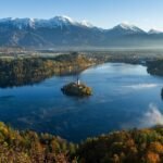
On most world maps, Lake Baikal looks narrow and remote. In reality, it is a giant rift lake in southern Siberia whose depth, age, clarity, and endemic wildlife place it in a category of its own. That is why Baikal matters not just as a superlative on a map, but as one of the world’s most important freshwater systems.
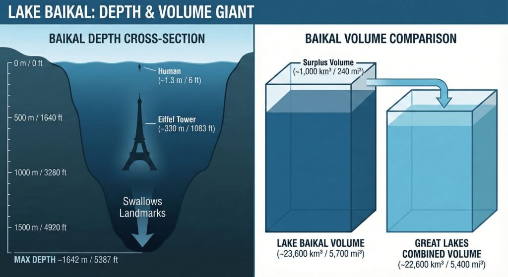
Lake Baikal is the world’s deepest lake, located in southern Siberia, Russia. It reaches roughly 5,387 feet (1,642 meters) in maximum depth and holds about one-fifth of the planet’s unfrozen surface freshwater, which makes it important not only geographically, but scientifically and environmentally as well.
How to use this article: If you want the essentials fast, go straight to the key numbers table, the depth and water-volume explanation, the ice-season section, or the main pressure points.
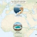
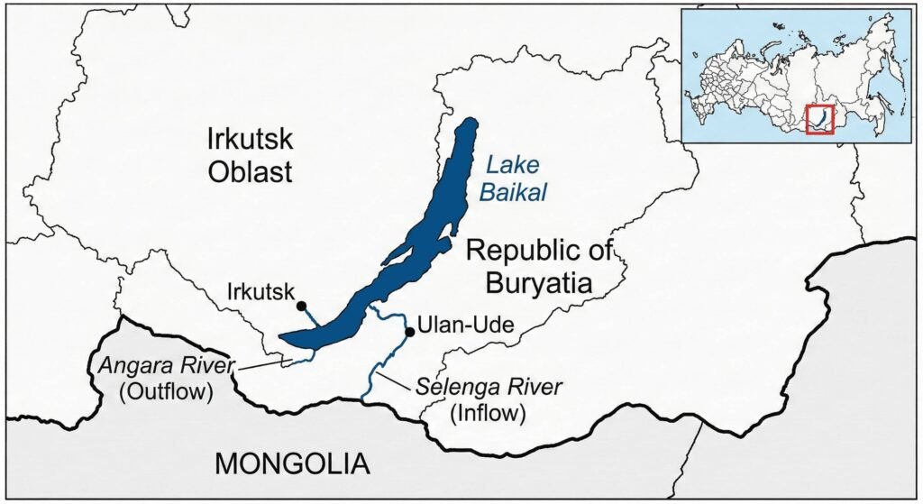
Where Is Lake Baikal? Map, Coordinates & Regional Setting
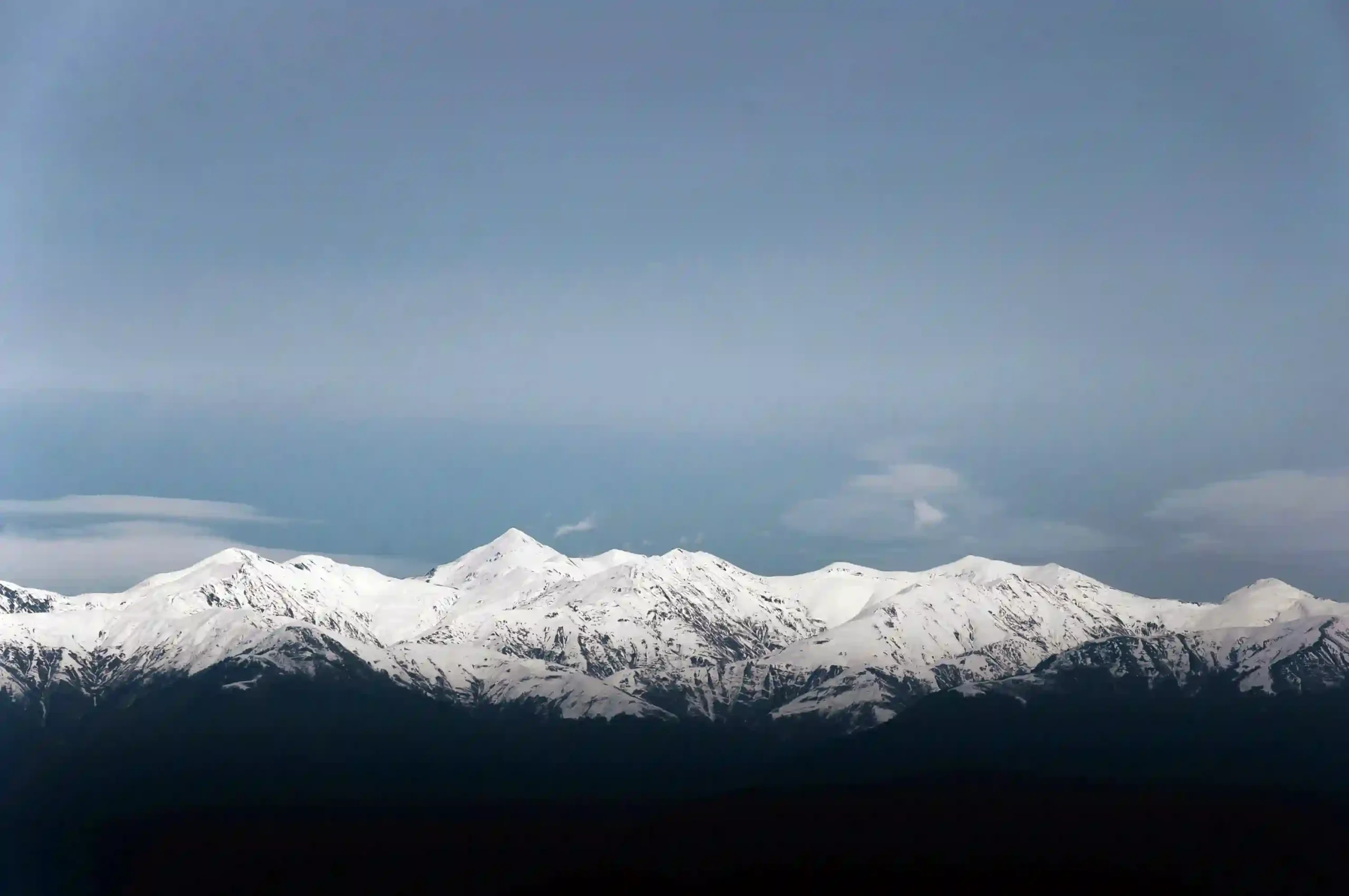
Lake Baikal lies in southeastern Siberia, in the Asian part of Russia. It sits between Irkutsk Oblast on the northwestern side and the Republic of Buryatia on the southeastern side, with UNESCO listing the World Heritage property in the broader area around 53°N, 108°E.
The lake occupies a long southwest-to-northeast basin framed by mountain country. Its surface area is commonly given at roughly 12,200 square miles (31,500 square kilometers), though some reference tables round it a little higher. What makes Baikal stand out, however, is not surface spread alone; it is the depth of the basin and the amount of freshwater stored inside it.
Baikal itself lies wholly inside Russia, but its hydrological setting is wider than the shoreline map suggests. The Selenga River, the lake’s largest inflow, rises in Mongolia, while the Angara River is Baikal’s only outflow. That makes the lake a Russian water body with a broader regional watershed story behind it.
Lake Baikal by the Numbers
If you only need the headline facts for a quick check, these are the figures most often used in standard reference works.
| Metric | Value | Notes |
|---|---|---|
| Maximum depth | About 5,387 feet (1,642 meters) | UNESCO often rounds this to about 5,577 feet (1,700 meters) in summary text. |
| Average depth | About 2,441 feet (744 meters) | Exceptionally deep on average for a lake of this size. |
| Length | 395 miles (636 kilometers) | Measured along the lake’s main southwest-to-northeast axis. |
| Maximum width | Up to 49 miles (79 kilometers) | Britannica also gives an average width of about 30 miles (48 kilometers). |
| Surface area | About 12,200 to 12,240 square miles (31,500 to 31,700 square kilometers) | Small differences reflect rounding and measurement conventions. |
| Water volume | About 5,500 to 5,660 cubic miles (23,000 to 23,600 cubic kilometers) | Largest freshwater lake by volume. |
| Age | About 20 to 25 million years | UNESCO summarizes it as about 25 million years old. |
| UNESCO World Heritage | 1996 | Listed for landscape, geology, ecology, and biodiversity value. |
Different references round Baikal’s depth, area, and volume a little differently, so the safest way to present the figures is as well-established approximate ranges rather than fake precision. The broader conclusion does not change: Baikal is extraordinarily deep, old, and water-rich.
How Deep and How Big Is Lake Baikal?
Depth, Volume and Water Clarity
Baikal’s fame comes from the combination of depth and stored water. A lake can be large in surface area without being very deep, but Baikal combines both traits at an unusual level. That is why it is widely described as holding about one-fifth of the world’s unfrozen surface freshwater, and why reference works often note that its volume exceeds that of the five North American Great Lakes combined.
Baikal is also known for exceptionally clear water. Britannica notes that visibility from the surface can reach about 131 feet (40 meters) under favorable conditions. That clarity is tied to low mineral content, low suspended matter, and the lake’s cold, oxygen-rich character rather than to any single dramatic seasonal effect.
How Lake Baikal Formed: Rift Valley, Age & Geology
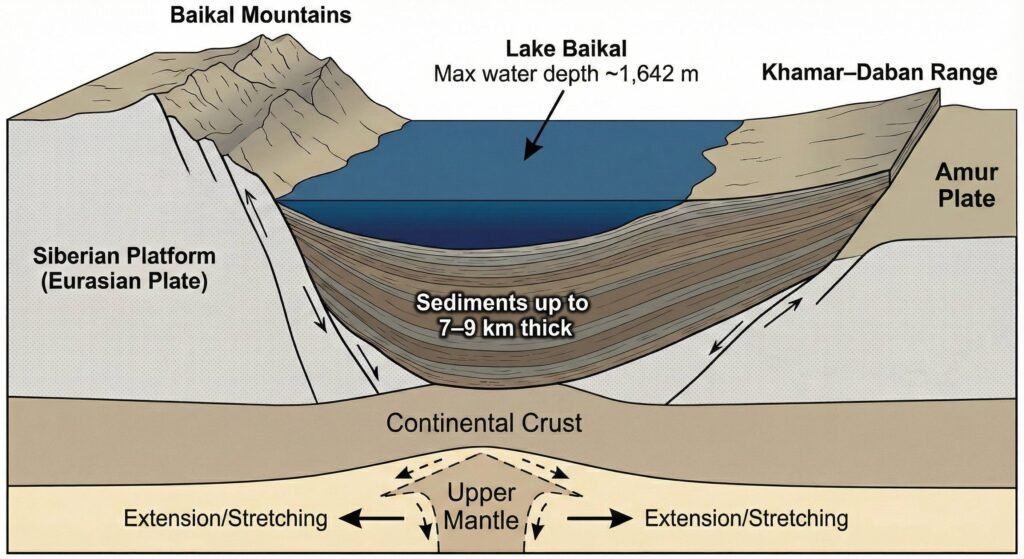
Lake Baikal sits in the Baikal Rift Zone, where continental crust is being pulled apart. Geodetic studies commonly describe present-day extension across the region at only a few millimeters per year, often around 0.16 inches (4 millimeters) annually. That sounds tiny on a human timescale, but over millions of years it is enough to help create and maintain a very deep basin.
Its age matters just as much as its depth. UNESCO summarizes Baikal as about 25 million years old, while Britannica gives a slightly broader range of 20 to 25 million years. Either way, the main point is clear: Baikal is an ancient lake that has remained open long enough to preserve a long geological and environmental record.
What lies below the lake floor is part of the story too. Britannica notes that sedimentary layers on the bottom may reach roughly 3.8 miles (6.1 kilometers) in thickness, and USGS work on Baikal cores has long treated the basin as an important archive of past climate change. That is one reason Baikal matters far beyond regional geography.
Climate, Seasons & Famous Ice of Lake Baikal
Temperatures, Ice and Climate Change
Baikal lies in a strongly continental climate zone, but the lake’s huge water mass softens some extremes right along the shore. Britannica gives average winter air temperatures around 1°F to -6°F (-17°C to -21°C) and average August temperatures around 52°F (11°C) near the lake. That mix of Siberian cold and lake moderation helps shape the region’s distinctive seasonal rhythm.
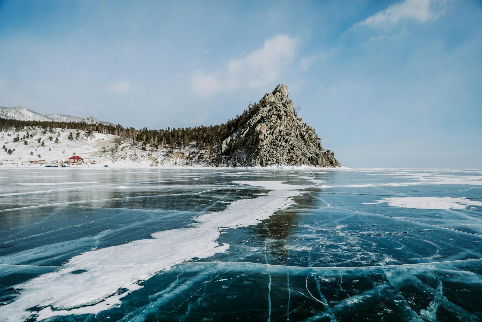
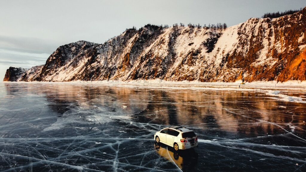
The surface usually freezes in January and breaks up in May or June. During that frozen season, Baikal becomes visually famous for broad ice sheets, long cracks, trapped bubbles, pressure features, and the clear blue look seen in so many winter photographs from the lake.
Scientists also watch Baikal closely as a climate signal. A widely cited long-term study reported significant warming of surface waters along with changes in the lake’s basal food web over recent decades. That does not mean Baikal has stopped being cold; it means even a huge, deep lake can register ecological change in ways that matter.
Wildlife of Lake Baikal: Endemic Species & Food Webs
Lake Baikal is one of the world’s great freshwater biodiversity systems. Britannica describes roughly 1,500 to 1,800 animal species at different depths and hundreds of plant species on or near the surface, with the majority of species considered endemic to the lake. UNESCO makes the same broader point in simpler language: Baikal’s age and isolation produced one of the richest and most unusual freshwater faunas on Earth.
The food web begins with microscopic life in the upper waters and extends down into cold, oxygen-rich depths. That matters because Baikal is not just species-rich; it is structurally unusual. Life persists in a very deep freshwater basin where cold conditions, oxygenation, and long isolation helped produce specialized forms found nowhere else.
Baikal Seal (Nerpa): A Freshwater Specialist
The Baikal seal, or nerpa, is the lake’s best-known animal. Britannica describes it as the only true freshwater seal in the world and one of the clearest symbols of Baikal’s evolutionary isolation. It is not just a local curiosity; it is one of the easiest ways to understand how unusual this lake really is.
Fish, Sponges & Tiny Crustaceans
Baikal’s fauna includes omul, grayling, whitefish, sturgeon, the translucent golomyanka, endemic amphipod crustaceans, and the freshwater sponges that helped make the lake famous among limnologists. These species are important not only individually, but as part of a cold-water system whose endemicity is one of Baikal’s defining scientific features.
People, Culture & History Around Lake Baikal
Indigenous Communities and Russian Expansion
Lake Baikal is not an empty wilderness bowl on a map. The lake sits within the historical homeland of Buryat communities on its eastern side, and later Russian expansion tied the basin into wider Siberian transport and settlement networks. That layered human geography matters because Baikal’s story has always been both environmental and cultural.
In the modern era, the lake’s shores became linked more tightly by rail, road, tourism, and industry. The wider Baikal region is often associated with the Circum-Baikal Railway, lake settlements such as Listvyanka, and the long argument over how a globally important freshwater system should coexist with development.
The Soviet-era pulp and paper complex on the southern shore became one of the clearest symbols of that tension. Britannica notes that its waste triggered major environmental protests and later protection measures, turning Baikal into a landmark case in Russian environmental debate as well as physical geography.
Environmental Pressures & Protection
Climate Change at Lake Baikal
Climate pressure on Baikal is no longer a speculative future topic. Long-term work on the lake has linked warming surface waters with changes in plankton structure and seasonal behavior, which matters because Baikal’s ecological stability has long depended on cold-water patterns. Even in a lake this large, warming can alter timing, food webs, and habitat conditions.
Pollution and Conservation Actions
Pollution pressure is often strongest near the shore rather than in the deep central basin. Peer-reviewed work on Baikal’s coastal zone has linked local ecological degradation to untreated sewage, nutrient loading, benthic algal outbreaks, and other shoreline stresses, especially near settlements and tourism hubs. That is an important distinction: a giant lake can look healthy offshore while still being stressed at the edges.
Protection, however, is substantial as well. Lake Baikal became a UNESCO World Heritage Site in 1996, and the wider region includes reserves, national parks, and coastal protection measures noted by Britannica. The practical test is not whether Baikal is legally famous; it is whether wastewater control, tourism management, and long-term monitoring keep pace with the pressures now visible around the shoreline.
FAQ
Why is Lake Baikal considered the world’s deepest lake?
Because its maximum depth is commonly placed around 5,315 to 5,387 feet (1,620 to 1,642 meters), with UNESCO often rounding that to about 5,577 feet (1,700 meters). The basin formed in an active continental rift, which helps explain why it could remain so deep over a very long geological period.
Is Lake Baikal also the largest lake in the world?
Not by surface area. What makes Baikal number one is freshwater volume, not footprint. That is why it is often described as holding about one-fifth of the planet’s unfrozen surface freshwater.
Why is Lake Baikal so old compared with most lakes?
Most lakes disappear on much shorter timescales because they fill with sediment or drain away. Baikal persisted because it formed in a tectonic rift that kept creating accommodation space while the basin continued to evolve.
What is the most famous animal in Lake Baikal?
The best-known species is the Baikal seal, or nerpa. It is widely described as the world’s only true freshwater seal and is one of the strongest symbols of the lake’s ecological isolation.
When does Lake Baikal freeze?
In a typical year, the surface freezes in January and thaws in May or June. Exact timing varies by year and by part of the lake, which is one reason it is smarter to describe the season as a pattern rather than a fixed annual calendar.
What are the main threats facing Lake Baikal now?
The main concerns usually mentioned together are climate-driven ecological change, shoreline wastewater problems, nutrient loading, and tourism pressure in sensitive coastal areas. The lake’s offshore waters and nearshore zones do not always show the same condition at the same time.
What Did We Learn Today?
Lake Baikal earns its reputation not because of a single headline number, but because several rare traits come together in one place: great depth, great age, huge freshwater volume, rift geology, remarkable clarity, and a level of endemic life that makes the lake scientifically exceptional. That same uniqueness is exactly why Baikal has to be read as both a natural wonder and a fragile system whose edges can start changing long before the whole lake looks “in crisis.”
Sources & Data Notes
I leaned mainly on UNESCO World Heritage material, Encyclopaedia Britannica, and limnology and rift-geology studies for the core figures and framing here. Some measurements are rounded, and different references do not always present Baikal’s depth, area, or volume with exactly the same level of precision; newer monitoring releases can also shift some ecology details. I used AI assistance for cleanup and structure, but the factual framing and final editorial choices were handled manually.