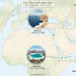
The Dead Sea is an endorheic hypersaline lake between Jordan and western shores shared by Israel and the West Bank. Its exposed shoreline is Earth’s lowest, its brine is often summarized as about 34% salt, and its density makes floating easy. The natural northern lake continues to decline as inflow no longer balances evaporation and industrial withdrawals.
Dead Sea at a glance:
- Where is it? In the Jordan Rift Valley, east of the Mediterranean.
- Is it a lake or a sea? A closed inland lake with an ancient traditional “sea” name.
- Who borders it? Jordan on the east; the West Bank and Israel on different parts of the west.
- Why is it famous? Its low shoreline, dense brine, easy floating, salt formations and historical setting.
- What is happening to it? The natural northern basin is falling because losses exceed replenishment.
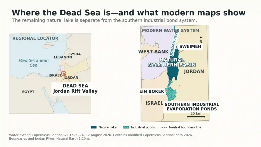
Where Is the Dead Sea and What Does the Map Show?
Regional location
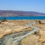
The Dead Sea lies in West Asia in the Jordan Rift Valley, at the lower end of the Jordan River and Dead Sea system. The Jordan River enters from the north. Smaller wadis, springs and groundwater also contribute water, but no river carries it onward to an ocean.
The shoreline and its political geography
Jordan lies along the eastern shore. The West Bank and Israel lie along different stretches of the western side, with Israel along the southwestern shore. This is geographic wording: the West Bank is a territory, not a country, and a neutral map should show its boundary without using the lake to imply a sovereignty judgment.
Why is it called a sea if it is a lake?
Geologically and hydrologically, it is a lake: it is inland, surrounded by land and has no connection to the world ocean. “Sea” survives as a traditional name for a large, salty body of water. Arabic al-Baḥr al-Mayyit means “the Dead Sea,” while Hebrew Yam HaMelach means “the Sea of Salt.”
The natural northern lake and the southern ponds
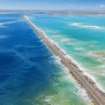
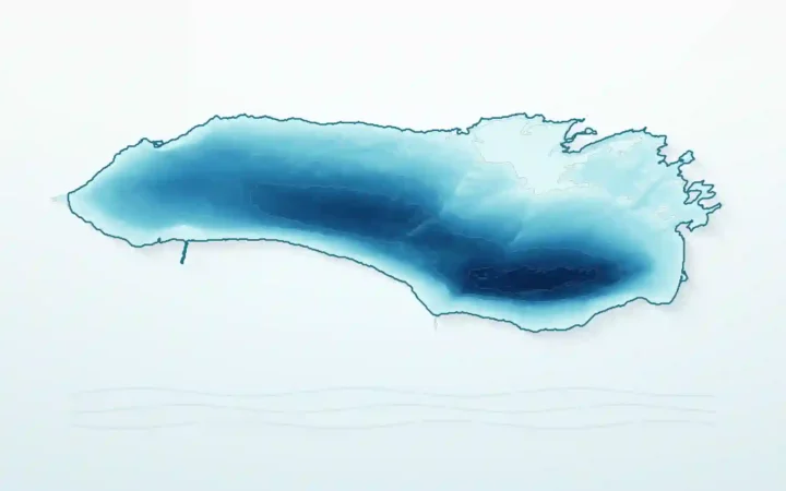
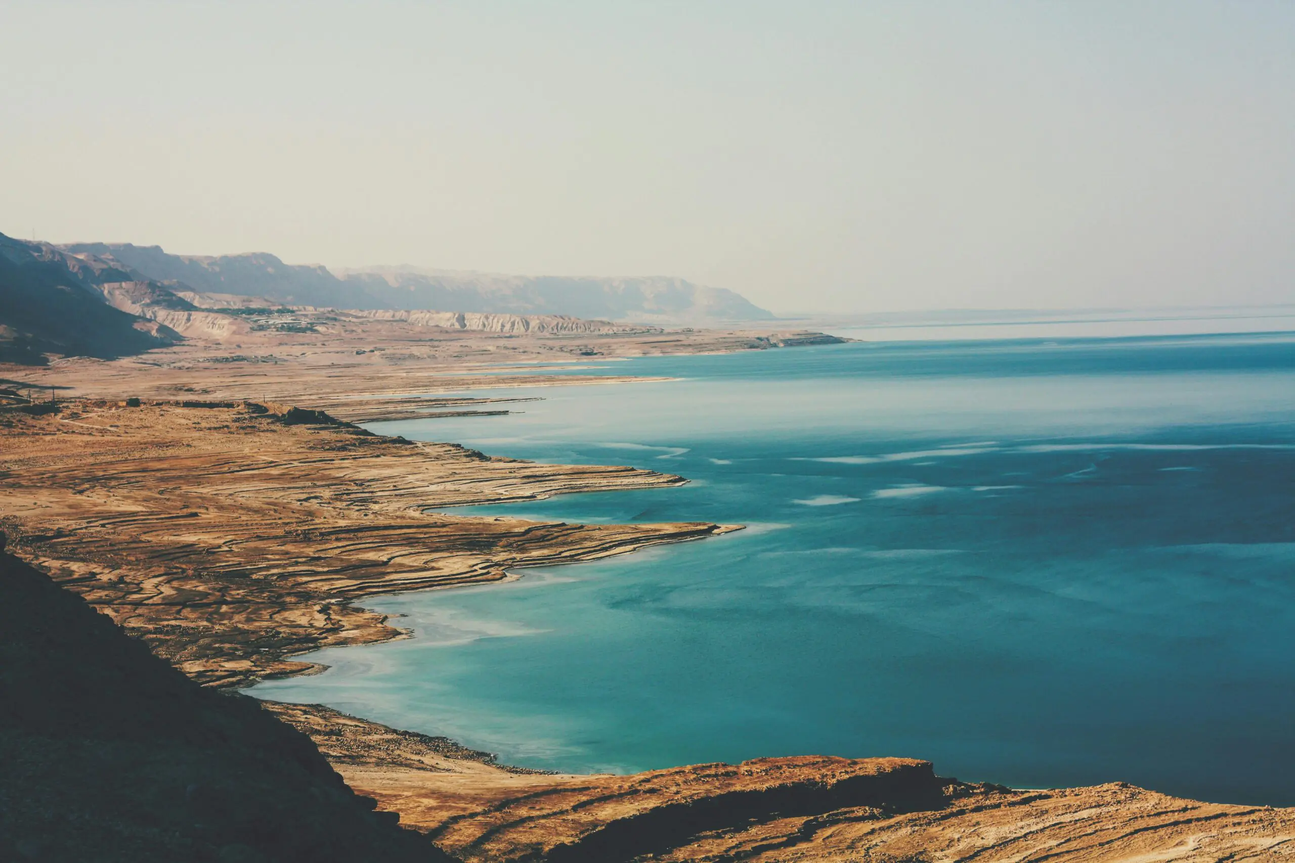
The dark, irregular water body in the north is the remaining natural Dead Sea. South of the exposed Lisan area, geometric blue and green cells are industrial evaporation ponds. The old shallow southern basin ceased functioning as a natural continuation of the lake after the falling level separated it; companies now pump northern-basin brine south to maintain the pond system.
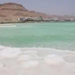
This changes how photographs should be read. Sweimeh’s Jordanian resort coast faces the natural northern lake. Ein Bokek’s Israeli hotel and beach zone fronts managed Evaporation Pond No. 5. Both contain dense brine and allow floating, but they are not the same water body or the same shoreline process.
Dead Sea Facts and Current Measurements
| Fact | Best concise reference |
|---|---|
| Geographic type | Endorheic hypersaline lake |
| Main inflow | Jordan River |
| Natural outlet | None |
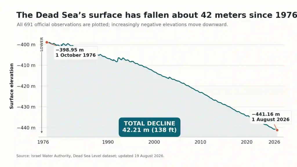
| Latest official surface elevation | −441.16 m on August 1, 2026, about 1,447 ft below sea level |
| Approximate salinity | About 342 g/L total dissolved salts in a 2011 Geological Survey of Israel study—roughly 34% mass per volume, but about 27–28% by mass; depth, date and method matter |
| Approximate maximum depth | About 920 ft (280 m), reported for 2024 in a 2025 scientific review |
| Natural northern-basin dimensions | Roughly 31 miles long and up to 9 miles wide (50 × 15 km); orientation figures, not a current shoreline survey |
| Main environmental trend | Falling water level, retreating natural shoreline and expanding ground-instability zones |
| Main tourism areas | Sweimeh, Jordan, on the natural lake; Ein Bokek, Israel, on a managed southern pond |
The Israel Water Authority’s monthly dataset added the August 1 reading after the article brief’s July reference of −441.00 m. Dates stay attached because the surface continues to change.
The shoreline at that elevation is the lowest exposed shoreline on Earth. It should not be called the planet’s absolute lowest point: ocean trenches descend much farther, but they are submerged. The depth figure is also dated rather than timeless. Both the water surface and the salt-covered basin floor change, so current depth should not be calculated simply by subtracting today’s surface elevation from an old floor measurement.
How the Dead Sea Formed
A pull-apart basin within a strike-slip fault system
The Dead Sea occupies a deep pull-apart basin within the left-lateral Dead Sea Transform. The dominant fault motion is sideways. Where offset and overlapping strike-slip fault strands created local extension, the crust subsided and made room for a deep sediment-filled depression.
This is more accurate than saying two plates simply pulled straight apart. Long-term tectonic subsidence created the basin over millions of years; it does not explain the rapid modern fall of the water surface, which is a water-budget problem.
From Lake Lisan to the modern Dead Sea
The modern lake is one phase in a much longer history. During the last glacial period, the larger Lake Lisan filled the Dead Sea basin and extended through much of the Jordan Valley. Its level rose and fell with regional hydroclimate before the lake contracted near the end of the Pleistocene, leaving terraces and finely layered salt-and-mud deposits around today’s smaller lake.
Why It Is Salty, Why People Float, and What Lives There
Salinity begins with a closed drainage basin
Rivers, runoff and groundwater carry dissolved minerals into the basin. There is no outlet river to remove them. In the hot, arid climate, water evaporates while most dissolved material remains; once the brine reaches saturation with a mineral such as halite, some salt also crystallizes and settles.
That is the short mechanism behind why the Dead Sea is so salty. A 2011 Geological Survey of Israel study reported about 342 grams of dissolved salts per liter. That is about 34% mass per volume and nearly ten times the dissolved-salt concentration of ocean water per liter. Because Dead Sea brine has a density near 1.24 kg/L, however, it is about 27–28% salt by mass—not 34% by mass.
Depth, date and analytical method still matter. Dead Sea studies may report total dissolved solids in g/L, g/kg or a specialized quasi-salinity measure, so 342 g/L must not be silently rewritten as 342 g/kg.
Dense brine produces stronger buoyancy
Dead Sea brine has a commonly cited density near 1.24 kg/L, far above fresh water. A body immersed in it displaces unusually heavy liquid, so the upward buoyant force balances body weight while a larger share of the body remains above the surface.
That explains why people float in the Dead Sea without needing to treat the lake as magical or impossible to drown in. High buoyancy helps a person recline, but it can make it harder to recover after rolling face-down.
Is the Dead Sea really dead?
It is not biologically sterile. Fish and most familiar aquatic plants and animals cannot survive in the main brine, where microbial abundance is generally low. Salt-adapted microorganisms—including archaea and bacteria—do survive, and less-saline underwater spring environments can support denser microbial communities. Archaea are a separate domain of life, not a type of bacteria.
Why Is the Dead Sea Shrinking?
The lake is losing more water than it receives
Evaporation is natural here; the modern decline comes from a water balance that no longer replaces those losses. The main pressures work together:
- Reduced Jordan River and tributary inflow: far less water reaches the lake than before large-scale development of the basin.
- Upstream diversion: cities, farms and reservoirs use water across the wider river system before it reaches the lower Jordan.
- Industrial brine withdrawal: mineral producers in Israel and Jordan pump natural-lake brine into southern evaporation ponds.
- Natural evaporation: intense heat, dry air and a rain-poor basin remove water from the lake surface.
- Climate variability and warming: rainfall, runoff and heat affect the annual balance, but climate is an added pressure—not a substitute for the documented effects of diversion and industry.
The official monthly record makes the long-term result visible. The July 2026 point specified in the original brief remains in the table, while the newer August reading supplies the current endpoint.
| Measurement date | Surface elevation | Change from October 1976 |
|---|---|---|
| October 1, 1976 | −398.95 m (about 1,309 ft below sea level) | Starting reference |
| January 24, 1990 | −406.83 m (about 1,335 ft below sea level) | Down 7.88 m (about 26 ft) |
| January 1, 2000 | −413.20 m (about 1,356 ft below sea level) | Down 14.25 m (about 47 ft) |
| February 1, 2010 | −423.16 m (about 1,388 ft below sea level) | Down 24.21 m (about 79 ft) |
| January 1, 2020 | −434.42 m (about 1,425 ft below sea level) | Down 35.47 m (about 116 ft) |
| July 1, 2026 | −441.00 m (about 1,447 ft below sea level) | Down 42.05 m (about 138 ft) |
| August 1, 2026 | −441.16 m (about 1,447 ft below sea level) | Down 42.21 m (about 138 ft) |
Table downloads (2)
- Dead Sea reference facts, with dates and measurement caveats (10 × 2)View tableDownload CSV
- Selected points in the Israel Water Authority Dead Sea level series (8 × 3)View tableDownload CSV
Sinkholes and the Dead Sea’s Future
How retreating water creates sinkholes
As the lake falls, the nearby groundwater system shifts. Water that is fresher than the underground brine moves through buried salt layers and dissolves them. Cavities grow below the surface; when the sediment above can no longer carry its own weight, the ground collapses.
A 2017 Geological Survey of Israel study documented more than 6,000 sinkholes along the western coast over the preceding 25 years. That is a dated western-shore inventory, not a current total for the entire basin. Sinkholes and subsidence have damaged or constrained beaches, farms, roads and other infrastructure on both sides of the lake.
Monitoring helps, but it cannot promise exact prediction
Geologists combine mapped salt layers and known collapses with satellite radar measurements of subtle ground deformation. A June 2026 government audit describes Geological Survey of Israel susceptibility maps and warning zones used in planning and risk management. Such tools can identify vulnerable areas and precursory subsidence; they cannot guarantee the precise place and time of every collapse.
That uncertainty is why an abandoned beach or unregulated shoreline must not be approached simply because the surface looks firm. Barriers, closures and official access routes are part of the hazard response, not obstacles to bypass.
Will the Dead Sea disappear by 2050?
No accepted model says the lake will simply vanish by 2050. A straight-line projection ignores changing basin shape, reduced evaporating area, brine chemistry, salt precipitation and continuing groundwater or runoff inputs. Long-term models instead tend toward a much smaller lake approaching a new water balance at a lower elevation.
That does not make continued decline harmless. Models disagree about the final level and timing, and communities could face decades or centuries of shoreline retreat, subsidence, ecological change and infrastructure costs before any new balance is reached.
People, Industry, and Cross-Border Water Choices
Minerals, jobs and environmental costs
Dead Sea brine supports major mineral industries, especially potash for fertilizer and bromine- and magnesium-based products. Solar ponds concentrate pumped brine so selected salts can be separated and processed. For a closer look at the chemistry, see GeographyPin’s guide to the Dead Sea’s mineral mix.
These operations provide employment, exports and industrial inputs in Israel and Jordan, but evaporation of transferred brine also contributes to the natural lake’s deficit. Restoration policy therefore has to balance livelihoods and public revenue against water loss, environmental damage and long-term infrastructure exposure.
A shared watershed, not a one-shore problem
The immediate shore involves Jordan, Israel and the West Bank. The wider Jordan River basin also reaches upstream parts of Lebanon and Syria. Water storage, irrigation, urban supply, wastewater management and environmental releases across that system can influence how much flow ultimately reaches the lake.
Why a Red Sea–Dead Sea transfer is not a simple fix
Red Sea–Dead Sea concepts have proposed desalinating Red Sea water and sending remaining seawater or brine toward the Dead Sea. The large regional concept was studied, but no such lake-restoration transfer is operating.
The difficulty is not just laying a pipe. Mixing chemically different waters could change stratification, stimulate biological blooms or precipitate gypsum; a full system would also require costly infrastructure, energy, financing, environmental safeguards and durable agreements among the affected parties. Any future proposal has to be described as a proposal until it is funded, built and operating.
History and Cultural Meaning
People have lived, farmed and traveled around the lower Jordan Valley for millennia. Jericho lies north of the lake, while sites such as Ein Gedi and Masada preserve different parts of the western desert’s settlement and political history. Salt, bitumen, springs and north–south routes gave the basin practical value long before modern tourism.
The lake appears in biblical geography as the Salt Sea and Sea of the Arabah, and the surrounding landscape is associated with stories about Sodom, Lot, David and other traditions. Those associations belong to religious and cultural history; they are not substitutes for geological evidence about how the basin formed.
The Dead Sea Scrolls were discovered in caves near Qumran on the northwestern shore beginning in 1947—not in the water. Their manuscripts belong to a separate historical subject, so this pillar does not reproduce their discovery and contents in detail.
Visiting the Dead Sea Safely
Choose the water system as well as the side
Ein Bokek is the principal Israeli resort area and faces a maintained southern evaporation pond. Sweimeh is Jordan’s main resort area and faces the natural northern lake. For border, transport and side-by-side planning details, compare visiting the Dead Sea from Israel and Jordan; those changing details do not belong in this broad geographic pillar.
A short safe-visit checklist
- Use a maintained, officially permitted beach with safe access and freshwater showers.
- Enter slowly, sit and recline onto your back; do not dive, jump, splash or attempt normal face-down swimming.
- Keep brine out of the eyes and mouth. Swallowing it can be medically dangerous; seek immediate help if it happens.
- Rinse with fresh water after leaving the lake, and expect cuts or recently shaved skin to sting sharply.
- Protect yourself from intense heat and sun, drink water and limit strenuous activity during hot hours.
- Stay away from fenced, abandoned and unregulated shorelines because of sinkholes, unstable mud and damaged infrastructure.
- Treat desert flash-flood warnings seriously. Rain falling far upstream can send sudden water through nearby wadis and affect roads or trails.
Beach status, roads, weather warnings and security conditions can change. Check the relevant Jordanian or Israeli authorities shortly before a visit and follow instructions on site.
Is the Dead Sea the Saltiest Lake?
It is among the saltiest large natural lakes, but it is not the saltiest natural water body of every size. NASA reports salinity above 40% for Antarctica’s tiny Don Juan Pond, compared with its rounded 34% figure for the Dead Sea. Other lakes and ponds can also match or exceed the Dead Sea under particular sampling conditions.
Rankings depend on whether tiny ponds count, which depth and season were sampled, and whether sources report mass fraction, grams per liter or another salinity measure. GeographyPin’s comparison of the world’s saltiest lakes explains those category problems in more detail.
Frequently Asked Questions
Where is the Dead Sea?
It lies in the Jordan Rift Valley in West Asia. Jordan is to the east, while the West Bank and Israel lie along different portions of the western side.
Is the Dead Sea in Israel or Jordan?
It is not confined to one side. Jordan borders the eastern shore; the West Bank and Israel border different stretches of the western shore.
Is the Dead Sea a lake?
Yes. It is an inland endorheic lake with no river outlet to an ocean. “Sea” is its traditional name, not its hydrological classification.
How salty is the Dead Sea?
A 2011 technical study reported about 342 g/L of dissolved salts, often summarized as about 34% mass per volume. With the brine’s high density, that is about 27–28% by mass. Depth, date and measurement convention still affect the result.
Why do people float in the Dead Sea?
The concentrated brine is much denser than fresh water. It therefore supplies enough buoyant force to support body weight while a relatively large share of the body stays above the surface.
Is anything alive in the Dead Sea?
Yes, but not fish or most ordinary aquatic organisms. Salt-adapted archaea, bacteria and other microorganisms survive in the lake and in less-saline spring environments.
How far below sea level is the Dead Sea?
The official surface elevation was −441.16 m on August 1, 2026, approximately 1,447 ft below sea level. Its shoreline is the lowest exposed shoreline on Earth.
Why is the Dead Sea shrinking?
River diversion and upstream water use have greatly reduced inflow, while natural evaporation and industrial brine pumping continue to remove water. Climate variability adds pressure but is not the sole cause.
Will the Dead Sea disappear?
It is not expected simply to vanish by 2050. Continued decline may eventually leave a smaller lake approaching a lower equilibrium, but the timing, final elevation and consequences remain uncertain.
Is the Dead Sea safe to visit?
Managed beaches can be visited safely when local rules are followed. Use official access, avoid face-down swimming and diving, never swallow the brine, heed heat and flood warnings, and stay away from unregulated shorelines.
What Did We Learn Today?
The Dead Sea is a closed hypersaline lake whose natural northern basin must be distinguished from the southern industrial pond system. Its dense brine explains the famous floating, while reduced river inflow, industrial withdrawal and persistent evaporation explain the modern decline. That decline is lowering the world’s lowest exposed shoreline and driving sinkhole risk, but it does not support a simple claim that the lake will vanish by 2050.
Sources & Data Notes
Current measurements: The surface elevation and 1976–2026 decline come from the Israel Water Authority monthly series as available on August 19, 2026. The August reading supersedes the July figure that was latest when the article brief was prepared. Elevations are rounded only after calculations, and every current level retains its measurement date.
Stable geographic facts: Lake type, fault-basin formation, the northern-lake/southern-pond distinction and the salinity mechanism come from geological, hydrological and remote-sensing sources. Basin dimensions are rounded, while maximum depth is a dated scientific estimate rather than a timeless figure. The salinity row preserves the technical distinction between mass per volume and mass fraction, while visitor access and hazard guidance should be rechecked before travel.