Greenland’s hidden geography is the secret landscape buried under its massive ice sheet. While the island’s surface is mostly ice, rugged bedrock lies beneath — ancient mountains, deep valleys, and even a canyon about 750 km (466 mi) long. Remarkably, if all the ice vanished, Greenland might not be a single island at all but an archipelago of two or three big islands separated by a central sea.
Greenland’s Ice-Covered Colossus
Greenland is the world’s largest non-continental island. It spans about 2.16 million km² (836,000 sq mi) — over three times the size of Texas and nearly four times the size of France. Despite its name, Greenland is overwhelmingly white with ice: around 80% of the island is covered by the expansive Greenland Ice Sheet. This ice cap, second only to Antarctica’s in size, blankets the interior. Only a narrow, rocky rim of coastal land is ice-free. Beneath that ice lies the actual land of Greenland — a land we rarely see.
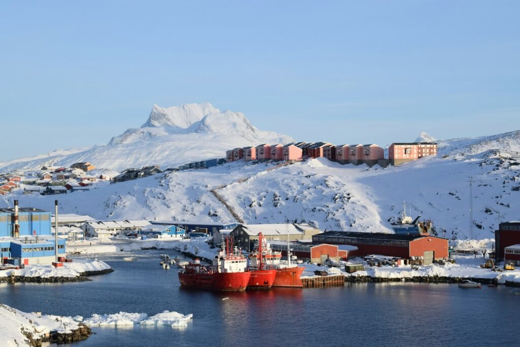
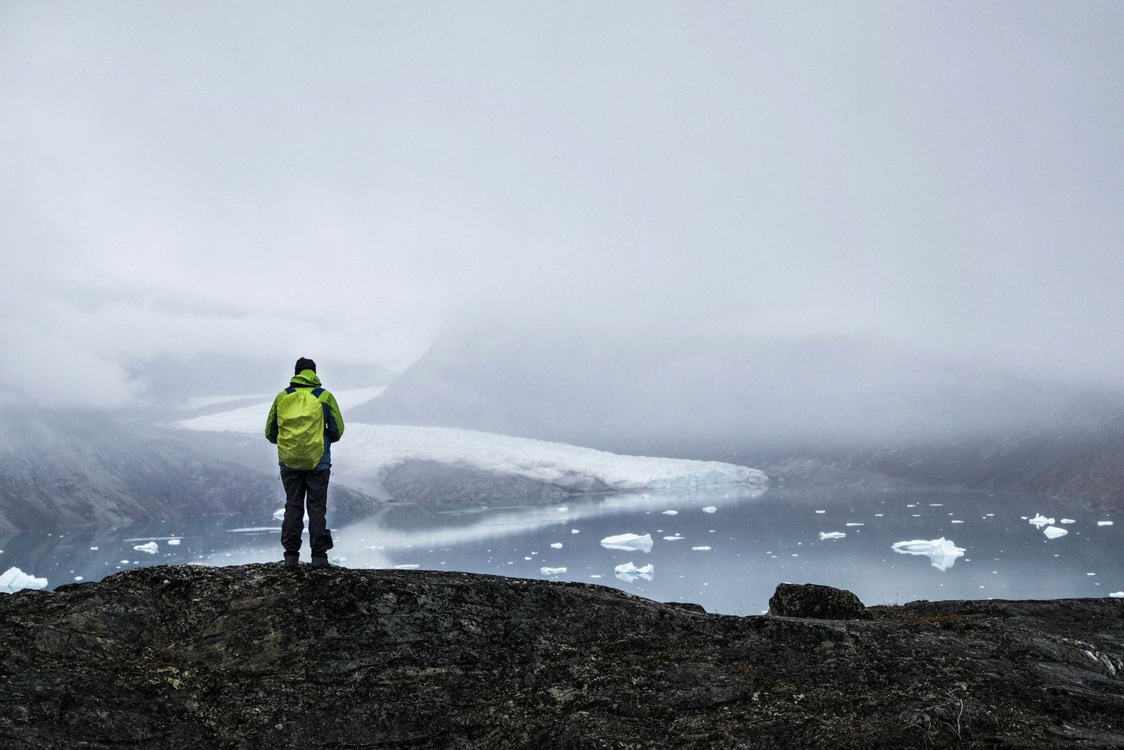
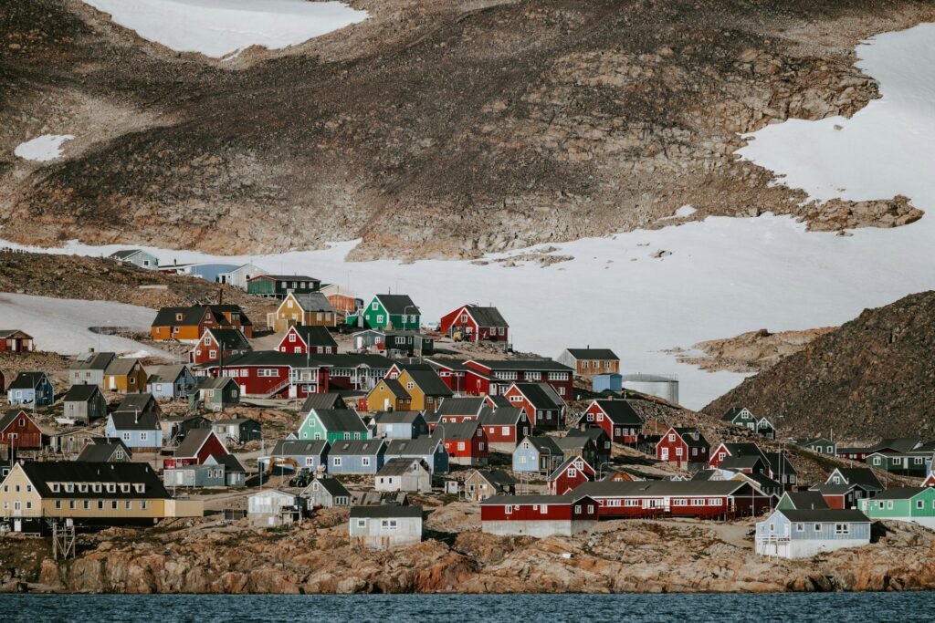
Most of Greenland’s 56,000 residents live along the coasts at the ice-free edges. All towns and settlements (including the capital, Nuuk) cling to the coastal fringes, because the inland ice is uninhabitable. The ice sheet towers over the interior, reaching up to about 3 kilometers (1.9 miles) thick at its deepest point. Its weight presses down the bedrock below. If you dug straight down at the island’s center, you would bore through roughly a mile or two of solid ice before hitting rock. That ice has persisted for tens of thousands of years, hiding the geography underneath.
| Metric | Value |
|---|---|
| Total area of Greenland | 2,166,000 km² (836,300 sq mi) |
| Portion covered by ice | ≈1,755,000 km² (677,855 sq mi), ~81% |
| Ice sheet thickness (avg / max) | ~1,500 m / 3,000 m (≈5,000 ft / 10,000 ft) |
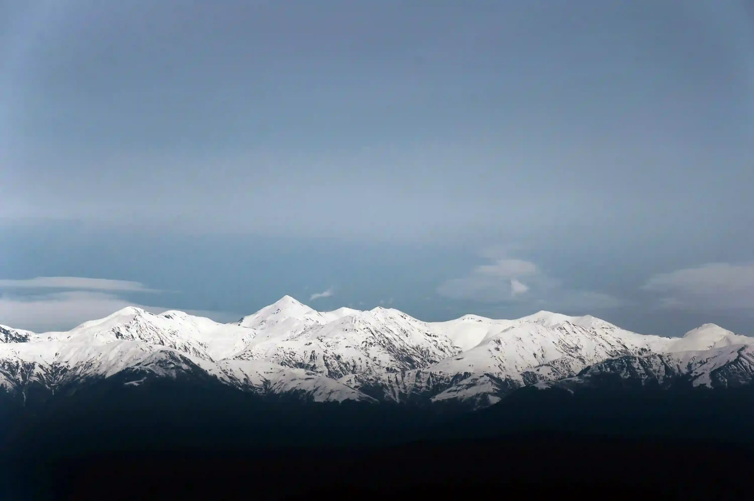
| Highest point (mountain peak) | Gunnbjørn Fjeld — 3,700 m (12,139 ft) |
| Coastline length | ≈39,330 km (24,430 mi) |
| Longest hidden canyon | ~750 km (466 mi) |
| Sea-level rise if all ice melts | ≈7 m (~23 ft) |
Mountains and Canyons Beneath the Ice
Bedrock: Peaks, Valleys, and Fjords
Underneath Greenland’s ice lies a landscape that would astonish anyone who could see it. Far from flat, the bedrock is rugged and varied. Scientists describe Greenland’s hidden base as a complex terrain of mountains, deep valleys, and ancient fjords. In other words, the rock under the ice has peaks and cliffs, likely carved by rivers and glaciers long ago — much like other mountainous lands. Some buried mountains in Greenland’s interior show peak-to-valley relief comparable to parts of the Appalachian Mountains, yet ice covers them completely today—though their absolute elevations are generally lower than Greenland’s highest coastal summits such as Gunnbjørn Fjeld (3,700 m / 12,139 ft).
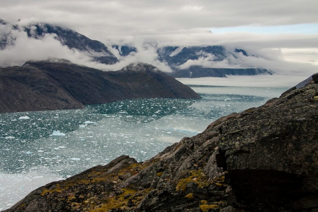
Over millions of years, the immense weight of the ice sheet pushed the central ground down like a heavy thumb on soft clay. Parts of Greenland’s bedrock in the interior now sit below sea level, depressed by the ice’s mass. If you removed the ice instantly, much of Greenland’s middle would form a low basin or bowl. Roughly one-fifth of the island’s bedrock lies beneath today’s sea level because of this effect. Over time, the rock would rebound once freed of weight — a process called isostatic rebound — and the land would rise. Near the coasts, by contrast, the bedrock shoots upward. Tall coastal mountains and cliffs ring the island’s edges, which is why Greenland has such steep fjords along the shore.
The Hidden Grand Canyon
One of the most striking discoveries in Greenland’s hidden geography is a colossal subglacial canyon — essentially a “Grand Canyon” buried under the ice. In 2013, scientists using ice-penetrating radar mapped a canyon more than 750 km (460 mi) long snaking under northern Greenland. This hidden gorge is longer than Arizona’s Grand Canyon and currently ranks as the world’s longest known canyon. In places, it reaches 800 m (2,600 ft) deep, with steep V-shaped walls. Researchers think an ancient river carved it before the ice ages, and later meltwater under the ice widened parts of it. Today the canyon is completely concealed by ice above, and satellites and radar reveal its course. This “Greenland Grand Canyon” likely channels subglacial meltwater from the ice sheet’s interior to the sea.
More features lurk beneath the ice. Scientists identify subglacial lakes and rivers under Greenland’s ice sheet, kept liquid by geothermal heat and pressure. These hidden pockets of water resemble those under Antarctica’s ice. They show that Greenland’s under-ice environment is not static rock but an active system where water flows, sometimes pooling in sub-ice “lakes” before draining out through glaciers or ice fjords. Together, these buried canyons, valleys, and water channels reveal a secret world only now being mapped by modern technology.
Is Greenland One Island or Many?
Early Hypothesis (1951): Paul-Émile Victor
We normally think of Greenland as a single gigantic island. It’s often called “the largest island on Earth.” Yet a provocative question remains: Could Greenland actually be an archipelago in disguise? In 1951, French polar explorer Paul-Émile Victor led a survey that suggested a striking possibility: under the ice, Greenland might consist of three large islands instead of one. His team proposed that narrow ice-covered straits divide the land. If filled with seawater, these straits could reach the ocean near places like Ilulissat Icefjord in the west, the far north, and the northeast. In essence, the thick ice sheet has acted like glue, holding multiple land pieces together. The claim was controversial and unproven without direct views beneath kilometers of ice.
Modern Mapping and Models
Today, advanced radar and satellite mapping allow scientists to revisit the idea. Modern data show deep valleys and possible channels in the bedrock. Some geologists hypothesize that if all the ice disappeared, seawater would flood interior basins and break Greenland into two or three major islands with a large inland sea in the middle. Computer models of Greenland’s bedrock support this concept: they depict a central bowl, now below sea level, surrounded by higher rimmed portions that form today’s coastlines. Without ice, that bowl would fill with ocean water and produce a new inland sea separating land blocks.
What We Know — and What We Can’t See Yet
This scenario remains a scientific hypothesis. As long as the ice sheet stays in place, we cannot directly observe the “islands” beneath, and the bedrock would rise once freed of ice, potentially changing the picture. Even so, evidence strongly suggests that Greenland’s apparent single island hides a multipart landform. In short, the globe’s largest island may look whole only because it wears an ice “coat.” The truth underneath could be far more archipelago-like.
Coastal Islands and Fringing Archipelagos
Major Coastal Islands
Even aside from the ice-hidden interior, Greenland isn’t a single solid block of land. The coastline of Greenland is wildly irregular, carved by countless fjords, bays, and peninsulas. Its total length is about 39,000 km (24,000 mi) — roughly the distance around the Earth at the equator. Along these convoluted coasts lie hundreds of offshore islands of many sizes. The biggest is Disko Island (Greenlandic: Qeqertarsuaq) off the west coast, about 8,578 km² (3,312 sq mi). It ranks among the world’s 100 largest islands and is Greenland’s second largest after the main island.
Smaller Islets and Skerries
Other sizeable islands include Ammassalik Island in the southeast and the Upernavik Archipelago in the northwest, which contains dozens of small islands scattered in Baffin Bay. Most coastal islands are much smaller — rocky islets and skerries dot the fjords. Many lack permanent residents (aside from seabirds and the occasional polar bear). Coastal glaciers often carved these minor islands from the surrounding rock. In the far north, Peary Land (on the mainland) is flanked by tiny coastal islands along the Arctic Ocean. In the far south near Cape Farewell, an archipelago of small islands sits at Greenland’s tip.
Counting the Islands
Altogether, Greenland comprises the huge main island plus numerous outlying islands. There is no simple count, because totals depend on how small an island you include; estimates reach into the hundreds or more. The key point: Greenland’s geography already includes significant coastal archipelagos. As ice retreats, that constellation could grow.
Melting Ice: New Islands and Rising Land
Greenland’s ice is not static — it is melting in a warming climate. As the ice sheet and glaciers shrink, they expose land unseen for thousands of years. In some cases, new islands appear where ice once connected everything. A well-known example is Uunartoq Qeqertaq, commonly called “Warming Island.”
Warming Island Emerges
Warming Island lies off Greenland’s east coast and was revealed around 2005–2007. The island had been there all along, but a glacier covered or attached it, making it seem part of the mainland. As the glacier retreated quickly in the early 2000s, water channels opened and separated the land into a true island. By 2007, scientists announced this “new” island — hidden by ice until then. The Oxford Atlas of the World named Warming Island the “Place of the Year” in 2007 to highlight how climate change can redraw maps.
One editor observed that water, not rock, lay beneath the ice bridge that had connected the land. More islets are likely to appear as the frozen fringe around the world’s largest island continues to melt. Many coastal pieces that look connected today may actually be ice links. As those “ice bridges” vanish, we may discover more islands detached from the mainland.
Rising Land (Isostatic Rebound)
Beyond revealing islands, melting reduces the load on the crust, and the land rises. In some Greenland towns, the ground lifts by a few millimeters each year. Over decades, this uplift changes local sea levels — the sea appears to fall relative to the land. Researchers project parts of the coast could see falling relative sea level by up to 1–3 meters by 2100, even as global sea level rises. Harbors may become shallower, and new rocks or sandbars could emerge above water.
A Future Map Reimagined
Together, melting ice, emerging islands, and land rebound could redraw Greenland’s map. Centuries from now, the central ice might shrink significantly, revealing the hypothesized archipelago within. Coasts would likely host more islands as glaciers retreat, removing icy ties. Edges of Greenland could also extend slightly where uplift occurs. Over very long timescales, a complete melt would raise global seas by about 7 meters (23 feet), submerging low-lying coasts elsewhere. In Greenland, some interior areas might become shallow seas at first.
FAQ
Is Greenland really one island or more than one?
Officially, Greenland is one enormous island (the largest in the world). However, research suggests that beneath the ice it might consist of two or three landmasses separated by basins. If the ice were removed and the low interior flooded, Greenland would likely appear as an archipelago of a few big islands rather than a single contiguous island. For now, the ice sheet “glues” these parts together, so people experience it as one island.
What would Greenland look like without its ice sheet?
If Greenland’s ice vanished, the island would look dramatically different. A huge central basin filled with water would create an inland sea. Higher areas (now the coastal regions) would stand out as separate landmasses around that sea. In simple terms, ice-free Greenland might resemble a ring of mountains and peninsulas — essentially two or three big islands encircling a new ocean gulf in the middle. Over time, the land would rebound upward without the ice’s weight, which could make the central sea shallower.
How many islands does Greenland have?
Besides the main island, Greenland has many smaller islands along its coasts — likely hundreds, or more if you include tiny skerries. These include large ones like Disko Island (about 8,578 km²) and countless small, uninhabited islets in the fjords. The exact number isn’t fixed, because new small islands can be revealed as glaciers retreat and definitions vary. The coastline (over 39,000 km long) is highly fragmented, so islands appear along most shores.
How thick is the ice on Greenland?
Greenland’s ice sheet is enormously thick. On average, the ice is about 1.5 kilometers (nearly a mile) thick. In the thickest central parts, it can reach up to 3 kilometers (10,000 feet). Near the edges of Greenland, the ice thins and eventually becomes glaciers that flow into the sea. The interior ice cap forms a vast plateau deep enough to cover entire mountain ranges beneath it.
Is Greenland’s ice sheet melting, and how fast?
Yes. In the 1990s, Greenland lost roughly 90 cubic kilometers of ice per year. By the early 2000s, the rate more than doubled to around 220 cubic kilometers per year. This rapid melt makes Greenland one of the largest contributors to global sea-level rise. In the 2010s and 2020s, satellite measurements show Greenland shedding on average several hundred billion tons of ice annually. The loss comes from surface melting and faster flow of outlet glaciers into the ocean. If warming continues, the ice loss may speed up further. Greenland holds enough ice to raise global sea levels by about 7 m (23 ft) over very long timescales.
Why is it called “Greenland” if it’s covered in ice?
The name “Greenland” dates back over a thousand years to the Viking explorer Erik the Red. According to the Icelandic sagas, Erik named it “Green land” to attract settlers, believing a pleasant name would encourage migration. He likely saw green fjords in summer and chose to emphasize them. In reality, Greenland was then (as now) mostly ice-covered, though coastal areas in summer can be green with tundra vegetation. The name stuck — part history, part early marketing.
What Did We Learn Today?
- Greenland is the world’s largest island (about 2.16 million km²) and is about 80% covered by a massive ice sheet.
- Beneath the ice, Greenland’s bedrock is rugged with mountains and valleys — including a hidden canyon ~750 km long, among the longest on Earth.
- The ice’s weight has pushed much of Greenland’s interior below sea level. If the ice vanished, seawater would flood the lowlands and likely split the land into 2–3 islands around a central sea.
- Greenland’s coastline is extremely jagged, with countless fjords and hundreds of coastal islands. As glaciers retreat, small “new” islands (like Warming Island in 2007) have been revealed.
- Climate change is reshaping Greenland’s geography. The ice loss rate accelerated from the 1990s to the 2000s, global sea level could rise ~7 m if all Greenland ice melts over long timescales, and the land is rising as ice weight decreases (isostatic rebound).