La Paz is one of South America’s most geographically distinctive major cities: Bolivia’s seat of government occupies a steep Andean basin, while El Alto spreads across the plateau above.
Its elevation, vertical urban form, cultural life, and unusual relationship with Sucre shape nearly every practical question about the city.
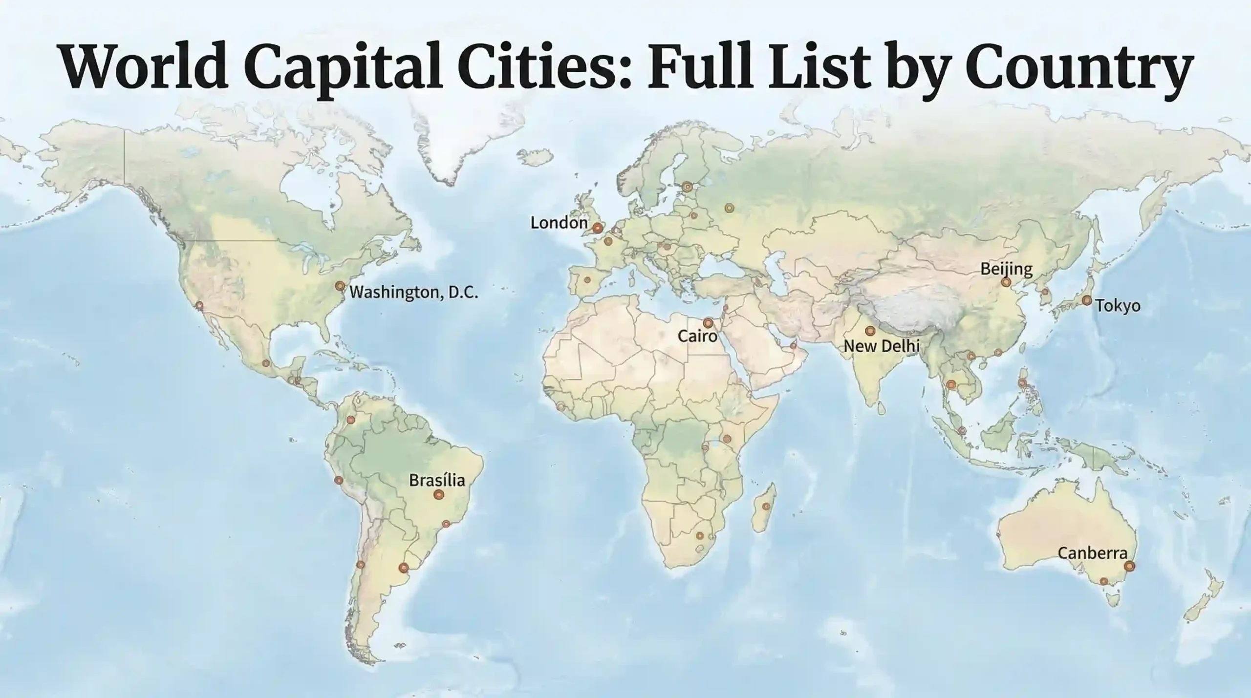
La Paz is Bolivia’s seat of government and the world’s highest administrative capital, centered at about 11,975 feet (3,650 m). Bolivia’s Constitution names Sucre as the capital, while the national executive and legislature work in La Paz. The familiar “highest capital” label therefore describes La Paz’s governmental function, not Bolivia’s constitutional wording.
How to use this article: Use the La Paz–Sucre capital check for the legal distinction, the La Paz–El Alto explanation for the city’s vertical geography, the Mi Teleférico section for transport, or the altitude advice before a visit.
Geography and Setting
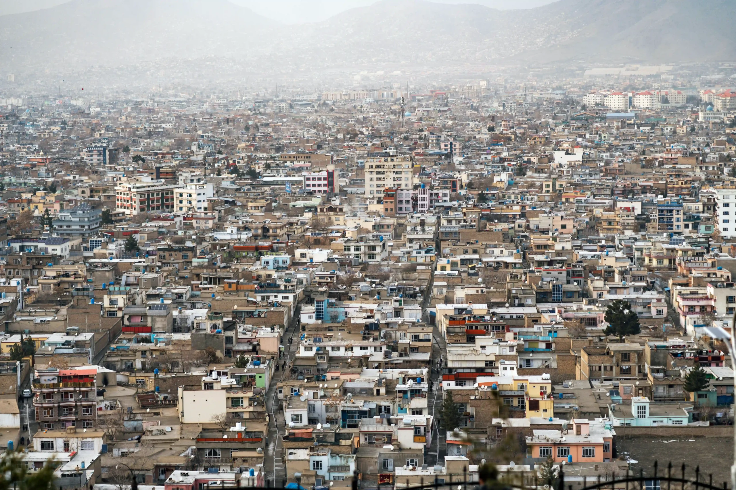
La Paz lies in west-central Bolivia southeast of Lake Titicaca. Its central districts occupy a deep basin crossed by the Choqueyapu River, while neighborhoods climb steep slopes toward the Altiplano and El Alto.
That physical drop between valley and plateau is the organizing fact behind the city’s climate, urban form, and transport. Illimani, at the southern end of the Cordillera Real, forms its most recognizable mountain backdrop.
How high is La Paz?
For practical comparisons, the CDC Yellow Book uses approximately 11,975 feet (3,650 m) for La Paz. That is a reference elevation, not a claim that every neighborhood sits at one level.
A frequently cited built-up-city range is about 10,660 to 13,450 feet (3,250 to 4,100 m). Municipal planning material uses a broader urban-zone range beginning around 9,840 feet (3,000 m), showing that figures depend on the boundary and area measured rather than representing a factual disagreement.
Why the La Paz–El Alto relationship matters
La Paz and El Alto are separate cities and municipalities, but they function as one closely connected metropolitan system. La Paz spreads through the basin below, while El Alto occupies the higher and flatter Altiplano surface.
This vertical relationship helps explain differences in temperature, commuting patterns, transport access, and urban expansion more clearly than a standard city-center description would. El Alto’s growth also extended the metropolitan area across terrain that is easier to build on than La Paz’s steep slopes.
Why the climate feels different from the latitude
La Paz lies within tropical latitudes, but elevation keeps conditions much cooler than the location on a world map might suggest. Lower neighborhoods are generally milder than exposed districts near the plateau, while high altitude also brings dry air, colder nights, and stronger ultraviolet exposure.
| Feature | Practical meaning |
|---|---|
| National role | Seat of government and administrative capital |
| Reference elevation | About 11,975 feet (3,650 m) |
| Commonly cited built-up range | About 10,660 to 13,450 feet (3,250 to 4,100 m), depending on the area counted |
| Core landform | A steep basin crossed by the Choqueyapu River |
| Main urban partner | El Alto on the Altiplano above |
| Mountain backdrop | Illimani in the Cordillera Real |
The snapshot shows why La Paz is difficult to reduce to a single label. It is a seat of government, a high-altitude basin city, and one half of a closely connected valley-to-plateau metropolitan system.
Capital Status and Historical Background
La Paz or Sucre: which one is the capital?
Article 6 of Bolivia’s 2009 Constitution states that Sucre is the capital. Official national institutions show the practical division: the presidency and Plurinational Legislative Assembly operate in La Paz, while the Supreme Tribunal of Justice is seated in Sucre.
The precise description is therefore Sucre as Bolivia’s constitutional capital and La Paz as its seat of government, commonly called the administrative capital. This split-seat arrangement is why maps and capital references can appear inconsistent. (Bolivian Constitution, 2009; official government sites, 2026)
GeographyPin’s world capital cities list records both roles rather than forcing Bolivia’s arrangement into a single-city answer.
| City | Role | Why it matters |
|---|---|---|
| La Paz | Seat of government and administrative capital | The national executive and legislature operate here |
| Sucre | Constitutional capital | The Constitution names it as capital, and the Supreme Tribunal of Justice is seated there |
From colonial foundation to national government seat
La Paz was founded by Spanish captain Alonso de Mendoza on October 20, 1548, initially at Laja. It was moved soon afterward to its present setting in the Choqueyapu basin and carried the colonial name Nuestra Señora de La Paz.
In 1827, a national law formalized the name La Paz de Ayacucho. Following the Federal War of 1898–1899, La Paz became Bolivia’s de facto seat of national government, while Sucre retained its constitutional position.
Why this history still matters
The La Paz–Sucre distinction is not minor historical trivia. It determines how the two cities should be labeled in maps, textbooks, capital lists, and international reporting. Describing La Paz simply as “the capital” communicates its practical role but leaves out Bolivia’s constitutional wording.
Culture, Identity, and Daily Life
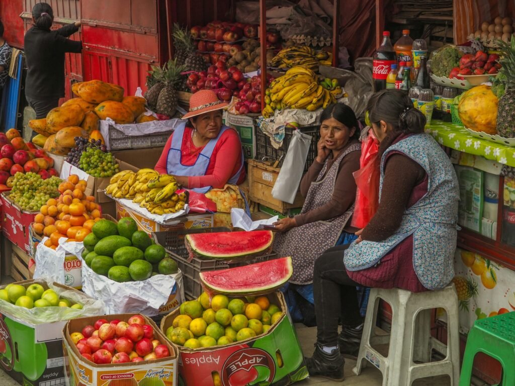
La Paz is not defined only by ministries and legislative buildings. Andean migration and Aymara cultural continuity remain visible in markets, language, dress, ritual life, food, and civic celebrations.
Aymara presence and city identity
Municipal historical research describes migration from rural Andean communities as essential to the development of modern La Paz. The Mercado de las Brujas area reflects part of that continuity, with handicrafts and tourist goods sold alongside herbs, offerings, and other items associated with Andean and Aymara ritual practice.
Reducing the market to a tourist curiosity would miss its wider meaning. It belongs to an urban culture in which commerce, belief, public space, and cultural memory continue to intersect.
Landmarks, museums, and civic space
Plaza Murillo is the political center of La Paz, while the San Francisco area, Calle Jaén, older church façades, and market streets show other layers of the city. The National Museum of Art and the National Museum of Ethnography and Folklore add visual, historical, and Indigenous cultural context.
This combination of government buildings, religious architecture, museums, and everyday commerce gives central La Paz a civic character that is more complex than a conventional administrative district.
UNESCO-recognized living traditions
UNESCO inscribed the ritual journeys during Alasita on the Representative List of the Intangible Cultural Heritage of Humanity in 2017 and the Gran Poder festival in 2019. These inscriptions recognize living practices rather than the city as a whole, emphasizing community participation, ritual, music, dance, and exchange.
Economy, Transport, and Urban Systems
La Paz’s role as the seat of government concentrates national institutions and services, while commerce, finance, manufacturing, and street-based trade remain important to the wider urban economy. The valley-to-plateau terrain directly shapes how people, goods, and services move through the metropolitan area.
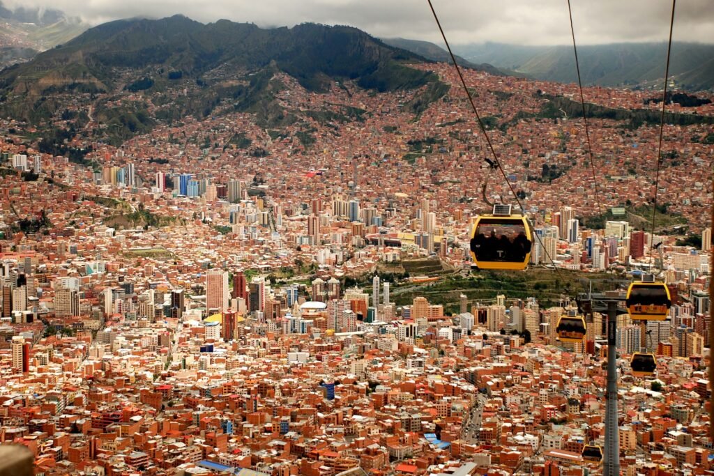
Why the city works vertically
Many cities expand mainly across flat land. La Paz grew along slopes, through side valleys, and upward toward the Altiplano edge. Elevation therefore affects road access, commuting time, neighborhood connections, and the practicality of conventional surface transport.
A flat street map cannot fully explain the city. The height difference between central La Paz, its hillside districts, and El Alto is just as important as the horizontal distance between them.
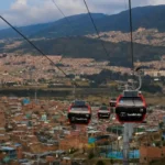
Mi Teleférico and the valley-to-plateau link
Mi Teleférico is one of the clearest examples of La Paz adapting transport to its terrain. Official 2026 company material identifies 10 lines and 36 stations across La Paz and El Alto.
The cable-car network is not simply a sightseeing attraction. It is a public transport system that crosses steep slopes and links the basin with the plateau without following the same congested road corridors as cars and buses.
Airport and external connections
El Alto International Airport is located in El Alto on the plateau above central La Paz. NAABOL, Bolivia’s airport operator, describes it as a strategic terminal for national and international flights. Its location means many arriving passengers begin at a higher elevation before descending toward central La Paz.
Intercity highways and buses connect the metropolitan area with Bolivia’s western highlands and routes toward Peru and Chile. Weather, demonstrations, and roadblocks can affect overland travel, so departure conditions should be confirmed close to the journey.
Visiting La Paz
For visitors, the city’s physical setting and altitude are immediately noticeable. Steep streets, abrupt views, and Illimani on the skyline make La Paz memorable, but the body may need time to adjust before strenuous sightseeing.
How to handle the altitude
The CDC Yellow Book lists La Paz at approximately 11,975 feet (3,650 m) and identifies the first three to five days after ascent as the key period for acute acclimatization. It recommends gradual ascent where possible, avoiding alcohol for the first 48 hours, and keeping exercise mild during those first two days.
Headache accompanied by nausea, dizziness, unusual fatigue, or loss of appetite can indicate acute mountain sickness. Do not move to a higher sleeping elevation while symptomatic. Worsening symptoms, confusion, loss of coordination, or breathlessness at rest require urgent medical attention and descent when medically advised or safely possible.
Check current travel conditions before departure
The U.S. Department of State’s June 4, 2026 advisory says travelers should reconsider travel to La Paz because of unrest. Demonstrations and roadblocks can disrupt transport and access to essential services with little warning. Conditions can change after publication, so consult current official guidance, airline information, and local transport updates immediately before traveling.
What to see in the city itself
A compact first itinerary works well when it combines an overhead view with a street-level walk. Mi Teleférico helps explain the city’s physical form, while Plaza Murillo, the San Francisco area, Calle Jaén, museums, and market streets show its political and cultural life at ground level.
The pairing matters because La Paz becomes easier to understand after seeing both its topography and the public spaces that developed within it.
What to pair with La Paz nearby
Tiwanaku, a UNESCO World Heritage property in the Department of La Paz, provides important context for the pre-Hispanic history of the southern Andes. Lake Titicaca is another defining geographic reference for the wider Altiplano region. (UNESCO World Heritage Centre)
Pairing La Paz with Tiwanaku or Lake Titicaca shows that the city is closely connected to the highland world around it rather than functioning as an isolated urban stop.
Frequently Asked Questions
Is La Paz the capital of Bolivia?
Bolivia’s Constitution names Sucre as the capital. La Paz is the seat of the national executive and legislature, so it is commonly described as Bolivia’s administrative capital or seat of government.
Why is La Paz called the world’s highest capital city?
La Paz is the world’s highest seat of national government, with a reference elevation of about 11,975 feet (3,650 m) and some neighborhoods considerably higher. The label refers to its administrative role; it does not mean Bolivia’s Constitution names La Paz as the capital.
Are La Paz and El Alto the same city?
No. They are separate cities and municipalities within one closely connected metropolitan area. La Paz occupies the basin and surrounding slopes, while El Alto spreads across the higher Altiplano.
Is Mi Teleférico mainly for tourists?
No. Mi Teleférico is a public transport network serving La Paz and El Alto. Its elevated views make it useful for sightseeing, but its main urban purpose is moving passengers across terrain that is difficult for conventional road transport.
How should a first-time visitor prepare for La Paz?
Plan light activity after arrival, limit alcohol during the first 48 hours, allow time to acclimatize, and learn the warning signs of altitude illness. Current travel advisories and local transport conditions should also be checked immediately before departure.
What Did We Learn Today?
La Paz is best understood as Bolivia’s seat of government and the world’s highest administrative capital, with Sucre retaining the constitutional title. Its canyon-to-plateau setting explains the elevation range, its close but separate relationship with El Alto, the city’s cool highland conditions, and the practical value of Mi Teleférico. For visitors, that same geography makes acclimatization and current travel checks essential parts of planning.
Sources & Data Notes
Capital-status wording was checked against Bolivia’s 2009 Constitution and official executive, legislative, and judicial sources; geographic and historical context was checked against UN-Habitat, UNRISD, and La Paz municipal material. UNESCO supplied the heritage references, Mi Teleférico and NAABOL supplied current transport information, and the CDC Yellow Book and U.S. Department of State supplied altitude and travel guidance. Elevations are rounded and vary according to the neighborhood and boundary used, while transport operations and travel conditions can change after publication. This article was prepared and editorially reviewed by Z.K. Atlas, who completed the final factual checks and publication approval and accepts publication responsibility. AI tools may have assisted during the editorial process, including with language refinement and the creation or editing of visual materials.