“Baltic countries” usually means three neighboring states, but a map of the Baltic Sea shows many more countries. The useful distinction is between the three-state region, the sea’s coastline and the Baltic language family.
The Baltic countries are Estonia, Latvia and Lithuania, arranged north to south along the eastern Baltic Sea. Their capitals are Tallinn, Riga and Vilnius. They are not the same as all nine Baltic Sea coastal countries, and Estonian is not a Baltic language: it belongs to the Finnic branch of Uralic.
How to use this article: Find the three capitals, check the bordering countries, or compare three states with nine coastal countries.
1. Find the Three Baltic Countries
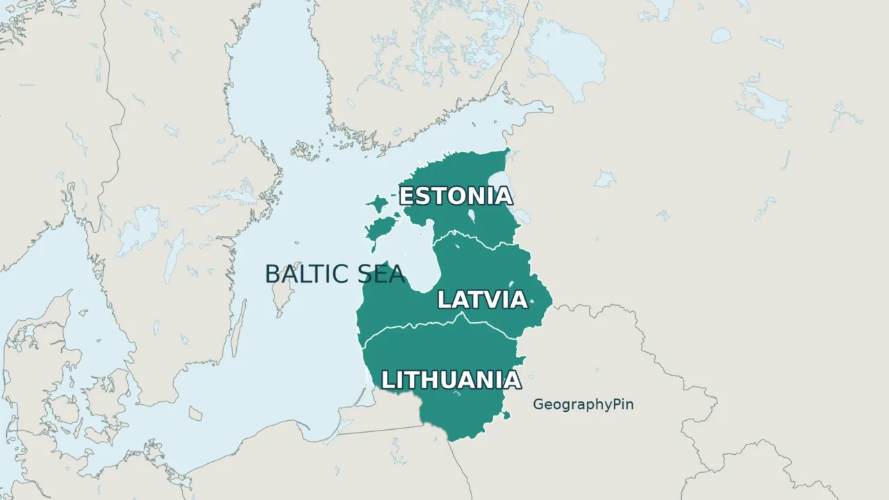
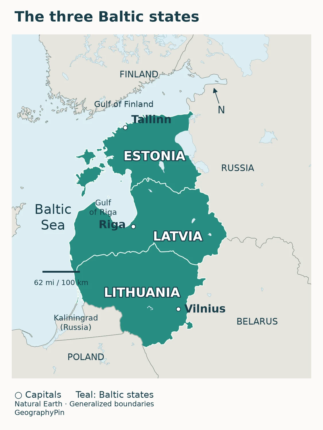
The Baltic states form a connected group on the eastern side of the Baltic Sea. Reading north to south, the order is Estonia, Latvia, Lithuania. They are three independent countries, not provinces of one larger Baltic country.
Countries and capitals, north to south
| Country | Capital | How to find it |
|---|---|---|
| Estonia | Tallinn | Northernmost; south of the Gulf of Finland |
| Latvia | Riga | Middle country; around the southern Gulf of Riga |
| Lithuania | Vilnius | Southernmost; between Latvia and Poland/Belarus |
The capitals do not follow one straight coastal line. Tallinn lies on Estonia’s northern coast, Riga is near the southern end of the Gulf of Riga, and Vilnius is inland in southeastern Lithuania. A capital marker identifies a city, not the center of the country.
Start with Estonia at the top rather than memorizing the countries as an alphabetical list. Latvia touches both of the other Baltic states. Lithuania and Estonia do not share a land border: Latvia lies between them.
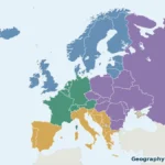
For the surrounding continental picture, the Europe map and regional country sheets show how this compact group fits into the larger continent. The close-up here gives the three states more room, so their borders, capitals and coastal setting are easier to distinguish.
2. Read the Borders and Coastlines
Which countries share their borders?
| Baltic state | Neighboring countries |
|---|---|
| Estonia | Latvia; Russia |
| Latvia | Estonia; Lithuania; Russia; Belarus |
| Lithuania | Latvia; Belarus; Poland; Russia (Kaliningrad Oblast) |
This table excludes neighbors across the open sea. Finland is across the Gulf of Finland from Estonia, but the two countries have no land border. Sweden lies across the Baltic Sea rather than against the western land boundary of any Baltic state. Some international boundary sections run through rivers or lakes; “neighbor” here does not mean that every stretch is dry land.
Why Russia appears in two places
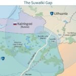
Russia lies east of Estonia and Latvia. It also has a separate piece of territory, Kaliningrad Oblast, between Lithuania and Poland. Kaliningrad is not a fourth Baltic state: it is part of Russia, separated from the country’s main territory by other countries.
That geography explains a common map-reading mistake. Lithuania borders Russia through Kaliningrad, not through the main Russian territory farther northeast. Belarus, meanwhile, reaches Lithuania and Latvia but has no Baltic Sea coastline.
Watch the water shapes as well as the borders. The Gulf of Finland runs eastward between Estonia and Finland. The Gulf of Riga lies between Latvia and Estonia. Estonia’s offshore islands are part of the country, not additional Baltic states. Lithuania has its own Baltic coast even though its capital is inland.
The maps are regional orientation aids. Their generalized lines are not boundary surveys, and they do not describe border-crossing access, travel restrictions or military positions.
3. Baltic States Are Not All Baltic Sea Countries
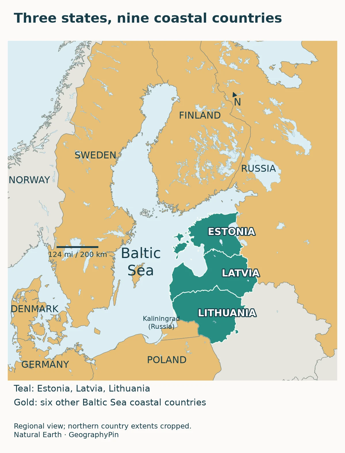
Three states, nine coastal countries
The word “Baltic” changes meaning with the noun beside it. Baltic states means Estonia, Latvia and Lithuania in the modern regional grouping. Baltic Sea coastal countries means countries with a shore on the sea or its connected gulfs.
HELCOM, the Baltic marine environment commission, identifies nine coastal countries: Denmark, Estonia, Finland, Germany, Latvia, Lithuania, Poland, Russia and Sweden. The three Baltic states are part of that nine-country set, not a separate set to add to it.
| Term | What it identifies | Key distinction |
|---|---|---|
| Baltic states / Baltic countries | Estonia, Latvia and Lithuania | A three-state regional grouping |
| Baltic Sea coastal countries | Nine countries around the sea | Includes six countries outside the Baltic states |
| Baltic languages | A branch of Indo-European languages | Includes Latvian and Lithuanian, not Estonian |
Poland and Sweden are therefore Baltic Sea countries without being Baltic states. Russia has Baltic shores both at Kaliningrad and along the Gulf of Finland, but is counted once in the coastal-country total. Denmark is included in the established nine-country coastal list even though it sits at the sea’s western approaches rather than beside the three states.
A drainage-basin map answers yet another question: where does water flow toward the Baltic Sea? A country can contain land draining toward the sea without having a coast on it. Do not use a watershed boundary or a regional organization’s membership list to silently replace the coastal-country list.
4. Why Estonian Is Not a Baltic Language
The Baltic-state grouping is geographic and political, not a statement that everyone speaks related languages. Estonia’s official language is Estonian; Latvia’s is Latvian; Lithuania’s is Lithuanian. These are distinct languages, not three names for one shared national language.
| Language | Branch | Language family |
|---|---|---|
| Estonian | Finnic | Uralic |
| Latvian | Baltic | Indo-European |
| Lithuanian | Baltic | Indo-European |
University of Helsinki research places Estonian and Finnish in the Finnic branch. Latvian and Lithuanian, by contrast, belong to the Baltic branch of Indo-European. The word “Baltic” in a language-family name is therefore narrower than its use in the expression “Baltic states.”
This does not make Estonia any less a Baltic state. Nor does it turn Finland into one simply because Finnish and Estonian are related. Languages and countries are being classified by different criteria.
Neighboring languages can influence one another without belonging to the same family. Research on Baltic–Finnic contact documents interaction between Latvian and Finnic languages, including Estonian and Livonian. Shared words or long contact do not erase the underlying distinction.
The table describes the named official languages, not every language spoken within each country. A country-colored political map should not be read as an ethnic map or as proof that only one language is used throughout its territory.
5. Where the Baltics Fit Within Europe
“Northern Europe,” “Eastern Europe” and “the Baltic states” describe different kinds of grouping. Under the United Nations M49 statistical classification, Estonia, Latvia and Lithuania are all in Northern Europe. M49 explicitly explains that its regional assignments serve statistical purposes rather than deciding political or other affiliations.
The Baltic label is more specific than that broad northern grouping. It does not mean that every country classified as Northern European is Baltic, or that a historical discussion using “Eastern Europe” has changed the three countries’ locations.
The distinction is useful when comparing lists. GeographyPin’s Eastern European countries map uses the M49 grouping, which excludes the three Baltic states. They still appear in the wider Europe countries and capitals reference.
The Baltic Assembly supplies a practical example of the three-state grouping: it brings together parliamentarians from Estonia, Latvia and Lithuania. Cooperation does not make the three countries a single sovereign state. Each retains its own capital and institutions.
For a reliable mental map, keep three layers separate: the three countries on the eastern Baltic shore, the nine countries bordering the wider sea, and the language families spoken across the region. A statement can be correct in one layer and wrong in another.
Frequently Asked Questions
Are the three Baltic states members of the European Union?
Yes. Estonia, Latvia and Lithuania all joined the European Union on May 1, 2004. EU membership is a separate classification from being a Baltic state or having a Baltic Sea coastline.
Does “Baltics” mean the same thing as “Balkans”?
No. The Baltics refers to Estonia, Latvia and Lithuania in this context. The Balkans is a different region in southeastern Europe; the similar-sounding names do not identify the same countries.
What Did We Learn Today?
A useful Baltic map separates countries, coastlines and languages. Estonia, Latvia and Lithuania form the three-state group; the wider Baltic Sea has nine coastal countries. Their capitals and borders make the north-to-south sequence clear, while the language comparison explains why Estonia belongs to the region even though Estonian is Finnic rather than Baltic.
Sources & Data Notes
The three-state grouping follows Baltic parliamentary cooperation; the nine-country coastal list follows HELCOM. Northern Europe refers specifically to UN M49, not a universal cultural boundary. Maps use generalized Natural Earth geometry and distinguish country groups, not language territories, maritime jurisdictions or catchment boundaries. Capital names follow EU country profiles. No population totals or exact boundary measurements are used.
- Baltic Assembly: cooperation among the three national parliaments
- HELCOM: the nine Baltic Sea coastal countries
- UN Statistics Division: M49 regional classification
- European Union: Estonia country profile
- European Union: Latvia country profile
- European Union: Lithuania country profile
- Investment and Development Agency of Latvia: geographic facts
- Lithuanian Ministry of Foreign Affairs: country and neighbors
- University of Helsinki: Finnic languages and the Baltic Sea language area
- Journal of the International Phonetic Association: Standard Lithuanian
- Anna Stafecka: Baltic–Finnic linguistic contact (research abstract)
- Natural Earth: public-domain map-data terms