Lithuania’s Baltic coast is only one part of its geographic story. Inland, lowlands, wooded hills, lakes and river valleys connect the capital and other cities with farming regions and the coast. Following the Nemunas system westward helps explain how these landscapes fit together, while the Curonian Spit shows how a narrow strip of sand can separate two very different bodies of water.
Lithuania is the southernmost of the three Baltic states, with Vilnius as its capital. Its geography combines lowlands, glacially shaped hills and lake districts with the Nemunas basin and a Baltic coastline. The Curonian Spit is land separating the sea from the Curonian Lagoon; both the spit and lagoon extend beyond Lithuania into Russia’s Kaliningrad region.
How to use this article: Compare the main landscapes, distinguish the spit from the lagoon, or follow the inland-to-coast water connection.
1. Locate Lithuania and read its Baltic borders
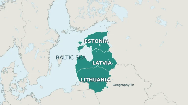
Lithuania borders Latvia to the north, Belarus to the east and southeast, Poland to the southwest and Russia’s Kaliningrad region to the southwest and west. The Baltic Sea lies to the west. Kaliningrad is Russian territory separated from the main body of Russia; it is not part of Lithuania.
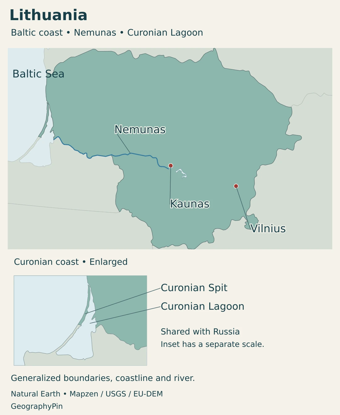
Vilnius lies inland in the southeastern part of the country. Kaunas occupies another inland river setting, while Klaipėda is the principal city associated with the Baltic port and lagoon entrance. The country’s capital and its maritime gateway are therefore different places.
The southern Baltic state has both land and sea connections
Estonia, Latvia and Lithuania form the familiar north-to-south sequence of Baltic states. Lithuania’s border with Poland provides a land connection to the rest of the European Union, while the Baltic coast provides a separate maritime connection.
The border region often discussed as the Suwałki Gap has a narrower strategic meaning than Lithuania as a whole. Our Suwałki Gap explainer covers that topic separately. For basic orientation, use the Baltic countries map rather than treating every regional label as a physical landform.
2. Country facts and dated population
| Item | Fact | Date or scope |
|---|---|---|
| Capital | Vilnius | Constitutional capital and seat of national government |
| Population | 2,887,592 | Usually resident population at January 1, 2026 |
| Area | About 25,206 sq mi (65,284 km²) | Geographical size published by the EU country profile, attributed to Eurostat 2026 |
| State language | Lithuanian | Constitutional status; distinct from all languages used by residents |
| Currency | Euro (EUR) | Euro-area member since January 1, 2015 |
| Government | Republic with a president, parliament and prime minister | Government depends on parliamentary approval and confidence |
| Administrative units | 10 counties and 60 municipalities | Territorial administrative classification, not physical regions |
Usually resident people, with a clear reference date
The population figure is the usually resident total for January 1, 2026, not the number of Lithuanian citizens living worldwide. It should also not be interpreted as a new census count or a live counter of everyone physically present in the country today.
City, municipal and national figures describe different territories. A population for Vilnius municipality is not automatically a count of its continuously built-up urban area or wider commuting region. Matching both date and geographic unit matters before making comparisons.
The published area in the table is a geographical-size measure. It is not a measurement of the country’s offshore waters, and no separate dry-land or inland-water allocation is inferred from that headline figure.
3. Lowlands, lake country and the Curonian coast
Compare the main physical settings
| Setting | Location | What distinguishes it |
|---|---|---|
| Central lowlands | Broad interior plains | Relatively low relief, cultivated land and river corridors |
| Hilly and lake-rich uplands | Parts of the western and eastern interior | Glacially shaped ridges, depressions and varied local relief |
| Aukštaitija lake landscapes | Northeastern Lithuania | Wooded lake basins, connecting streams and intervening ridges |
| Curonian coast and lagoon margin | Western maritime edge | Sand dunes, coastal settlements, a shallow lagoon and the route to the Baltic Sea |
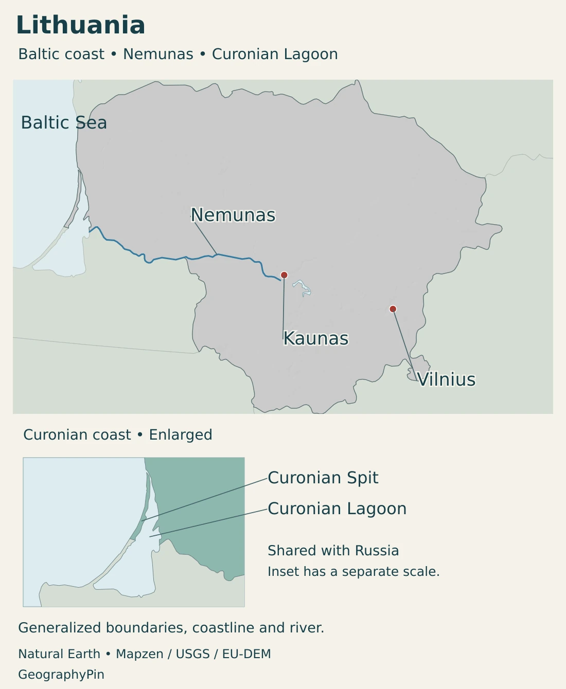
Lithuania is predominantly low-lying, but that does not make every part of it level. Valleys, ridges and lake basins create substantial local contrasts. An upland in this setting means higher terrain relative to nearby lowlands, not an alpine mountain system.
Glacial landscapes contain more than isolated lakes
Aukštaitija National Park protects a landscape of wooded lake basins, ridges and river systems. The lake-filled valleys and intervening higher ground form a connected physical pattern rather than a random collection of blue patches.
That pattern influences settlement and access. A short straight-line distance between two lakeside places may cross water or a ridge, while a road follows a longer route around them. Forests, villages and cultural sites are part of the same landscape, not features separate from its natural setting.
The Curonian Spit is land; the lagoon is water
The Curonian Spit is a narrow sandy peninsula separating the Baltic Sea from the Curonian Lagoon. The spit is shared by Lithuania and Russia’s Kaliningrad region. Its UNESCO World Heritage designation describes a shared cultural landscape, not a single national jurisdiction.
The dunes are not simply untouched scenery. Wind, waves, vegetation and human management have shaped them. Following periods of forest clearance and moving sand, stabilization and reforestation became important to the survival of settlements and the landscape.
The lagoon lies behind the spit. It is connected to the Baltic through the Klaipėda Strait, so it should not be confused with either the open sea or an entirely enclosed inland lake. Lithuania contains only part of this larger coastal system.
4. The Nemunas basin and coastal water connections
The Nemunas links inland Lithuania with the lagoon
The Nemunas system is a major organizing feature of Lithuania’s inland geography. The river reaches the Curonian Lagoon, connecting upstream landscapes with the coastal water system. Its tributaries expand that connection beyond the main river corridor.
The Neris joins the Nemunas at Kaunas. Vilnius lies beside the Neris and its smaller tributary, the Vilnia, so the capital is connected to the wider Nemunas drainage network without standing on the Nemunas itself.
A river basin means the land drained by a river and its tributaries. A water-management district is an administrative planning unit and can include neighboring coastal catchments as well. Lithuania’s Nemunas river-basin district therefore should not be treated as an exact synonym for the natural Nemunas catchment.
Not every Lithuanian river belongs to the Nemunas
Lithuania also participates in the Lielupe, Venta and Daugava river-basin districts. These northern and northeastern water connections cross national borders. A country boundary does not stop runoff or make water-quality management a purely domestic task.
Land use upstream can affect downstream waters through sediment and nutrient movement. The European Commission’s river-basin assessment identifies reducing pollution reaching the Baltic Sea and Curonian Lagoon as an important water-management concern. Coastal conditions are consequently linked to activities well inland.
A maritime coast and a more continental interior
Lithuania lies in a mid-latitude climate zone. The Baltic coastal area has a stronger maritime character than the interior, while inland conditions show more continental influence. The contrast is gradual rather than a sharp weather boundary.
Elevation, local shelter and proximity to water add further differences. Long-term regional patterns help explain the landscape, but they do not specify the conditions of a particular winter, summer or river season. A coastal location and an inland town need not experience the same temperature or wind at the same time.
5. Vilnius, Kaunas and regional life
Vilnius, Kaunas and Klaipėda occupy different settings
Vilnius is the constitutional capital and the seat of national government. Its historic center developed around hills and the meeting of the Neris and Vilnia. The surviving townscape reflects both this physical setting and the cultural history of the city.
Kaunas sits at the confluence of the Nemunas and Neris. It is an inland river city, not the country’s Baltic seaport. Klaipėda occupies the coastal setting beside the lagoon and sea, with maritime functions that differ from those of the capital.
These three locations illustrate why a national profile needs more than a single city marker. Government institutions, river connections and maritime access can be concentrated in different places and linked through transport and economic networks.
State language and everyday cultural life
Lithuanian is the state language under the Constitution. The same constitutional framework protects citizens belonging to ethnic communities in fostering their language, culture and customs. Official state-language status does not imply that every resident uses the same language in private life.
Vilnius’s historic urban landscape also reflects the contributions of different linguistic and religious communities. That cultural history does not make language, ethnicity and citizenship interchangeable categories. Nor should the language used at home be assumed from a person’s place of residence alone.
Administrative units and natural regions have different purposes
Lithuania’s municipalities organize local administration, while counties provide a broader territorial classification. Lake districts, lowlands and river basins do not follow those boundaries exactly.
A national physical map therefore need not reproduce every local-government division to explain how the landscape works. Conversely, knowing a town’s municipality does not tell you which river system drains its surrounding land.
6. Government, energy and routes to the sea
Lithuania’s national institutions include the president, the Seimas parliament and the government led by the prime minister. The president appoints the prime minister with the approval of the Seimas, and the government’s program must receive parliamentary approval before it is empowered to act.
The prime minister directs the government’s activities. This division of roles is more informative than treating the president and prime minister as interchangeable titles. Local municipalities operate within the national constitutional framework rather than as separate sovereign states.
Hydropower and pumped storage are not the same process
Kaunas Hydroelectric Power Plant uses water on the Nemunas to generate electricity. The associated reservoir is a managed river landscape, distinct from the natural Curonian Lagoon at the coast. English sources sometimes call the reservoir “Kaunas Lagoon,” which can make the two names easy to confuse.
Kruonis pumped storage uses a different principle: electricity pumps water from the lower Kaunas reservoir to a higher artificial reservoir, and water later flows back through turbines to generate electricity. It stores energy for later use rather than creating a new river-water supply.
The route from Kaunas to Klaipėda crosses different waters
The Inland Waterways Directorate identifies a route connecting Kaunas with Klaipėda through the Nemunas and Curonian Lagoon. This is a useful geographic connection between the interior and the coast, not evidence that every reach is navigable for every vessel at all times.
Klaipėda’s port setting joins lagoon waters with access to the Baltic Sea. Waterway depth, channels, terminals and inland connections matter alongside the natural location. A coast creates access opportunities, but transport infrastructure determines how those opportunities can be used.
Inland and coastal geography belong in the same picture
Lithuania’s farmland and forests, inland cities and Baltic gateway are connected rather than separate geographic worlds. Rivers provide drainage and energy settings, roads and other transport links connect settlements, and coastal conservation protects a landscape shaped by both nature and people.
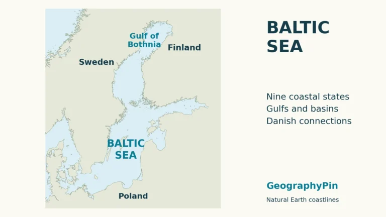
The broad picture is a low-lying Baltic country with meaningful local variation. Understanding the difference between a spit, lagoon, reservoir and river basin makes that picture much clearer. Our Baltic Sea guide extends the view beyond the national coast.
Frequently Asked Questions
Is the Curonian Spit entirely in Lithuania?
No. The sandy peninsula is shared by Lithuania and Russia’s Kaliningrad region. Its physical continuity and shared heritage designation do not erase the international border.
Are Kaunas Lagoon and the Curonian Lagoon the same place?
No. Kaunas Lagoon is a name used for the inland reservoir on the Nemunas. The Curonian Lagoon is a coastal water body separated from the Baltic Sea by the Curonian Spit.
Is Vilnius on the Nemunas River?
No. Vilnius is on the Neris and Vilnia. The Neris joins the Nemunas at Kaunas, linking the capital to that wider drainage system.
What Did We Learn Today?
Lithuania combines lowlands and lake-rich uplands with inland river cities and a distinctive Baltic coast. The Nemunas system links much of that interior to the Curonian Lagoon, while the spit separates lagoon waters from the sea. Vilnius, Kaunas and Klaipėda occupy different but connected settings, and clear statistical and territorial definitions keep the country’s physical and political geography distinct.
Sources & Data Notes
Statistics retain their reference dates. The Curonian coastal landscape crosses an international border; physical continuity is separate from national jurisdiction. River-basin districts are management units rather than exact synonyms for natural catchments.
- UNESCO: Modernist Kaunas: Kaunas at the confluence of the Nemunas and Neris.
- Lithuanian Geological Survey: Quaternary geology: Glaciers and meltwater shaped the plains, uplands, ridges and intervening depressions.
- Council of the European Union: annual population update: October 22, 2026 document, annex: total usually resident population at January 1, 2026; Lithuania 2,887,592.
- European Union: Lithuania country profile: Matching population and 65,284 km² geographical size, attributed to Eurostat 2026, plus capital and euro membership. No separate land–water accounting is inferred.
- Constitutional Court: Constitution, hosted by UNHCR Refworld: Consolidated constitutional text: Articles 14 and 17 on language and capital, and Article 37 on ethnic communities.
- Government of Lithuania: constitutional obligations: Prime minister, Cabinet, presidential appointment with Seimas approval and parliamentary responsibility.
- State Data Agency: territorial administrative division: 10 counties and 60 municipalities; not a claim of elected county governments.
- UNESCO: Curonian Spit: Shared Lithuanian–Russian sand-dune peninsula, separation of sea and lagoon, and the history of stabilization and forest management.
- State Service for Protected Areas: national parks: Aukštaitija’s lake basins, ridges, forests and connected river systems.
- European Commission: Lithuania river-basin assessment: February 2025 assessment: low-lying terrain, four international river-basin districts and the distinction between the Nemunas district and the natural catchment.
- Lithuanian Hydrometeorological Service: climate regions: Broad maritime–continental contrast. The page’s historical climatic-region data are not a current forecast.
- UNESCO: Vilnius Historic Centre: Hill and river-confluence setting and the multicultural history of the urban landscape.
- Klaipėda city municipality: geographical location: City location beside the Baltic Sea and Curonian Lagoon; undated city statistics and weather averages are not used.
- Inland Waterways Directorate: waterway schemes: Nemunas–Curonian Lagoon route from Kaunas to Klaipėda; not a current navigation or vessel-clearance advisory.
- Ignitis Group: Kaunas hydropower: Hydroelectric generation on the Nemunas, without assuming a fixed annual generation share.
- Ignitis Group: Kruonis pumped storage: Water pumped from Kaunas reservoir to a higher artificial reservoir for later generation. Expansion plans and capacity forecasts are outside this profile.
Map sources and scope: Original GeographyPin maps use Natural Earth country, river, lake and populated-place data. Natural Earth data are public domain. Generalized boundaries and coastline are not an official boundary survey. Names and geographic context also use the PCGN Lithuania factfile.
Vilnius and Kaunas use Natural Earth city-coordinate attributes. The source river record named Neman depicts only the lower Nemunas near Kaunas toward the Curonian Lagoon, not its complete upstream route through Lithuania and Belarus. No synthetic continuation is added. The north-up Curonian coast inset uses a separate enlarged scale, showing the shared Lithuanian–Russian spit and lagoon without asserting a precise in-water allocation. Generalized lake and coastal shapes are not current shoreline or navigation data.
Hillshade is calculated from genuine elevations accessed through Mapzen Terrain Tiles, without vertical exaggeration. Global elevation data courtesy of the U.S. Geological Survey. Produced using Copernicus data and information funded by the European Union – EU-DEM layers. Elevation-source attribution and terms apply. Historical elevation is not a current surface survey; relief shading is not bathymetry or numerical elevation bands. The coastal inset is a locator rather than an elevation inset.
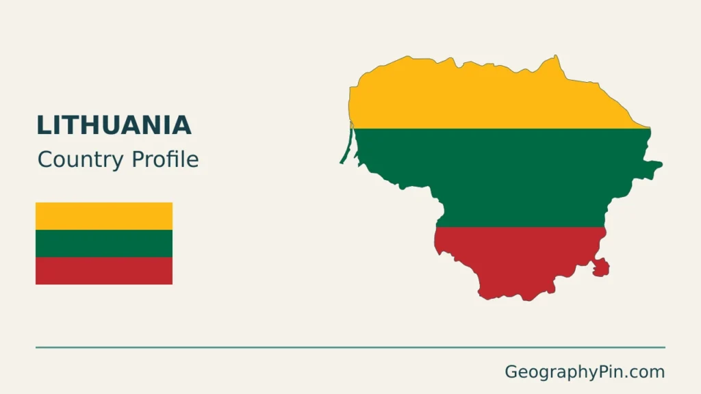
The cover uses Lithuania flag artwork from Commons. The intact 5:3 flag appears separately from the decorative outline motif.