The Baltic is a sea, but its water is much less salty than ordinary open-ocean water. The explanation lies in its water budget and its narrow connections to the ocean, not in the name printed on a map. The same geography also helps explain why conditions near the surface can differ sharply from those deep below.
The Baltic Sea is brackish because rivers and net precipitation supply freshwater while narrow, shallow connections restrict saltwater exchange with the North Sea. Fresher upper water generally flows outward and more saline water can enter below it. The resulting salinity varies across the basin and with depth; the Baltic is neither uniformly fresh nor uniformly oceanic.
How to use this article: Locate the ocean connection, compare regional surface values, and understand the layered water below.
1. Freshwater supply changes the balance
Brackish means a mixture, not a separate kind of salt
Brackish water is water with a salinity between freshwater and seawater. In the Baltic, rivers and precipitation supply freshwater, while salt arrives through the entrance region connected to the North Sea. These waters mix, producing conditions that are neither uniformly fresh nor uniformly oceanic.
The important quantity is the balance, not simply the presence of rivers. Many ocean coasts receive river water without becoming a whole brackish sea. The Baltic combines substantial freshwater supply with restricted marine exchange. Its narrow, shallow entrance passages limit how freely its water mixes with the much larger ocean outside.
Think of adding freshwater to a container of salty water: the concentration can fall without removing all the salt. In the real Baltic, however, the container has both incoming and outgoing water. A useful explanation therefore needs to include the routes through which saltwater enters and mixed water leaves, rather than imagining a basin that only fills up.
The catchment extends beyond the shoreline
Rain or snow falling on land can eventually reach the sea through rivers. The relevant freshwater source area is therefore the drainage catchment, not just the sea surface. Our explanation of what a river is distinguishes the channel from the wider land area that feeds it.
Net precipitation means precipitation falling directly on the sea minus evaporation from its surface. Changes in runoff and net precipitation can affect the Baltic’s salinity, but not necessarily at every location or depth at the same time. A wet month in one coastal city is not a measurement of the whole basin’s water budget. The 2022 review Salinity dynamics of the Baltic Sea emphasizes both freshwater forcing and exchange through the Danish entrance region.
2. The Baltic is connected to the ocean
Find the Danish entrance region
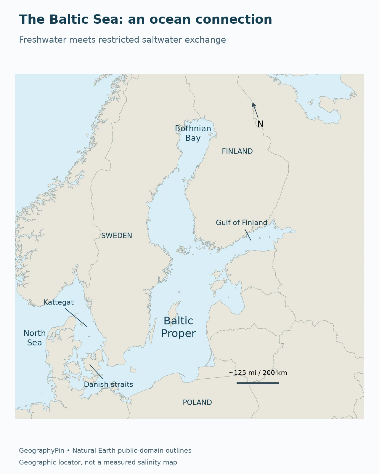
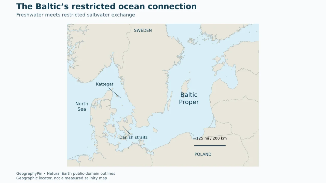
The Baltic communicates with the North Sea through the Danish straits, Kattegat and Skagerrak. The Sound, also called Øresund, and the Belt passages are parts of this entrance system. They are not a single broad opening where the whole sea can mix freely with the ocean.
The locator shows the setting, not a measured salinity field. Its pale-blue water has one color so that no reader mistakes a decorative gradient for observations. The most important geographic relationship is the constrained southwestern connection versus the long reach toward the northern and eastern gulfs.
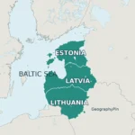
The term “Baltic” also needs context. The three Baltic countries are Estonia, Latvia and Lithuania; the Baltic Sea and its catchment cover a much broader geographic setting. A political grouping of countries is not the same thing as the marine basin whose water balance is being explained.
Two opposing flows can occur in the same entrance system
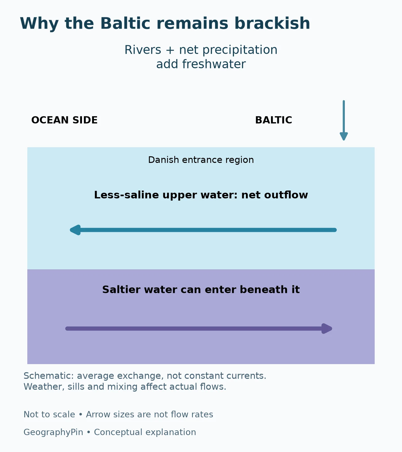
In the average exchange, relatively fresh upper water leaves the Baltic, while more saline water can enter beneath it. The direction shown in the diagram is a simplified overall pattern, not a claim that every passage has two identical currents continuously running at fixed speeds.
Weather and sea-level differences alter the flows, while shallow sills and mixing affect how much incoming saltwater reaches farther into the Baltic. The arrows deliberately have no numerical flow labels. Their thickness is not a comparison of transport volumes, and the drawing is not a cross-section of a particular strait.
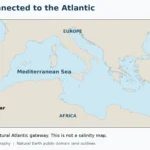
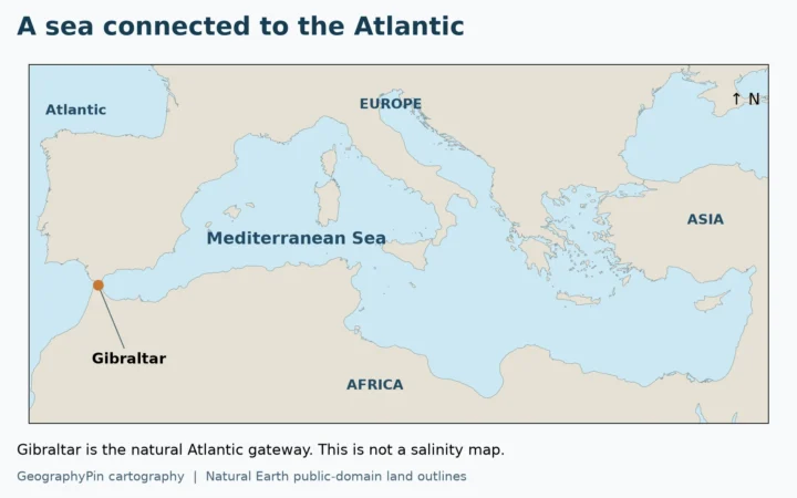
This pattern differs from the Mediterranean’s evaporation-dominated balance. There, less-saline Atlantic water generally enters above saltier Mediterranean outflow. The Baltic’s freshwater surplus supports the opposite overall concentration pattern. Being partly enclosed does not, by itself, determine whether a sea becomes especially salty or relatively fresh.
3. Salinity changes across the sea and with depth
Representative surface values are not a beach forecast
HELCOM’s 2023 overview describes a broad surface pattern: higher salinity near the entrance and lower salinity toward the northern and eastern parts of the Baltic. Its illustrative ranges are useful for orientation, provided their scope stays attached to the numbers.
| Area described by HELCOM | Representative surface practical salinity |
|---|---|
| Entrance in the Sound | About 15–18 |
| Baltic Proper | About 7–8 |
| Northern and eastern parts | About 0–2 |
These are the assessment’s broad regional values, not new GeographyPin measurements, fixed boundaries or current readings at every point. “Northern and eastern parts” should not be read as an assertion that every northern or eastern bay always falls within the same narrow range. Rivers, mixing, season and location matter.
A reported value should travel with four pieces of information: where it was measured, the depth, the date or averaging period, and the salinity convention. Without them, two valid observations can look contradictory. A sample near a river mouth and a deep-water sample offshore are answering different questions.
Practical salinity is not a percentage
The HELCOM overview labels these values “psu,” a common notation for practical salinity. Practical salinity is formally dimensionless and is based on conductivity. A value of 7 does not mean that the water contains 7% salt.
The TEOS-10 seawater framework distinguishes practical salinity from Absolute Salinity, expressed in grams per kilogram. Neither should be silently relabeled as grams per liter: a volume-based concentration also depends on density. These distinctions are particularly useful in a basin where river inputs affect seawater composition as well as its dilution.
The table retains the source’s practical-salinity convention rather than pretending to make a precise chemical conversion. For a simple geographic comparison, the relative pattern is sufficient: entrance waters are generally saltier than the far northern and eastern surface waters.
4. A fresher surface can cover saltier deep water
The halocline separates water with different salinity
Salinity can increase downward as well as change horizontally. Saltier water is generally denser than fresher water at comparable temperature and pressure, allowing a more saline layer to occupy deeper parts of the basin. Temperature also influences density; salt is not the only control.
A halocline is a zone in which salinity changes rapidly with depth. It is not a solid lid, but stratification can restrict mixing between upper and deeper water. Its depth and strength vary between sub-basins and over time, so a single line drawn across the whole Baltic would be misleading.
This is why describing the Baltic as “almost freshwater” can conceal an important part of its geography. A low surface value does not establish the salinity of the deep basin underneath. Nor does a salty deep layer mean that the entire water column resembles open-ocean seawater.
Major inflows are events, not a daily reset
Large saline-water inflows can renew deeper waters, but they are intermittent. A 2026 study of Baltic deep salinity, summarized by SMHI, shows that the effect of an inflow depends partly on the basin’s salinity before the event. An equally sized inflow need not produce an identical salinity change on two occasions.
That is a useful warning against reading a headline about “new saltwater entering the Baltic” as though the sea has been uniformly replaced. Different water masses move, mix and reach different basins. A dated observation of an inflow is evidence of that event, not a guarantee of the next year’s conditions everywhere.
5. Why brackish water matters for life and oxygen
Species encounter different conditions across the basin
HELCOM describes Baltic communities as a mixture of marine, freshwater and brackish-water species. Toward the less-saline northern and eastern waters, freshwater species play a larger role, particularly in estuaries and coastal areas. Salinity helps determine which organisms can thrive where.
That does not mean a salinity map alone can predict every species distribution. Temperature, oxygen, habitat and other environmental conditions also matter. The useful geographic point is that the Baltic is not one uniform marine environment: a species comfortable near the ocean entrance may face very different conditions farther into the basin.
Oxygen loss is not caused simply by the presence of salt
Saline inflows can carry oxygen into deeper water, yet they do not permanently remove the causes of oxygen depletion. HELCOM identifies excess nutrients as an important pressure: they promote biological production, and the breakdown of organic material contributes to oxygen consumption at depth.
The physical layering and the biological demand must be considered together. Restricted mixing can limit replenishment while decomposition consumes oxygen. Conversely, an oxygen-bearing inflow may improve conditions in a particular deep area without eliminating nutrient inputs or guaranteeing lasting recovery.
“Brackish” therefore describes salinity, not cleanliness or ecological health. Low salinity is not proof that water is safe to drink or swim in, and a high salinity reading is not by itself evidence of pollution. Those questions require the relevant water-quality or bathing-water information, not a taste-based judgment.
6. How to interpret a claim about a fresher Baltic
Separate a trend from a snapshot
Before accepting a claim that the Baltic is becoming fresher or saltier, identify the water layer, region and time interval. Surface changes, deep-basin changes and a whole-sea average are not interchangeable. An inflow can raise salinity locally while a different region responds to increased freshwater supply.
For example, compare two descriptions: “this coastal surface sample was fresher than last week” and “the basin’s average salinity declined over several decades.” The first is a local observation over a short interval. The second requires a consistent long record and a defined averaging method. Neither automatically proves the other.
The 2022 review stresses uncertainty in future salinity projections. Freshwater supply, ocean conditions, exchange and sea-level change interact; a simple warming-equals-freshening slogan leaves out much of the system. No future salinity map or numerical forecast is implied by the conceptual figures here.
The reliable starting point remains the water budget. Freshwater supply dilutes the basin, restricted ocean connections limit exchange, and layered circulation distributes salt unevenly. That combination explains why the Baltic is a brackish sea without making every place in it chemically identical.
Frequently Asked Questions
Is brackish water the same as polluted water?
No. Brackish describes salinity between freshwater and seawater. Pollution and bathing-water safety require separate evidence about water quality; salinity alone does not answer those questions.
Does a practical salinity of 7 mean 7% salt?
No. Practical salinity is a dimensionless conductivity-based quantity. A percentage, grams per kilogram and grams per liter are different conventions and should not be substituted without the relevant definition or conversion.
Does saltwater enter the Baltic every day in the same way?
No. The overall exchange pattern varies with weather, sea levels and mixing. Major inflows into deeper basins are intermittent events, not a constant replacement of the entire sea.
What Did We Learn Today?
The Baltic is brackish because its freshwater supply and restricted ocean exchange create a different balance from the open sea. That balance produces regional contrasts and vertical layers, not one salinity everywhere. A useful comparison keeps the location, depth, time period and measurement convention attached to each number, and distinguishes salinity from oxygen or pollution.
Sources & Data Notes
Regional surface ranges retain HELCOM’s practical-salinity convention and broad geographic scope; they are not live measurements. The original locator uses Natural Earth 1:10-million land outlines projected in ETRS89 / LAEA Europe, with an approximate map scale. It is not a salinity or legal-boundary map. The exchange illustration is conceptual and does not represent measured depths, current speeds or transport volumes. No future salinity forecast is calculated.
- HELCOM, State of the Baltic Sea 2023: physical setting and representative salinity
- Lehmann et al. (2022): Salinity dynamics of the Baltic Sea
- TEOS-10: practical and Absolute Salinity conventions
- SMHI (2026): research summary on deep salinity and inflow variability
- Hieronymus (2026): Baltic sea deep salinity
- HELCOM: species and brackish-water conditions
- HELCOM, State of the Baltic Sea 2023: eutrophication
- Natural Earth: public-domain cartographic data