The gap between Spain and Morocco looks small on a world map, but three different questions are often bundled together: where the strait lies, how far it is across, and which way its water flows. A close-up map and a view beneath the surface separate those questions.
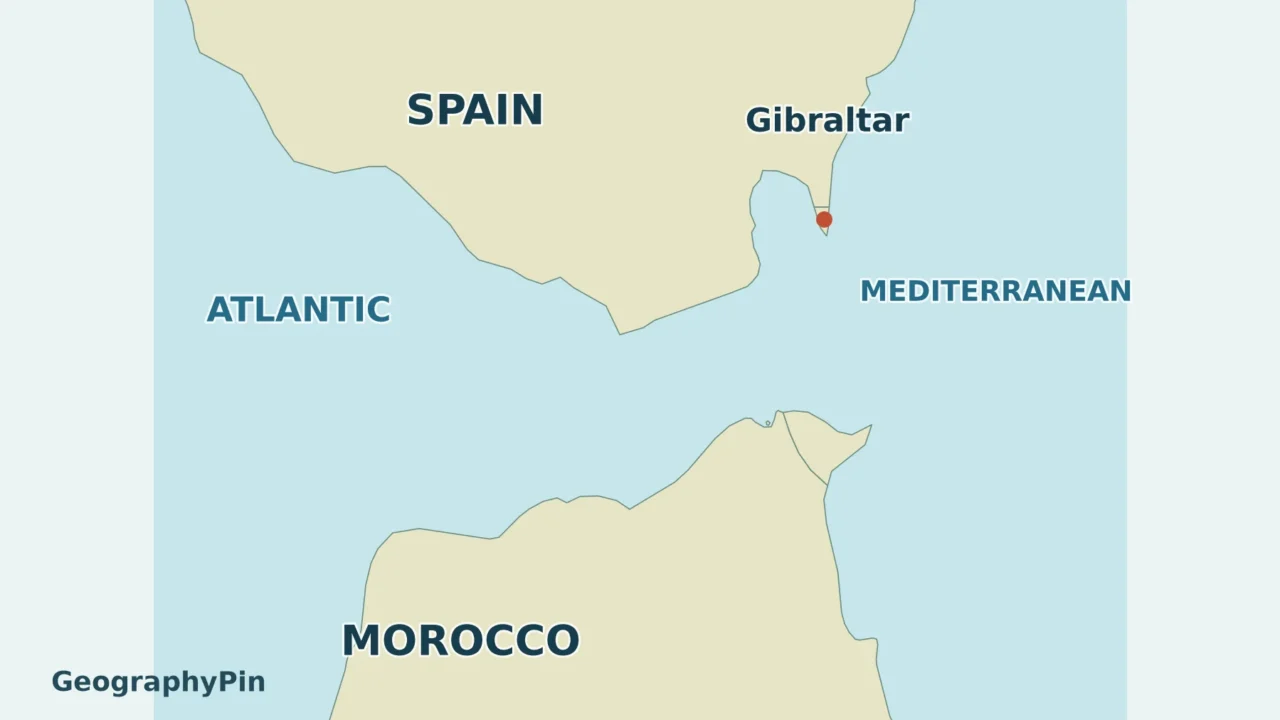
The Strait of Gibraltar connects the Atlantic Ocean in the west with the Mediterranean Sea in the east, between southern Europe and northern Africa. Its narrowest sector is about 9 miles (14 kilometers) wide. Gibraltar itself is a small territory beside the passage, while water generally flows in opposite directions in upper and lower layers.
How to use this article: Locate the five coastal places, compare width with journey distance, or see the two-layer water exchange.
1. Locate the Strait of Gibraltar
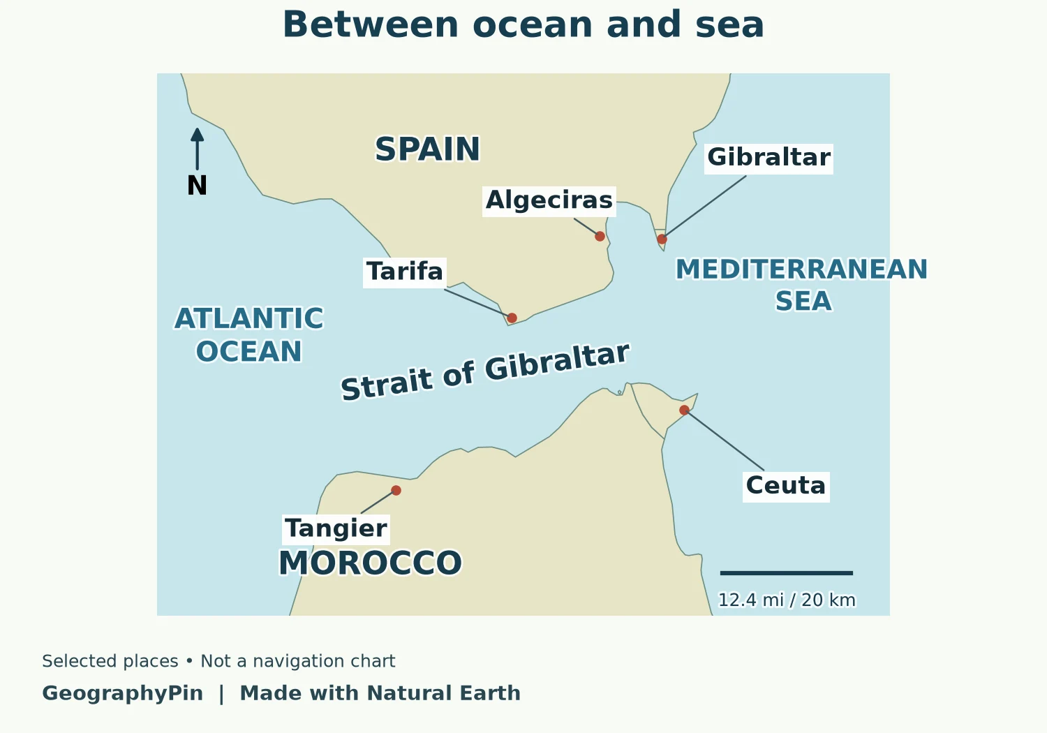
Start with the two large water labels, then find the narrow passage between them. Spain lies on the European side to the north; Morocco occupies most of the African coast to the south. Ceuta, on the African side near the eastern entrance, is a Spanish autonomous city.
The strait connects the Atlantic Ocean to the western Mediterranean. The Mediterranean waters immediately east of the passage are the Alboran Sea. Farther west, the Atlantic approach opens toward the Gulf of Cádiz.
Five places that orient the map
| Place | Map position | Useful distinction |
|---|---|---|
| Tarifa | Southern tip of Spain | Near the narrowest sector, west of Gibraltar |
| Tangier | Moroccan coast toward the Atlantic end | A city, not the southern endpoint of every width measurement |
| Algeciras | Spanish side of the Bay of Gibraltar | Separate from the territory of Gibraltar |
| Gibraltar | Northern side near the eastern entrance | A British Overseas Territory on a small peninsula |
| Ceuta | African side near the eastern entrance | Spanish-administered city, not Gibraltar |
The map uses generalized coastlines and selected place markers. It does not show maritime jurisdiction, traffic lanes or a surveyed minimum-width line. Those are different layers of information and should not be inferred from its colors.
2. Narrowest width is not a crossing route
Which distance does the number describe?
A useful rounded description is about 9 miles (14 kilometers) across at the narrowest sector, the Tarifa Narrows. That is the figure used in Sánchez-Román and colleagues’ Ocean Science study of the strait. ESA gives a nearby rounded figure of about 8 miles (13 kilometers) between Point Marroquí in Spain and Point Cires in Morocco.
These figures should not be read as competing millimeter-precise surveys. The sources give different approximate figures, without establishing a single shared measurement method. For an exact comparison, the endpoints and coastline data would need to be specified. This map is an orientation guide, not the source of either published measurement.
The strait’s length is another dimension: ESA describes a channel about 36 miles (58 kilometers) long. A length follows the passage broadly west to east; a minimum width crosses it between opposing coasts. A port-to-port voyage is a third measurement, with its own start, finish and route.
That distinction matters whenever a headline says “Europe is only nine miles from Africa.” It describes a narrow gap between the continents, not the distance from any Spanish port to any Moroccan port. Nor does it mean Gibraltar and Tangier are nine miles apart. Check the actual endpoints before comparing a journey with the headline width.
3. Why water moves in both directions
Atlantic water above, Mediterranean water below
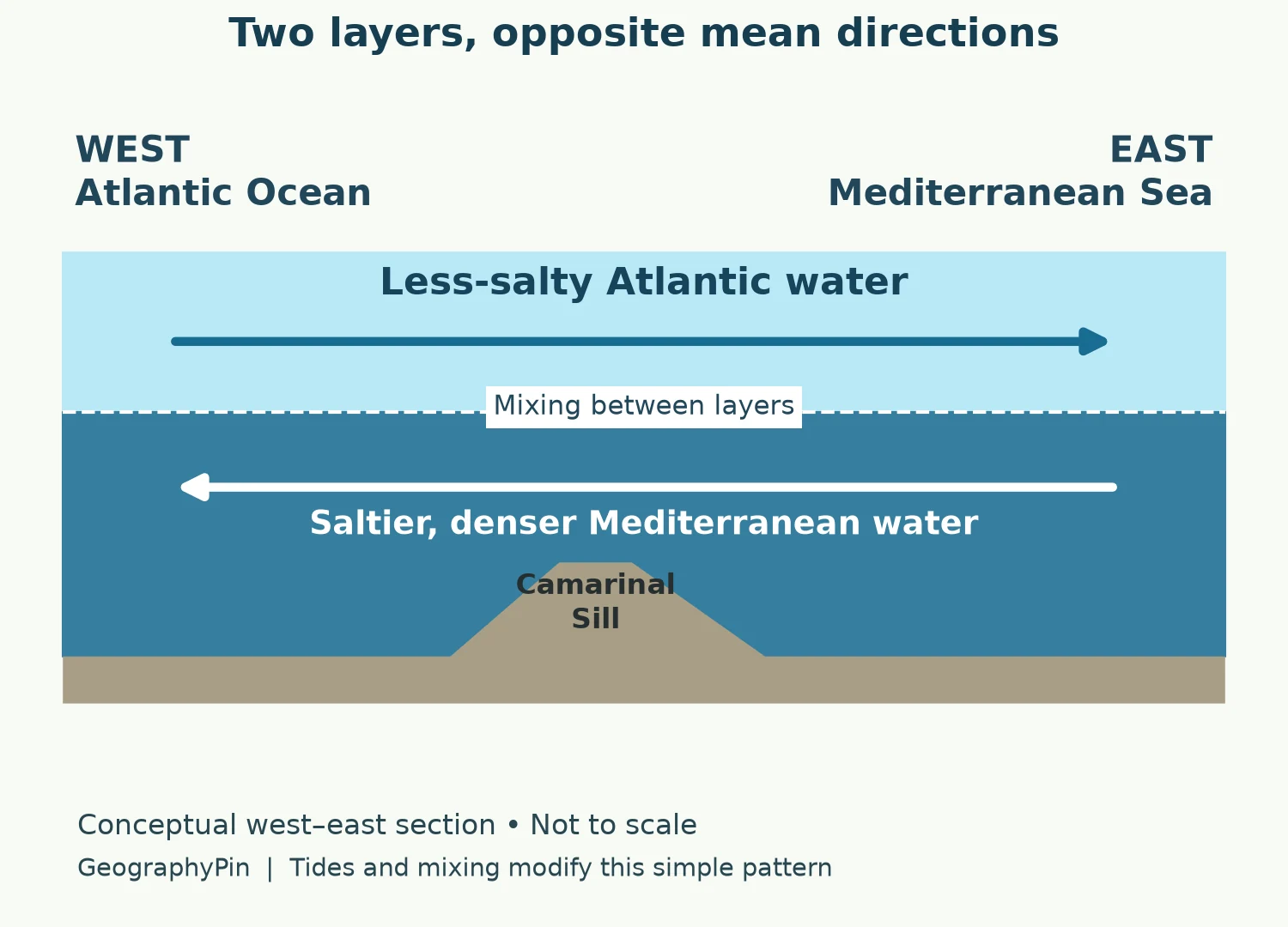
The usual large-scale pattern has two opposing layers. Relatively less-salty Atlantic water enters the Mediterranean near the surface. Saltier, denser Mediterranean water leaves beneath it, heading west into the Atlantic. “Less salty” is comparative: the incoming Atlantic water is still seawater, not fresh river water.
Evaporation removes more water from the Mediterranean than precipitation and river inflow replace. The exchange includes a net inflow that helps balance this water deficit. This does not mean the lower outflow stops; inward and outward movement coexist.
The Camarinal Sill is a rise in the underwater floor. Flowing water must pass over this submerged obstacle, and tides help generate internal waves. These waves occur within the water column rather than being simply the familiar wind-driven waves on its surface. ESA explains that satellite radar can detect their effects on surface roughness.
The tidy diagram is only a starting point. The layers mix and exchange water; their interface moves, and tidal currents alter the instantaneous flow. The arrows show mean directions, not a promise that every parcel of water moves that way at every moment. For the broader forces behind circulation, compare wind, density and tidal currents.
4. Gibraltar is not the entire strait
Three different things share the name: the Strait of Gibraltar is a waterway; Gibraltar is a British Overseas Territory; and the Rock of Gibraltar is a landform within that territory. The map’s Gibraltar marker locates the territory, not the center of the whole sea passage.
Gibraltar is administered as a British Overseas Territory, as the UK government states. Spain maintains a sovereignty claim. This geographic locator does not attempt to resolve that dispute or draw territorial-water boundaries.
The name also does not mean that all land facing the strait is British. Tarifa and Algeciras are in Spain, Tangier is in Morocco, and Ceuta is on the African side under Spanish administration. A continent label and an administrative label answer different questions.
For the general geographic test, a strait connects larger waters while separating land. Gibraltar is a specific example of that relationship. The Strait of Hormuz is a different passage altogether, between the Persian Gulf and Gulf of Oman, not another entrance to the Mediterranean.
Frequently Asked Questions
Does the Atlantic stop mixing with the Mediterranean at a visible line?
No. Water masses can differ in salinity and produce fronts or visible surface patterns, but there is no impermeable wall between the two waters. Mixing is part of the exchange through the strait.
Can this map be used to plan a boat crossing?
No. It omits depths, hazards, traffic-separation schemes and live conditions. Use appropriate official nautical charts and current maritime information rather than an educational locator.
What Did We Learn Today?
Read Gibraltar at two scales: the territory is one small location beside a much larger passage, while the strait links two major water bodies. Its narrowest width is not a port-to-port distance. Beneath the map’s surface, opposing layers connect the Atlantic and Mediterranean through an exchange shaped by density, tides and the seabed.
Sources & Data Notes
Distances are rounded source descriptions, not measurements from the illustration. The locator uses Natural Earth 1:10 million coastlines and populated places; Tarifa’s marker uses municipal settlement coordinates. Political colors do not encode sovereignty. The original exchange diagram summarizes mean flow and contains no measured bathymetry, fixed interface depth or current-speed estimate.
- ESA: Earth from Space: Strait of Gibraltar
- ESA: Convergence of continents and currents
- Sánchez-Román et al.: Modelling study of transformations of the exchange flows along the Strait of Gibraltar
- UK government: Gibraltar’s administrative status
- UK–EU joint statement: differing sovereignty and jurisdiction positions
- Natural Earth: public-domain map data
- Tarifa municipal emergency plan: principal settlement coordinates