The Mississippi River basin is the land drained by the Mississippi and its connected tributaries. It reaches far beyond the main river, linking the Missouri, Ohio and other systems to the Gulf of Mexico. Basin boundaries cross state lines, and lower-river maps need to distinguish Mississippi drainage from the connected Atchafalaya system.
Start here: Read the map boundary convention, then follow the tributary table and Gulf-outlet explanation. The map shows a modeled basin; the engineered lower-river and delta connections need the explanation below.
1. Mississippi River basin map: how to read the system

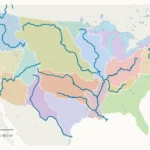
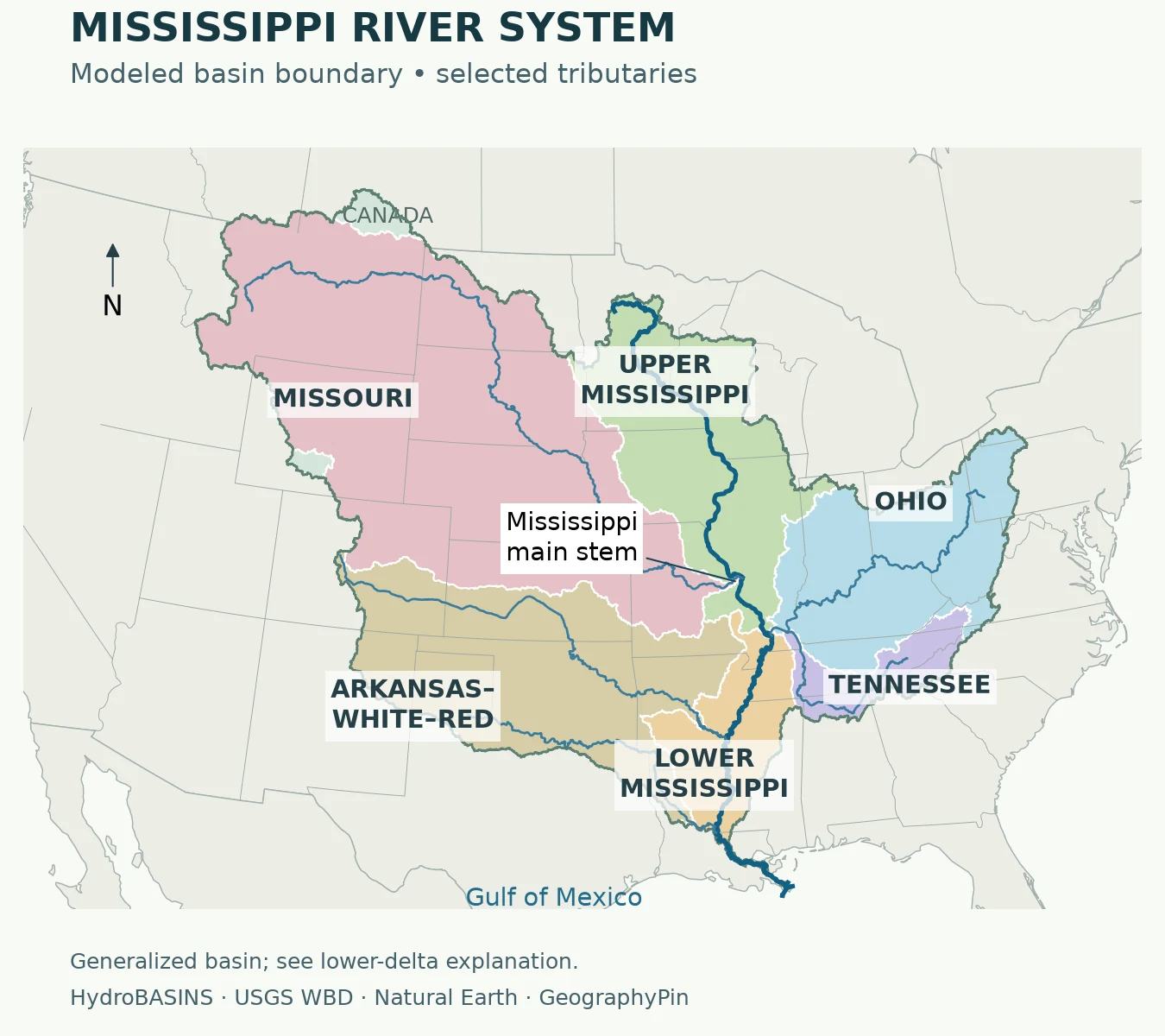
Mobile map key: 1. Missouri; 2. Upper Mississippi; 3. Ohio; 4. Tennessee; 5. Arkansas–White–Red; 6. Lower Mississippi. These are regional color labels, not a list of six direct tributaries.
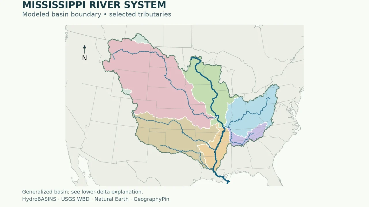
Choose 2× or 4× and scroll inside the map; Fit / Reset restores the full view. The outer boundary follows HydroBASINS, a global modeled drainage dataset. Interior colors use broad USGS water-resource regions clipped to that boundary. Blue lines locate selected rivers, not every tributary. The modeled outline does not reproduce all engineered Atchafalaya and delta connections. Enlarge the map.
The Mississippi is the river running through the middle of a much larger branching network. The Missouri brings water from the west; the Ohio brings water from the east. Other tributaries connect through those rivers rather than meeting the Mississippi directly.
Use the colors to separate broad regional systems, then follow the blue channels. A colored region is an area of land, while a river is a channel within it. The outer line is a generalized model boundary, useful for continental orientation but not for deciding whether a particular house, wetland or field drains to the Mississippi.
Why the boundary convention matters
The map separates two datasets with different purposes. HydroBASINS supplies the outer modeled basin. USGS hydrologic units supply the interior regional colors. Those colors are clipped to the modeled outline: simply merging all six USGS regions would incorrectly include some neighboring Gulf coastal drainage. A model also cannot fully represent an engineered, branching delta, so read the Atchafalaya section alongside the map.
For a nationwide comparison rather than this river-system focus, use the U.S. rivers and drainage basins map. Follow that broader map to compare the Mississippi with other major U.S. river systems.
2. The river, its basin and its tributaries are different things
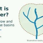
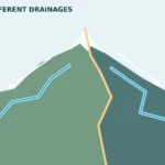
A drainage basin is the land whose surface water drains toward a river system or specified outlet. Its boundary is a drainage divide, often following higher ground. A tributary is a river or stream entering another river. A distributary branches away from a river and carries water toward a different downstream route.
The Mississippi River itself begins at Lake Itasca in Minnesota and reaches the Gulf of Mexico through Louisiana. The river basin extends far beyond the states along that main channel. A place can belong to the basin even when the Mississippi is hundreds of miles away, because local streams connect through a chain of tributaries.
The National Park Service describes the basin as approximately 1.2 million square miles (3.2 million square kilometers), covering all or parts of 31 states and two Canadian provinces. Those are published regional approximations, not measurements calculated from the colored polygons above. Different sources may use different boundaries, particularly around the connected Atchafalaya system and the Gulf coast.
A basin map shows drainage connections, not a guarantee that every drop reaches the sea. Evaporation, plant uptake, infiltration, reservoirs and withdrawals affect water along the route. It is also not a flood map: land inside a basin is not necessarily at risk from the main river’s floods.
3. Major tributaries: which river flows into which?
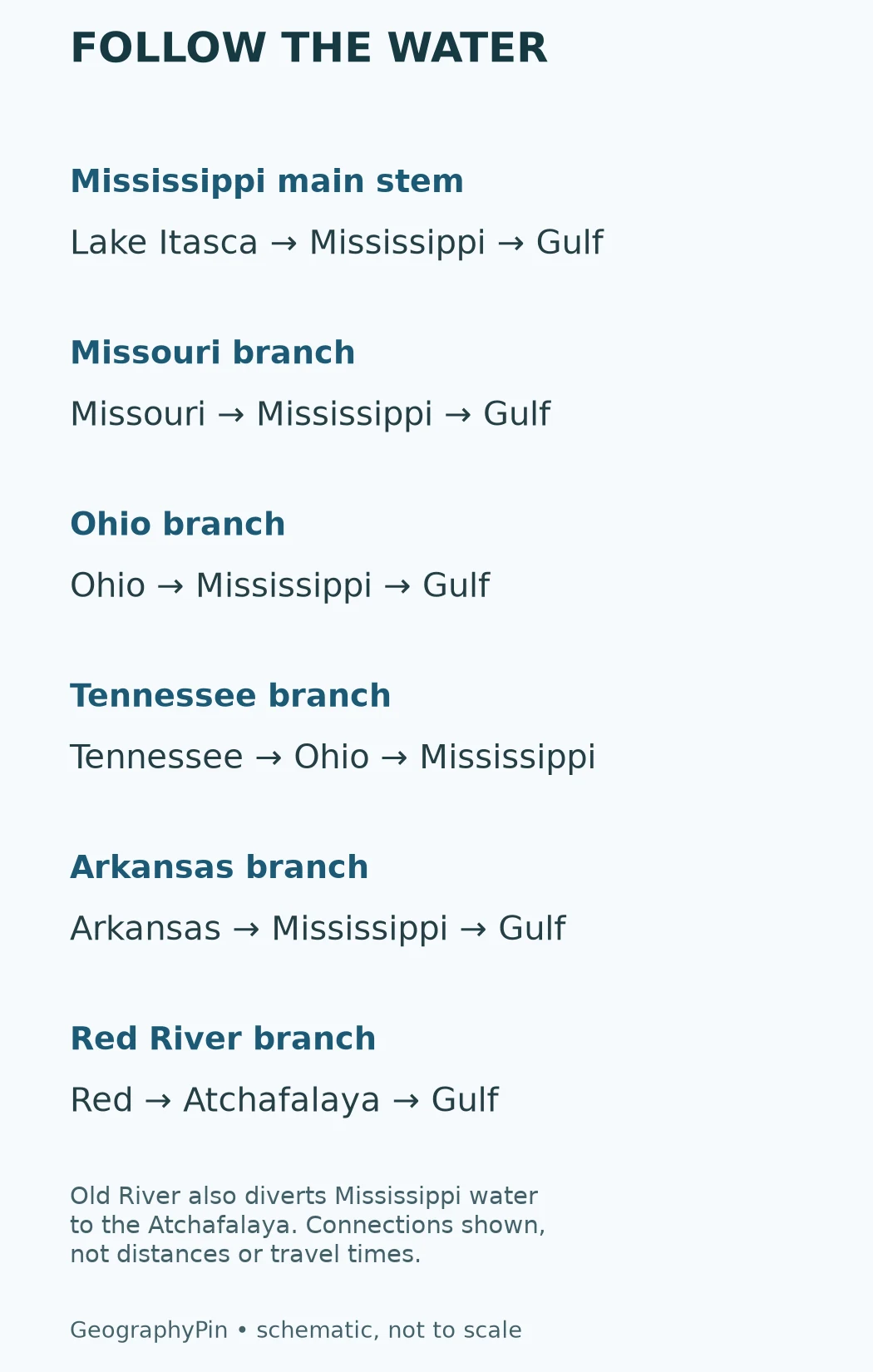
| River | Next major connection | How to read it |
|---|---|---|
| Missouri | Mississippi | A major western branch |
| Ohio | Mississippi | A major eastern branch |
| Tennessee | Ohio | Reaches the Mississippi indirectly |
| Arkansas | Mississippi | A western tributary |
| Red River of the South | Atchafalaya | Part of the connected Gulf-outlet system |
The Missouri and Ohio each meet the Mississippi directly. Their junctions explain why water arriving from distant parts of the interior can share the same lower-river channel.
The Tennessee is especially useful for understanding tributary hierarchy. It enters the Ohio before the Ohio enters the Mississippi. Calling it part of the Mississippi basin is correct; saying it flows directly into the Mississippi is not. Similarly, a small headwater stream can belong to several nested basins, from its local catchment to the continental-scale system.
These connections do not by themselves establish a longest-river ranking. A named river, a continuous source-to-mouth route and a complete river system are different measurement choices. Likewise, the Strahler stream-order method classifies branching relationships rather than simply ranking named rivers by length.
4. Why basin boundaries do not follow state lines
The familiar figure is 31 states, but the essential words are all or parts of. A state boundary is an administrative line; a watershed boundary follows drainage. Counting a state does not mean every river in that state flows toward the Mississippi.
On the map, gray state lines provide orientation while colored hydrologic regions show another kind of geography. For a particular location, trace the local stream and its receiving river or consult a detailed watershed map. Do not assign an entire state to the basin merely because its name appears inside the shaded area.
The international border does not stop a watershed either. The National Park Service’s broad basin description includes parts of two Canadian provinces. The map’s national-scale linework is an orientation aid, not a parcel-level or border-survey dataset.
5. The Gulf outlet and the Atchafalaya connection
Most simple diagrams end with one arrow labeled “Mississippi → Gulf.” The lower system is more complicated. The Atchafalaya is another route to the Gulf, receiving Red River water as well as Mississippi water diverted through the Old River control system.
The National Park Service explains the managed distribution as approximately 70 percent continuing down the Mississippi and 30 percent passing into the Atchafalaya, measured against the combined Mississippi and Red River flow. That is not the same as saying the Atchafalaya receives 30 percent of the Mississippi alone.
This connection is why environmental sources often use the name Mississippi/Atchafalaya River Basin. EPA explicitly treats the two basins together in its Gulf hypoxia work. When comparing maps or area figures, check whether the source means the Mississippi main-stem catchment, that connected system, or a grouping of water-resource regions.
Drainage connections also help explain why changes far inland can matter at the coast. Nutrients carried through the network can contribute to coastal water-quality problems. A basin map establishes the connection, but it does not measure the nutrient load from a particular tributary or predict the size of a low-oxygen zone.
6. What this map can and cannot tell you
Use this map to recognize the major branches, distinguish the main river from the surrounding drainage regions and understand why the basin crosses state boundaries. Use the pathway diagram to check the order of selected downstream connections.
Do not use either visual for navigation, flood evacuation, property drainage or engineering. River widths are exaggerated for readability, small channels are omitted and the coastal boundary is deliberately qualified. A map of drainage geography does not replace current river observations. For interpreting a station reading, see how to read a river gauge.
The background landforms also matter: divides shape where water can flow, even though they are not drawn as raised ridges on this map. The physical map of the United States provides the wider terrain context.
Frequently Asked Questions
Is the Mississippi basin the same as the Mississippi River?
No. The river is a channel; the basin is the land connected to its drainage network. Many places in the basin drain through tributaries without being near the main river.
Does the Tennessee River flow into the Mississippi?
Indirectly. The Tennessee enters the Ohio, and the Ohio then enters the Mississippi. The downstream sequence matters when reading a tributary map.
Are all 31 states entirely inside the basin?
No. The standard description says all or parts of 31 states. State borders and drainage divides do not coincide, so a state can contain more than one major drainage system.
Why does the Red River appear with the Atchafalaya?
The Red River of the South connects to the Atchafalaya route. The Atchafalaya also receives diverted Mississippi water through Old River, making it part of a connected lower-river system rather than simply another direct Mississippi tributary.
Can this map show whether my home will flood?
No. It is a regional drainage map, not a flood-hazard map. Flood risk requires location-specific flood mapping and current warnings, not just membership in a large basin.
What Did We Learn Today?
- The basin is a connected area of land, not just the Mississippi channel.
- The Missouri and Ohio enter the Mississippi; the Tennessee enters through the Ohio.
- The state count includes whole and partial state coverage.
- The Atchafalaya connection and coastal mapping conventions need explicit explanation.
Sources & Data Notes
- USGS: Tennessee River basin study: Tennessee–Ohio tributary connection.
- National Park Service: Mississippi River facts: Main river, tributaries and approximate basin extent.
- EPA: Mississippi/Atchafalaya River Basin: Combined-system convention and Gulf water-quality context.
- National Park Service: the Lower Mississippi Delta: Old River and the combined-flow distribution.
- USGS: hydrologic-unit names and definitions: Regional boundaries, including coastal drainage within Region 08.
- USGS Watershed Boundary Dataset service: Two-digit water-resource-region geometry.
- Natural Earth: data and public-domain terms: Generalized country, state and river linework.
Map method: The outer outline is HydroBASINS North America level 3, version 1c, polygon HYBAS_ID 7030047060. This is a generalized modeled basin derived from HydroSHEDS terrain data, not a modern engineering survey. USGS WBD regions 05, 06, 07, 08, 10 and 11 are clipped to it for interior colors; their boundaries are not treated as the outer watershed. Natural Earth supplies generalized river lines and administrative context. Projection: NAD83 / Conus Albers (EPSG:5070). Line thicknesses are symbolic. Lower Atchafalaya and delta flow connections are explained in the text and diagram rather than inferred from the polygon.
Data vintage and credit: HydroBASINS v1c is a model product, not a November 2026 remapping. Cite Lehner and Grill (2013), Global river hydrography and network routing. See HydroBASINS documentation and download terms. Natural Earth is public domain. Original map styling and pathway diagram: GeographyPin.
HydroSHEDS attribution: This product, GeographyPin Mississippi River Basin Map, incorporates data from the HydroSHEDS version 1 database which is © World Wildlife Fund, Inc. (2006–2022) and has been used herein under license. WWF has not evaluated the data as altered and incorporated within GeographyPin Mississippi River Basin Map, and therefore gives no warranty regarding its accuracy, completeness, currency or suitability for any particular purpose. Portions of the HydroSHEDS v1 database incorporate data which are the intellectual property rights of © USGS (2006–2008), NASA (2000–2005), ESRI (1992–1998), CIAT (2004–2006), UNEP-WCMC (1993), WWF (2004), Commonwealth of Australia (2007), and Her Royal Majesty and the British Crown and are used under license. The HydroSHEDS v1 database and more information are available at HydroSHEDS.
Area and counting: The approximate basin area and state count are attributed published descriptions, not measurements derived from this map. No global size ranking, channel-length ranking or parcel-level drainage claim is made. HydroBASINS reports a model area, but that attribute is not substituted for the separately attributed National Park Service estimate.