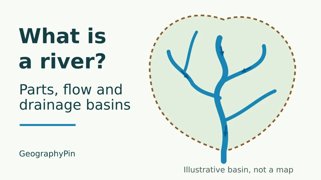
A river is easier to understand when you look beyond the blue line on a map. Its branches collect water from a surrounding area of land, and what happens across that area helps determine how much water reaches the main channel.
A river is a natural watercourse that carries flowing water along a channel, generally from higher ground toward a lower outlet. Tributaries feed it, and its drainage basin is the area supplying surface drainage to a chosen point. Rivers can flow year-round or intermittently, and their water does not always reach an ocean.
How to use this article: Compare year-round and temporary flow, untangle watershed terminology, or try the diagram tracing exercise.
1. The Main Parts of a River
River, stream, creek and brook are overlapping names for flowing watercourses. A river is usually understood to be larger than a creek, but there is no universal width or length at which one must become the other. The USGS treats these names as closely related terms, rather than fixed size classes.
| Part | Meaning |
|---|---|
| Source and headwaters | The source is the river’s identified beginning. Headwaters are its upper reaches and small upstream channels. |
| Channel and bed | The channel is the passage carrying the flow. The bed is its bottom. |
| Banks | The sides of the channel, which contain ordinary flows but may be overtopped during floods. |
| Tributary | A river or stream that feeds another watercourse; the term can also describe a stream entering a lake. |
| Confluence | The place where two or more flowing channels meet. |
| Main stem | The principal channel in a river network. |
| Mouth | Where a river enters another river, a lake, a sea or an ocean. |
A mapped source should not be confused with the origin of every drop in the river. Water can enter along the whole network through tributaries, runoff and groundwater seepage. Likewise, a tributary is not necessarily a tiny creek: a substantial river can feed a still larger system.
2. Why Rivers Flow and Why Flow Changes
Gravity drives river water toward lower elevations. “Downstream” describes the direction of flow, not the bottom of a map. A river can flow north, south, east or west, and change compass direction many times along its route.
This is the broad drainage pattern, not a rule that every current always moves one way. Tides can temporarily reverse flow in tidal reaches; NOAA describes this at the Saint John River’s Reversing Falls in Canada.
Where river water comes from
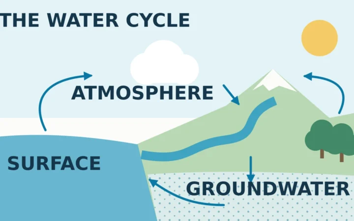
Rainfall runoff, melting snow or ice, groundwater and releases from upstream lakes or reservoirs can supply a river. Their relative importance changes between places and seasons. Groundwater often sustains base flow, the flow that continues between episodes of direct runoff.
Hydrologists measure discharge: the volume passing a point per unit of time, commonly in cubic feet per second or cubic meters per second. It is different from water speed or depth. Storms, seasonal melt, withdrawals and dam operations can change discharge, so the same river can look very different on two visits.
Year-round and temporary flow
- Perennial: normally maintains surface flow throughout the year.
- Intermittent: flows for part of the year, often seasonally.
- Ephemeral: flows briefly during or soon after precipitation events.
These describe flow behavior, not three sizes of river. Different reaches of one network can behave differently, and drought or human changes can alter their permanence. This is why claims about countries without permanent rivers need a definition of what counts.
3. Drainage Basins, Watersheds and Divides
A drainage basin is the area whose surface drainage feeds a common outlet. The outlet might be a river mouth, a reservoir outlet or a measuring point farther upstream. Choose a different outlet and you define a different contributing area.
One area, different terminology
In U.S. usage, watershed commonly means a drainage basin. Catchment is another widely used term for the contributing area. British usage can differ: the Environment Agency’s Fluvial Design Guide glossary uses “watershed” for the boundary between catchments. Check whether a source means the area or its edge.
What a drainage divide separates
A drainage divide separates surface drainage heading toward different outlets. It commonly follows ridges or other relatively high ground. The basin includes the hillsides and land between streams, not just the channel network. A riverbank is therefore not a basin boundary.
The outline describes surface drainage, not an impermeable underground wall. Groundwater divides can differ from surface-water divides, as USGS groundwater diagrams illustrate. Underground geology and pumping can affect where groundwater travels.
Nor does every raindrop inside the outline reach the outlet. Water may evaporate, return to the atmosphere through plants, soak into the ground or remain in storage. The basin identifies drainage connections; it does not promise that all precipitation becomes river discharge.
4. Trace a Drainage Basin Step by Step
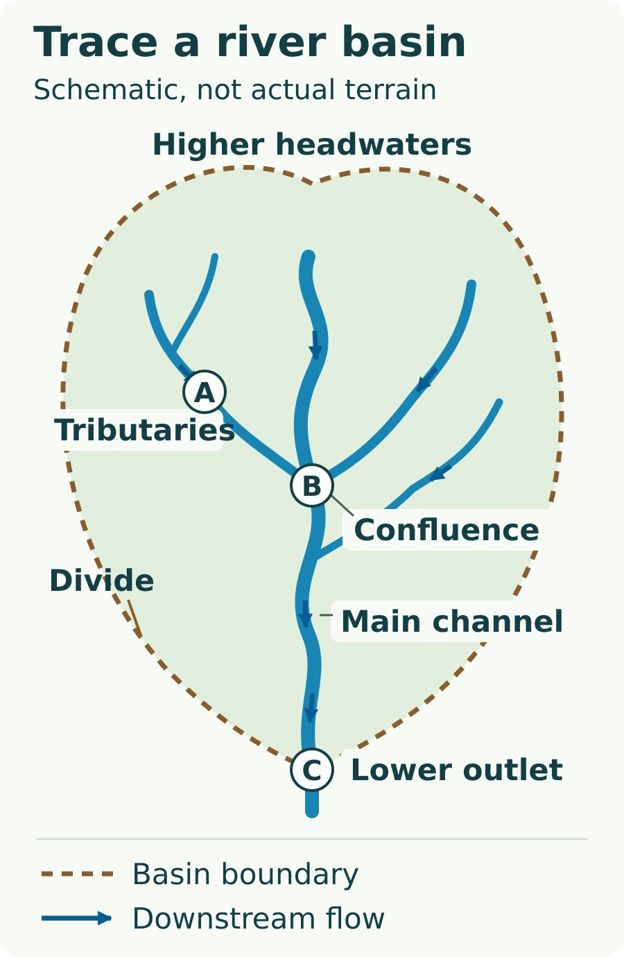
The green area below drains toward outlet C. The dashed brown line is its surface-drainage boundary, and the blue arrows show downstream flow from higher headwaters toward the lower outlet. The drawing is schematic, not a surveyed landscape or a map of a real river.
From A to B to C
- Start at A. Follow the tributary in the arrow’s direction until it joins the other channels at B.
- Continue downstream. From B, follow the main channel to C. A downstream journey follows the connected flow path, rather than a straight line to the outlet.
- Work backward from C. Trace every connected upstream branch, including the tributary that joins below B. All belong to the network draining through C.
- Read the boundary. The shaded land enclosed by the dashed outline supplies surface drainage toward C. Land outside it belongs to neighboring drainage areas.
- Move the outlet to B. The contributing basin becomes smaller. The tributary joining below B and the land draining only to that lower reach are excluded.
On a real map, finding the streams is only the beginning. Use elevation contours or terrain data to trace the dividing high ground around their contributing slopes. A blue-line map alone does not show the exact boundary, especially in flat, engineered or complex underground-drainage settings.
Check your understanding: Does the lower-right tributary drain through B? No. It joins downstream of B, so it contributes to C’s basin but not B’s. This is why the outlet must be specified before a basin is measured.
5. River Networks and Their Outlets
Many drainage networks branch like a tree: smaller channels join larger ones. Each tributary has its own contributing basin nested inside the larger one. Real rivers can also split into multiple channels. A distributary carries water away from a main channel, often across a delta, rather than feeding into it.
A river can enter another river, a lake or the ocean. Some systems end in inland basins without a surface outlet to the sea, and some channels lose their surface flow through infiltration, evaporation or withdrawals. “Every river reaches the ocean” is therefore too simple.
The Mtkvari, also called the Kura, provides a regional example: its river system drains to the Caspian Sea. To distinguish water moving along a channel from water held in a basin, see how lakes and their drainage work.
These connections also explain why upstream land use matters downstream. Water can carry sediment and dissolved substances through the network. Channels and surrounding land change together; the resulting valleys, meanders and floodplains are covered in water erosion landforms.
What Did We Learn Today?
To read a river system, identify its channels, follow the downstream connections and choose an outlet before tracing its drainage basin. Tributaries add water, confluences join channels and divides separate surface drainage areas. The basin is broader than the river itself, while groundwater, seasonal flow and inland outlets explain why real systems are more varied than a single blue line leading to the sea.
Sources & Data Notes
This explainer uses surface-drainage basins defined relative to a chosen outlet. “Watershed” follows common U.S. area-based usage unless the British boundary meaning is specified. Flow categories describe typical behavior, not fixed legal classifications. The original diagram is conceptual: it contains no measured terrain, scale, basin area or real-world coordinates.
- USGS Water Science School: Rivers, Streams, and Creeks; Watersheds and Drainage Basins; Streamflow and the Water Cycle.
- USGS: NAWQA Glossary and Water Science Glossary, for river vocabulary and flow measurements.
- EPA: Learn about Regional SDAMs, for perennial, intermittent and ephemeral flow.
- Environment Agency: Fluvial Design Guide: Glossary, for British and American watershed terminology.
- USGS: The Importance of Ground Water in the Great Lakes Region, especially the surface-water and groundwater divide diagrams; NOAA: JetStream Max: Bay of Fundy: The Highest Tides in the World, for tidal flow reversal.
- UNDP Kura II: The Kura River, for the Kura’s outlet to the Caspian Sea.