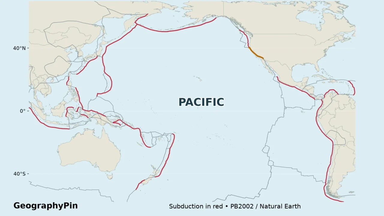
A Ring of Fire map can look like one continuous line around the Pacific. In reality, it brings together different plate boundaries, volcanic arcs and earthquake zones. Reading those differences is more useful than tracing an unbroken horseshoe.
The Ring of Fire is the broad zone of frequent earthquakes and volcanism around much of the Pacific Ocean. Subduction zones explain many of its volcanic arcs, but transform boundaries also produce earthquakes. It is not a separate tectonic plate, a continuous volcanic chain or a region with one universally agreed boundary.
How to use this article: Check the map colors, compare San Andreas with subduction, or find out why Hawaiʻi is different.
1. Read the Ring of Fire map
What the colors actually mean
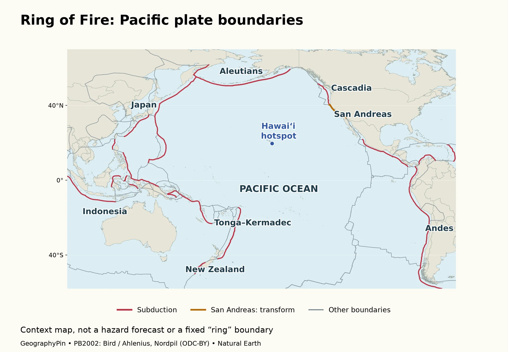
Red lines are boundary segments classified as subduction in the source dataset. Orange highlights the generalized San Andreas boundary segment as a transform example. Gray lines are the remaining plate boundaries: they must not all be read as transform faults. Some are spreading centers, and some involve other forms of convergence or complex movement.
The blue point identifies Hawaiʻi’s hotspot setting, well inside the Pacific rather than on its plate edge. Labels name regional examples, not individual eruption sites. The map deliberately does not add a thick shaded “Ring of Fire” corridor with invented limits.
These are generalized, global-scale boundaries from the PB2002 plate model published in 2003, not a complete inventory of local active faults. A boundary line is also not the exact location of every associated volcano: volcanic arcs commonly lie landward of the oceanic trench. For the broader physical setting, see the Pacific Ocean overview.
2. Follow the main Pacific boundary segments
Follow the margins from the Americas toward Alaska, then across the northern Pacific and south toward New Zealand. The examples below are geographic guideposts, not an exhaustive list of countries or a formal membership test.
| Region | Main setting discussed | How to read it |
|---|---|---|
| Andes | Subduction along western South America | The Nazca–South America boundary is a major example; the entire Andes is not one uninterrupted active volcanic arc. |
| Mexico and Central America | Subduction along the Pacific side | These margins involve plates such as Cocos, rather than only the Pacific Plate. |
| Cascadia | Juan de Fuca system beneath North America | The offshore boundary and the inland Cascade volcanic arc are different features. |
| California | San Andreas transform example | Sideways motion produces earthquakes without creating a subduction-style volcanic arc along the fault. |
| Alaska and Aleutian Islands | Subduction and a curved volcanic arc | The island chain and offshore trench help explain the northern bend. |
| Kamchatka and Japan | Western Pacific subduction systems | Several plate relationships are involved; “Pacific edge” is a regional shorthand. |
| Tonga, Kermadec and New Zealand | Subduction plus a changing boundary through New Zealand | Do not apply one boundary type to the whole country. |
The Pacific Ocean and Pacific Plate are not interchangeable outlines. The eastern Pacific includes ocean floor on other plates, while boundary systems in the southwest involve smaller plates and multiple arcs. This is why a simple map of the Pacific Plate alone cannot explain all the places commonly associated with the belt.
3. Why subduction and transform faults behave differently
At a subduction zone, one plate descends beneath another. Earthquakes can occur along the contact and within the surrounding rocks and descending slab. Volcanic arcs form above parts of these systems, so the earthquake and volcano patterns are related without occupying precisely the same line.
That distinction separates a map of plate boundaries from a map of volcano locations. The red lines here show the first, not the second. A volcano beside a red boundary is not necessarily erupting, and an unmarked area is not necessarily free of earthquakes.
San Andreas is a transform example
Along the San Andreas fault system, the principal motion is sideways between the Pacific and North American plates. The National Park Service describes a broad zone of shearing, not just a single neat crack. The orange map segment is therefore an educational generalization, not a detailed fault trace for property or engineering decisions.
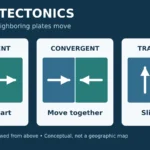
Transform motion is not the process that produces a subduction volcanic arc. That does not mean all of California is nonvolcanic: the state contains different tectonic settings. The useful comparison is between mechanisms, not between supposedly “volcanic” and “nonvolcanic” countries. The plate tectonics explainer sets out the three basic boundary types.
New Zealand provides another warning against simple labels. GNS Science describes subduction at Hikurangi and a linked system of faults through the country, including the Alpine Fault. A single country can sit across different styles of plate interaction.
4. Why there is no perfect ring
“Ring of Fire” is a useful popular geographic label, not the name of a single scientific structure. The Smithsonian Global Volcanism Program explicitly notes that definitions vary. Its selected volcanic-region definition excludes Indonesia’s mostly Australia–Sunda arc and much of the Izu–Mariana system, even though broader educational maps often include those areas.
This map shows the boundary systems for context, including Indonesia, rather than claiming that every displayed red line belongs to one official Ring of Fire. It also shows other oceanic boundaries in gray so that the empty space in a cartoon horseshoe is not mistaken for an absence of tectonics.
Hawaiʻi is volcanic, but not a plate-edge arc
The USGS distinguishes Hawaiian hotspot volcanism from the west-coast and Aleutian volcanoes associated with the Ring of Fire. Hawaiʻi lies within the Pacific Plate. Its volcanoes are therefore not evidence that the entire Pacific basin is a subduction belt. Mauna Kea is one example of a Hawaiian volcano.
Location outside the plate-edge belt does not remove other hazards. A tsunami generated by a distant Pacific earthquake can cross the ocean and reach Hawaiʻi. A map of where an event begins and a map of where its effects travel answer different questions.
Frequently Asked Questions
Does the Ring of Fire cause 90% of all earthquakes?
The USGS gives about 90% as a broad educational estimate for the circum-Pacific belt. It should not be treated as a precise annual result or used to calculate a location’s risk. A reproducible count would require a defined region, time window, earthquake catalog and magnitude threshold.
Can the whole Ring of Fire erupt at once?
It is not one connected magma reservoir. Separate volcanoes and boundary systems have their own processes. The regional label is not evidence that activity at one volcano predicts an eruption all around the Pacific.
Can this map tell me whether a place is safe?
No. This is a regional explanatory map, not a seismic-hazard, evacuation or volcano-alert map. Site-specific decisions require the relevant geological agency’s current hazard information and local emergency guidance.
What Did We Learn Today?
Reading the Ring of Fire means separating a regional pattern from its underlying mechanisms. Subduction helps explain volcanic arcs, transform faults explain another style of earthquake-producing boundary, and Hawaiʻi demonstrates that volcanism also occurs away from plate edges. The map is most useful when its legend and limits remain as clear as its lines.
Sources & Data Notes
Boundaries use the generalized PB2002 model, not a current local fault inventory. Subduction is taken from its classification; the San Andreas example is separately identified using the National Park Service explanation. Natural Earth supplies the land outlines. The map uses a Pacific-centered longitude–latitude layout; it is not equal-area and has no uniform distance scale. No earthquake catalog, volcano census or official Ring of Fire perimeter is mapped.
- USGS: Subduction Zone Science FAQs
- USGS: Cool Earthquake Facts, including the approximate 90% statement
- USGS: About Volcanoes, contrasting hotspots and plate-edge settings
- Smithsonian Global Volcanism Program: Pacific Ring of Fire definitions
- National Park Service: Transform Plate Boundaries
- GNS Science: New Zealand’s faults
- Bird (2003): An updated digital model of plate boundaries; Hugo Ahlenius, Nordpil: converted data, Open Data Commons Attribution License.
- Natural Earth: public-domain basemap terms