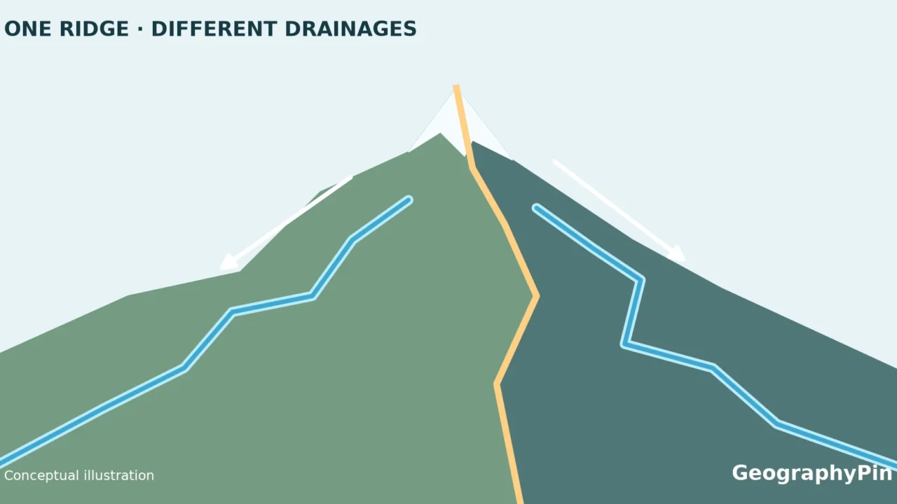
A line through the mountains can explain why nearby streams belong to completely different river systems. But the familiar “Pacific on one side, Atlantic on the other” description needs a little care. The Continental Divide has branches around an inland basin, and northern drainage routes make the continent more complicated than a two-color map.
The Continental Divide, or Great Divide, separates major drainage systems across western North America. The map below shows its contiguous U.S. route, including Wyoming’s closed Great Divide Basin. It is a drainage boundary, not a river or a hiking trail, and not every nearby stream reaches an ocean.
How to use this article: Check why east and west need context, then compare the Pacific connection with the Mississippi connection.
1. Continental Divide map: the U.S. route
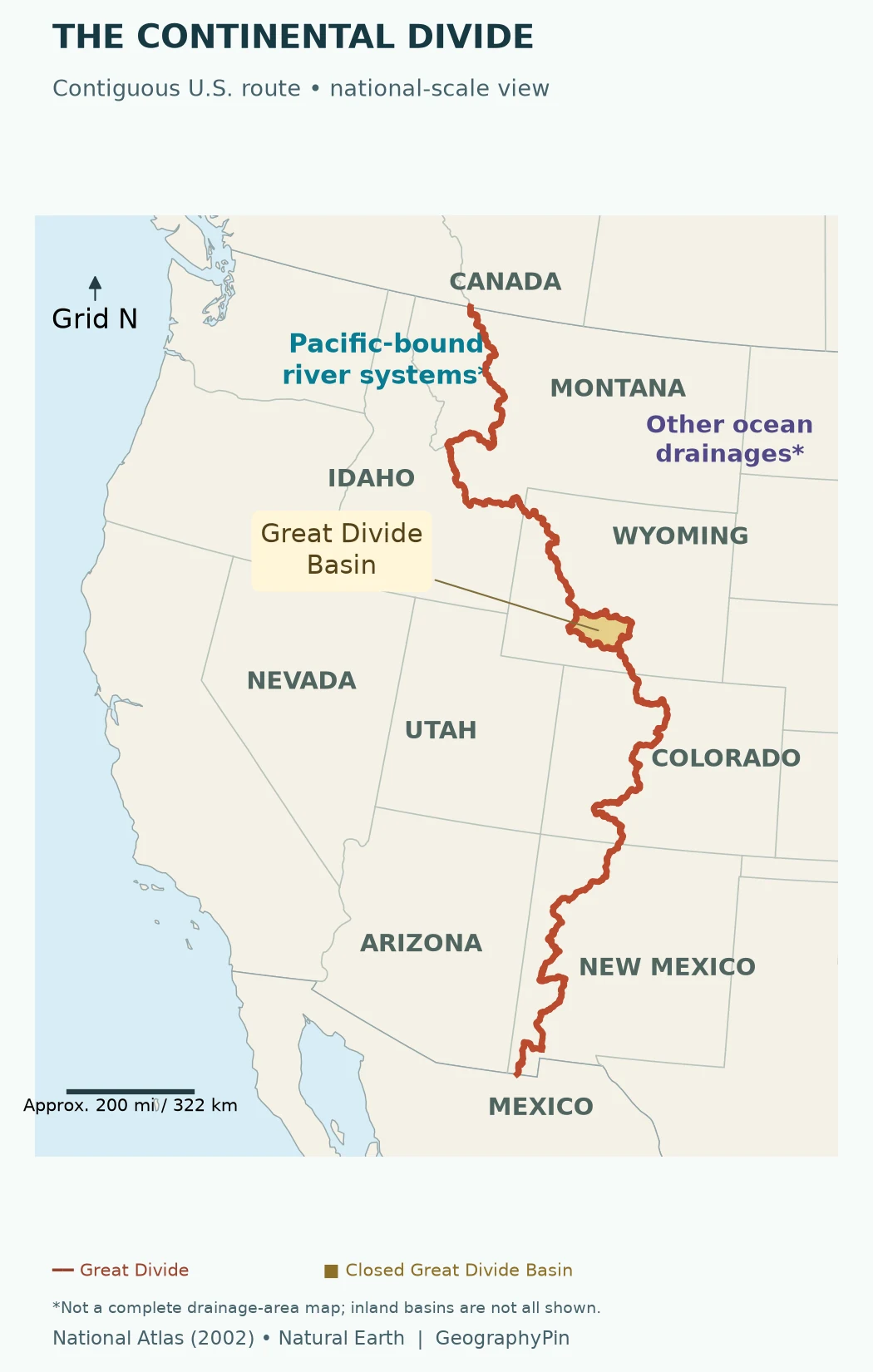
Follow the route south from Montana toward the Idaho–Montana border region, through Wyoming, Colorado and New Mexico. It bends with the terrain rather than tracing a straight north–south meridian. In Wyoming, the enclosed gold area is an important part of the story, not a missing section of the line.
The Rocky Mountains provide much of the familiar setting, but “the Rockies” and “the divide” are not interchangeable. A mountain range is a broad landform; a drainage divide is a boundary between drainage areas. Our physical map of the USA puts the mountain system in its wider landscape.
Only the U.S. reach is drawn here because the underlying National Atlas layer covers that reach. Across North America, the Great Divide continues through western Canada and Alaska to the north and into Mexico to the south. Do not interpret the ends of this map’s red line as the ends of the continental feature.
The source line was compiled for national-scale mapping using 1:2,000,000-scale source material. Enlarging this image makes labels easier to read; it does not turn the line into a surveyed, parcel-level boundary or a navigable hiking route.
2. What a drainage divide means
A drainage basin is land contributing water to a common outlet. The divide separates it from neighboring drainage areas. Large basins contain smaller ones, so a continental divide is only one level in a much larger network of watershed boundaries.
A helpful mental model is a roof ridge: water falling on opposite slopes can leave by different gutters. Real landscapes are less tidy. Runoff follows channels, while some water infiltrates the ground, evaporates or remains stored as snow, ice or lake water. A map of drainage connections is not a prediction of each drop’s journey.
Why “east” and “west” need context
The Great Divide is commonly introduced as a split between Pacific and Atlantic drainage. At continental scale, that shorthand hides Arctic and Hudson Bay drainage and areas with no ocean outlet. Even within one national park, different sides of a mountain can lead into more than two major drainage systems.
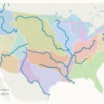
In Colorado’s Rocky Mountain National Park, the National Park Service describes west-side waters as Colorado River headwaters and east-side streams as part of the Mississippi drainage. That is a useful local example, not a rule that every point west of the Great Divide sends water to the Pacific. The U.S. rivers and drainage basins guide shows how tributaries connect at a broader scale.
3. Two downstream journeys from Glacier
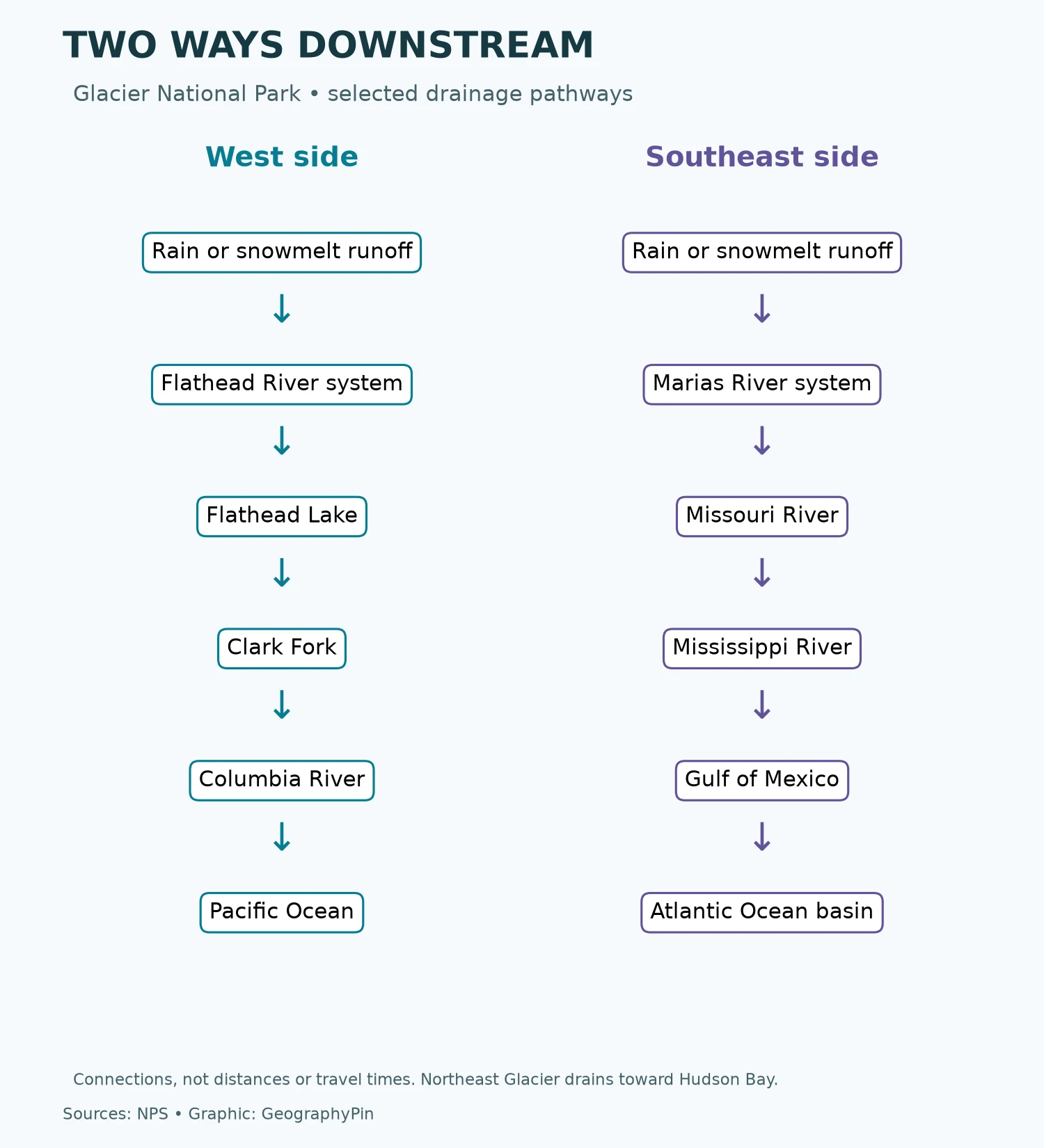
Glacier National Park offers a clear comparison. These are selected drainage connections, not measured travel times or promises that a particular raindrop will complete the entire route.
West-side route: the Pacific
Runoff entering Glacier’s west-side drainage joins the Flathead system. The downstream connection passes through Flathead Lake and the Clark Fork, then reaches the Columbia River and Pacific Ocean.
Southeast-side route: the Mississippi system
Runoff entering the Marias system from southeast Glacier connects to the Missouri and then the Mississippi. The Mississippi’s outlet is the Gulf of Mexico, which belongs to the wider Atlantic Ocean basin.
There is also a northern complication: northeast Glacier drains toward Hudson Bay through the Saskatchewan–Nelson system. Triple Divide Peak therefore helps explain why two arrows alone cannot represent every drainage relationship in the park.
4. Why the line loops in Wyoming
The Great Divide Basin is an inland drainage area in southern Wyoming’s Red Desert. Its water has no natural surface-drainage outlet to either ocean. The divide branches around the basin, producing the loop highlighted on the map.
The Wyoming State Geological Survey describes brief-flowing streams and salty lakes in this arid basin. Evaporation helps explain the salt accumulation. This is an example of endorheic drainage: water collects within an enclosed drainage system rather than continuing along a river to the sea.
The Wyoming basin and the much larger Great Basin farther west are different geographic names. Do not use the gold patch on this map as the boundary of the Great Basin, or assume it represents every internally drained area in the western United States.
The key map-reading lesson is simple: a continental-scale boundary does not guarantee ocean drainage on every piece of neighboring land. Check the basin itself before assigning a destination.
5. The divide is not the trail
The Continental Divide National Scenic Trail is a recreational route. The geographic divide is a hydrological boundary. Their names are closely connected, but they describe different kinds of feature.
A trail map answers questions about an actual route, access and travel. This map answers a different question: where is the broad drainage boundary? A red line here does not show an open path, a permitted crossing, a safe campsite or available water.
If you are planning a trip, use the responsible land agency’s trail information and current conditions rather than this educational image. For understanding the water itself, our water cycle explainer follows the processes that connect precipitation, runoff, storage and evaporation.
Frequently Asked Questions
Does the Continental Divide follow state borders?
Only in places. The map shows the divide along part of the Idaho–Montana boundary, but also through the interiors of states such as Wyoming and Colorado. It is a drainage boundary, not a political boundary.
Does all water west of the Continental Divide reach the Pacific?
No. Some western basins have no natural surface outlet to an ocean. Water can also evaporate, soak into the ground or remain stored. The divide describes drainage connections, not a promise that every drop reaches the sea.
Why does the Continental Divide split into two lines in Wyoming?
The branches surround the Great Divide Basin, an internally drained area. Its water has no natural surface outlet to either ocean. The gold loop on this map highlights that basin; it is not the much larger Great Basin farther west.
What Did We Learn Today?
The Great Divide makes more sense when read with the river networks on either side. Its U.S. route links the familiar Rocky Mountain setting with less obvious features such as Wyoming’s closed Great Divide Basin. Glacier’s downstream connections show both the Pacific–Mississippi contrast and the northern Hudson Bay complication. The line is a drainage boundary, not a guarantee that all water reaches an ocean and not a substitute for a trail map.
Sources & Data Notes
The route map uses the National Atlas of the United States’ 2002 Continental Divide line, distributed through the linked feature service, over Natural Earth country and state boundaries. GeographyPin reprojected the geometry to USA Contiguous Albers Equal Area (EPSG:5070). The gold area is the closed Wyoming loop in that linework, not a newly measured basin boundary. No Canada or Mexico extension was drawn. The flow diagram is a schematic of selected NPS-described connections. Neither figure depicts river discharge, travel time or every drainage area.
- National Atlas Continental Divide dataset and source description.
- Natural Earth: public-domain basemap data.
- USGS: watersheds and drainage basins.
- National Park Service: Glacier’s Continental Divide and downstream connections.
- National Park Service: Rocky Mountain National Park drainage.
- Wyoming State Geological Survey: Great Divide Basin.
- National Geographic: continental divides and North American context.
- National Park Service: the larger Great Basin.
- Bureau of Land Management: Continental Divide National Scenic Trail.