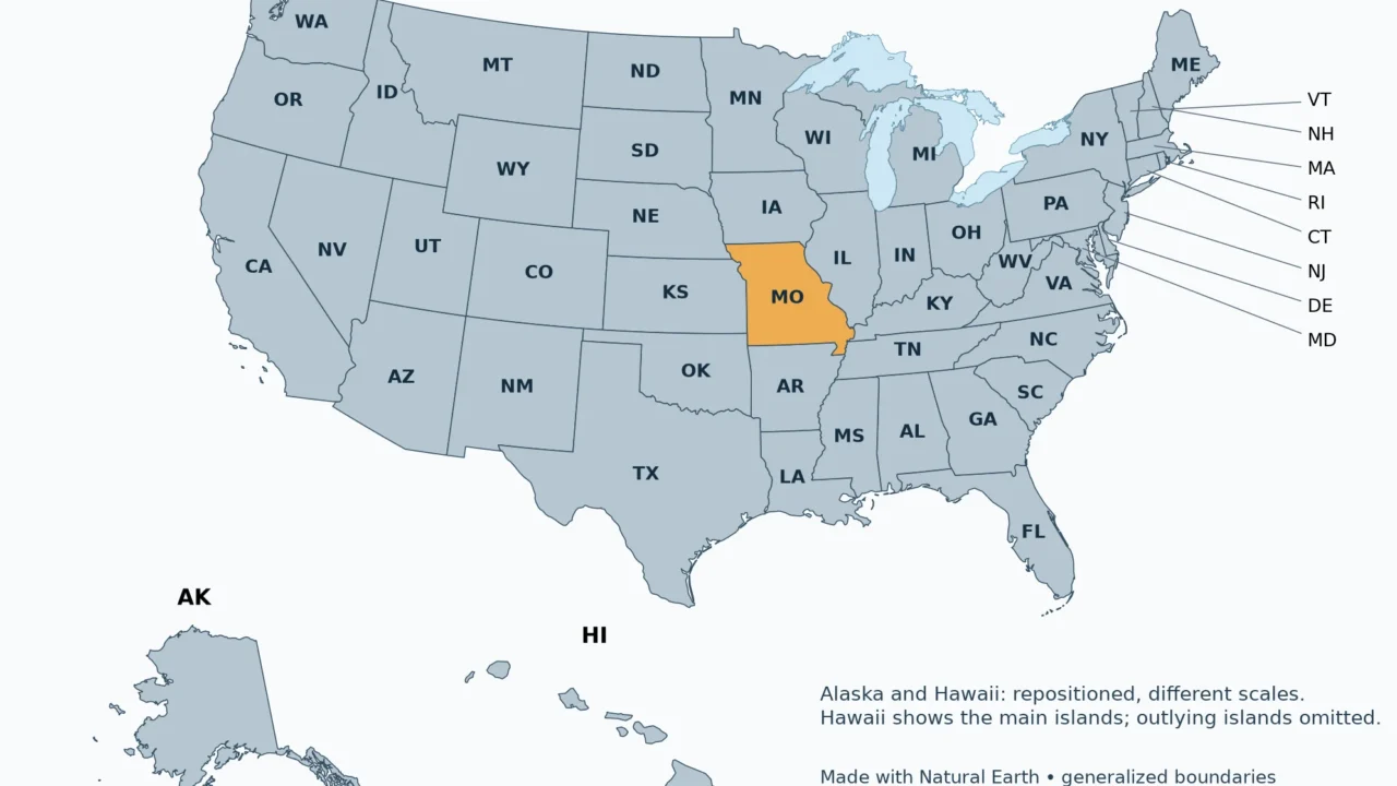
A two-letter address code can identify a state without explaining where it is. Missouri is easiest to place by its neighbors and the two major rivers that shape its geography.
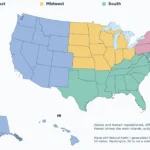
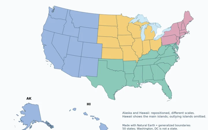
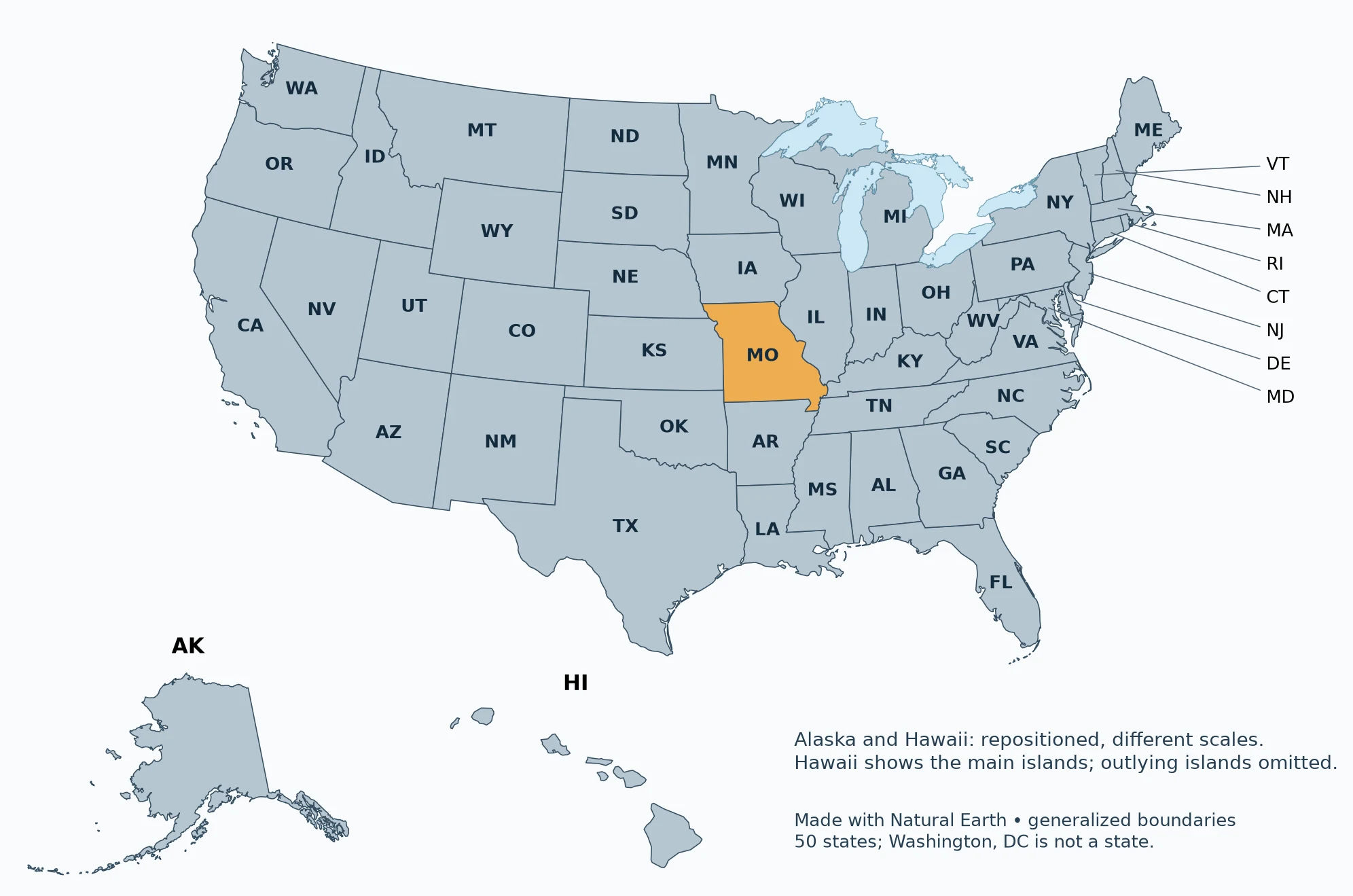
MO is the USPS abbreviation for Missouri, a state in the central United States. Its capital is Jefferson City. In the Census Bureau’s system, Missouri belongs to the Midwest and the West North Central division. Montana uses MT, not MO. Missouri borders eight states, including Kansas to its west and Illinois to its east.
Choose your task: distinguish mo, mt and ms, separate city and metro names, identify the eight neighbors.
1. What Does MO Stand For?
Distinguish MO, MT and MS
| Code | State | Capital |
|---|---|---|
| MO | Missouri | Jefferson City |
| MT | Montana | Helena |
| MS | Mississippi | Jackson |
MO is a postal abbreviation, not a shortened name for the entire Midwest. In an address, it identifies Missouri between the city name and ZIP Code. A reference to the Missouri River is different: the river extends far beyond the state that shares its name. Always distinguish a state code from a river name or a regional label.
2. Missouri on the US Map

Missouri is inland, away from both ocean coasts. Its location connects the central plains with the Mississippi River corridor. The Census Bureau places the whole state in one statistical region, even though its landscapes change between the northern plains, the Ozarks and the southeastern lowlands. A region label therefore provides orientation, not a complete description of the terrain.
3. Capital and Major Cities
Separate city and metro names
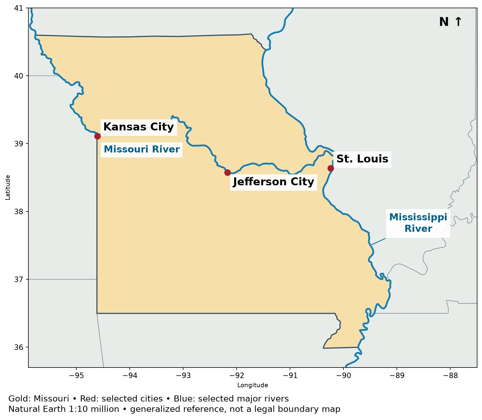
Jefferson City is Missouri’s capital. The Census Bureau’s 2023 state-facts summary identifies Kansas City as Missouri’s largest city by city-proper population; that is not a ranking of metropolitan areas. St. Louis is another major city, near the eastern edge of the state along the Mississippi River. Springfield is an important city in southwestern Missouri.
Kansas City, Missouri and Kansas City, Kansas are separate municipalities on opposite sides of the state line. The metropolitan area crosses that line. A reference simply to “Kansas City” can therefore describe a city or a wider urban region, so check the state and geographic unit before comparing population figures.

4. Missouri’s Eight Neighboring States
Identify the eight neighbors

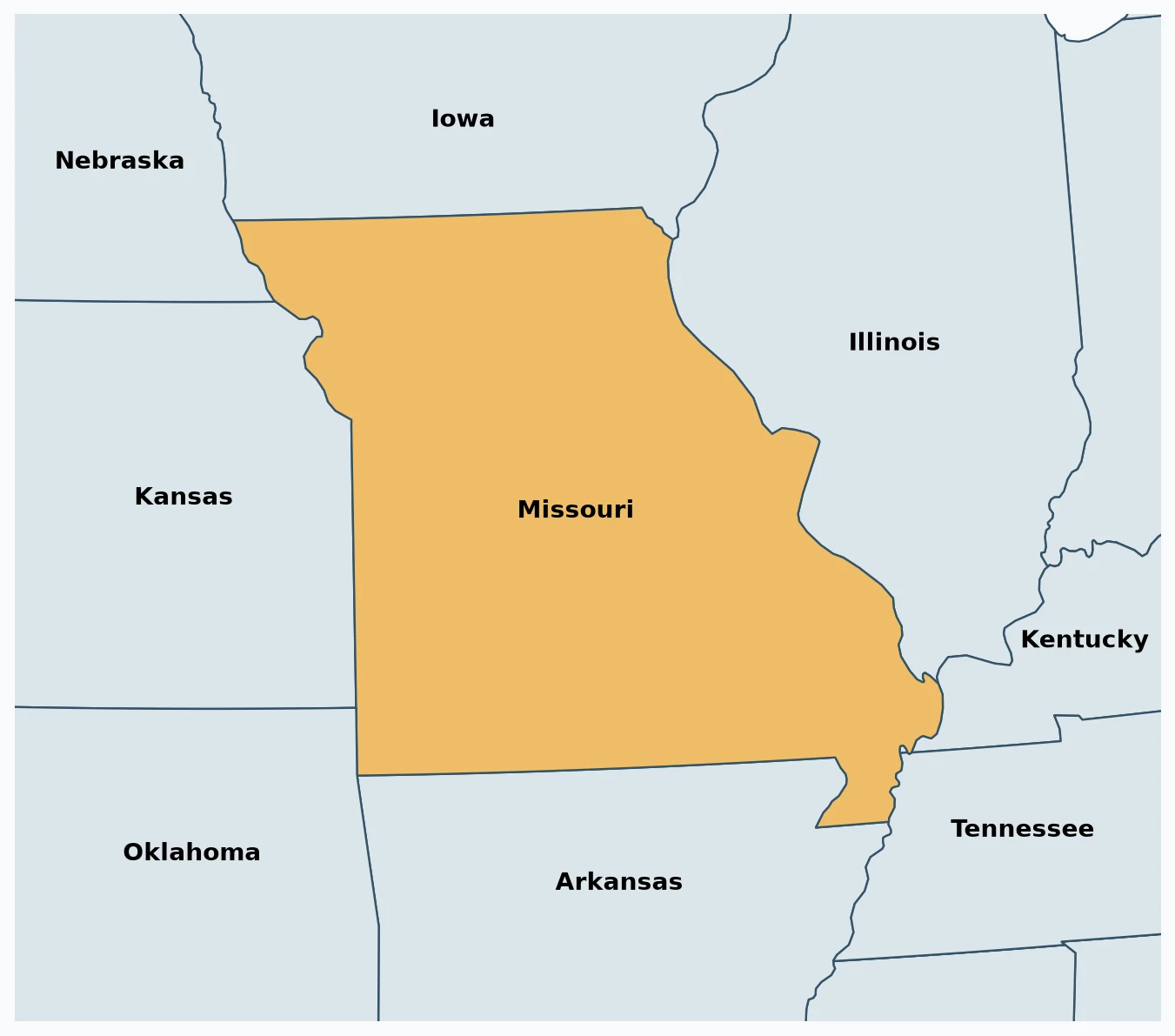
Starting to the north and moving clockwise, Missouri borders Iowa, Illinois, Kentucky, Tennessee, Arkansas, Oklahoma, Kansas and Nebraska. The Kentucky and Tennessee contacts are short compared with some of the other borders, which makes them easy to miss on a small map. Nebraska meets Missouri in the northwest; Oklahoma meets it in the southwest.
River channels and legal boundaries do not always coincide perfectly. A generalized small-scale map shows the overall relationship, not every bend, island or boundary adjustment.
5. Rivers, Ozarks and the Bootheel
The Missouri River crosses the state and joins the Mississippi River north of St. Louis. The Mississippi runs along Missouri’s eastern side. These are separate rivers, and the state is not contained within the Missouri River basin alone. A drainage basin follows water-flow connections, not state boundaries.
The Ozark landscape occupies much of southern Missouri, with dissected uplands, valleys and exposed rock. Northern and western areas include plains and lowlands. The southeastern Bootheel is a projecting part of the state associated with the Mississippi lowlands. These contrasts are more useful geographic clues than assuming that every Midwestern state is uniformly flat.
What Did We Learn Today?
MO identifies Missouri, while MT identifies Montana. Missouri’s capital, its Kansas City naming ambiguity, its eight neighbors and its position between the plains, Ozarks and Mississippi lowlands explain much more than the two-letter code alone.
Sources & Data Notes
The detailed desktop national locator and neighboring-state maps use public-domain Natural Earth 1:50 million administrative boundaries. Simplified phone maps use Natural Earth 1:10 million boundaries and lake polygons, with fewer labels for readability. The city-and-river detail uses Natural Earth 1:10 million boundaries, populated places and river data. They are generalized reference maps, not legal boundary or navigation products. The contiguous United States uses EPSG:5070; Alaska EPSG:3338; Hawaii EPSG:3759. Insets are repositioned and use different scales. These maps do not portray the insets in their true relative locations.
Great Lakes water is separated from state land using Natural Earth lake polygons. Administrative lake jurisdiction is not shown as dry land; state counts and Census membership are unchanged.