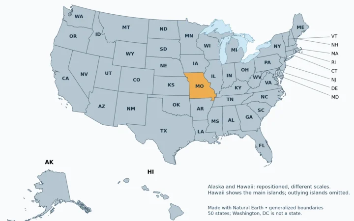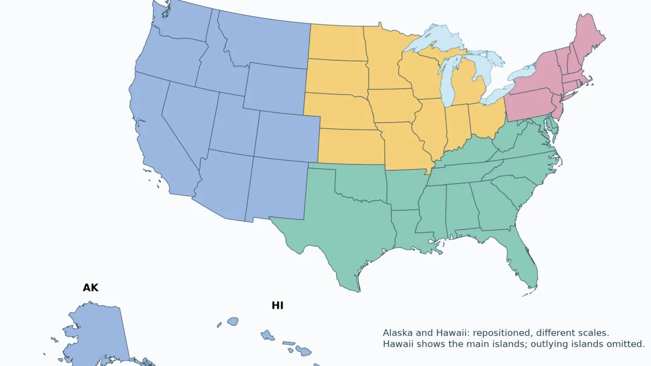
A regional label is useful only when its definition is clear. This reference uses the Census Bureau’s statistical framework, rather than mixing it with climate zones, cultural regions or school-map conventions.
The US Census Bureau groups the 50 states and Washington, DC into four regions: Northeast, Midwest, South and West. Those regions contain nine divisions. These are statistical categories, not new governments or universal cultural boundaries. A state can belong to a Census region while also being described by a different informal geographic label.
Choose your task: read the four-region map, identify the nine divisions, download the classification.
1. Map of the Four Census Regions
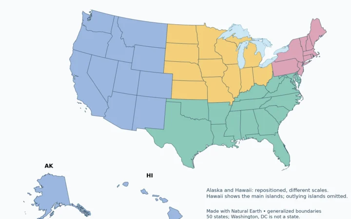
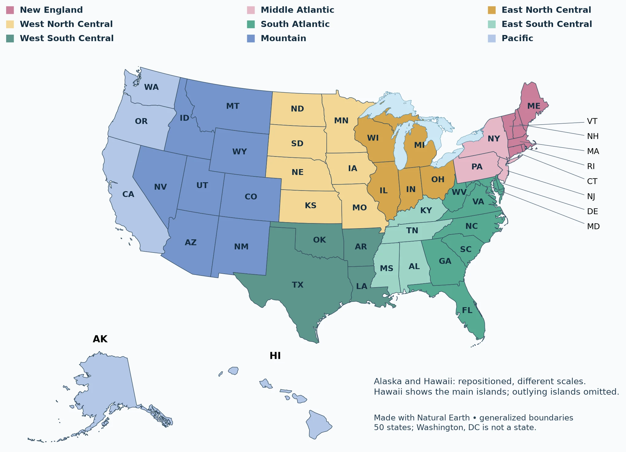
Maps fit the screen initially. Choose 2× or 4× to zoom, swipe or scroll inside the map, then choose Fit / Reset to restore the overview. DC belongs to the South Atlantic division but is too small to distinguish on these overview maps.
Read the four-region map
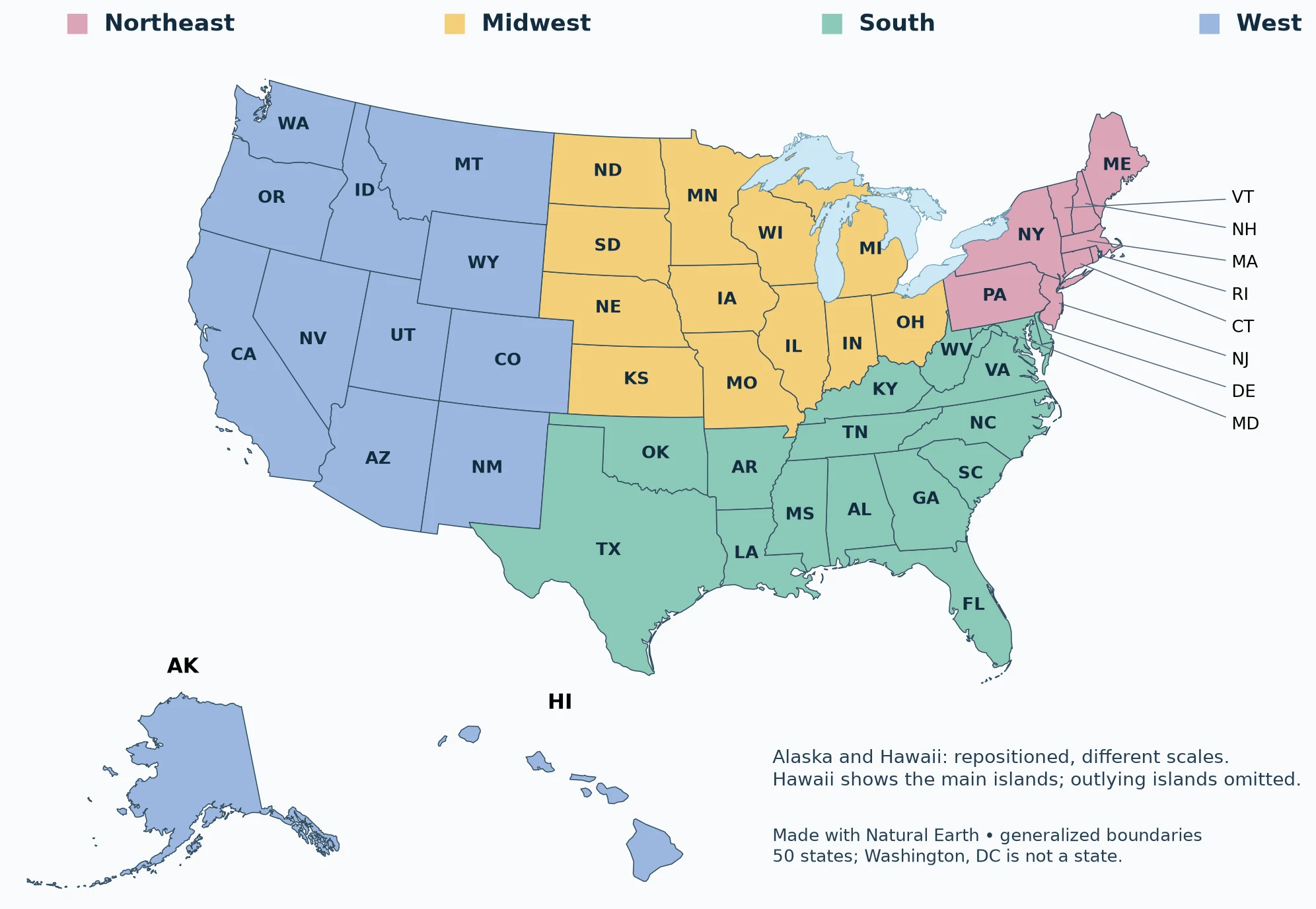
Use the colors to see the broad groups, then use the table for exact membership. The regional boundaries follow state membership; they are not drawn from rivers, mountains or climatic thresholds. Alaska and Hawaii belong to the same western region as the Pacific coast states even though they do not adjoin them.
2. The Nine Census Divisions
Identify the nine divisions
| Region | Division | Members |
|---|---|---|
| Northeast | New England | Connecticut, Maine, Massachusetts, New Hampshire, Rhode Island, Vermont |
| Northeast | Middle Atlantic | New Jersey, New York, Pennsylvania |
| Midwest | East North Central | Illinois, Indiana, Michigan, Ohio, Wisconsin |
| Midwest | West North Central | Iowa, Kansas, Minnesota, Missouri, Nebraska, North Dakota, South Dakota |
| South | East South Central | Alabama, Kentucky, Mississippi, Tennessee |
| South | West South Central | Arkansas, Louisiana, Oklahoma, Texas |
| South | South Atlantic | Delaware, Florida, Georgia, Maryland, North Carolina, South Carolina, Virginia, West Virginia; District of Columbia (not a state) |
| West | Pacific | Alaska, California, Hawaii, Oregon, Washington |
| West | Mountain | Arizona, Colorado, Idaho, Montana, Nevada, New Mexico, Utah, Wyoming |
A division is a subdivision of a region. New England and Middle Atlantic together form the Northeast. The Midwest divides into East North Central and West North Central. The South has three divisions: South Atlantic, East South Central and West South Central. Mountain and Pacific together form the West. A division name does not replace a state’s postal abbreviation.
3. Find a State’s Region
Download the classification
| Region | States |
|---|---|
| Northeast | Connecticut, Maine, Massachusetts, New Hampshire, New Jersey, New York, Pennsylvania, Rhode Island, Vermont |
| Midwest | Illinois, Indiana, Iowa, Kansas, Michigan, Minnesota, Missouri, Nebraska, North Dakota, Ohio, South Dakota, Wisconsin |
| South | Alabama, Arkansas, Delaware, Florida, Georgia, Kentucky, Louisiana, Maryland, Mississippi, North Carolina, Oklahoma, South Carolina, Tennessee, Texas, Virginia, West Virginia |
| West | Alaska, Arizona, California, Colorado, Hawaii, Idaho, Montana, Nevada, New Mexico, Oregon, Utah, Washington, Wyoming |
Download the 50-state classification CSV. Each row records the state, postal abbreviation, capital, region and division. DC is explained separately because the download is explicitly a state list. When constructing a complete Census-region dataset from it, add DC to South/South Atlantic rather than treating it as a state.
State membership and population totals are different kinds of data. The classification alone cannot establish the most populous region or a regional growth rate. Those comparisons require a single dated population dataset and consistent inclusion of DC.
4. Northeast Is Not the Same as New England
New England contains Connecticut, Maine, Massachusetts, New Hampshire, Rhode Island and Vermont. The Census Northeast also includes New Jersey, New York and Pennsylvania, the Middle Atlantic division. New York is therefore in the Northeast but not New England. This distinction matters when a chart, survey or school assignment uses one label instead of the other.
NE has another meaning in postal addresses: it is the USPS abbreviation for Nebraska. Nebraska belongs to the Midwest, not the Northeast. In a map legend or dataset, spell out “Northeast” unless the abbreviation has been explicitly defined.
5. Why Other US Region Maps Look Different
Terms such as Southwest, Pacific Northwest, Great Plains, Appalachia and Great Lakes describe other useful geographic relationships. Their memberships depend on the purpose and source. They should not be silently substituted for the four-region Census system. A physical-region map may split a state; a Census-region map assigns each state to one group.
Texas is classified in the South, within West South Central. Maryland and DC are in the South Atlantic division. Those placements can surprise readers who expect a cultural definition of the South. They are not mistakes within this statistical framework. Similarly, Missouri is in the Midwest even when an account of its history emphasizes connections with the South.
Before comparing two “regional” datasets, check their membership lists. Matching labels alone are not enough. If one source uses a custom Northeast and another uses the Census Northeast, different results may reflect different boundaries rather than an error in the numbers.
What Did We Learn Today?
The four Census regions form a consistent statistical framework, and the nine divisions add detail within it. New England is only part of the Northeast, NE can mean Nebraska, and informal regions answer different geographic questions. Exact membership matters more than assuming that familiar regional names always describe the same area.
Sources & Data Notes
Maps use public-domain Natural Earth 1:50 million administrative boundaries. They are generalized reference maps, not legal boundary or navigation products. The contiguous United States uses EPSG:5070; Alaska EPSG:3338; Hawaii EPSG:3759. Insets are repositioned and use different scales. These maps do not portray the insets in their true relative locations.
Great Lakes water is separated from state land using Natural Earth lake polygons. Administrative lake jurisdiction is not shown as dry land; state counts and Census membership are unchanged.
- Natural Earth: public-domain terms
- USPS Publication 28: two-letter abbreviations
- BLS: Census regions and divisions
The 50-state reference and CSV omit DC by design; the division table includes it explicitly. Puerto Rico and the island areas are not members of these Census regions or divisions. Division fills are categorical, not a measure of population or land area.