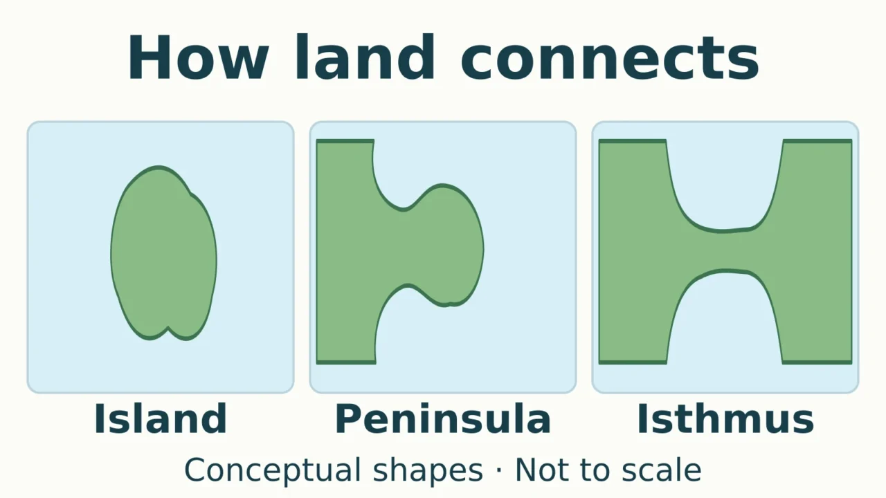
The easiest way to distinguish an island, a peninsula, and an isthmus is to trace the shoreline and look for a land connection. Their outlines can vary greatly, so recognizing what connects to what is more useful than memorizing a particular shape.
An island is surrounded by water, a peninsula is almost surrounded by water but remains attached to a larger land area, and an isthmus is a narrow strip joining two larger land areas with water on opposite sides. A strait reverses the isthmus pattern: it is a water passage between land areas.
How to use this article: Compare a peninsula and its connection, check what a canal changes, or see why tidal islands need an extra qualification.
1. Compare the Three Landforms
All three terms describe land. What changes is whether that land stands apart, extends outward, or forms a narrow connection. The table compares the same features rather than assigning each landform a supposedly standard size.
| Feature | Island | Peninsula | Isthmus |
|---|---|---|---|
| Water around it | Surrounds the land | Almost surrounds the projection | Lies on opposite sides of the strip |
| Land connection | Absent in the basic case | Attached at its base | Connects larger areas at both ends |
| What to identify | The separate land area | The projecting land area | The narrow connecting part |
| Example | Sicily | Baja California | Isthmus of Panama |
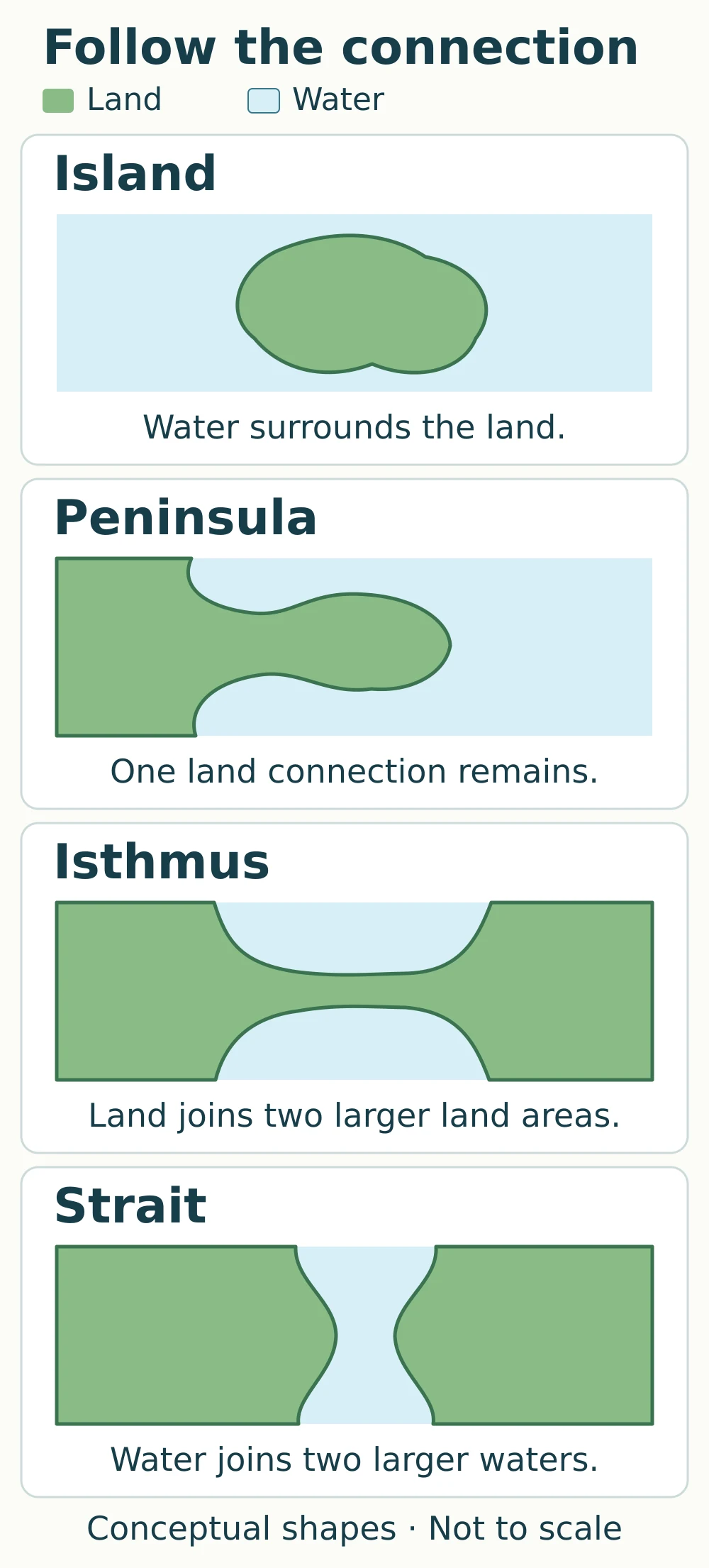
The drawing deliberately simplifies the shoreline. A crooked, mountainous, or irregular feature can still fit a definition; a coastline does not need to resemble a neat oval or an hourglass.
2. What Each Landform Name Describes
Island: land with water all around
An island is a separate area of land surrounded by water. The surrounding water can be an ocean, a sea, a lake, or a river. Islands also vary in origin, so the word alone does not tell you whether the land formed through volcanism, sediment accumulation, or separation from a larger landmass.
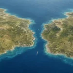
Sicily is a useful example because the narrow Strait of Messina separates it from mainland Italy. The gap is water, even though the two shores are close. NASA’s satellite account of the Messina Strait shows that distinction clearly.
Continents are normally treated as a separate geographic category rather than counted as islands. And an island is a landform, not automatically a country. For a different island setting, GeographyPin’s explanation of coral atolls and ring-shaped reefs looks at how reefs and islands can occur together.
Peninsula: a projection that remains attached
A peninsula extends into water while remaining connected to a larger land area. The familiar classroom phrase “water on three sides” is a useful starting point, but real shorelines do not have exactly three straight edges. The essential distinction is that the projecting land remains attached at its base.
Baja California illustrates the pattern. The Mexican peninsula lies between the Pacific Ocean and the Gulf of California, with a land connection to the north. Its long shape is easy to recognize, but peninsulas do not all have to be long and thin.
Isthmus: the narrow connecting strip
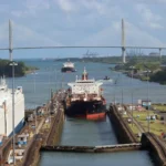
An isthmus is the narrower land between two larger land areas, with water on opposite sides. It can connect a peninsula to a broader landmass, or connect much larger regions. The Isthmus of Panama links North and South America and lies between the Pacific and Atlantic Ocean systems.
A peninsula and an isthmus can therefore be parts of the same setting. The peninsula is the projection; the isthmus is its narrow connection, where such a connection exists. Do not label the entire projecting land area an isthmus just because its base is narrow.
3. Isthmus vs. Strait: Land Link or Water Link?
An isthmus connects land and separates waters. A strait connects larger waters and separates land. In both cases, the narrow part is the key, but its material is different.
In the Strait of Messina, the narrow passage is water between Sicily and mainland Italy. In an uncut isthmus, the narrow connection is land. This is why reading the map legend matters: a thin blue passage and a thin green or brown strip can describe opposite arrangements.
A human-dug navigation canal is a different kind of waterway from a natural strait. For the fuller distinction between straits, channels, sounds, and canals, see what makes a waterway a strait.
4. Canals, Tides, and Size: Where Simple Rules Need Care
A canal can cut the connection without erasing the name
A canal across an isthmus creates an artificial water passage through the land connection. However, established geographic names do not necessarily change to match a purely literal “water all around” test.
The Corinth Canal cuts across the Isthmus of Corinth in Greece. NASA’s account of the canal still calls the land to its south the Peloponnese Peninsula and identifies the isthmus through which the canal runs. Calling the Peloponnese an island in a strictly physical sense needs that canal qualification; simply declaring that its peninsula name is wrong would obscure common geographic usage.
A tidal island has a connection exposed at low tide
At a tidal island, access across exposed ground changes with the tide. St Michael’s Mount in Cornwall, England, is a clear example: its cobbled causeway is exposed at low tide and covered at high tide, as the site’s own access explanation describes.
A low-tide photograph alone can therefore be misleading. “Tidal island” communicates more than forcing the place into a permanent island-or-peninsula choice. If visiting one, use the site’s current crossing guidance rather than inferring safe access from a map.
There is no universal size test to memorize
The geographic definitions used here do not prescribe a minimum island area or a fixed ratio between a peninsula’s neck and its wider part. Similarly, “narrow” in an isthmus definition is relative to the land around it. A number invented to settle every case would give false precision.
Small islands are often called islets, and naming practices can vary. Use the feature’s physical arrangement and the terminology of the relevant mapping authority together, especially where artificial changes or tides complicate the outline.
5. A Practical Map-Reading Test
Start with a map that shows enough of the surrounding coast. A tightly cropped picture can hide the very connection you need to identify.
- Check the legend. Identify land and water before interpreting a narrow line or gap.
- Trace the shoreline. Water surrounding a separate land area suggests an island. Check for tidal connections or artificial cuts before stopping there.
- Look for the base of a projection. Land that extends into water but remains attached is a peninsula.
- Inspect any narrow connection. A strip of land joining two wider land areas, with water on opposite sides, is an isthmus. A narrow water passage joining larger waters is a strait.
- Check the named feature’s scope. A label may refer to the whole peninsula, its neck, or the water beside it.
For practice, imagine a broad piece of land jutting into a lake, attached to the shore by a thin neck. The whole projection is a peninsula; the neck is an isthmus. A separate patch of land farther out in the same lake is an island. These labels answer different questions about the same landscape rather than competing to describe every part of it.
What Did We Learn Today?
Follow the connection rather than judging the outline alone: an island stands apart in water, a peninsula projects from larger land, and an isthmus forms a narrow land link. A strait is the water-link counterpart. Real examples need an extra check for tides, canals, and established names, and a peninsula can have an isthmus at its base without the two terms meaning the same thing.
Sources & Data Notes
This comparison uses general physical-geography definitions, not legal rules for maritime boundaries. Narrowness is relative, and no numeric size or neck-width threshold is imposed. The original illustrations simplify connections and are not maps to scale. Named examples are supported by the references below; the canal example also illustrates continuing conventional usage.
- National Geographic Society: Island, Peninsula, and Isthmus, for basic definitions, varied island settings, and named landform examples.
- U.S. Geological Survey: GNIS Domestic Names Feature Classes, for geographic naming categories, including islands, isthmuses, capes, and canals.
- University of Hawaiʻi at Mānoa: Seafloor Features and Mapping the Seafloor, especially Table 7.6’s coastal terminology.
- NASA Earth Observatory: Messina Strait, Italy and Corinth Canal, for the Sicily example and the canal-cut isthmus.
- St Michael’s Mount: Getting to St Michael’s Mount, for the tidal island and causeway example.