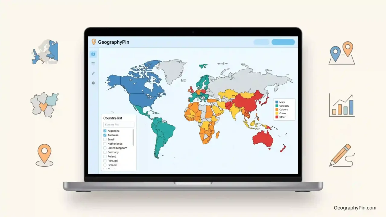
The best free online map maker depends on the job. GeographyPin is the simplest option for highlighting countries from a pasted list; MapChart offers more geographic detail; Google My Maps handles places and routes; Datawrapper builds maps from data; and Scribble Maps is suited to drawing and annotation.
How to use this article: Jump to the quickest tool match, see the simplest country highlighter, compare all five tools side by side, or check what actual users report.
The fastest choice by map type
“Map maker” and “map creator” can describe several different products. A country highlighter fills countries by category. A location map plots places and routes. A choropleth changes regional colors according to numerical data. An annotation tool lets the creator draw over a street or satellite basemap.
Match the tool to the sentence you are trying to show
- “Highlight these countries”: GeographyPin Map Maker.
- “Color these states, provinces, or regions”: MapChart.
- “Put these places and routes on a familiar map”: Google My Maps.
- “Turn these values into a statistical map”: Datawrapper.
- “Draw lines, zones, and notes over a map”: Scribble Maps.
A larger feature set is not automatically an advantage. If the finished image only needs ten or thirty highlighted countries and a legend, importing spatial data, creating layers, configuring tooltips, or learning drawing controls adds work without improving the result.
How the five tools were judged
The comparison considers task fit, number of steps, input method, geographic detail, labeling, customization, free output, and the point at which a beginner may need instructions. The numbers identify five selections; they are not an overall ranking across every kind of map project.
The five best free online map makers
Transparency note: GeographyPin publishes this comparison and created the first tool. It solves a narrower problem than the other products, and its limitations are stated clearly.
1. GeographyPin Map Maker: simplest for highlighting countries
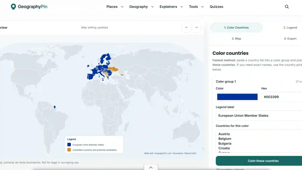
GeographyPin Map Maker is a country highlighter for people who already know what belongs on the map. Copy a list from a document or spreadsheet, paste it into a color group, add a legend label, and repeat for additional groups.
Users do not need to find and click every country. Controls cover colors, the legend, map appearance, highlighted-country labels, and export, making the tool useful for slideshows, classroom work, reports, articles, membership maps, and travel projects.
What it does not do: the current version supports a world map and country-level highlighting only. It does not provide state or province maps, street-level places, routes, statistical mapping, collaborative layers, or spatial analysis.
2. MapChart: best for subdivisions and map variety
MapChart is the closest direct alternative for color-coded political maps. It offers world and continent maps, U.S. states and counties, subdivisions in many countries, individual country maps, and historical or fictional templates. Its geographic breadth is the reason to choose it.
The tradeoff is its usual click-based workflow. Coloring a few countries is easy; working through a long prepared list takes more attention because each one must be found and selected. Repetitive clicking creates more opportunities to overlook an item, while showing labels only for highlighted countries is less direct.
MapChart is stronger when a project needs provinces, states, counties, patterns, or specialized templates. It also states that created maps use a Creative Commons Attribution-ShareAlike license, which publishers should check before reuse.
3. Google My Maps: best for places, routes, and collaboration
Google My Maps works on Google’s familiar basemap and adds markers, shapes, directions, photos, descriptions, spreadsheet imports, and layers. Maps can be shared, edited with other people, or embedded on a website.
Basic marker placement does not require GIS expertise, but users still meet layers, location columns, marker styles, routes, and sharing permissions. Google’s creation instructions are computer-based and require signing in.
Custom maps can be viewed through Google Maps on a phone, but editing and route creation remain centered on desktop; saved routes are not live turn-by-turn navigation. For highlighting national territories, My Maps is not simply harder—it is the wrong workflow.
4. Datawrapper: best for maps driven by real data
Datawrapper is built for data visualization rather than quick country selection. Its choropleth maps color regions by value, symbol maps plot markers, and locator maps show where events or places are situated. It also handles tooltips, responsive embeds, annotations, scales, and publication layouts.
Public reviews generally describe Datawrapper as approachable for a data-visualization product. In G2’s small set of ten reviews, users praised its no-code workflow and ability to turn spreadsheets into clear visuals, while recurring criticisms included limited customization, awkward color controls, and delays or difficulty with larger datasets.
Its free plan supports published maps, embeds, and PNG downloads with Datawrapper attribution; white-label and vector or PDF exports are paid features. For statistics, its setup is valuable. For a basic country list, preparing rows, matching geographic units, and configuring categories is extra work.
5. Scribble Maps: best for drawing directly on maps
Scribble Maps turns a basemap into a drawing and planning surface. Users can add lines, arrows, shapes, markers, labels, measurements, routes, and other annotations for event plans, field projects, property notes, or travel ideas.
User feedback is positive overall. Scribble Maps held a 4.6-out-of-5 G2 rating from 199 reviews when checked, with users frequently praising the quick start and intuitive drawing tools. Reported frustrations included lag on larger projects, features that become paid just as a user needs them, and some advanced controls that require tutorials.
The basic drawing experience can be easy, but the product is much wider than a country highlighter. Its free plan allows five maps and a 450 × 450-pixel image export; list imports, larger exports, overlays, heatmaps, and advanced functions require paid access (Scribble Maps, 2026).
Side-by-side comparison
The practical differences become clearer when the same simple question is applied to every tool: “I already have a country list—how much work stands between that list and a finished map?”
Which tool fits which project?
| Tool | Best use | Country-list workflow | Main advantage | Main limitation |
|---|---|---|---|---|
| GeographyPin Map Maker | Highlighting countries for projects and presentations | Paste country names into color groups | Fastest and most focused workflow | World map and countries only |
| MapChart | Countries, states, provinces, counties, and detailed templates | Usually select areas by clicking | Far more geographic detail | Long lists take more manual work |
| Google My Maps | Places, routes, layers, and shared maps | Not designed for filling countries from a list | Familiar basemap and collaboration | Desktop-first, multi-step workflow |
| Datawrapper | Statistical, interactive, and editorial data maps | Prepare and match structured data | Strong data visualization and publishing | Unnecessary setup for a basic list |
| Scribble Maps | Drawing, annotation, planning, and routes | Manual drawing rather than country-list highlighting | Flexible markup over real-world maps | Free export and advanced features are limited |
For country highlighting, GeographyPin and MapChart are the real direct comparison. The other three belong in the list because “map maker” has broader meanings, but they solve different problems and should not be judged as though they were country-coloring tools.
Why GeographyPin focuses on one simple job
GeographyPin Map Maker grew from a publishing problem. For one project, we had a list of 33 countries to highlight. Selecting each one was not difficult, but it was repetitive and easy to check twice because one missed click could leave a country off the map.
You should not need to learn mapping software for a simple slide
The missing tool was a focused bridge between a country list and a finished visual: paste the list, choose a color, name the group, select the labels, customize the appearance, and export.
That narrow scope is both the advantage and the limitation. GeographyPin cannot replace the other tools’ regional, location, data, or drawing features. It removes unnecessary work when those abilities are not required.
When simplicity matters most
- A student needs a group of countries highlighted for a class presentation.
- A writer needs a clean country map for an article.
- A team needs membership categories shown in a slideshow.
- A traveler wants to color visited, planned, and future destinations.
- A researcher has country groups but does not need a statistical choropleth.
In those cases, the best map maker is the tool that finishes the job with the fewest chances for error.
How to make a highlighted-country map quickly
A prepared country list is enough to start. It can come from a spreadsheet, research notes, a document, or another GeographyPin article.
From country list to finished map
- Open the free online map maker. The world map and first color group are ready for input.
- Paste the country names. Separate them with new lines, commas, or semicolons rather than selecting each country manually.
- Choose the group color and label. Use a label that explains the meaning, such as “Current members” or “Countries visited.”
- Add more groups when necessary. Give each category its own country list, color, and legend meaning.
- Check the matched countries. Confirm spelling, aliases, tiny states, territories, and any place that did not appear as expected.
- Adjust labels and appearance. Show the country names the reader actually needs, position the legend, and keep the map readable.
- Export and preview the result. Check it at the same size it will have in the slide, report, article, or project.
The process remains simple because the tool already knows the national boundaries. The user supplies the country groups and meaning rather than drawing geography from scratch.
Common mistakes and publishing checks
A fast workflow still needs a final accuracy check. A polished map can mislead if a country is missing, a category is unclear, or a disputed boundary is shown without context.
Check meaning before design
- Use clear legend labels: “Members,” “Applicants,” and “Non-members” communicate more than “Blue,” “Yellow,” and “Other.”
- Do not use categories for continuous statistics: If color intensity must represent a value, a properly configured choropleth in Datawrapper may be the safer choice.
- Avoid color-only meaning: Use sufficient contrast, visible labels, or patterns so the map remains understandable for readers with color-vision differences.
- Check every pasted name: Alternative country names, abbreviations, territories, and spelling differences can affect matching.
- Review small countries: Island states and microstates can be hard to notice at world scale even when correctly highlighted.
- Add a date when the subject changes: Alliances, memberships, election results, travel rules, and political classifications can become outdated.
- Check map and data licenses: Free creation does not always mean unrestricted commercial reuse.
Preview the export on mobile and inside the finished presentation or page. A comfortable editor legend may become cramped when reduced.
FAQ
What is the easiest free online map maker?
For highlighting countries from a prepared list, GeographyPin Map Maker is the easiest option in this comparison because users can paste country names instead of selecting countries individually. For drawing on local maps, Scribble Maps may feel easier; for familiar place markers, Google My Maps may be more suitable.
Can I paste a list of countries and highlight them automatically?
Yes. GeographyPin Map Maker accepts country names separated by lines, commas, or semicolons. Each list can be assigned to a color group with its own legend label, allowing several categories to appear on one world map.
Is GeographyPin Map Maker better than MapChart?
It is better for one specific job: highlighting countries quickly from pasted lists. MapChart is better when the project needs states, provinces, counties, detailed country maps, historical templates, or other geographic options that GeographyPin does not currently provide.
Can Google My Maps highlight entire countries?
Google My Maps can work with imported or manually drawn shapes, but it is primarily designed for places, markers, lines, routes, and layers. It is not the efficient choice for someone who simply has a list of national territories to color.
Is Datawrapper difficult to use?
Datawrapper is considered approachable compared with many data-visualization products, and it does not require coding for standard maps. It still requires structured data and decisions about map type, geographic matching, scales, legends, tooltips, and publishing, making it unnecessary for a basic country-highlighting task.
Is Scribble Maps suitable for a quick project?
Yes, especially when the project needs markers, drawn areas, arrows, labels, or routes. Many users praise its quick drawing workflow. It is less suitable when the entire task is to highlight a prepared list of countries, and its free export size and advanced features are limited.
Can I use a free custom map commercially?
That depends on the tool, underlying basemap, imported data, export method, and applicable license. Check the current terms before placing a map in a paid product, advertisement, client project, commercial presentation, or publication.
Is a map maker different from a map creator?
The terms usually mean the same thing in online searches. The important distinction is the output: some map creators highlight countries, while others plot places, visualize numerical data, draw annotations, or build fictional geography.
What Did We Learn Today?
The best map maker is the one that matches the actual job. GeographyPin provides the fastest route from a country list to a highlighted world map; MapChart adds much deeper regional coverage; Google My Maps handles places and collaboration; Datawrapper turns structured data into maps; and Scribble Maps supports drawing and planning. More features are valuable only when the project needs them.
Sources & Data Notes
This comparison uses official feature pages, help documentation, pricing information, licensing terms, verified G2 user feedback, and the author’s firsthand experience creating country maps for GeographyPin projects. Review totals, ratings, free-plan limits, and interface details reflect information available in July 2026; figures may be rounded or simplified, and later product updates can change them. The article was written and editorially reviewed by the author, with AI assistance used to organize research and support drafting.