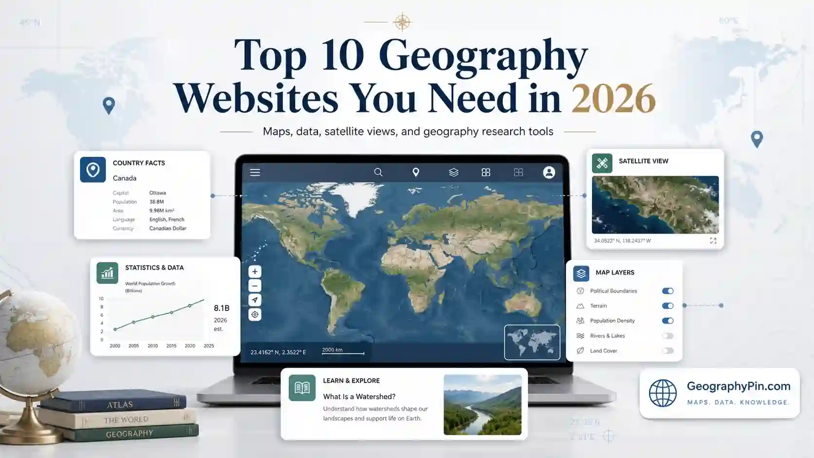
The geography websites you need in 2026 are the ones that match your task: Britannica for edited context, Wikipedia for fast orientation, UN Data for statistics, OpenStreetMap for reusable map data, and Google Earth for visual place checks. GeographyPin fits beside them by turning geographic facts into cleaner, article-level explanations.
How to use this article: Treat this page as a source picker: use the quick-pick table when you need a fast choice, the Factbook note before using old country data, the OpenStreetMap note for reusable map data, and the GeographyPin source stack to see how these tools work together.
Quick Comparison: Which Geography Website Should You Use?
Most people do not need ten geography websites open at once. The smarter approach is to match the website to the job: definition, map, data, classroom explanation, GIS work, or visual inspection.
Fast pick table
| Need | Best website | Why it fits |
|---|---|---|
| Clean definition or background | Britannica | Edited reference style with stable explanations |
| Fast orientation on almost any topic | Wikipedia | Broad coverage, internal links, maps, and references |
| Simple country or region overview | World Atlas | Readable maps, lists, and geography explainers |
| Official-style statistical comparison | UN Data | Formal international datasets through one portal |
| School or classroom geography | National Geographic Education | Maps, videos, activities, and lesson-friendly resources |
| Reusable open map data | OpenStreetMap | Community-built open data for mapping and GIS use |
| Satellite and 3D place understanding | Google Earth | Imagery, terrain, 3D buildings, and Street View context |
If you only remember one rule, remember this: use reference sites to understand a place, data sites to measure it, and map tools to see it. GeographyPin’s role is to combine those layers into clear explanations that are easier to read than raw source material.
1. Encyclopædia Britannica
Britannica remains one of the strongest geography websites for edited, stable explanations. It is best for topics such as physical geography, countries, regions, landforms, climate concepts, human geography, and cartographic history.
Britannica describes its online encyclopedia as fact-checked and built from a large collection of articles, biographies, videos, and reference pages. That makes it useful when you need a careful starting point rather than a fast-changing public-edit page (Britannica, 2026).
Best for quick reference checks
Use Britannica when you need a clean definition, a safe overview, or a more polished explanation before checking maps, primary statistics, or specialist sources.
Strengths
- Edited reference material with a formal editorial style
- Strong for definitions, biographies, country context, and historical background
Limits
- Some deeper material may sit behind access limits
- Not designed as an interactive mapping or statistical platform
2. Wikipedia
Wikipedia is still one of the fastest ways to understand a geography topic before going deeper. Its biggest strength is coverage: countries, rivers, mountains, cities, islands, administrative divisions, border questions, climate regions, and historic places often have pages with maps, references, and related links.
The English Wikipedia had more than 7.17 million articles in May 2026, which explains why it often appears first when people search for geographic topics (Wikimedia, 2026). Its open-edit model is powerful, but sensitive claims still need verification through primary or institutional sources.
How to use Wikipedia safely
Use Wikipedia for orientation, terminology, related topics, and source discovery. For statistics, borders, legal status, or disputed political claims, follow the references and confirm the facts elsewhere.
Strengths
- Free, broad, and constantly revised
- Excellent for cross-links, maps, references, and topic discovery
Limits
- Quality varies by topic, editor activity, and political sensitivity
- Not enough by itself for professional or academic citation work
3. World Atlas
World Atlas is a strong general geography website for maps, country profiles, regional explainers, and visually friendly reference pages. It works well when you want a more readable entry point than a technical database but more geographic framing than a short dictionary-style definition.
Its biggest value is accessibility. Country pages, physical geography pages, and regional features are usually presented in a way that is easy to scan, especially when a reader needs fast geographic context before moving to deeper sources.
Best for map-based context
Use World Atlas when a map, location description, or regional overview helps you understand the subject faster than a dense reference page.
Strengths
- Readable country, region, and physical geography pages
- Good balance between maps, facts, and short explanations
Limits
- Some pages may be more introductory than analytical
- Ads and page layout can affect the reading flow
4. CIA World Factbook
CIA World Factbook needs a special 2026 note. For many years, it was one of the most convenient country-reference tools online, with standardized entries on geography, people, government, economy, energy, transport, and security.
On February 4, 2026, the CIA announced that The World Factbook had sunset as one of its public publications (CIA, 2026). That makes it historically important, but it should no longer be treated as a normal live-updated country-data source.
Use it as a legacy reference, not a live data source
The Factbook still matters because its structure taught many people how to compare countries in a standardized way. For current 2026 figures, check national statistical offices, UN agencies, the World Bank, or other active institutional databases.
Strengths
- Clear country-profile structure
- Useful for historical comparison and old standardized categories
Limits
- Sunset as a CIA public publication in 2026
- Current facts should be verified with active data sources
5. UN Data
UN Data is one of the most useful geography-related resources when the question depends on statistics rather than narrative explanation. It brings United Nations statistical databases into one entry point, which makes it useful for development, population, economy, environment, and social-indicator research.
UN Data is not always the easiest website to use, but it is valuable because the numbers usually come from formal statistical systems and reporting cycles. That makes it better for serious comparison than a random summary page.
Best for data-heavy research
Use UN Data when you need downloadable figures, country comparisons, or a more official statistical base. Expect some lag, because international datasets depend on reporting schedules and country submissions.
Strengths
- Authoritative international datasets
- Useful for country comparisons and statistical research
Limits
- Interface can feel technical
- Some figures may lag behind national releases or fast-moving events
6. National Geographic Education
National Geographic Education is especially useful for classroom geography, visual learning, and introductory explanations. The site offers maps, videos, interactives, live events, and other educational resources across subjects and grade levels (National Geographic Society, 2026).
The site’s main strength is presentation. It turns geographic ideas into teachable resources, which makes it useful for students, teachers, parents, and anyone who wants a more visual explanation of places, ecosystems, maps, and human-environment relationships.
Best for classroom-style learning
Use National Geographic Education when you want maps, lesson-friendly materials, and visual context rather than raw data tables or technical GIS workflows.
Strengths
- Strong visuals, videos, maps, interactives, and teaching resources
- Excellent for introductory and school-level geography
Limits
- Less focused on advanced research
- Some resources are organized around classroom needs rather than quick reference
7. Geographical Magazine
Geographical is the official magazine of the Royal Geographical Society with IBG and has been published in the United Kingdom since 1935 (Royal Geographical Society, 2026). It covers geography, culture, wildlife, exploration, and related subjects with a strong visual and narrative style.
This is not a database or map engine. Its value is long-form geography: features, photography, reporting, and expert-led stories that connect places with people, ecosystems, and current pressures.
Best for narrative geography
Use Geographical when you want thoughtful articles and field-style reporting, not just a fast definition or a country-statistics table.
Strengths
- Strong photography and long-form geography writing
- Useful bridge between academic geography and public storytelling
Limits
- Not built for raw data downloads or map exports
- Some full content may require subscription access
8. OpenStreetMap
OpenStreetMap is one of the most important geography websites because it is not just a map you look at. It is a global open-data mapping project, built by contributors and licensed under the Open Data Commons Open Database License by the OpenStreetMap Foundation (OpenStreetMap Foundation, 2026).
For many users, OSM is valuable because it includes roads, trails, paths, local features, buildings, and place details that may be missing or delayed in commercial map products. For developers, researchers, and GIS users, it can also be a base layer and data source for custom mapping projects.
Best for open map data
Use OpenStreetMap when you need editable, reusable, community-built map data. For critical work, check local data quality because coverage can vary sharply between regions.
Strengths
- Open-data structure with global community contributions
- Very useful for custom maps, local features, and GIS workflows
Limits
- Data quality depends on local contributor activity
- Requires more technical knowledge for exports and advanced use
9. Geography Realm
Geography Realm focuses heavily on GIS, geospatial technology, cartography, remote sensing, spatial analysis, and applied geography. It is one of the better choices when you want to understand how geographic information is collected, analyzed, mapped, and used.
Compared with a general encyclopedia, Geography Realm is more technical. That is a strength for GIS learners and professionals, but it can feel less friendly if you only need a simple definition or a country overview.
Best for GIS and geospatial learning
Use Geography Realm when the question is less “where is it?” and more “how do we map, measure, classify, or analyze it?”
Strengths
- Focused on GIS, cartography, and geospatial methods
- Useful for practical explanations and technical geography topics
Limits
- Can be too technical for casual geography use
- Not mainly designed as a general world-reference website
10. Google Earth
Google Earth is the strongest visual geography tool on this list. It combines satellite imagery, 3D terrain, 3D buildings in many cities, Street View perspectives, and time-based imagery features that help users compare places visually.
Google Earth is especially useful for understanding landforms, city growth, coastlines, mountain terrain, rivers, desert margins, islands, and human settlement patterns. It is less useful when you need carefully cited statistics or downloadable institutional datasets.
Best visual tool for place understanding
Use Google Earth when you need to see the shape of a place: terrain, distance, landscape context, urban form, or environmental change over time.
Strengths
- Excellent satellite imagery and 3D visual context
- Useful for terrain, cities, coastlines, and place comparison
Limits
- Not a substitute for cited statistical databases
- Imagery dates and detail levels vary by location
Case Study: Where GeographyPin Fits
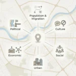
GeographyPin is not trying to replace Britannica, Wikipedia, UN Data, OpenStreetMap, or Google Earth. It sits between them. The goal is to turn scattered geographic information into readable explainers, clean profiles, practical maps, and source-aware pages that make a place or concept easier to understand.
A strong geography article should not rely on one type of source or one type of presentation. A country profile, strait explainer, river article, or physical geography guide works better when it combines clear definitions, map context, careful statistics, and plain-language explanation.
How GeographyPin uses this source stack
A useful GeographyPin workflow often looks like this: start with Britannica or Wikipedia for orientation, check institutional sources for sensitive facts, use UN-style data portals for numbers, use OpenStreetMap or Google Earth for spatial context, and then build a clean explanation that helps the subject make sense.
FAQ
What is the best geography website overall?
There is no single best geography website for every task. Britannica is strong for edited explanations, Wikipedia is useful for quick orientation, UN Data is better for statistics, OpenStreetMap is stronger for open map data, and Google Earth is best for visual place understanding.
Which geography website is best for students?
National Geographic Education is one of the best choices for students because it uses maps, videos, interactives, and classroom-friendly explanations. Britannica and World Atlas are also useful for quick school research.
Which website is best for geography data?
UN Data is stronger for formal international statistics. For current country-level figures, it is also worth checking national statistics offices, World Bank datasets, UN agency databases, and official government sources.
Is the CIA World Factbook still useful in 2026?
Yes, but mainly as a legacy reference. Since the CIA announced the Factbook had sunset on February 4, 2026, it should not be treated as a normal live-updated country-data website. Use archived material carefully and verify current facts elsewhere.
Which geography website is best for maps?
Google Earth is best for visual exploration, satellite imagery, and terrain context. OpenStreetMap is better when you need open, reusable map data or local mapping detail that can be edited and exported.
Should I trust geography facts from one website only?
For basic orientation, one good website may be enough. For borders, population, political status, economic figures, climate statistics, or disputed topics, compare at least two stronger source types: an edited reference and an official or institutional data source.
Where does GeographyPin fit among these geography websites?
GeographyPin fits as an explanation-first geography website. It uses source-aware research, map context, practical structure, and clean writing to turn geographic facts into readable articles rather than leaving users to compare raw sources alone.
What Did We Learn Today?
The best geography websites in 2026 work best as a toolkit, not as one universal winner. Encyclopedias explain, data portals measure, education sites teach, open mapping projects supply reusable spatial detail, and Google Earth turns geography into something you can inspect visually. GeographyPin’s job is to bring those layers together into cleaner geography pages that answer the question without making the reader do all the source work alone.
Sources & Data Notes
I checked this page against official and institutional source types where possible, including publisher pages, United Nations Statistics Division material, CIA public notices, OpenStreetMap licensing notes, Google Earth product information, Wikimedia statistics pages, National Geographic Education resources, and Royal Geographical Society publication notes. Some counts and platform descriptions are rounded or generalized because websites change features, access rules, and update cycles over time. New releases after May 2026 may change individual details. AI assistance was used only for light editorial cleanup, formatting consistency, and structure support; the source judgment and final wording remain editorial.