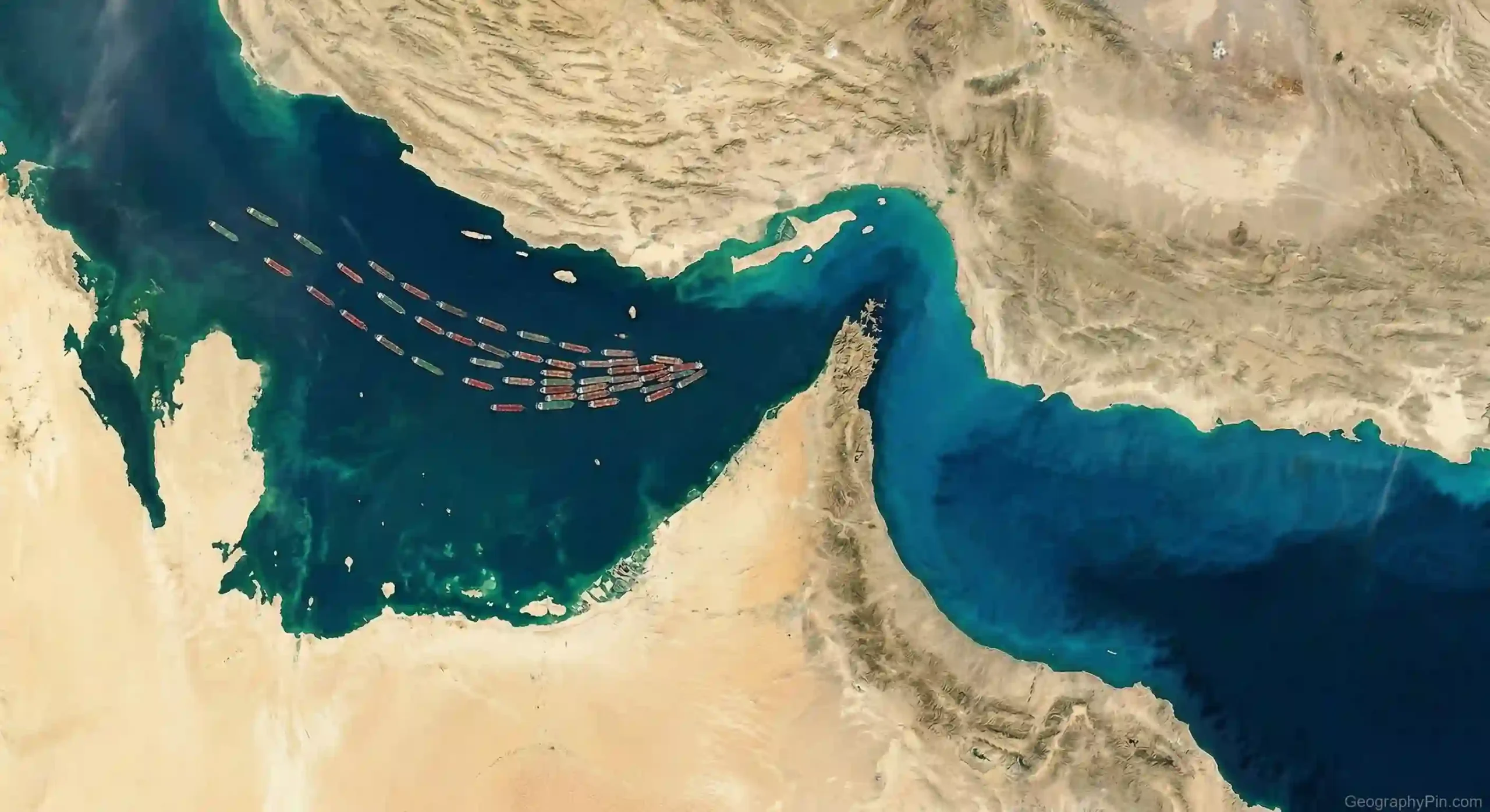
The Strait of Hormuz is one of those places that turns up whenever oil prices jump or military tension rises in the Gulf. The reason is straightforward: it is a narrow sea passage in a very strategic spot, and an outsized share of the world’s energy trade has to pass through it.
The Strait of Hormuz is the narrow waterway between Iran and Oman that connects the Persian Gulf to the Gulf of Oman and the Arabian Sea. It matters because recent energy-agency estimates place oil flows through it at around 20 million barrels per day, with roughly one-fifth of global LNG trade also moving through this same passage.
How to use this article: If you want the fastest route to the answer, jump to the quick location check, the trade scale, how the lanes work, or the control question.
Where the Strait of Hormuz actually is
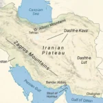
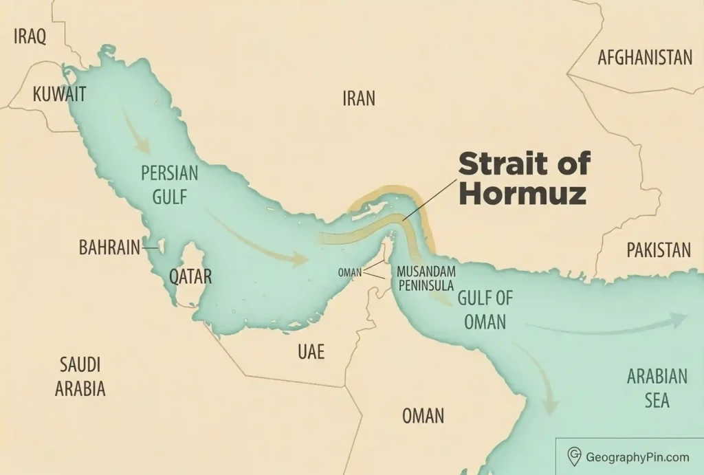
The strait sits at the southeastern end of the Persian Gulf. To the north is Iran. To the south is Oman’s Musandam exclave, which projects into the mouth of the Gulf. Moving eastward through the strait takes ships into the Gulf of Oman and then out to the Arabian Sea and the wider Indian Ocean.
The quick location check
If you picture the Persian Gulf as a large enclosed body of water, the Strait of Hormuz is its narrow exit. That is the simplest way to understand its geography. It is not a canal and not a man-made shortcut; it is a natural strait linking Gulf waters to the open sea.
| Feature | Short answer |
|---|---|
| Type of waterway | A natural strait |
| Connects | The Persian Gulf to the Gulf of Oman and Arabian Sea |
| North side | Iran |
| South side | Oman’s Musandam Peninsula |
That physical setup explains why the strait matters so much: for ships leaving most Gulf export terminals, there is no normal seaborne route out that avoids this passage.
Why this narrow passage matters so much
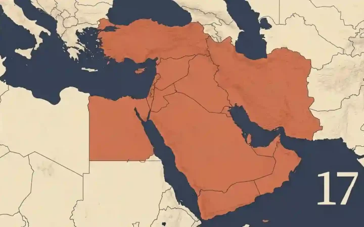
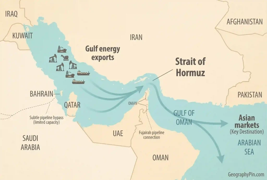
The strait matters because it is the main maritime outlet for the energy-producing states around the Persian Gulf. Official energy analyses describe it as the primary export route for oil from Saudi Arabia, the UAE, Kuwait, Qatar, Iraq, Bahrain, and Iran, even though a limited portion of Saudi and Emirati exports can bypass it by pipeline.
The trade scale
Recent estimates show the scale clearly. The U.S. Energy Information Administration said oil flow through the strait averaged 20 million barrels per day in 2024, equal to about one-fifth of global petroleum liquids consumption and more than one-quarter of global seaborne oil trade. It also reported that around one-fifth of global LNG trade moved through Hormuz in 2024, largely from Qatar.
That is why Hormuz is usually described as a chokepoint. The term does not mean every ship is guaranteed to stop there during a crisis. It means the global system depends heavily on a narrow route where disruption, delay, rerouting, or even credible threats can have effects far beyond the Gulf itself.
How ships move through it
A common mistake is to imagine the whole strait as one open, unstructured corridor. In practice, shipping is organized through traffic lanes. Britannica notes that the strait is about 35 to 60 miles wide overall, but the inbound and outbound tanker lanes are each about 2 miles wide, separated by a 2-mile buffer zone. Those lanes lie mostly in Omani territorial waters and partly in Iranian waters.
How the lanes work
This is one reason the strait feels strategically fragile even though its total width is much larger than the shipping lanes themselves. Tankers are funneled through a managed passage, and while the waterway is generally deep enough for large vessels, traffic depends on predictable navigation, insurance, naval presence, and risk calculations by ship operators.
In other words, “narrow” here is not just a map fact. It is an operational fact. A passage can remain technically open while becoming commercially difficult, more expensive, or too risky for normal shipping patterns.
Who controls it and can it be closed?
No single country simply “owns” the Strait of Hormuz in the everyday sense people often mean. Iran controls the waters north of the main shipping lanes, Oman controls the south, and the shipping lanes themselves are generally described as operating under international maritime law. That is why the better question is not “Who owns it?” but “Who can influence passage through it?”
The control question
A prolonged, total blockage is usually presented as difficult, not least because the strait is deep and shipping can still be managed under heavy protection. But energy agencies stress that a full closure is not the only problem that matters. Harassment, missile risk, mining, ship seizures, insurance shocks, or even partial disruption can still produce major economic consequences because alternative export routes are limited compared with the volume that normally moves through Hormuz.
That is the key practical point. The strait does not need to be sealed shut like a door for the world to feel the impact. It only needs to become dangerous enough that normal traffic slows, diversions grow, or traders begin pricing in supply risk.
Why the whole world watches it
Even though much of the oil and gas moving through Hormuz is headed to Asia, the effect of a disruption would not stay regional. Oil is priced in a global market, and the IEA notes that most spare crude production capacity is also concentrated in the Gulf region. That means a shock at Hormuz can affect both actual supply flows and the market’s sense of future backup capacity.
Why prices react before any full closure
Recent market behavior shows this clearly. In June 2025, the EIA noted that Brent crude rose from $69 to $74 per barrel in a day amid regional tensions even though maritime traffic had not been fully blocked. That is a good reminder that Hormuz matters not only when ships stop moving, but also when markets fear they might.
So the most accurate short explanation is this: the Strait of Hormuz matters because geography gives it leverage. It is a narrow exit from a critical energy-exporting region, and the world economy is still exposed to what happens there.
FAQ
Is the Strait of Hormuz a canal?
No. It is a natural strait, not a man-made canal. It forms the sea outlet from the Persian Gulf into the Gulf of Oman and the Arabian Sea.
Which countries border the strait directly?
Iran borders the northern side, and Oman’s Musandam exclave borders the southern side. The UAE is nearby and strategically relevant, but the core north-south strait geography is Iran and Oman.
Does all Gulf oil have to pass through Hormuz?
No, not all of it. Saudi Arabia and the UAE have some pipeline routes that can bypass the strait, but official analyses say many Gulf exporters still depend heavily on Hormuz and the alternative capacity is limited relative to normal flows.
Can one country legally shut it on its own?
The situation is more complicated than a simple ownership claim. The shipping lanes are generally described as lying mostly in Omani waters, partly in Iranian waters, and operating under international maritime law, which is why disputes over passage have wider international significance.
Why do fuel and oil prices elsewhere react to tension there?
Because such a large share of globally traded oil and LNG moves through Hormuz, and because global oil prices respond to risk as well as physical shortages. Traders do not wait for a total shutdown before repricing supply risk.
What Did We Learn Today?
- The Strait of Hormuz is the natural sea passage between Iran and Oman at the exit of the Persian Gulf.
- Its importance comes from function, not just size: it is the main export route for a huge share of Gulf oil and LNG.
- Shipping there moves through defined traffic lanes, so operational risk matters as much as map width.
- The world watches Hormuz because even partial disruption can move prices and shipping decisions quickly.
Those are the core points supported by standard geography references and recent energy-agency assessments.
Sources & Data Notes
This article was prepared with AI assistance and editorial review, using standard reference material on maritime geography together with official energy analysis from agencies such as the U.S. Energy Information Administration and the International Energy Agency. Figures are rounded where appropriate, and newer releases or market shifts can change some details without changing the basic geographic reality of why the strait matters.