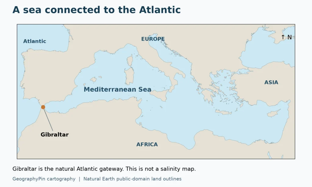
The Mediterranean is connected to the Atlantic, yet much of its water is saltier than the water arriving through Gibraltar. Its salinity reflects the combined effect of water loss, freshwater supply and a two-way exchange with the ocean.
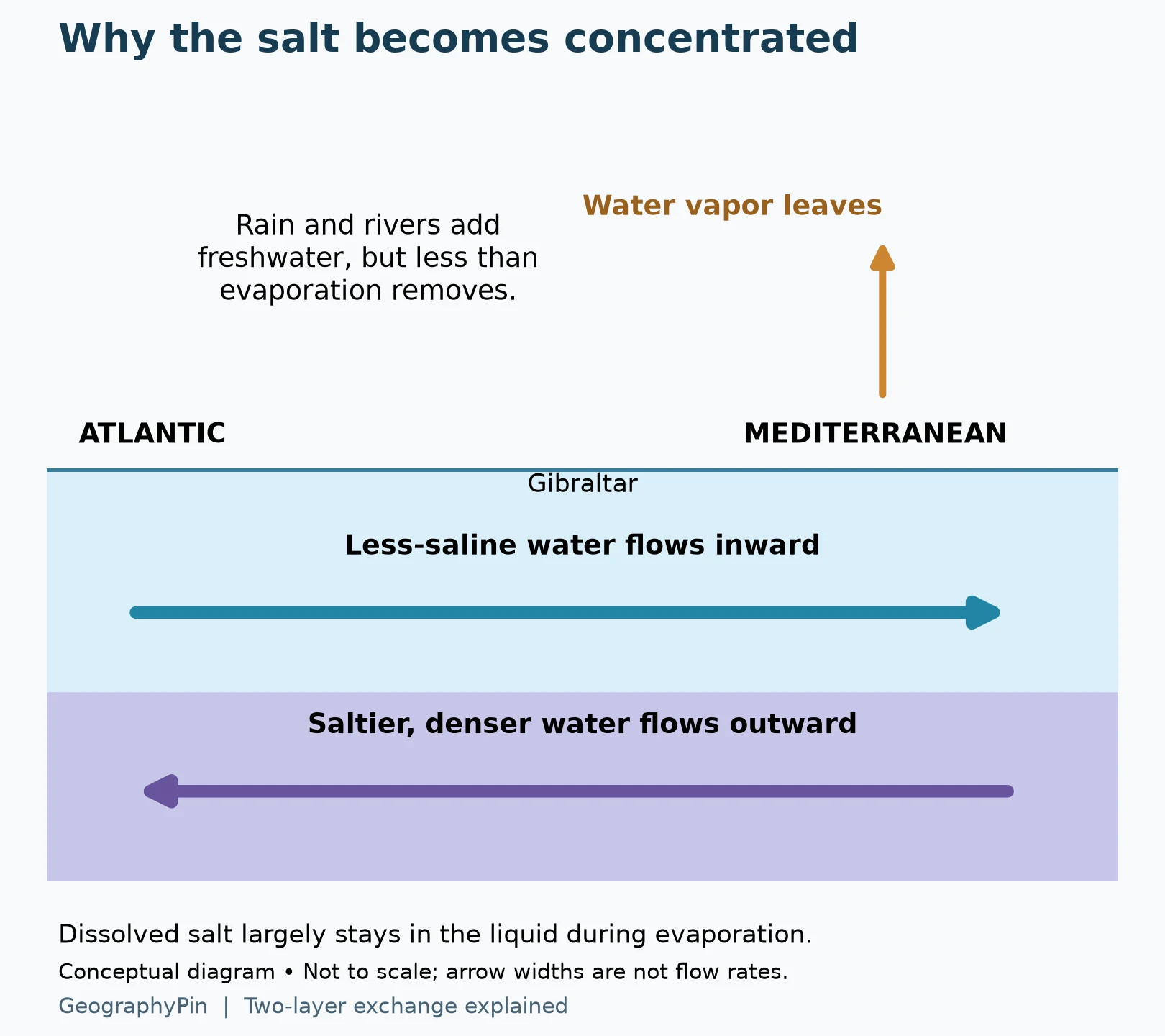
The Mediterranean is relatively salty because evaporation removes more water than rain and rivers replace, concentrating the dissolved salts left behind. Less-saline Atlantic water enters near the surface through Gibraltar, while saltier Mediterranean water flows outward below it. This exchange keeps the basin connected to the ocean rather than turning it into a closed salt lake.
1. Evaporation Removes Water, Not the Dissolved Salt
Concentration can rise without adding salt
When water evaporates from the sea surface, the dissolved salts largely remain in the liquid. The amount of water falls relative to the amount of dissolved material, so salinity rises. Evaporation does not manufacture new salt, and a more concentrated sample does not necessarily contain more total salt than it did before.
That distinction is the key to the Mediterranean. Its regional water balance has a persistent evaporative deficit: over the basin as a whole, evaporation exceeds freshwater supplied by precipitation and rivers. Ocean exchange supplies the remaining water needed to balance the deficit over longer periods.
The sun provides energy for evaporation, but “it is hot” is an incomplete explanation. Evaporation also depends on atmospheric humidity, wind and the difference between conditions at the sea surface and in the air. Rainfall, runoff and water exchanged through the straits matter at the same time. One sunny afternoon cannot explain the salinity of an entire basin.
A small worked example
Imagine a hypothetical sample with 100 mass units of solution, including 3.5 units of dissolved salt. If 10 units of water evaporate and no salt is added or removed, 90 units of solution remain. The salt fraction rises from 3.5/100 to 3.5/90, or from 3.5% to about 3.89% by mass.
This is a teaching calculation, not a Mediterranean measurement or a prediction that the sea will lose 10% of its water. It isolates one process so the arithmetic is visible. The real sea also receives and exports water and salt, mixes vertically and exchanges water between its sub-basins.
2. Gibraltar Carries Water in Both Directions
Atlantic water enters above the Mediterranean outflow
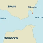
At the Strait of Gibraltar, relatively less-saline Atlantic water generally enters the Mediterranean in an upper layer. Saltier Mediterranean water leaves underneath. A map with only an inward arrow therefore gives an incomplete picture: there is a two-layer exchange, not a one-way pipe feeding a sealed basin.
The outgoing Mediterranean water is comparatively dense. Salinity contributes to that density, while temperature also matters. It would be misleading to say that all warm water must remain at the surface or that salt alone determines every current. Cooling, mixing, pressure and the basin’s circulation influence how water masses form and move.
The schematic below shows the basic directions, not the precise depth of the interface or the shape of the seabed. Tides, weather and mixing produce variability around this simplified pattern. It is an explanation of the exchange, not a navigation chart or a forecast of the current at a particular hour.
More water can enter than leaves without trapping all the salt
Over a long-term simplified water balance, a net Atlantic inflow compensates for the Mediterranean’s water deficit. That does not mean the salt brought in must accumulate forever. The outflow carries salt back to the Atlantic at a higher concentration.
A larger volume of less-saline inflow and a smaller volume of more-saline outflow can approximately balance their salt transport while leaving a net inward water transport. In a perfectly steady teaching model, the salt entering and leaving would balance. The real Mediterranean is not perfectly steady: storage, circulation and freshwater inputs change, so measured salinity can change as well.
The broader basin also exchanges water with the Black Sea through the Turkish Straits system. That input matters to a complete budget, particularly in the northeastern Mediterranean. Gibraltar is the main Atlantic connection, not the only boundary through which water can enter the Mediterranean system.
3. There Is No Single Salinity for Every Mediterranean Beach
Water masses differ from west to east and with depth
Water entering from the Atlantic is modified as it circulates, mixes and experiences the Mediterranean water balance. Surface salinity generally increases away from the Atlantic entrance toward the eastern basin, but local river mouths, rain, seasonal mixing and circulation create exceptions. A single value cannot describe every coast, depth and month.
A 2023 Copernicus Ocean State Report chapter describes entering Atlantic water at Gibraltar at about 36.2 on the practical-salinity scale. For comparison, Price and Baringer’s 1994 review describes Mediterranean source water for the outflow at 38.4, before substantial mixing with Atlantic water. These are representative water-mass values, not a live reading for a beach or an exact basin-wide average.
The distinction between surface and subsurface water is equally important. A satellite-derived sea-surface product, a ship’s sample and an average through the upper several hundred meters do not measure the same volume. Comparing them without noting depth can create a false impression of disagreement or change.
| Comparison | What it helps explain | What it does not establish |
|---|---|---|
| Atlantic inflow versus Mediterranean outflow | The concentration contrast in the Gibraltar exchange | Salinity at every Mediterranean beach |
| Western versus eastern basin | Broad regional differences in water masses and freshwater balance | A uniform west-to-east increase at every point |
| Surface sample versus deeper profile | Vertical structure and mixing | A single value for the entire water column |
| One year versus a long record | Variability and possible trends | A climate trend from one unusual summer |
Local freshwater can change the picture
Near a river mouth, freshwater can create a less-saline surface layer or plume. Its extent varies with river flow, wind, currents and mixing. Heavy rain can also freshen the surface temporarily. Those local effects do not overturn the basin-scale explanation; they show why scale matters.
The same reasoning applies in the opposite direction. A sheltered coastal lagoon can become particularly salty under strong evaporation and limited exchange, but that does not make its salinity representative of the open Mediterranean. Always identify the water body actually sampled.
4. Read Salinity Units Before Comparing Numbers
Practical salinity is not grams per liter
Oceanographic studies often report practical salinity, sometimes with the label “PSU.” Practical salinity is formally dimensionless and is derived from seawater conductivity. It should not be silently rewritten as grams of salt per liter or as a percentage.
TEOS-10, the international thermodynamic framework for seawater, distinguishes practical salinity from Absolute Salinity, expressed in grams per kilogram. The values are numerically close for ordinary seawater, but they are different quantities and require appropriate conversion when precision matters.
A value near 38 on the practical-salinity scale does not mean the water is 38% salt. Likewise, grams per kilogram is a mass-based concentration, whereas grams per liter is based on volume. Converting between mass and volume concentrations requires information about density.
This is especially important when comparing seawater with concentrated brines. A lake described using grams per liter can look deceptively comparable to an oceanographic salinity value, even though the units and sometimes the measurement methods differ. The arithmetic example earlier deliberately used a stated mass fraction so its meaning would not be ambiguous.
5. Why the Mediterranean Is Not Simply a Larger Dead Sea
An open marine exchange changes the salt budget
The Mediterranean has a natural connection to the Atlantic and an outgoing saltwater flow. The Dead Sea is a hypersaline lake with no natural river outlet to the ocean. Both experience evaporation, but their pathways for water and dissolved material are fundamentally different.
That is why “evaporation makes it salty” is a useful starting point, not a complete classification. You also need to ask where the incoming water comes from and whether water carrying dissolved salts can leave. The Mediterranean’s Gibraltar exchange is essential to the answer.
GeographyPin’s Dead Sea explanation examines the closed-basin case in more detail. Do not transfer a brine concentration from that lake to the Mediterranean or assume the same degree of buoyancy simply because both taste salty.
Nor should the Mediterranean be described as the world’s saltiest water body. Such a claim would ignore hypersaline lakes and lagoons and the different definitions used in comparisons. The useful question here is why Mediterranean water is relatively saline compared with the Atlantic water entering it.
6. What a Rising Salinity Trend Would Mean
A changing water balance, not just a hotter thermometer
A long-term salinity increase can reflect changes in evaporation, rainfall, river input, ocean exchange and circulation. A temperature increase by itself does not specify the salinity change: it is necessary to examine the water and salt budgets, not merely assume that warmer water always has more salt.
A 2023 Copernicus Ocean State Report analysis examines the upper 984 feet (300 meters), comparing products over 1993–2019 and extending its regional reanalysis through 2021. The analysis excludes shelf areas where the water column is shallower than 984 feet (300 meters). It finds increasing salinity, with differences between eastern and western sub-basins and between data products. These findings do not imply that every coastal location becomes saltier every year.
Monitoring combines observations and analysis products because the basin is three-dimensional and variable. To assess a particular claim, ask which years, which depth range and which region were averaged. For a coastal decision, use measurements relevant to that actual location rather than a rounded Mediterranean-wide description.
Frequently Asked Questions
Does the salt evaporate with the water?
Dissolved salts largely remain in the liquid when water evaporates. Sea spray can carry salt particles into the air, but that is a different process from water becoming vapor.
Is the Mediterranean cut off from the Atlantic?
No. The Strait of Gibraltar supports a two-layer exchange: Atlantic water generally enters above saltier Mediterranean water flowing outward below it.
Does 38 PSU mean 38% salt?
No. Practical salinity is a dimensionless conductivity-based quantity, not a percentage. A percentage or a grams-per-liter value must not be substituted without the relevant definition and conversion.
Why is a river mouth sometimes less salty than the nearby sea?
River water dilutes seawater, especially near the surface before mixing disperses it. The size and strength of that freshwater plume change with river flow and marine conditions.
What Did We Learn Today?
The Mediterranean’s salinity comes from the balance between water loss, freshwater supply and exchange with neighboring seas. Evaporation concentrates salts, while Gibraltar allows both less-saline inflow and saltier outflow. Salinity varies by location, depth and season, and comparisons are meaningful only when the measurement convention and units are clear.
Sources & Data Notes
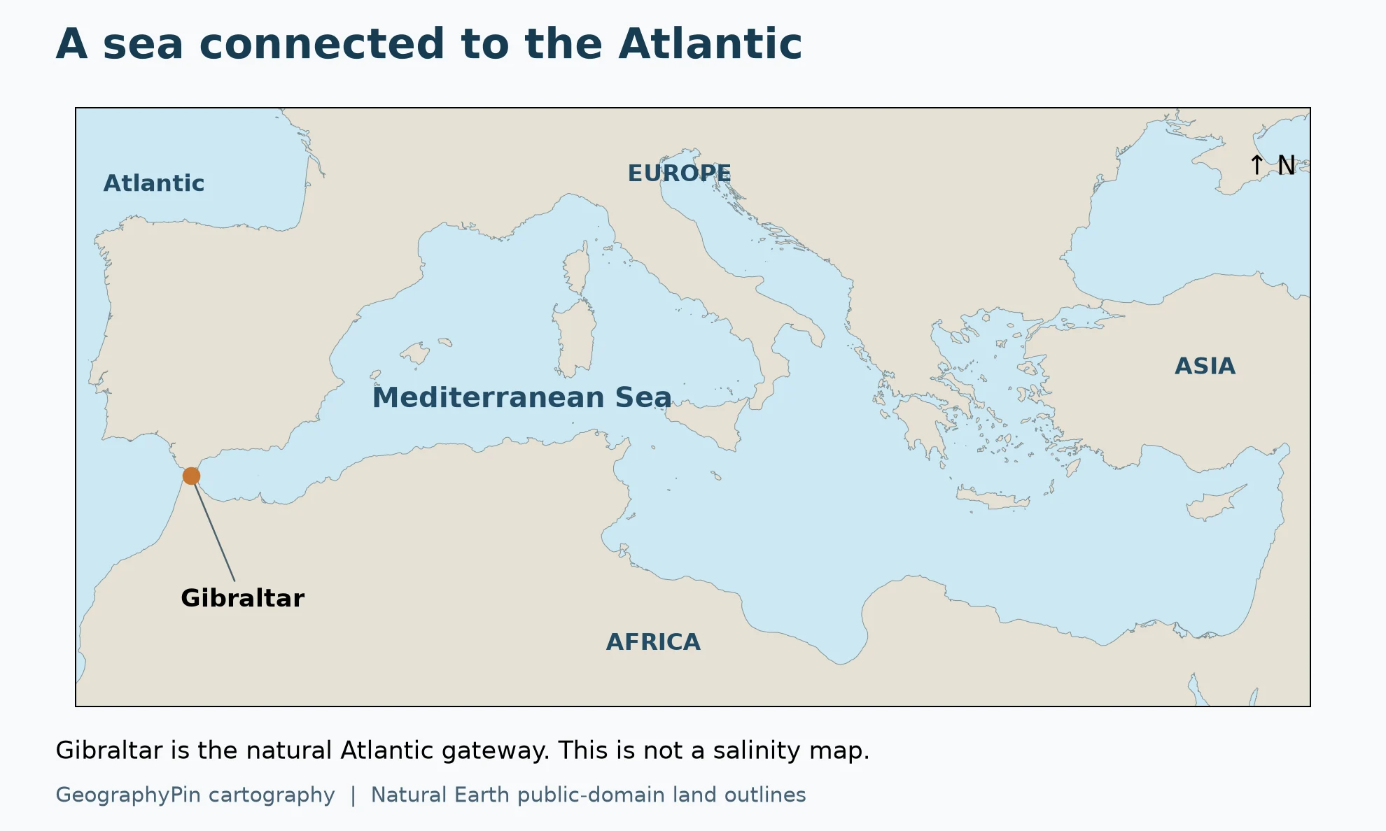
The map uses public-domain Natural Earth 1:10 million land outlines. It is a geographic locator, not a measured salinity map or a navigation chart. The exchange diagram is original explanatory artwork: it shows directions and processes, not measured depths, flow rates or a detailed Gibraltar seabed profile. The 100-unit calculation is hypothetical.
Numerical salinity examples refer to different source studies and water masses, not simultaneous observations. The 2023 report compares upper-ocean analysis products; it is not a beach forecast. Practical Salinity and Absolute Salinity are distinguished following TEOS-10. No exact basin-wide salinity, current local reading or trend at every coastline is implied.
- Aydogdu et al. (2023): Mediterranean salinity, Ocean State Report
- Liu et al. (2025): Mediterranean heat and salt budgets
- Price and Baringer (1994): Outflows and deep water production by marginal seas
- TEOS-10: seawater thermodynamic framework
- TEOS-10: converting Practical to Absolute Salinity
- NOAA: Why is the ocean salty?
- Natural Earth: public-domain data terms