The United Kingdom is often pictured as one island, but that misses Northern Ireland and the smaller islands around Great Britain. Its geography also changes sharply within each nation: mountain country, lowland farming districts, estuaries and large urban areas sit surprisingly close together.
The United Kingdom is a sovereign state off northwestern mainland Europe, comprising England, Scotland, Wales and Northern Ireland. London is its capital. Great Britain contains England, Scotland and Wales; Northern Ireland occupies part of the island of Ireland. Uplands are prominent in the north and west, while many major cities and farming districts occupy lower ground.
How to use this article: Separate island names from country names, compare land and inland-water measurements, or follow the relationship between terrain and cities.
1. Locate the United Kingdom and read its map
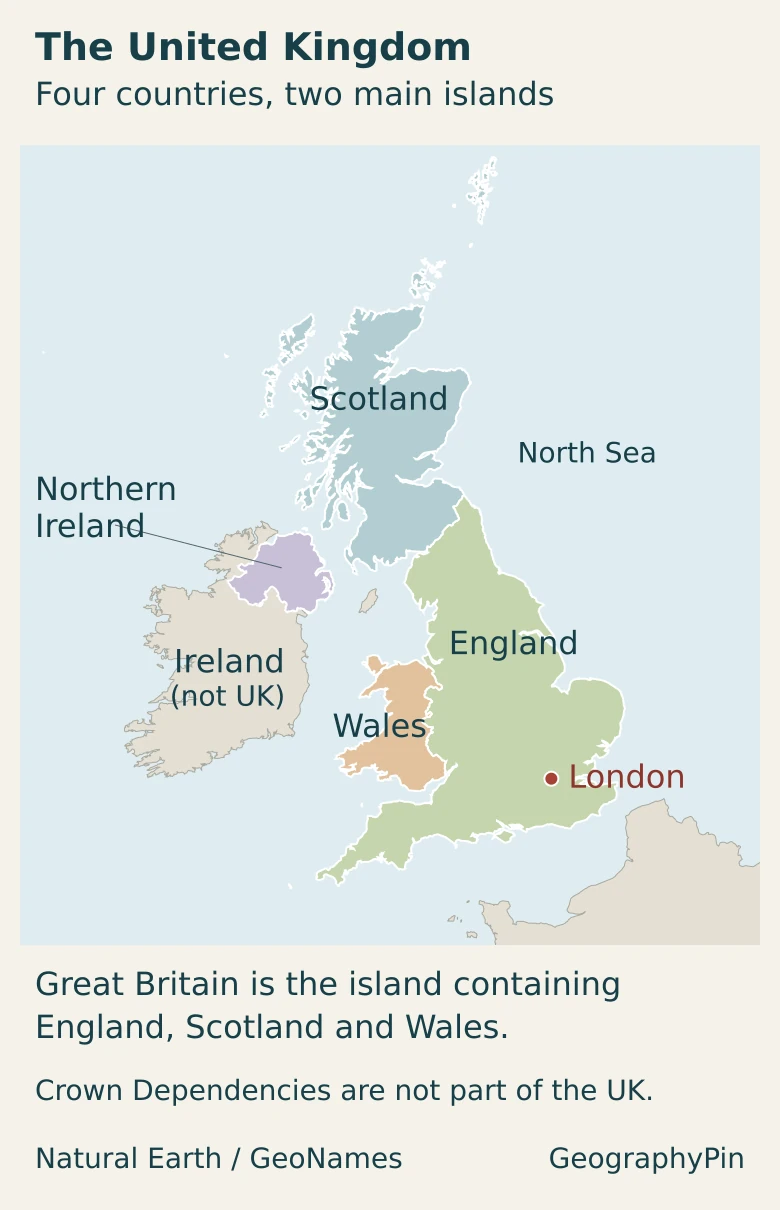
The UK lies between the North Atlantic and the North Sea, with the English Channel separating southern England from France. The Irish Sea lies between Great Britain and Ireland. Northern Ireland shares the UK’s land border with the Republic of Ireland; the rest of Ireland is not part of the UK.
Great Britain is not the whole United Kingdom
Great Britain is the large island containing the mainlands of England, Scotland and Wales. The UK is the political state that includes those nations, their associated islands, and Northern Ireland. England is only one constituent part. The separate UK, Great Britain and England comparison explains the terminology in more depth.
The Hebrides lie off western Scotland; Orkney and Shetland extend the country northward. These island groups are part of Scotland and the UK; the locator shows them in their geographic positions rather than in separate insets.
Proximity and constitutional membership are different things. Jersey, the Bailiwick of Guernsey and the Isle of Man are self-governing Crown Dependencies, not parts of the UK. The UK’s Overseas Territories are also outside the country totals used here. A map of all places linked to the British Crown would therefore answer a different question from a map of the UK.
2. Country facts: population, area and national scope
| Item | Reference |
|---|---|
| Official name | United Kingdom of Great Britain and Northern Ireland |
| Capital and UK government seat | London |
| Population | About 69,484,000 at mid-2025; ONS estimate released October 1, 2026 |
| Area to the mean-high-water coastline, including inland water | About 94,355 square miles (244,378 square kilometers); December 2024 SAM country rows combined |
| Land area, excluding inland water | About 93,723 square miles (242,743 square kilometers); same dataset and scope |
| Constituent parts | England, Scotland, Wales and Northern Ireland |
| Languages | English is widely used throughout; statutory language recognition varies by nation |
| Currency | Pound sterling (£; GBP) |
| Government | Parliamentary democracy and constitutional monarchy, with devolved institutions |
Why published UK area figures can differ
The table combines the four country rows in the Office for National Statistics’ December 2024 Standard Area Measurements dataset. Its coastline measure includes inland water but excludes the sea beyond mean high water. Removing inland water produces the smaller land-only figure. Neither is a measure of the UK’s territorial sea or overseas possessions.
These are flat map measurements, not the surface area obtained by following every hill and valley. Coastline definitions, source mapping and dataset dates can produce different national totals. Here, square-kilometer values and square-mile conversions are rounded to whole units; the method matters more than extra decimal places.
The population figure is a mid-2025 estimate, not a census count or a 2026 observation. ONS revised it from an earlier provisional total. National estimates can also be revised as better information becomes available, so comparisons should use compatible releases rather than mixing figures from different updates.
3. Uplands, lowlands and island landscapes
A useful first approximation is higher, more rugged ground in much of the north and west, and broader lowlands in much of the south and east. It is not a rule that every northern place is mountainous or every southern place is flat. Scotland has important lowlands, while southwestern England has uplands such as Dartmoor.
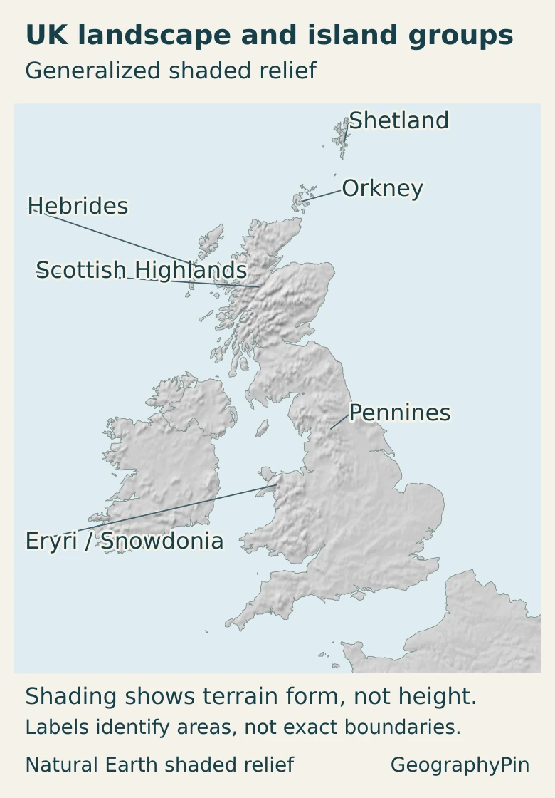
| Landscape | Location and character | Why it matters |
|---|---|---|
| Scottish Highlands and islands | Northern and western Scotland, with mountains, glens and varied island landscapes | Terrain channels routes and separates neighboring valleys |
| Central Lowlands and Southern Uplands | Lower ground across central Scotland, with uplands farther south | The central belt contains major cities and transport connections |
| Northern English uplands | Lake District and Pennines, with hills, valleys and upland moors | Higher ground contrasts with surrounding lowlands and urban corridors |
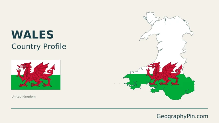
| Welsh uplands and valleys | Eryri in the northwest and extensive upland country farther south | Valleys and coastal margins provide distinct settlement settings |
| English lowlands and southern hills | East Anglia, the Midlands and southern basins, with chalk and limestone ridges | Farming, towns and transport occupy a varied landscape, not one flat plain |
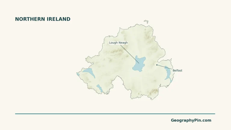
| Northern Irish lowlands and uplands | Lough Neagh’s lower surroundings, the Sperrins and other uplands | Lakes, hills and valleys divide a compact but varied area |
Rock type alone does not determine height. Resistance to erosion, permeability, geological structure and the effects of ice and rivers all matter. Southern England’s chalk hills illustrate the point: relatively soft but permeable chalk can remain prominent because water readily enters the rock instead of flowing across its surface.
In Scotland, major faults separate contrasting geological blocks. The Highland Boundary Fault marks a conspicuous transition between Highland and Lowland scenery, but that geological boundary is not a national border. The Scottish mountain ranges guide provides the more detailed mountain-by-mountain picture.
Past glaciers deepened valleys, excavated rock basins and left other enduring landforms. Edinburgh’s Castle Rock and Royal Mile form a crag-and-tail landscape shaped by ice. The lesson is that glacial geography is visible in cities as well as remote mountain valleys.
Ben Nevis is mapped by Ordnance Survey at 4,413 feet (1,345 meters). Its revised mapped height, announced in 2016, resulted from more precise surveying and rounding, not a sudden geological rise. Height figures describe a measurement convention as well as a mountain.
4. Atlantic weather, rivers and water
The Atlantic is central to the UK’s climate. Westerly weather systems frequently bring moist air toward the islands, while the surrounding seas moderate temperatures. Latitude, altitude, exposure and distance from the coast still create strong local differences. A sheltered lowland site and an exposed mountain can experience very different conditions on the same day.
The Met Office describes the east and south as generally drier, warmer and sunnier than the west and north. Moist Atlantic air often loses rain as it moves across western uplands, leaving some eastern areas more sheltered. This is a broad climatic contrast, not a promise that the west is always wet or the east always dry.
That distinction helps connect the physical map to land use. Cropland and improved grassland in Scotland are concentrated in the central belt and along the east coast, with extensive rough grassland in the Highlands. Slope, climate and access constrain land use together; elevation alone cannot explain a farm or forest.
Water also crosses political boundaries. Lough Neagh’s catchment includes a large part of Northern Ireland and some land in the Republic of Ireland. The lake drains toward the sea through the Lower Bann, and its levels are regulated. A watershed map therefore differs from a national map: water follows the terrain, not the line between jurisdictions.
The coasts are connections as well as edges. Estuaries provide routes inland, while the North Sea and Atlantic face different neighboring regions and weather exposure. Looking at rivers, coastlines and relief together is more informative than treating the country as an isolated outline.
5. People, cities and languages
Cities follow several corridors, not just a north–south divide
London stands in southeastern England on the Thames, but the UK’s human geography is not simply London surrounded by countryside. The Midlands and northern England contain major urban concentrations, including Birmingham and the Manchester–Liverpool and Leeds–Bradford areas. In Scotland, Glasgow and Edinburgh occupy the central belt rather than the highest mountain country.
Lower ground can make building and transport easier, yet terrain is only part of the explanation. Industrial development, ports, government, trade and established networks have shaped where cities grew. A valley can concentrate settlement rather than prevent it, and an upland region can contain towns with long industrial histories.
The four nations also have distinct political centers: London, Edinburgh, Cardiff and Belfast. Edinburgh’s city profile is useful for understanding Scotland’s capital without confusing it with the seat of the UK government.
English is widely used across the UK, but “official language” needs a jurisdiction. Welsh has official status in Wales. Gaelic and Scots gained official status in Scotland under provisions that took effect on November 30, 2025. Irish has official recognition in Northern Ireland under the 2022 legislation. These arrangements do not make the language rules identical throughout the UK.
Legal status is also different from everyday use. A language can have official recognition without being spoken by everyone in that jurisdiction. Regional languages, sign languages and languages brought through migration are part of the country’s linguistic landscape; a short facts table cannot represent every community.
6. Government and the geography of the economy
The UK combines a constitutional monarchy with parliamentary government. London is the seat of the UK Parliament and government. Scotland, Wales and Northern Ireland have devolved legislatures and governments with powers granted in legislation; their responsibilities are not identical. England does not have a separate national parliament equivalent to those devolved institutions.
This matters when reading national statistics or practical guidance. Education, health and other public policies can differ across the UK. Describing a rule for one nation as a rule for the whole country can therefore be misleading, even when all four appear under the same country name in an international table.
Services dominate the economy, encompassing much more than finance: retail, health, education, hospitality and professional work are also services. London has a particularly service-heavy economic structure, while manufacturing has a greater relative role in several other regions, including the Midlands and parts of northern England and Wales.
These different geographies connect without becoming interchangeable. Political borders organize government; uplands and lowlands help explain routes and land use; cities concentrate activity for historical and economic reasons. No single physical feature determines how the country works.
Frequently Asked Questions
Does “Ulster” mean Northern Ireland?
Not exactly. Ulster is a historic province whose extent includes Northern Ireland and part of the Republic of Ireland. The names are therefore not geographically interchangeable.
Does Great Britain include the smaller islands around its coast?
Strictly as an island name, Great Britain refers to the main island. Political and everyday uses sometimes extend the term to England, Scotland and Wales with their associated islands. For precise geographic comparisons, the stated coverage matters.
Were the UK’s latest censuses held at the same time?
No. In the most recent census round, England, Wales and Northern Ireland held censuses in 2021, while Scotland’s was in 2022. A comparable UK population estimate uses a common reference date and should not be described as one simultaneous census count.
What Did We Learn Today?
The UK’s political map and physical map describe different things. Four nations share a state, while islands, uplands, lowlands and river catchments cross or cut across administrative divisions. Atlantic exposure helps explain regional climates, and terrain interacts with industry, transport and government to shape settlement. Keeping area definitions, population dates and language jurisdictions visible prevents a compact country profile from turning into an oversimplified one.
Sources & Data Notes
The population observation is mid-2025, released in October 2026. Area figures sum the four country rows of the December 2024 ONS dataset, using its mean-high-water coastline and land-only measures; conversions use 1 square mile = 2.589988110336 square kilometers and are rounded. The landscape comparison is an explanatory selection, not an official exhaustive system of physical regions. Climate descriptions concern broad regional patterns, not a current forecast. Economic comparisons are qualitative, informed by the cited industry briefing’s dated regional data, not presented as new 2026 measurements. Language recognition is jurisdiction-specific.
- Population and reference dates: ONS mid-2025 population bulletin; ONS: combining and comparing UK census figures; ONS: city-region geography.
- Area definitions and dataset: ONS December 2024 country measurements; Standard Area Measurements methodology.
- National scope and naming: UK geographical-name guidelines; Ministry of Justice: Crown Dependencies.
- Terrain and geology: BGS: relief; BGS regional geological summaries; NatureScot: geological foundations; NatureScot: ice-carved landscapes.
- Specific landscapes: Ordnance Survey: Ben Nevis survey; DAERA: Sperrin landscape.
- Climate and land use: Met Office regional climates; Met Office: UK rainfall; Scottish Government land-use evidence.
- River catchments: Northern Ireland Department for Infrastructure: Lough Neagh.
- Language recognition: Welsh Government: Welsh language standards; Scottish Government: Gaelic and Scots official status; Office of the Irish Language Commissioner.
- Constitution and currency: House of Commons Library: the UK’s constitutional composition; House of Commons Library: devolution; Bank of England: sterling.
- Economic structure: House of Commons Library: industries in the UK.
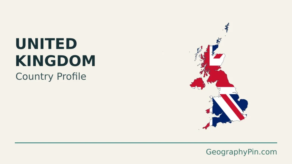
Map and illustration: Original GeographyPin graphics use public-domain Natural Earth country and map-unit geometry. The map’s London location comes from GeoNames, licensed under CC BY 4.0. All mapped boundaries and London use the same Lambert azimuthal equal-area projection. Northern Ireland is included in the UK; the Republic of Ireland is not. The locator omits remote Rockall and does not depict relief or exact physical-region boundaries. The terrain map reprojects Natural Earth’s public-domain 1:50 million shaded relief, derived from downsampled SRTM Plus data, into the same projection. It depicts generalized terrain form, not numeric elevation bands, exact landform boundaries or hiking detail. The featured illustration fits and clips a public-domain Union flag graphic within the generalized UK silhouette as an editorial motif, not a complete flag in its official proportions.