Scottish mountain names describe several different things: broad upland regions, smaller groups of peaks and lists based on summit height. A map becomes more useful once those categories are separated. The Cairngorms, the Highlands and the Munros are not interchangeable names for the same landscape.
Scotland’s mountain geography includes the Northwest Highlands, Grampian Highlands and Southern Uplands, alongside smaller groups such as the Cairngorms and the island mountains of Skye. These broad regions are not one continuous range. Munros are a classification of distinct summits at least 3,000 feet (914.4 meters) high, not a mountain range.
How to use this article: Check the regional convention, compare named mountain groups, or separate ranges from summit lists.
1. Reading Scotland’s mountain regions
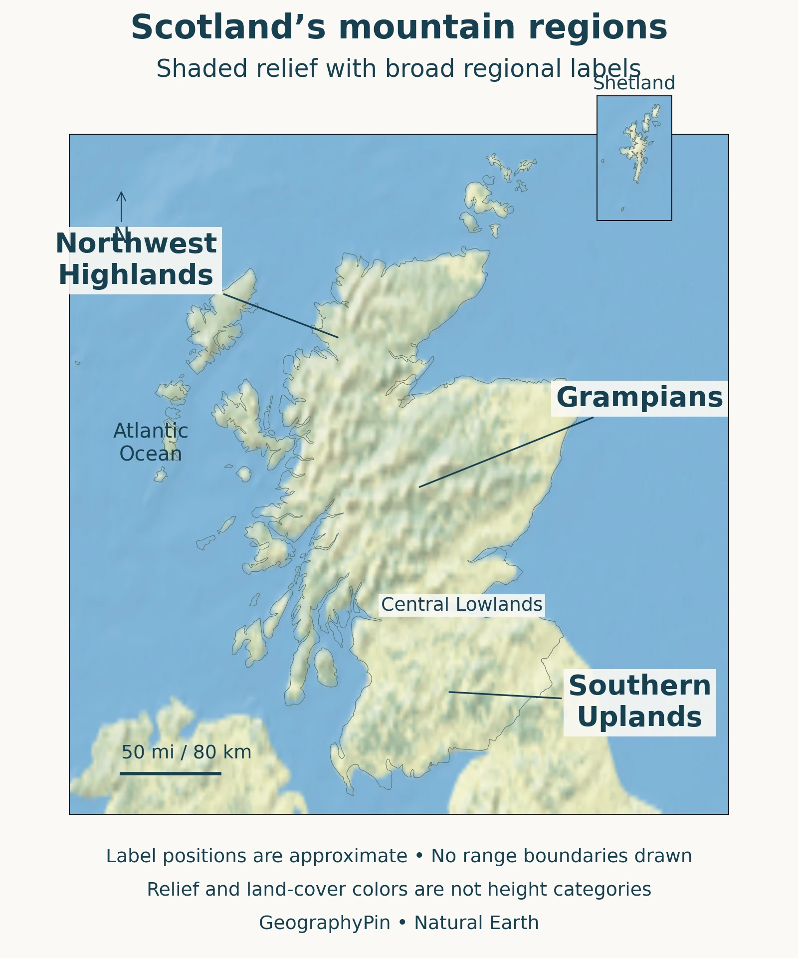
Scotland does not have one continuous mountain range. A useful broad overview distinguishes the Northwest Highlands, the Grampian Highlands southeast of the Great Glen, and the Southern Uplands south of the Central Lowlands. Smaller named groups and island mountains add another level of detail.
This is a regional orientation, not an official inventory of every Scottish range. Names operate at different scales: the Cairngorms are a more specific mountain group, while “Highlands” can describe a much broader landscape. Munros, by contrast, belong to a summit list rather than a geographically continuous range.
Regional names are not geological terranes
NatureScot: Scotland’s geological foundations describes five distinct geological foundation blocks. That scheme separates the North-west Seaboard from the Northern Highlands, whereas a broad geographical overview may group northern and western mountain country together. The two approaches answer different questions: where the uplands lie, and how their underlying rocks were assembled.
Read a region name alongside the convention used by its map. An area can belong to a broad highland landscape while containing several geological units and many individually named hills.
2. Northwest Highlands and the Grampians
Northwest of the Great Glen, the mountain country contains markedly different rocks. In the NatureScot: Northern Highlands foundations, much of the foundation is metamorphic Moine rock: older sandy and muddy sediments altered by heat and pressure. The more westerly seaboard has a different geological history, separated from that block by the Moine Thrust.
The NatureScot: North-west Seaboard foundations describes ancient Lewisian basement, younger Torridonian sedimentary rocks and remaining quartzite cover in parts of the northwest. Hills such as Suilven and Slioch illustrate how resistant remnants can stand above a surrounding landscape of different rock. “Northwest Highlands” is therefore useful for orientation, but not a statement that every mountain shares one composition.
Southeast of the Great Glen, the British Geological Survey: Grampian Highlands, chapter 1 uses a broad Grampian Highlands region extending to the Highland Boundary. Its guide includes coastal and relatively low-lying areas as well as central mountains, and explicitly acknowledges that the name can be used more narrowly. The Great Glen provides a recognizable dividing corridor; it should not be mistaken for the edge of every smaller mountain group.
This broad Grampian setting contains Ben Nevis and the Cairngorms, but the two are not the same mountain group. A regional map helps place them in relation to each other without flattening their local differences.
3. Named mountain groups show local differences
Cairngorms, Cuillin and Galloway
The Scottish Geology Trust: Cairngorms explains the Cairngorms through a granite massif, broad high surfaces and deeply cut valleys. Granite formed as molten rock cooled below ground, then became exposed through erosion. A plateau can therefore be part of a mountain landscape even when it lacks a continuous sharp crest.
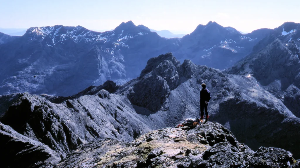
On Skye, the Geological Society: Cuillin identifies the Cuillin as the eroded roots of an ancient volcanic center. The dark Black Cuillin are mainly gabbro; the more rounded Red Cuillin are largely granite. This is not an active volcanic landscape, and its igneous history differs from a simple account of all Scottish mountains as identical old folded rocks.
In the southwest, the British Geological Survey: South of Scotland describes granite and granodiorite centers surrounded by resistant heat-altered rocks in the Galloway mountain country. Elsewhere in the Southern Uplands, sandstone and mudstone are prominent. These examples are selected to show different landscape settings, not to rank mountains by scenic value or produce a supposedly complete list.
The Southern Uplands themselves form a broad belt of rolling uplands near the English border. NatureScot: Southern Uplands foundations connects their foundations with sediment accumulated and compressed during closure of the ancient Iapetus Ocean. The geological join is not a precise modern political boundary, and the region should not be dismissed as flat simply because it lies outside the Highlands.
4. Fault corridors and glacial valleys
Ancient geological structures helped establish the framework of Scotland’s landscape. NatureScot identifies the Great Glen and Highland Boundary faults as particularly visible regional features. A fault is a break along which rocks have moved; its presence does not mean every nearby summit is a recently uplifted fault block.
Much later, glaciers reshaped that inherited terrain. The NatureScot: Ice-carved landscapes describes ice streams deepening pre-existing valleys, forming troughs and excavating rock basins. Loch Ness is one example of a basin within a glacially modified valley landscape.
Erosion was selective. In the Cairngorms, glaciers could strongly modify glens while leaving neighboring plateau surfaces relatively little changed. Elsewhere, ice scoured bedrock more extensively. It is therefore misleading to say that glaciers created every mountain from scratch or erased all traces of older landforms.
This distinction explains why a relief map can show broad upland surfaces beside steep-sided valleys. The present landscape combines a long geological history with uneven erosion, not one single event. It is a useful example of how physical geography connects rock, landform and surface processes.
5. Why Munros are not a mountain range
The Scottish Mountaineering Club: Hill lists maintains the Munro list: distinct Scottish peaks at least 3,000 feet (914.4 meters) high, with sufficient separation from neighboring peaks. The classification does not define one connected chain on a map. A mountain can be both a Munro and part of a named mountain group.
Location and classification answer different questions
| Description | What it tells you |
|---|---|
| Broad region | Its setting within a larger upland landscape. |
| Named mountain group | Its association with a more local group, such as the Cairngorms. |
| Munro | Its inclusion in a defined summit list, not a separate range. |
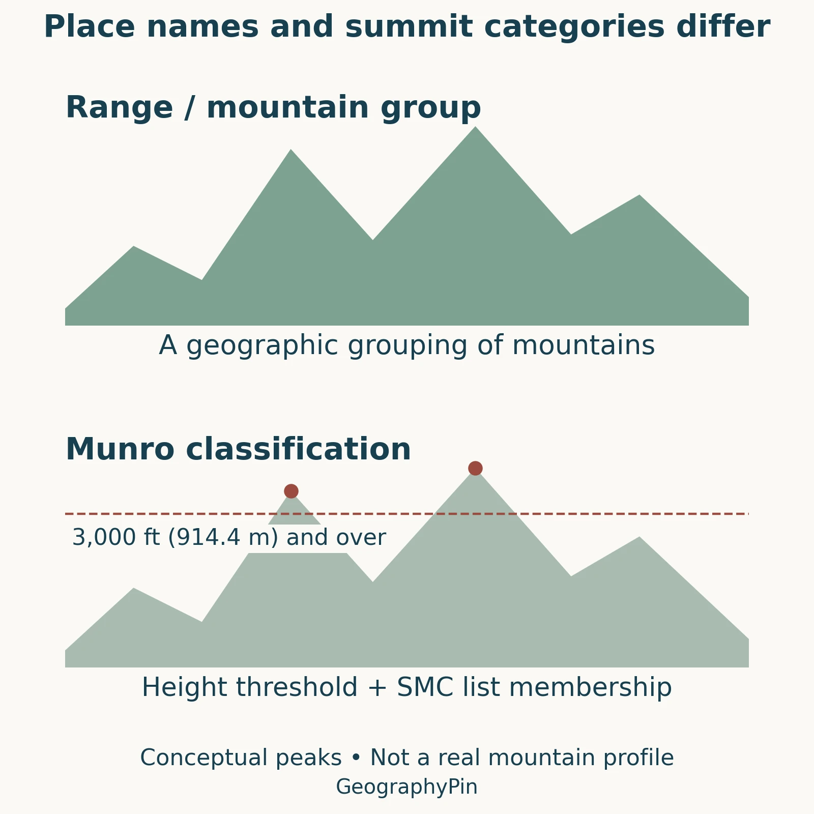
Subsidiary summits can be Munro Tops rather than separate Munros. The club’s separation criterion is not a single fixed prominence formula, so height alone does not determine list membership.
Nor does a height category describe walking difficulty. Route steepness, terrain and conditions are separate considerations. The regional map here is intended for geographic orientation, not choosing a safe ascent.
6. Reading summit heights correctly
Ben Nevis is Britain’s highest mountain, with an official rounded map height of about 4,413 feet (1,345 meters). The Ordnance Survey: Ben Nevis resurvey explains that its 2016 resurvey measured the highest natural point at 1,344.527 meters, which rounds upward to 1,345.
The revised figure did not mean the mountain suddenly rose through tectonic movement. More precise measurement changed the rounding used on maps. Older references can consequently give a different height without describing a different mountain.
Summit elevation also differs from the ascent along a route. A walk starts at some elevation above sea level and may include repeated descents and climbs. Use a summit height to compare elevations; use an actual route description to understand its ascent. Neither number tells you the horizontal extent of the mountain range around it.
What Did We Learn Today?
Scotland’s mountains are best understood at several scales. Broad regions provide orientation, named groups reveal local differences, and summit lists classify individual peaks. Ancient geology and uneven glacial erosion shaped the terrain, while a mountain’s listed height tells only one part of its geographic story.
Sources & Data Notes
The article uses a broad regional convention for orientation, not a legal boundary system or exhaustive inventory of ranges. NatureScot’s geological foundation blocks are a different classification. The BGS Grampian guide is used for regional scope, not its superseded summit-height figure. Ben Nevis elevation follows the Ordnance Survey resurvey; feet are rounded from the published whole-meter map height.
Map and diagram: GeographyPin. Relief and context boundaries use Natural Earth public-domain data. Regional labels are schematic locators, not surveyed outlines. The Natural Earth I shaded-relief raster is a generalized visualization, not a source of precise summit elevations or walking routes. Scotland’s outline follows the Natural Earth map-unit dataset; the equirectangular main view uses a reference latitude of 57°N. Shetland appears in a separate inset; remote Rockall is outside the view. The comparison diagram uses illustrative peaks, not actual named summits.
- NatureScot: Scotland’s geological foundations
- British Geological Survey: Grampian Highlands, chapter 1
- NatureScot: Northern Highlands foundations
- NatureScot: North-west Seaboard foundations
- NatureScot: Southern Uplands foundations
- NatureScot: Ice-carved landscapes
- Scottish Geology Trust: Cairngorms
- Geological Society: Cuillin
- British Geological Survey: South of Scotland
- Scottish Mountaineering Club: Hill lists
- Ordnance Survey: Ben Nevis resurvey
Featured photograph: The main ridge of the Cuillin on the Isle of Skye, photographed in 1976 by Adrian Pingstone. Original photograph and public-domain release; cropped, resized and converted to WebP. This historical view does not show current snow or climbing conditions.