Wales is often pictured through its mountains, but the contrast between upland interiors and lower coastal corridors is just as important. In the south, deeply cut valleys connect high ground with a belt of towns and cities near the sea. Reading those relationships explains more than treating Wales as a smaller version of England or as one continuous mountain range.
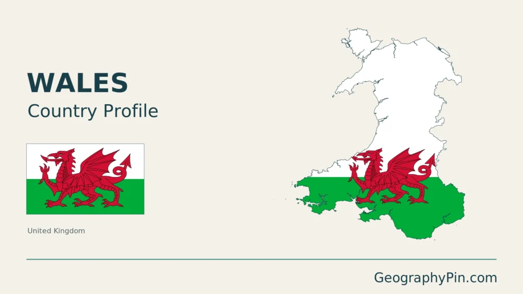
Wales is a constituent country of the United Kingdom on the western side of Great Britain, with associated islands. Its geography combines northern and central uplands, southern mountain landscapes, coastal lowlands and the south Wales valleys. Cardiff is the capital. Wales is distinct from England, but both are within the UK.
How to use this article: Locate Wales within Britain, read the terrain, or explore southern settlement.
1. Locate Wales within Britain
A country within the United Kingdom
Wales lies west of England, with the Irish Sea to the north and west and the Bristol Channel to the south. The shared Wales–England boundary is within the UK, not a frontier between sovereign states. Use the United Kingdom profile for the wider state-level picture.
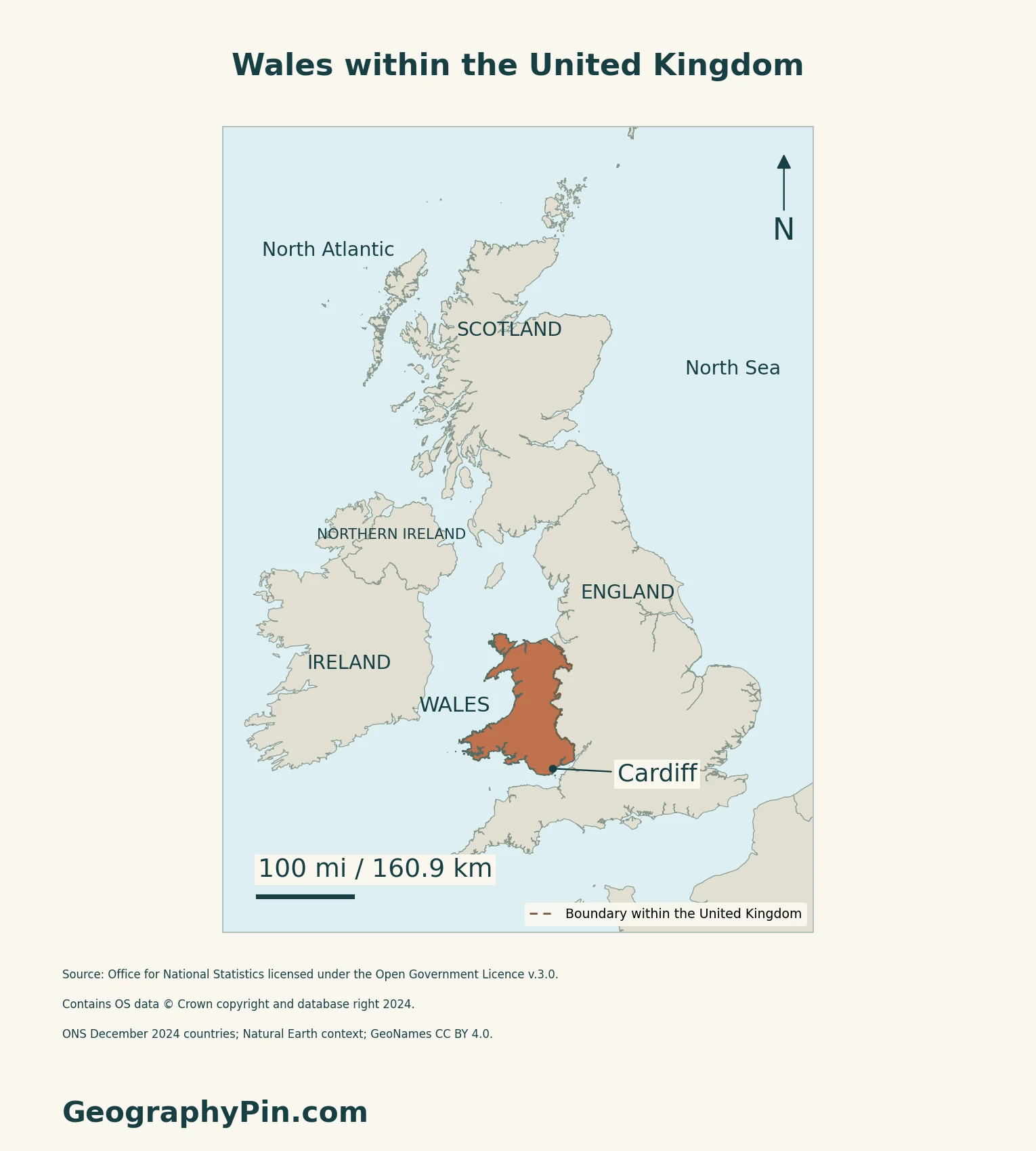
The coast is more than an edge around the mountains
Northwest Wales brings upland, lowland and coastal landscapes close together. Natural Resources Wales describes Eryri as the main mountain spine of that part of the country, with intervening settlements and lower ground. Anglesey is part of Wales, off its northwestern mainland.
Southwest Wales supplies another contrast. Preseli uplands and the Cleddau valleys sit alongside farmland, estuaries and an extensive coast. On Gower, rocky headlands and sandy bays on the south coast contrast with broad estuarine saltmarshes to the north.
2. Follow the Uplands and Southern Valleys
Eryri, the Cambrian Mountains and Bannau Brycheiniog
The Cambrian Mountains occupy central Wales between Eryri and Bannau Brycheiniog. The name covers a landscape of uplands, moorland and valleys rather than one isolated summit. Visit Wales identifies the headwaters of the Wye and Severn in this central mountain country, illustrating how uplands connect with river systems beyond their immediate slopes.
Eryri and Bannau Brycheiniog are the names used here for the landscapes commonly encountered in English-language sources as Snowdonia and the Brecon Beacons. The map’s regional labels are orientation points, not outlines of national parks or sharply bounded mountain systems.
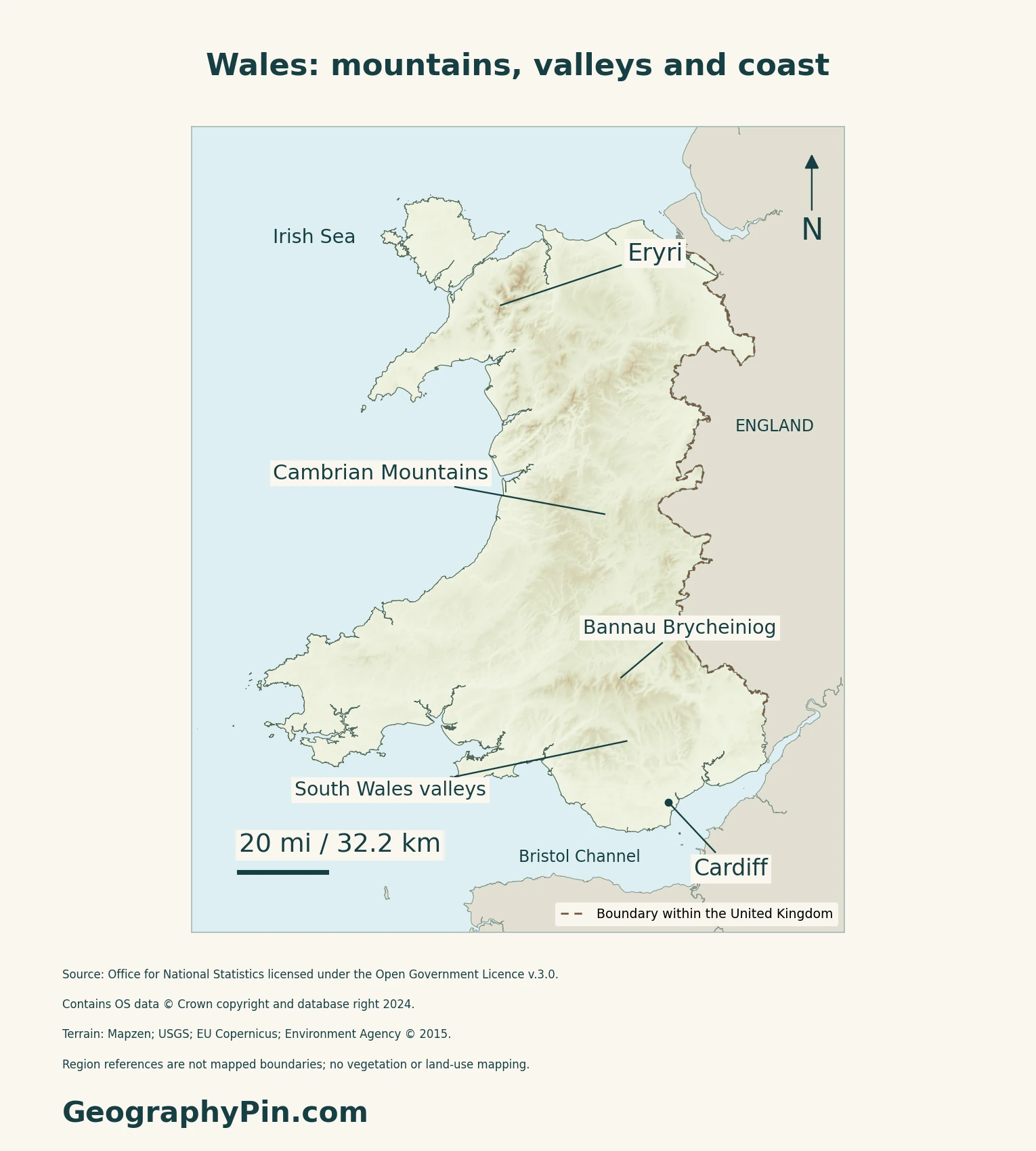
Why the valleys cut into high ground
The British Geological Survey describes much of its South Wales study area as an upland plateau cut deeply by rivers. Lower coastal ground around the Gwent Levels and Vale of Glamorgan contrasts with that dissected interior. The phrase “south Wales valleys” therefore does not mean that all of southern Wales is low or flat.
The South Wales Coalfield is a basin-shaped fold in sedimentary rocks. Its geological structure and its surface landscape are related but not identical: a downward fold in rock layers is not the same thing as an open bowl in the modern terrain. Coal mining and associated industries are part of the region’s history, not a description of every present-day valley settlement.
3. Connect Settlement and Maritime Climate
Cities and valleys meet the coastal lowlands
Natural Resources Wales’ landscape account places Cardiff, Barry and Newport in a coastal lowland corridor between the Severn estuary and the edge of the south Wales valleys. Roads, railways, ports and urban development share that corridor.
The same account records countryside between developed areas and green corridors extending into towns. “Urban south” and “rural interior” are useful broad contrasts, but neither should be read as an uninterrupted block of one land use.
The sea and high ground create local contrasts
The Met Office describes Wales as having a maritime climate, with the sea moderating temperatures and high ground producing marked local differences. Coastal locations generally have a smaller annual temperature range than inland areas, while upland conditions can be harsher. More sheltered eastern districts differ from exposed western and mountain locations.
4. Check Status and Dated Facts
| Item | Reference |
|---|---|
| Status | Constituent country of the United Kingdom |
| Capital | Cardiff (Caerdydd) |
| Population estimate | About 3,175,200 usual residents on June 30, 2025; ONS series released October 1, 2026 |
| Census reference | 3,107,500 usual residents on March 21, 2021, in the rounded first release |
| Land area reference | About 8,007 sq mi (20,737 km²), ONS December 2024 geography; inland water excluded |
| Languages | Welsh and English; Welsh has express statutory official status |
| Currency | Pound sterling (£, GBP) |
| Local administration | 22 local authorities |
Residents, not ancestry or visitors
The estimate covers usual residents regardless of nationality, not everyone of Welsh ancestry worldwide. Visitors and short-term migrants are excluded. The annual series updates a census base using births, deaths and migration; it is not a new census. Estimates can be revised, and the mid-year date differs from Census Day.
Welsh language status
Section 1 of the Welsh Language (Wales) Measure 2011 expressly gives Welsh official status. Part 1 came into force on February 9, 2011. The Measure ties that status to statutory rights and duties and says it does not affect the status of English. Language status is not a claim that every resident speaks both languages.
What Did We Learn Today?
Wales combines uplands, varied coasts and southern settlement corridors within one constituent country. Geological structure, visible relief and administrative boundaries describe different aspects of that geography.
Sources & Data Notes
Sources, dates and map conventions
The population series is a dated usual-resident estimate, rounded as published, not a present-day headcount. The census comparator is explicitly the rounded first release, not an asserted latest unrounded total. Area uses ONS land hectares excluding inland water, converted and rounded. The language summary distinguishes statutory status from individual language ability. Landscape descriptions use NRW area statements and its 2014 Cardiff, Barry and Newport character assessment; they are not a current land-use census. BGS supplies geological explanation, not present mining output. The 2016 Met Office regional material is used for qualitative climate relationships, not current records or numerical climate normals. Regional map labels are not national-park boundaries.
- ONS: Wales mid-year population, October 1, 2026
- Welsh Government: mid-2025 population methodology and local authorities
- ONS: rounded Census 2021 Wales reference, June 28, 2022
- ONS: December 2024 original country area measurements
- UK Parliament: Wales within the United Kingdom
- Welsh Government Wales.com: capital and currency
- Welsh Language (Wales) Measure 2011, section 1
- Welsh Government: language law and commencement, updated April 23, 2026
- Natural Resources Wales: northwestern landscape
- Natural Resources Wales: southwestern landscape
- Visit Wales: mountain landscapes
- British Geological Survey: South Wales
- Natural Resources Wales: Cardiff, Barry and Newport landscape, 2014
- Met Office: Wales regional climate, 2016 (qualitative context)
Original body maps use ONS December 2024 country boundaries, generalized to 20 metres and clipped to Mean High Water. All 151 Wales land components retain their source positions, including Anglesey and offshore islands; component count is not an island inventory and tiny features may not resolve. The dashed Wales–England boundary is within the UK, not between sovereign states. No council, park or landform boundaries are drawn. Source: Office for National Statistics licensed under the Open Government Licence v.3.0. Contains OS data © Crown copyright and database right 2024. Regional context uses Natural Earth countries 5.1.1 (public domain); place references use GeoNames (CC BY 4.0).
Qualitative relief uses Mapzen terrain tiles: United Kingdom terrain data © Environment Agency copyright and/or database right 2015, all rights reserved; Europe terrain produced using Copernicus data and information funded by the European Union, EU-DEM layers; global SRTM and GMTED2010 courtesy of USGS. All 185 negative samples within the source land mask are omitted transparently, without claiming they are all errors or that below-sea-level land is absent. Web Mercator maps use local WGS84 geodesic scale bars. Terrain colours do not map vegetation, geology or land use. The Eryri and Bannau Brycheiniog authorities corroborate the names; the labels do not delineate the parks.
Cover outline: ONS Countries (December 2024) Boundaries UK BGC. Source: Office for National Statistics licensed under the Open Government Licence v.3.0. Contains OS data © Crown copyright and database right 2026.