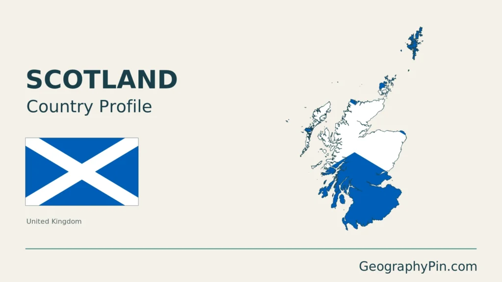
Scotland’s geography extends well beyond the mountainous mainland that often dominates its image. Island groups stretch north and west, while the central belt links major urban areas through a different landscape of lower ground and local hills. Understanding how those places fit together is more useful than treating Scotland as either an uninterrupted wilderness or a single mountain range.
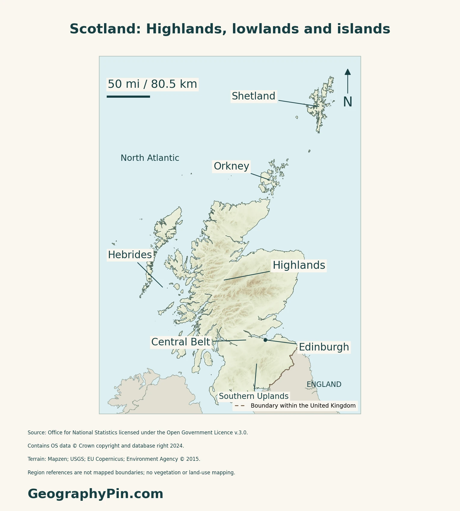
Scotland is a constituent country of the United Kingdom, comprising northern Great Britain and associated islands. Its broad landscape includes the Highlands, Central Lowlands and Southern Uplands. The Hebrides, Orkney and Shetland extend its island geography beyond the mainland. Edinburgh is the capital; Scotland is not a separate sovereign state.
How to use this article: Locate Scotland within Britain, read the terrain, or follow island groups.
1. Locate the Mainland and Island Groups
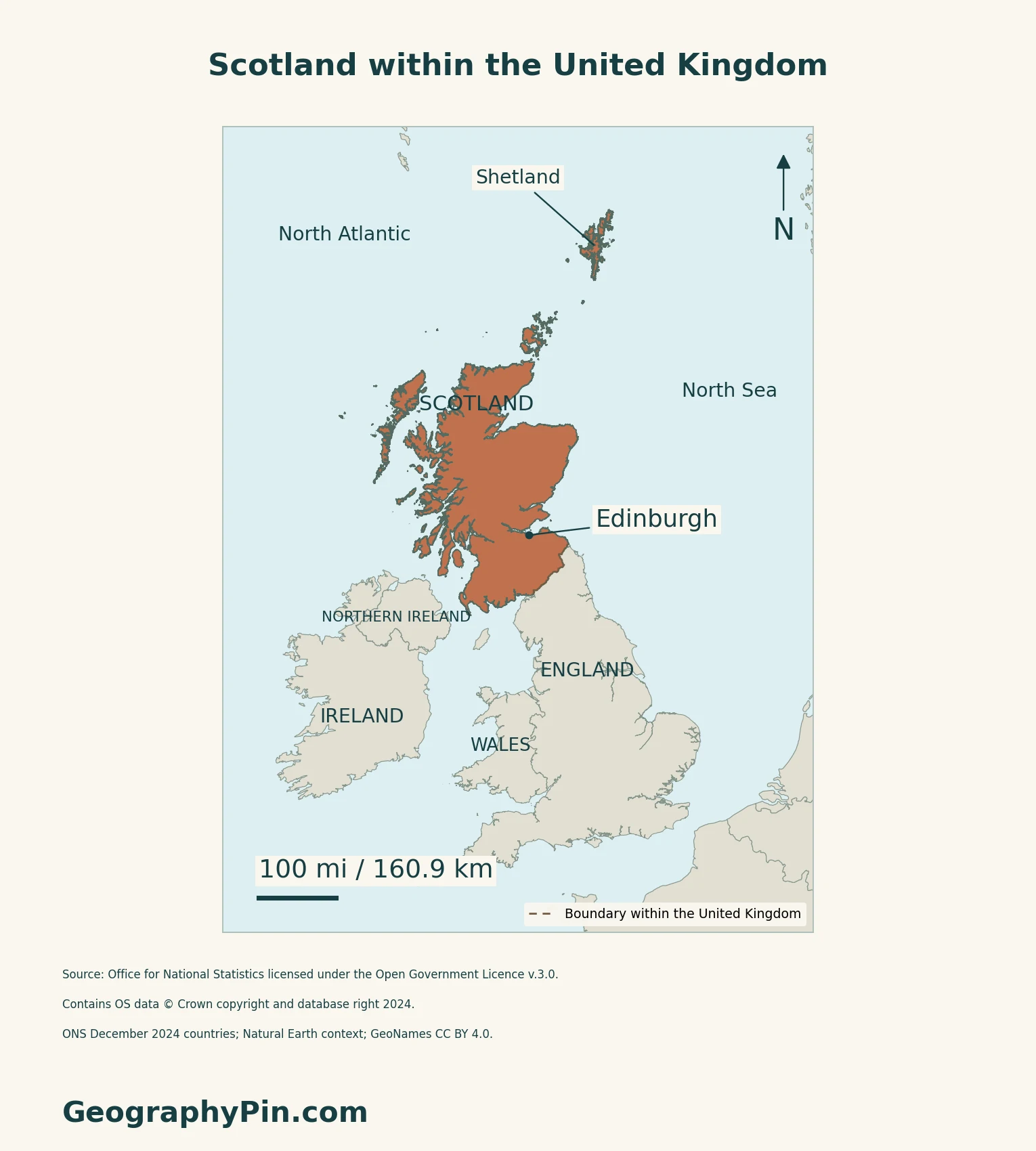
Scotland within the United Kingdom
England lies to the south of Scotland’s mainland. The North Sea is to the east, while Atlantic waters border the west and north. The Scotland–England line is a boundary within the United Kingdom, not a frontier between two sovereign states. The United Kingdom profile supplies the wider state-level context.
Hebrides, Orkney and Shetland are different groups
The Hebrides lie off the western mainland. Orkney lies north of the mainland’s northeastern tip, and Shetland is farther north.
National Records of Scotland identifies those three broad areas as the main concentrations of Scottish islands, while also noting islands in firths and freshwater lochs. An island-group label therefore describes only part of Scotland’s island geography.
The Scottish Government’s 2023 island-regions framework groups islands for research purposes. Those analytical regions are not a new set of sovereign territories or a replacement for the familiar geographical groups. Different island totals can answer different questions about land, habitation or statistical coverage.
2. Read the Main Landscape Contrasts
Highlands, central lowlands and southern hills
A broad physical overview distinguishes Highland country, the central lowlands and the Southern Uplands. This is a useful orientation, not a claim that every place within a region has the same height or character. NatureScot’s geological account identifies several underlying foundation blocks and shows why geological divisions are more detailed than that simple three-part sketch.
The Highland Boundary Fault marks a conspicuous transition between Highland and Lowland scenery. A geological fault is not an administrative border, and the regional labels on the original terrain map are not mapped fault traces.
The Midland Valley is not one flat valley floor
The British Geological Survey describes the Midland Valley as relatively low ground between the Grampian Highlands and Southern Uplands. It also stresses that the name refers to geological structure: the area includes hills, moorland and farmland rather than a uniformly level trough. Some conspicuous hills are formed from resistant volcanic rocks.
For individual mountain groups, summit classifications and the difference between ranges and Munros, use the dedicated Scottish mountain-ranges guide.
3. Connect Settlement and Atlantic Exposure
The central belt is a network of places
Scotland’s National Planning Framework 4 describes a densely populated central belt with city regions, towns, smaller settlements and rural surroundings. Its central planning area includes Glasgow, Edinburgh, Stirling, Dundee and Perth. This is a settlement and planning perspective, not a synonym for one strictly defined geological unit.
Estuaries are part of that geography: the framework identifies important settlements and economic assets around the Clyde, Forth and Tay. The separate Edinburgh city guide explores the capital’s urban landscape without substituting the city’s statistics for Scotland’s totals.
Mountain exposure helps explain rainfall contrasts
The Met Office explains that moist Atlantic air commonly arrives from the west. As winds rise over northern and western mountains, cooling encourages cloud and rain; rainfall generally diminishes farther east as weather systems cross the country. This helps explain why a national average cannot describe every Scottish coast, island or upland.
4. Check Status and Dated Facts
| Item | Reference |
|---|---|
| Status | Constituent country of the United Kingdom |
| Capital | Edinburgh |
| Population estimate | 5,545,500 usual residents on June 30, 2025; NRS release July 14, 2026 |
| Census reference | 5,439,842 on March 20, 2022, following further census processing |
| Land area reference | About 77,900 km² (30,077 sq mi), ONS December 2024 geography; inland water excluded |
| Languages | English is de facto official; Gaelic and Scots have statutory official status |
| Currency | Pound sterling (£, GBP) |
| Local administration | 32 council areas |
Residents and census revisions
The mid-2025 figure covers people usually living in Scotland, irrespective of nationality, rather than people of Scottish ancestry worldwide. NRS updates a census base for births, deaths, migration and other changes; estimates remain subject to revision. The 2022 census reference incorporates later processing, so it differs from the initial rounded release of 5,436,600.
Language status has a commencement date
The Gaelic and Scots official-status provisions in sections 1 and 33 of the Scottish Languages Act 2025 came into force on November 30, 2025. Their legal effect is tied to the functions specified in the legislation; this does not mean that everyone speaks all three languages. English’s de facto position is distinct from those express statutory provisions.
What Did We Learn Today?
Scotland’s mainland, island groups and central settlement network belong in the same geographic picture. Landscape divisions, statistical regions and political boundaries answer different questions, so their labels and coverage should stay explicit.
Sources & Data Notes
Sources, dates and map conventions
Population estimates and census results use different reference dates; the census figure incorporates the NRS correction to the initial release. Area follows the original ONS land measurement excluding inland water, converted and rounded, not an area calculated from this map. Gaelic and Scots status is checked against the enacted Act and its commencement instrument, not inferred from a bill or Royal Assent alone. Landscape context uses NatureScot’s geological-foundations overview and the physiography chapter of the BGS Midland Valley regional guide. The BGS book is a 1985 geological reference, not a source for current economic or population statistics. Settlement geography is attributed to the Scottish Government’s 2023 National Planning Framework 4; its future development ambitions are not presented as completed projects. NRS island geography policy and the 2023 Scottish Island Regions framework explain why physical groups, inhabited islands and research regions are different units. Rainfall mechanism follows the directly read Met Office explanation; no current-weather values or rainfall ranking is reproduced. Existing mountain and Edinburgh guides retain their narrower tasks.
- NRS: mid-2025 population estimates, July 14, 2026
- NRS Census 2022: corrected unrounded population and quality assurance
- NRS Census 2022: census-day date and initial-release context
- ONS: December 2024 country area conventions
- ONS: original country area data service
- UK Parliament: Scotland constituent-country reference
- City of Edinburgh Council: Scotland’s capital
- Scottish Languages Act 2025, sections 1 and 33
- Scottish Languages Act 2025 commencement regulations: November 30, 2025
- UK PCGN: English de facto status and UK terminology
- Official visitor guide: UK pound sterling currency
- NatureScot: Scotland’s geological foundations
- British Geological Survey: Midland Valley of Scotland, physiography chapter
- National Records of Scotland: Island Geography Policy, April 2024
- Scottish Government: Scottish Island Regions 2023
- Scottish Government: National Planning Framework 4, regional spatial context
- Met Office: rainfall and Atlantic orographic mechanisms
Original body maps use ONS December 2024 country boundaries, generalized to 20 metres and clipped to Mean High Water. All 3,706 Scotland land components are retained at their source positions, including the Hebrides, Orkney and Shetland. Rockall is outside this source coverage; tiny features may not resolve at display scale. The dashed shared boundary separates Scotland and England within the UK, not sovereign states. No county, national-park or landform boundaries are drawn. Source: Office for National Statistics licensed under the Open Government Licence v.3.0. Contains OS data © Crown copyright and database right 2024. Regional context uses Natural Earth countries 5.1.1 (public domain); place references use GeoNames (CC BY 4.0).
Qualitative relief comes from Mapzen terrain tiles: United Kingdom terrain data © Environment Agency copyright and/or database right 2015, all rights reserved; Europe terrain produced using Copernicus data and information funded by the European Union, EU-DEM layers; global SRTM and GMTED2010 courtesy of USGS. All 815 negative samples in the source land mask, including coastal and inland values, are omitted transparently. This is a nonnegative terrain subset, not evidence that all negative values are errors or that below-sea-level land is absent. No measured heights, vegetation or land-use classes are inferred. Web Mercator maps use local WGS84 geodesic scale bars; regional labels are geographic references, not surveyed extents.
Cover outline: ONS Countries (December 2024) Boundaries UK BGC. Source: Office for National Statistics licensed under the Open Government Licence v.3.0. Contains OS data © Crown copyright and database right 2026.