A winter forecast can change from snow to sleet to freezing rain even while your outdoor thermometer stays below freezing. The missing information is above your head: falling precipitation passes through layers that can melt it, refreeze it or leave it liquid until it reaches a cold surface.
In U.S. weather terminology, sleet is ice pellets that freeze before reaching the ground. Freezing rain arrives as liquid drops and freezes on cold surfaces, creating an ice coating. Both can make travel hazardous. The distinction depends on the precipitation’s journey through the atmosphere, not just the temperature measured near the ground.
How to use this article: Check the U.S.–UK terminology difference, compare the two air-layer pathways, or understand what a surface temperature cannot tell you.
1. Sleet and Freezing Rain Arrive in Different Forms
The quickest useful distinction is the state of the water as it arrives. Sleet consists of small, solid ice pellets. Freezing rain looks like rain while falling, but its liquid drops can freeze when they strike an exposed surface cold enough for ice to form.
| Feature | Sleet | Freezing rain |
|---|---|---|
| Arrives as | Ice pellets | Liquid drops |
| Where freezing occurs | In the air before landing | On sufficiently cold surfaces |
| Typical result | Pellets can bounce and accumulate | A coating or glaze of ice |
| Travel implication | Slippery accumulations are possible | Even light icing can be dangerous |
“Sleet” does not mean the same thing everywhere
In the United Kingdom, the Met Office uses sleet for a mixture of rain and snow. That is not the U.S. ice-pellet meaning used in this comparison. When reading a forecast from another country, check the issuing weather service’s terminology rather than assuming identical wording describes identical precipitation.
“Ice pellets” is therefore the clearer phrase when the intended meaning might be ambiguous. A rain-and-snow mixture, hard pellets and freezing liquid rain describe different observations, even though all can occur in unsettled winter weather.
2. Read the Air Layers, Not Just the Thermometer
Two common routes through warm and cold air
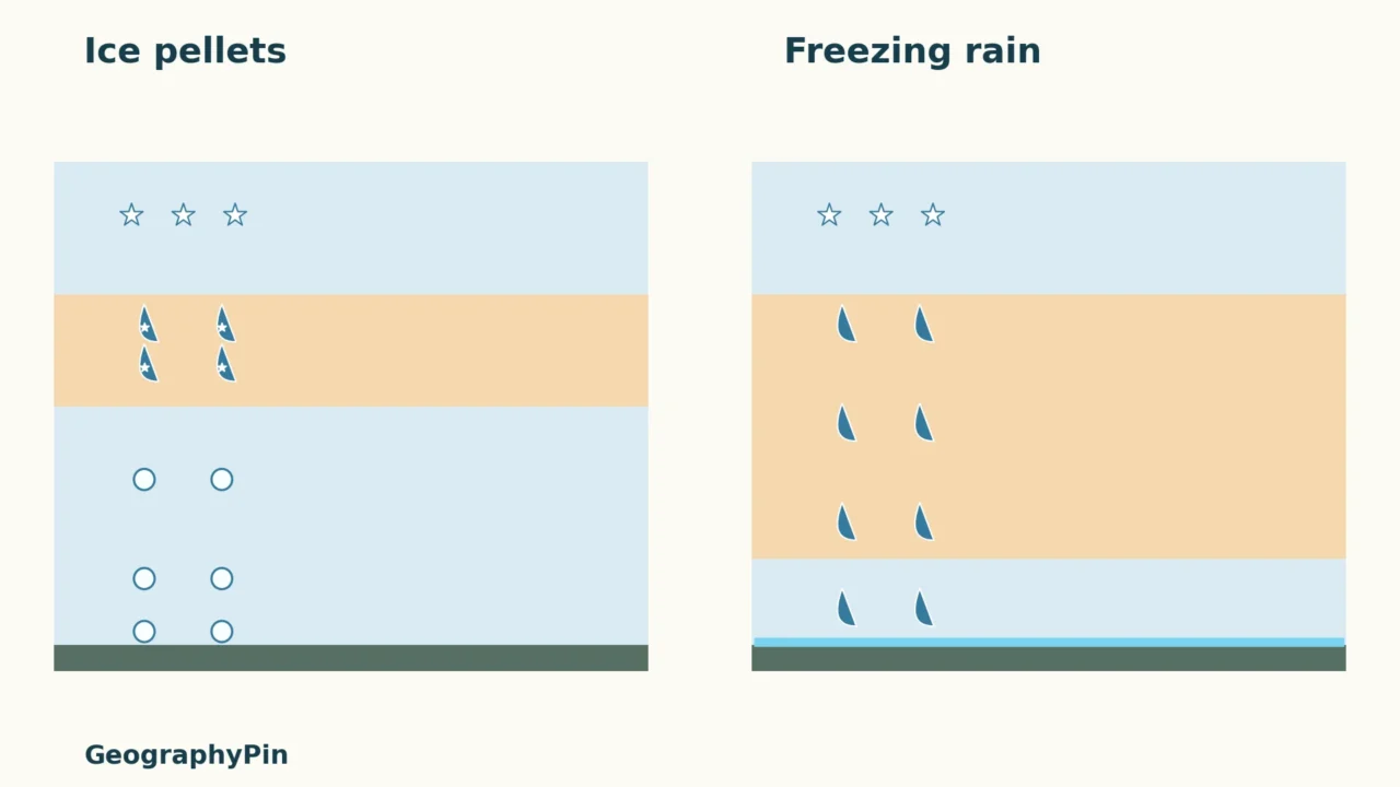
A common winter-storm pathway begins with snow aloft. For the wider movement of water between air and ground, see our water cycle explainer. In the sleet example, snow enters a relatively limited warm layer and partly melts. A colder layer below allows the particles to refreeze into pellets before they reach the ground.
In the freezing-rain example, the warm layer melts the snow completely. The drops then enter a shallower cold layer near the ground but remain liquid. They can become supercooled: liquid water below its usual freezing temperature of 32°F (0°C). Contact with a sufficiently cold surface produces ice.

Download the comparison diagram.
Read the figure from top to bottom, following the particles. The crucial question is whether water is solid or liquid when it arrives, not whether the whole air column can be described as “cold.” The diagrams deliberately omit numerical layer depths: there is no single universal depth that separates every sleet event from every freezing-rain event.
3. Why a Wintry Mix Can Change During a Storm
One temperature cannot describe the whole atmosphere
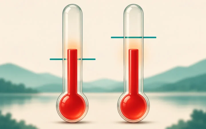
The temperature at head height does not measure the warm layer farther above you. That explains why a below-freezing surface reading does not automatically mean snow. The depth and warmth of the melting layer, the cold layer below it, and the initial particles all affect what reaches the surface.
As those conditions change, a location can experience more than one precipitation type. “Wintry mix” is not a single substance: it can describe a forecast or observation involving several forms of precipitation. Read the detailed forecast for which types are expected and when, rather than treating the phrase as a synonym for sleet.
The familiar melting-layer diagram is useful but is not a rule that every winter drop must begin as snow. Cloud temperature and moisture also matter, and supercooled liquid precipitation can form without the exact snow–melt–refreeze sequence drawn here. That is one reason meteorologists examine the atmospheric profile rather than relying on a simple surface-temperature cutoff.
4. Use the Forecast Without Underestimating Ice
Freezing rain is especially deceptive because it falls as liquid while producing ice on exposed surfaces. Accumulations can affect roads, branches and power lines. Sleet can also accumulate and create slippery travel conditions; identifying pellets does not establish that a route is safe.
Bridges and elevated roadways can be especially vulnerable to icing because cold air surrounds them. Do not use a wet-looking road or a single thermometer reading as proof that ice is absent. Follow current warnings and local road-condition information, and avoid unnecessary travel during dangerous icing conditions.
The figures explain precipitation, not a driving decision or a forecast for your location. Check the issuing weather service for timing and expected impacts. For U.S. conditions, start with the National Weather Service; elsewhere, use the responsible national or local service.
Frequently Asked Questions
Can liquid rain fall when the air is below freezing?
Yes. Supercooled drops can remain liquid below 32°F (0°C). Freezing rain describes those drops freezing on sufficiently cold surfaces, not ice pellets already frozen in the air.
Does a switch from freezing rain to sleet mean the danger is over?
No. Sleet can accumulate on top of existing ice, and both types can make surfaces slippery. A change in precipitation type does not remove ice already deposited.
What Did We Learn Today?
U.S. sleet is frozen before it lands; freezing rain remains liquid until it reaches a cold surface. The air layers above the ground help explain the difference, while changing profiles can produce a mix. Remember the different British meaning of sleet, and keep a precipitation label separate from a judgment about safe travel.
Sources & Data Notes
The original GeographyPin illustrations simplify common formation pathways described by the National Weather Service. They are not soundings, forecasts, measured layer depths or a complete classification of every winter precipitation process. No storm statistics or universal temperature-profile thresholds have been inferred.
- NWS Northern Indiana: Sleet, freezing rain and snow — ice pellets, supercooling and common layer sequences.
- NWS Louisville: Precipitation and vertical temperature profiles — contrasting melting and cold layers.
- NWS La Crosse: What causes a wintry mix? — surface, cloud and intervening-layer conditions.
- NWS Jackson: Freezing rain and sleet — icing hazards and exposed roadways.
- NOAA NSSL: Winter weather types — precipitation definitions and impacts.
- Met Office: Sleet — rain-and-snow terminology.
- Met Office: Freezing rain — liquid drops and surface icing.