This climatology quiz tests how well you understand weather processes, climate patterns and the evidence used to study them. Answer 24 questions on atmospheric motion, moisture, energy, regional climates and climate change, with explanations that show the reasoning behind each answer.
Meteorology studies the atmosphere and weather; climatology emphasizes climate patterns, variability and change over longer periods. They overlap but are not synonyms. This combined quiz is for geography enthusiasts who want more than place-name trivia, with self-contained scenarios and a few short calculations.
Explain the weather. Read the climate evidence.
24 questions · No timer · One point per correct answer
Easy, Medium and Hard are relative editorial difficulty levels for general geography learners, not standardized ratings. Every correct answer earns one point.
Choose an answer, then open “Show answer” to check it yourself. Interactive scoring appears when JavaScript is available.
Choose one answer, select Check answer, then continue to the next question.
Your Climatology and meteorology quiz result
Easy
Show answer
Correct answer: Comparing a region’s seasonal rainfall patterns and variability across several decades.
Climate concerns the statistics of weather over time, including averages and variability. Meteorology examines atmospheric processes and weather, while climatology emphasizes longer-term patterns and change; the fields overlap but are not synonyms.
Easy
Show answer
Correct answer: Three consecutive decades of observations.
A standard climate normal represents a 30-year reference period. It provides a baseline for comparison, not a forecast or an unchanging definition of “normal.” NOAA updates its normals each decade and applies statistical methods to handle issues such as missing observations.
Easy
Show answer
Correct answer: Earth’s tilted axis gives the hemispheres their most direct sunlight at different times of year.
As Earth orbits the Sun, its tilted axis changes which hemisphere receives more direct sunlight. When one hemisphere tilts toward the Sun, the other tilts away. Earth–Sun distance is not the main cause of the opposite seasons.
Easy
Show answer
Correct answer: Atmospheric gases absorb and emit thermal infrared radiation.
Earth’s surface emits thermal infrared radiation. Greenhouse gases absorb some of it and emit infrared radiation in different directions, including back toward the surface. This differs from stratospheric ozone’s filtering of incoming ultraviolet radiation; heat still escapes to space.
Medium
Show answer
Correct answer: +3.6°F (+2°C).
Subtract the reference mean from the observed mean: 71.6 − 68 = +3.6°F, or 22 − 20 = +2°C. An anomaly is a difference, not the actual temperature. Temperature differences convert without adding the 32-degree offset used for absolute Fahrenheit temperatures.
Medium
Show answer
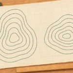
Correct answer: A stronger horizontal pressure gradient.
With the map scale and isobar interval fixed, closer lines mean a larger pressure change over the same distance. The pressure-gradient force acts from higher toward lower pressure. Actual wind also depends on forces such as Coriolis and friction.
Medium
Show answer
Correct answer: Toward the west, to the left of its motion.
Coriolis deflects moving air to the left in the Southern Hemisphere and to the right in the Northern Hemisphere. Left of a northward path is west. This describes the Coriolis contribution, not the complete path under all atmospheric forces.
Hard
Show answer
Correct answer: The horizontal temperature contrast between cold and warm air is generally greater.
Strong horizontal temperature contrasts are associated with stronger upper-level winds. Those contrasts are generally greater in winter, helping strengthen the polar-front jet. Its daily path and speed still vary with the evolving atmospheric circulation.
Easy
Show answer
Correct answer: It expands as the surrounding pressure decreases.
Pressure decreases with height, so the rising parcel expands and cools. This is adiabatic cooling: it does not require heat transfer to the surroundings. If the parcel eventually reaches saturation, condensation and cloud formation can follow.
Medium
Show answer
Correct answer: It decreases.
Relative humidity compares the water vapor present with saturation at the air’s temperature. When the same air is warmed under the stated conditions, its relative humidity falls. This does not mean that water vapor has disappeared.
Medium
Show answer
Correct answer: Condensation releases latent heat that partly offsets expansion cooling.
As water vapor condenses, latent heat is released within the parcel. That energy partly offsets cooling from expansion, so saturated ascent has a smaller cooling rate than unsaturated ascent. It does not mean the parcel stops cooling.
Medium
Show answer
Correct answer: The ocean-influenced place has a smaller annual temperature range.
The ocean’s slower warming and cooling moderates nearby air, often reducing the difference between summer and winter temperatures. Latitude alone does not determine the annual range. Ocean currents, winds and local geography also influence the result.
Easy
Show answer
Correct answer: A seasonal shift in the prevailing winds.
Monsoon refers to a seasonal wind change. It often brings a pronounced wet season, but a monsoon circulation can also produce a dry season. The term is not a synonym for any downpour and is not limited to South Asia.
Medium
Show answer
Correct answer: Mediterranean: dry summers and wetter winters.
December–February is summer in the Southern Hemisphere. Dry summers paired with mild, wet winters are characteristic of a Mediterranean climate. This identifies a broad seasonal pattern, not an exact Köppen subcategory from a complete monthly dataset.
Medium
Show answer
Correct answer: Little change in wind speed or direction with height.
Low vertical wind shear helps a tropical disturbance maintain organized convection. Strong changes in wind speed or direction with height can disrupt that organization. Warm water and low shear are favorable ingredients, not a guarantee that a cyclone will form.
Hard
Show answer
Correct answer: Horizontal temperature contrasts between air masses.
Extratropical cyclones draw their primary energy from horizontal contrasts between warm and cold air and commonly have fronts. Tropical cyclones instead depend strongly on ocean heat and latent heat release in organized convection. “Extratropical” does not mean harmless or necessarily weak.
Medium
Show answer
Correct answer: El Niño.
El Niño involves warming of the central/eastern equatorial Pacific together with changes in atmospheric circulation, including weaker trade winds. La Niña generally strengthens the usual trades and cold-water upwelling. The question describes a pattern, not the formal thresholds for declaring an event.
Medium
Show answer
Correct answer: A positive feedback that amplifies the initial warming.
The ice–albedo feedback reinforces an initial change: less reflective ice allows more solar absorption, which can promote additional warming and melting. “Positive” means amplifying, not beneficial. It does not imply that this is the only feedback or that warming must become unlimited.
Medium
Show answer
Correct answer: The cold week can coexist with a long-term global warming trend.
A local week is a short weather event, whereas global warming describes a broader long-term change. Atmospheric circulation and natural variability can still produce cold spells as average temperatures rise. Establishing the trend requires evidence across places and years.
Hard
Show answer
Correct answer: As conditional estimates of future climate under the stated assumptions.
Climate projections describe possible future conditions under assumptions such as greenhouse-gas emissions. Different pathways can produce different outcomes. They inform long-term climate risks and ranges; they are not exact daily weather forecasts for a distant date.
Medium
Show answer
Correct answer: More absorbed and stored heat, with less evaporative cooling.
Dark paving can absorb and store solar energy, while the loss of moist soil and plants reduces evaporative cooling. Heat stored in urban materials can be released later. These are contributing mechanisms; the effect also depends on local climate and the surfaces that were replaced.
Hard
Show answer
Correct answer: Air bubbles sealed within the ice.
Trapped bubbles preserve small samples of past air, allowing scientists to analyze its gases. Oxygen-isotope ratios in the ice provide a different, temperature-related line of evidence. These records are complementary, not interchangeable measurements.
Hard
Show answer
Correct answer: It is cooler than its surroundings and tends to sink back.
Using the supplied rounded rate, the parcel reaches 50°F (10°C), cooler than the surrounding 57.2°F (14°C). Under the model’s assumptions, it is denser and negatively buoyant, so its upward motion is resisted. Parcel temperature must be compared with the environment, not just with its starting temperature.
Hard
Show answer
Correct answer: Temporary surface cooling as more incoming sunlight is scattered back to space.
Reflective sulfate aerosols can reduce the solar energy reaching the surface and cause temporary cooling. This is an external forcing of the climate system, unlike a feedback triggered by warming. The outcome depends on the eruption and particles; not every aerosol or eruption has the same effect.
Make the weather and climate connections
Each correct answer earns one point, with no penalty for a wrong answer. At the end, select Review answers to see every question and explanation, or Try again to replay the same set. The quiz does not save your score between visits.
- Check the timescale and baseline. A local cold week, a monthly temperature anomaly and a long-term global trend answer different questions. An anomaly needs a stated reference period.
- Follow the physical process. Pressure differences, Earth’s rotation, expansion cooling and latent heat help explain what air does. Compare a parcel with its surroundings before deciding whether it will keep rising.
- Keep the setting in view. Hemisphere, season, ocean influence and wind shear matter. A useful general pattern is not a guarantee for every place or every storm.
- Separate evidence from assumptions. Trapped air and ice isotopes reveal different things. Future climate projections depend on their scenarios and do not forecast the exact weather on a distant date.
For a broader, configurable mix of places and geography topics, try the world geography quiz.
What Did We Learn Today?
Weather and climate are connected through atmospheric processes, but they describe different timescales and questions. Energy exchanges, pressure gradients and moisture help explain clouds, winds and storms. Oceans and seasonal circulation shape regional climates. Interpreting climate evidence means checking the baseline, distinguishing a local event from a long-term trend, and recognizing the difference between a feedback, an external forcing and a scenario-based projection.
Sources & Data Notes
The answers use directly consulted NOAA, NASA, Met Office and World Meteorological Organization material. Sources below identify the questions they support. Numerical and station examples are hypothetical, not observations from named places. The parcel exercise uses an explicitly rounded cooling rate and simplified assumptions. Regional climate descriptions are broad patterns, not complete Köppen classifications. Easy, Medium and Hard are editorial difficulty labels, not a standardized assessment or professional qualification.
- NOAA: What’s the difference between climate and weather? (Q1, Q19); Understanding Climate Normals (Q2); Origin of Wind (Q6, Q7); The Jet Stream (Q8); How Clouds Form (Q9); Parcel Theory (Q11, Q23).
- Met Office: Climate change glossary (Q1, Q4, Q17, Q18); Climate zones (Q12, Q14); UK and Global extreme events – Cold (Q19); The role of different timescales (Q20); High-impact low-likelihood (HILL) climate scenarios for the UK (Q20).
- NASA: What Causes the Seasons? (Q3, Q14); Climate and Earth’s Energy Budget (Q4, Q24); Paleoclimatology: The Ice Core Record (Q22); Aerosols: Tiny Particles, Big Impact (Q24).
- NOAA / National Weather Service: Glossary: Anomaly (Q5); A Discussion of Water Vapor, Humidity, and Dewpoint, and Relationship to Precipitation (Q10); Glossary: Extratropical (Q16).
- World Meteorological Organization: How the ocean shapes weather and climate (Q12).
- NOAA / NESDIS: What Is a Monsoon? (Q13).
- NOAA / National Ocean Service: How do hurricanes form? (Q15, Q16); What are El Niño and La Niña? (Q17).
- NOAA Arctic: Why is the Arctic So Sensitive to Climate Change and Why Do We Care? (Q18).
- NASA / My NASA Data: Urban Heat Islands (Q21).