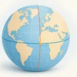
The Prime Meridian is easy to draw as a straight line on a world map. Following it across real coastlines and borders is more interesting: the route crosses eight countries, leaves gaps over water, and encounters the Ghana–Togo border more than once.
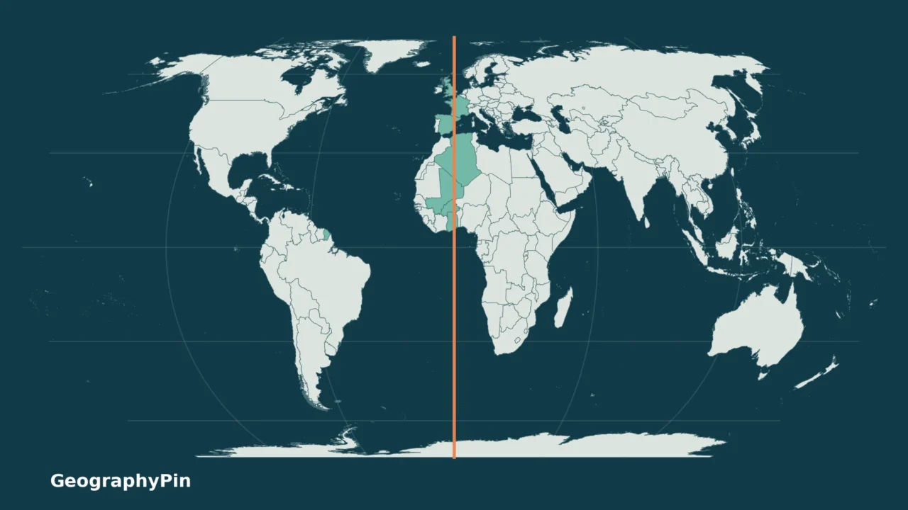
The Prime Meridian crosses land in eight countries: the United Kingdom, France, Spain, Algeria, Mali, Burkina Faso, Togo and Ghana. The line also crosses Antarctica, which is counted separately rather than as a ninth country. This list counts distinct countries, not individual border crossings or ocean areas.
How to use this article: Start with the eight-country list, inspect the Ghana–Togo close-up, or compare the historic Greenwich line and GPS zero.
1. Map and Complete Country List
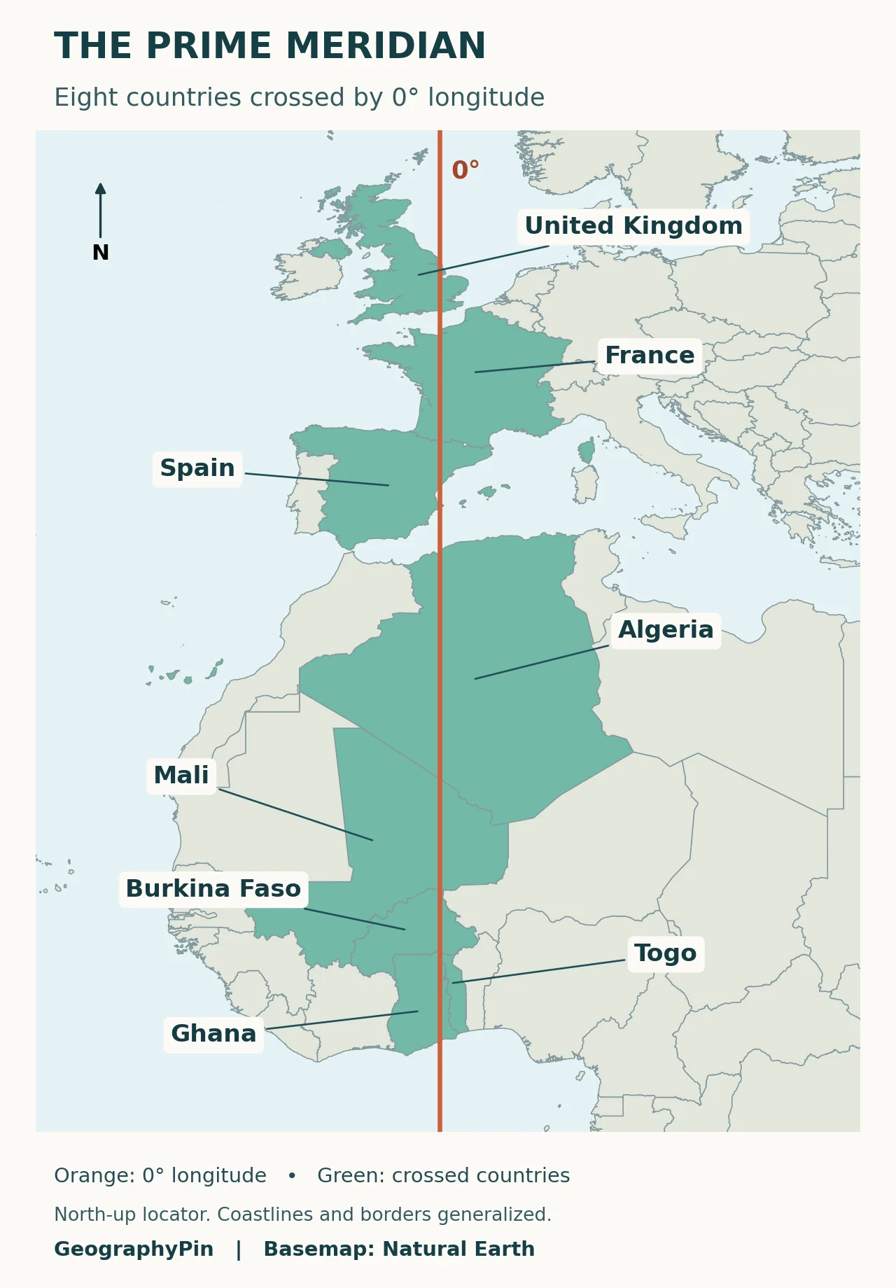
The eight-country list
Royal Museums Greenwich identifies these eight countries. The table starts in Europe and proceeds toward the Gulf of Guinea. England is part of the United Kingdom, so it is not counted as an additional country.
| Country | Region | What to notice on the map |
|---|---|---|
| United Kingdom | Europe | The land crossing is in England. |
| France | Europe | The line crosses metropolitan France. |
| Spain | Europe | The route reaches the Mediterranean coast. |
| Algeria | Africa | The first African country after the Mediterranean crossing. |
| Mali | Africa | The line continues through inland West Africa. |
| Burkina Faso | Africa | The next country south of Mali on the line. |
| Togo | Africa | The crossing occurs near its northwestern border. |
| Ghana | Africa | The route eventually reaches the Gulf of Guinea. |
Download the eight-country list as a CSV file. It includes the country, broad region and land-crossing status, not survey coordinates or travel directions.
Country color is a classification, not a statement that the meridian touches every part of that country. For example, the United Kingdom is highlighted as one country, although the line does not pass through Scotland, Wales or Northern Ireland. Likewise, the shaded shape of France is broader than the narrow north–south path.
For a different task, the world map with countries shows the wider political pattern. Here the useful question is much narrower: which land polygons intersect one specified line of longitude?
2. Why Ghana and Togo Need a Closer Look
One country can appear more than once along the route
A list of countries is not the same thing as a step-by-step border itinerary. The Ghana–Togo boundary bends around the zero-longitude line. In the Natural Earth boundary geometry used for these maps, the southbound route runs from Burkina Faso into Togo, then Ghana, back into Togo, and finally Ghana again before reaching the coast.
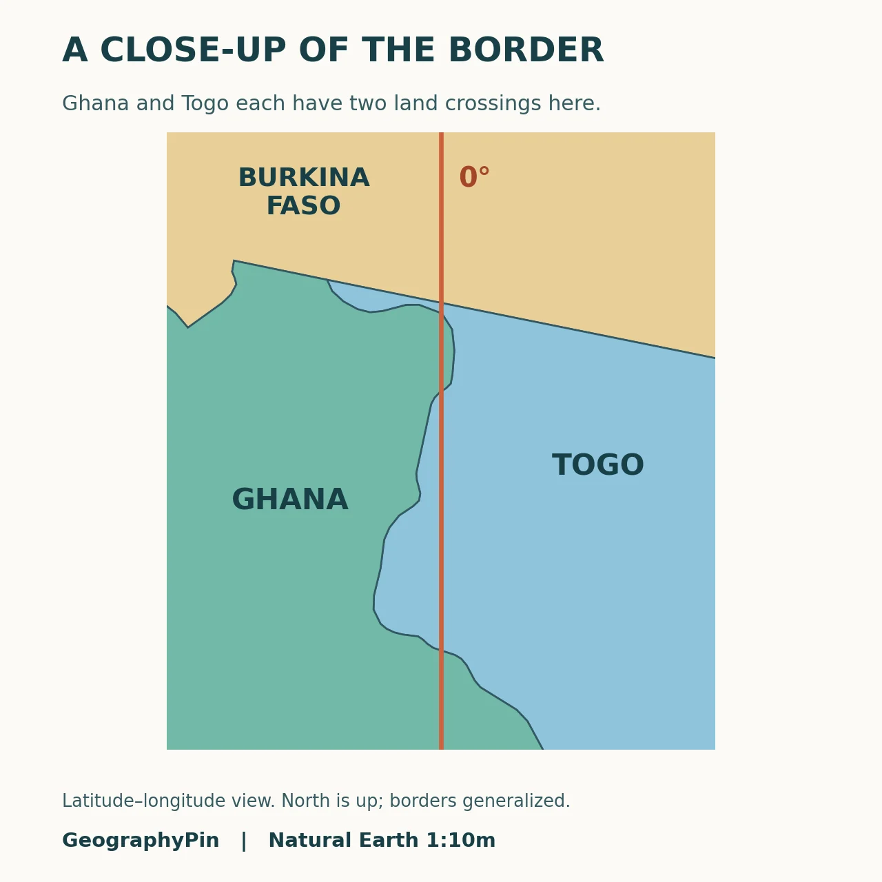
That does not make ten countries. Each sovereign state still contributes only one entry to the eight-country list. This is also why memorizing a simple chain without looking at the border can create a misleading picture.
The close-up is intended to explain that pattern, not locate a legal boundary on the ground. Natural Earth is a small-scale cartographic dataset; its bends are simplified. A border survey or a precise local crossing point requires more detailed official mapping.
3. Why Antarctica Does Not Add a Ninth Country
Continue south from Ghana and the meridian crosses the Atlantic, the Equator and the Southern Ocean before reaching Antarctica. Royal Museums Greenwich identifies Antarctica as the only Southern Hemisphere landmass crossed by this meridian.
Antarctica is a continent, not an extra entry in this country list. Territorial claims there are not equivalent to a universally recognized set of sovereign Antarctic countries. Article IV of the Antarctic Treaty preserves the parties’ positions on sovereignty and restricts new or expanded claims while the treaty is in force.
Keep the two answers separate: eight countries in this land-crossing count, but three continents along the full pole-to-pole route: Europe, Africa and Antarctica. Antarctica is outside the regional map above, so the map should not be mistaken for the meridian’s entire length.
4. Greenwich, GPS and Zero Longitude
The historic marker and the modern reference are different
The historic Greenwich meridian was tied to the Airy Transit Circle at the Royal Observatory. Modern satellite-based coordinates use the International Reference Meridian. NOAA explains that GPS zero longitude at Greenwich is about 334 feet (102 meters) east of the historic ground marker.
The maps here plot modern 0° longitude on the WGS84 geographic grid. The offset is far smaller than the width of the orange line at this regional scale, and it does not change the eight-country answer. It does matter if the task is to stand at an exact GPS coordinate rather than identify a country.
If coordinate notation is the confusing part, the latitude and longitude guide explains why latitude measures north–south position while longitude measures east–west position. Zero longitude alone identifies an entire meridian; a latitude is still needed to specify one place.
Frequently Asked Questions
Does the Prime Meridian cross the United States?
No. The United States is not one of the eight land-crossed countries. A line drawn vertically through a U.S.-centered map is not necessarily 0° longitude: check the longitude labels rather than the page layout.
Is the Prime Meridian the International Date Line?
No. The Prime Meridian is the zero-longitude reference. The date line lies broadly near the opposite meridian at 180°, with deviations around jurisdictions. Crossing 0° does not itself change the calendar date.
Does crossing the Prime Meridian mean crossing a national border?
No. Most of the displayed line lies inside countries or over water. Longitude is a coordinate reference, whereas a national boundary defines a political division; they are different kinds of line.
What Did We Learn Today?
The useful answer depends on what is being counted: eight distinct countries have land on the Prime Meridian, even though an irregular border can make a country appear more than once along its route. Antarctica belongs in the continental description rather than the country count. A regional locator explains those relationships, while exact local positioning requires the correct coordinate reference and more detailed mapping.
Sources & Data Notes
The country count is cross-checked against Royal Museums Greenwich and intersections of modern 0° longitude with Natural Earth 1:10 million country polygons. Antarctica is excluded from the country total. The maps are original GeographyPin compositions using public-domain Natural Earth data, with generalized boundaries rather than survey lines. Label anchors were checked against the corresponding country polygons. The Ghana–Togo close-up describes this dataset’s border pattern, not exact crossing coordinates. The featured world view uses Equal Earth; the two regional locators use a latitude–longitude grid.