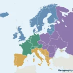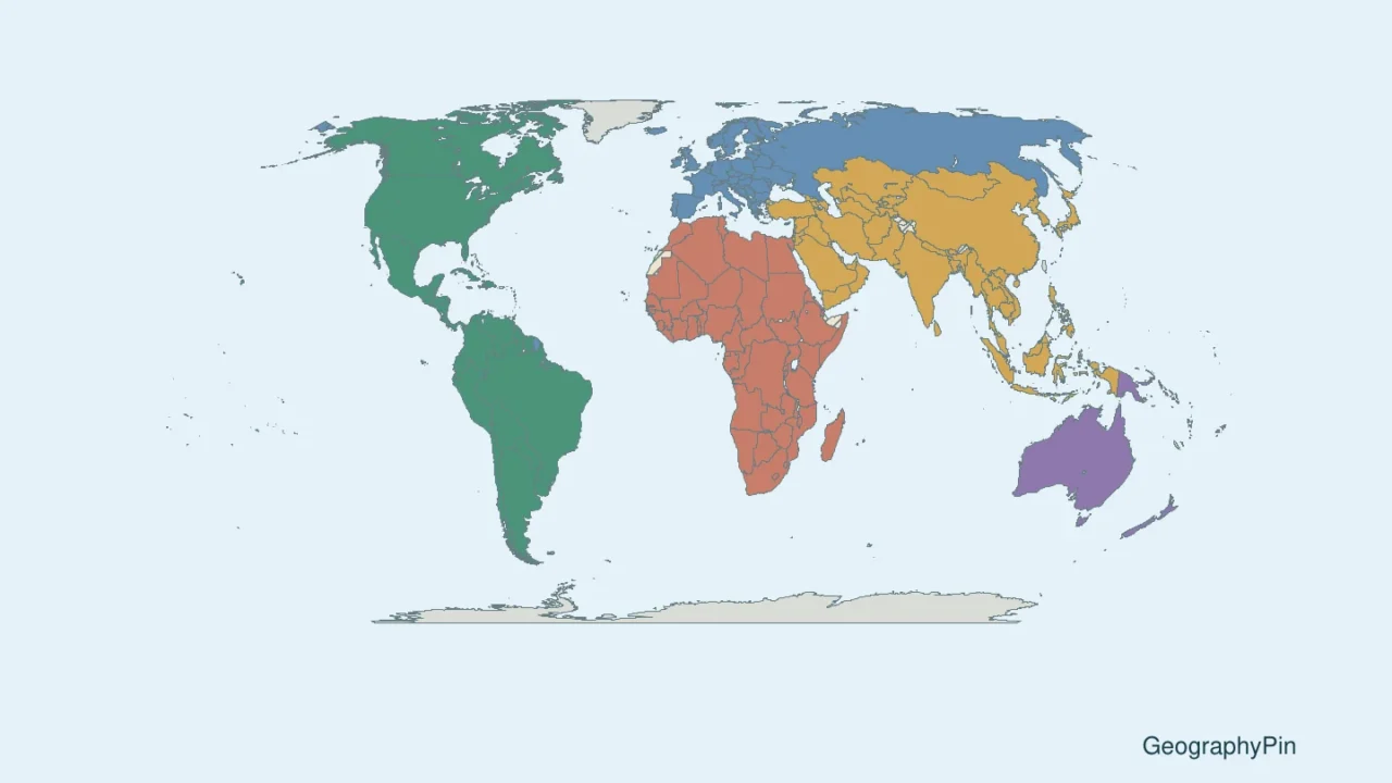
A useful world map should help you find a country, not make you decipher hundreds of tiny names. This reference pairs a whole-world overview with 22 numbered regional sheets. Every country in the stated 193-plus-2 roster has a locator and a name key, including small island states and European microstates.
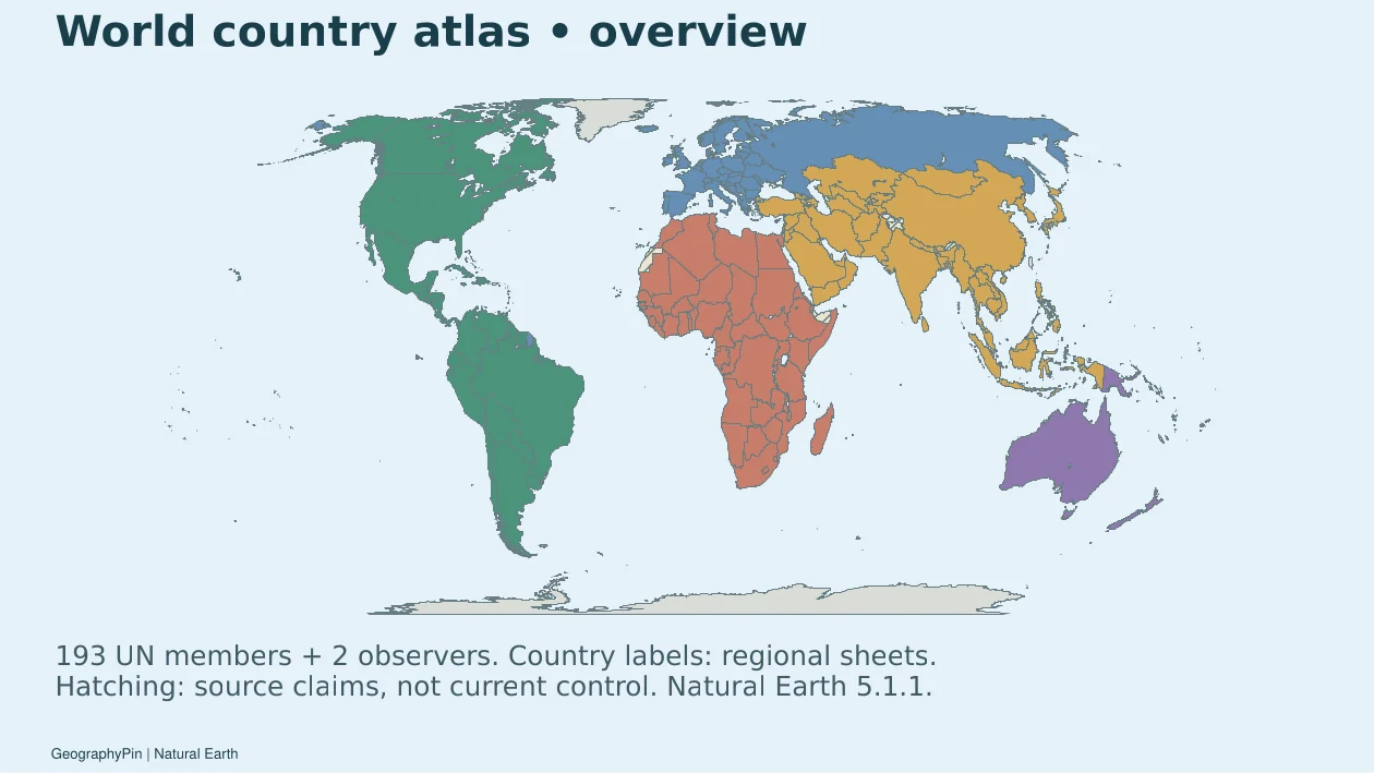
This world map atlas locates 195 countries using a defined roster: 193 United Nations member states and the two non-member observer states, the Holy See and the State of Palestine. Readable regional sheets carry the labels; the world overview and blank PDF provide context. Country counting is separate from disputed-boundary recognition.
Choose your task: check the 195-country scope, understand the boundary annotations, or download the atlas and blank map.
1. Find Your Region on the World Map
Start with the regional sheet closest to the place you want to find. The country number belongs to that sheet only. For example, number 1 on one sheet does not identify the same country as number 1 on another. The downloadable CSV records both sheet name and local number, so the key stays unambiguous.
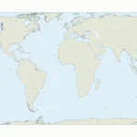
The world overview uses the Equal Earth projection. Regional sheets are north-up reference views with a latitude-adjusted display aspect. A world projection cannot preserve shape, area and distance everywhere at once; these maps are for identifying locations, not navigation or boundary surveying.
2. Open the Labeled Regional Sheets
Open a sheet to see its map, printable PDF and accessible text key together. Numbers identify countries, not capital-city coordinates. A leader line connects a displaced number to its true location when a country is too small or too close to its neighbors for an in-place label.
Northern Africa: 6 country locators
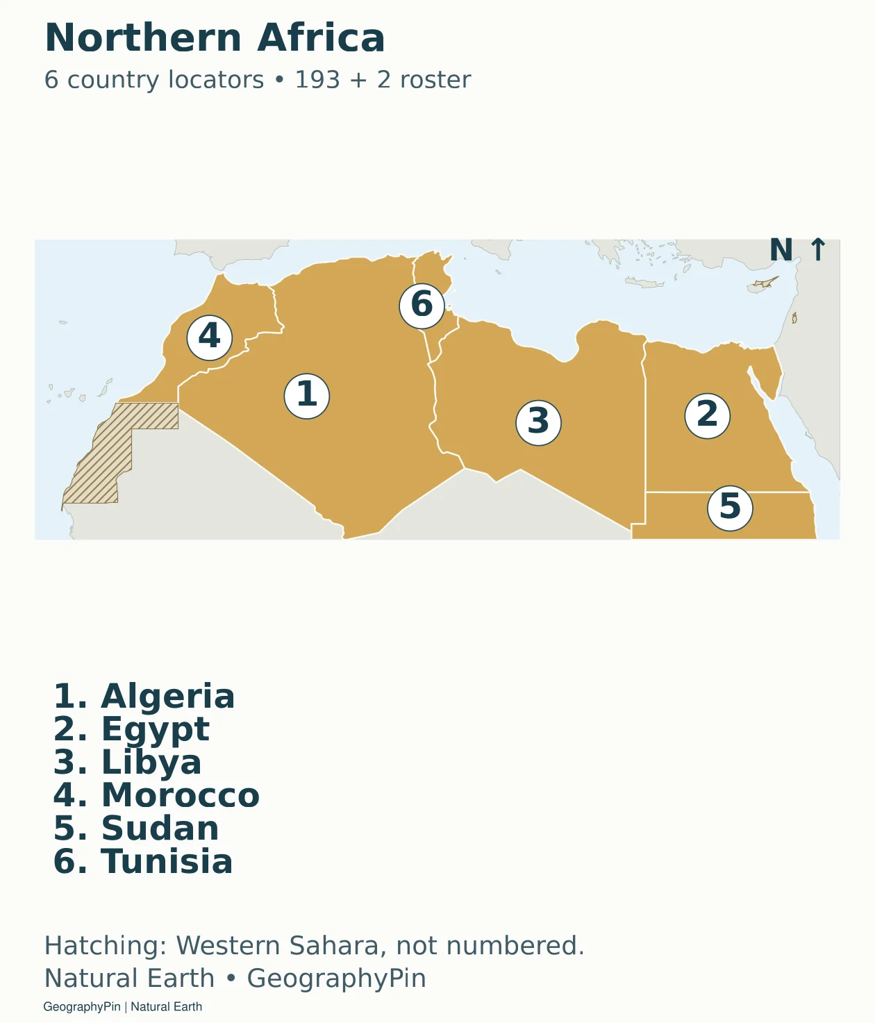
Download the Northern Africa sheet (PDF).
Accessible map key: 1. Algeria; 2. Egypt; 3. Libya; 4. Morocco; 5. Sudan; 6. Tunisia.
Western Africa: 16 country locators
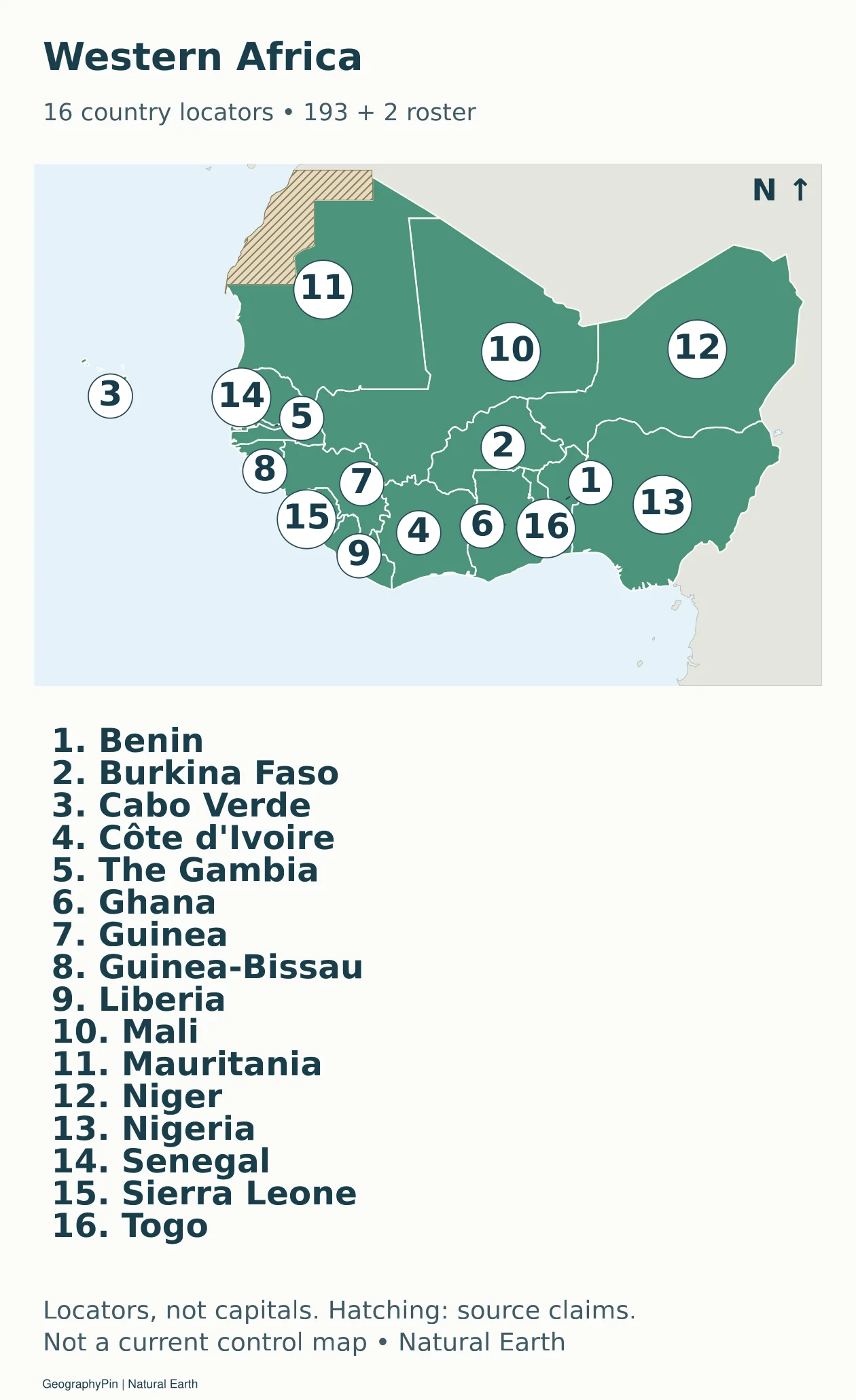
Download the Western Africa sheet (PDF).
Accessible map key: 1. Benin; 2. Burkina Faso; 3. Cabo Verde; 4. Côte d’Ivoire; 5. The Gambia; 6. Ghana; 7. Guinea; 8. Guinea-Bissau; 9. Liberia; 10. Mali; 11. Mauritania; 12. Niger; 13. Nigeria; 14. Senegal; 15. Sierra Leone; 16. Togo.
Middle Africa: 9 country locators
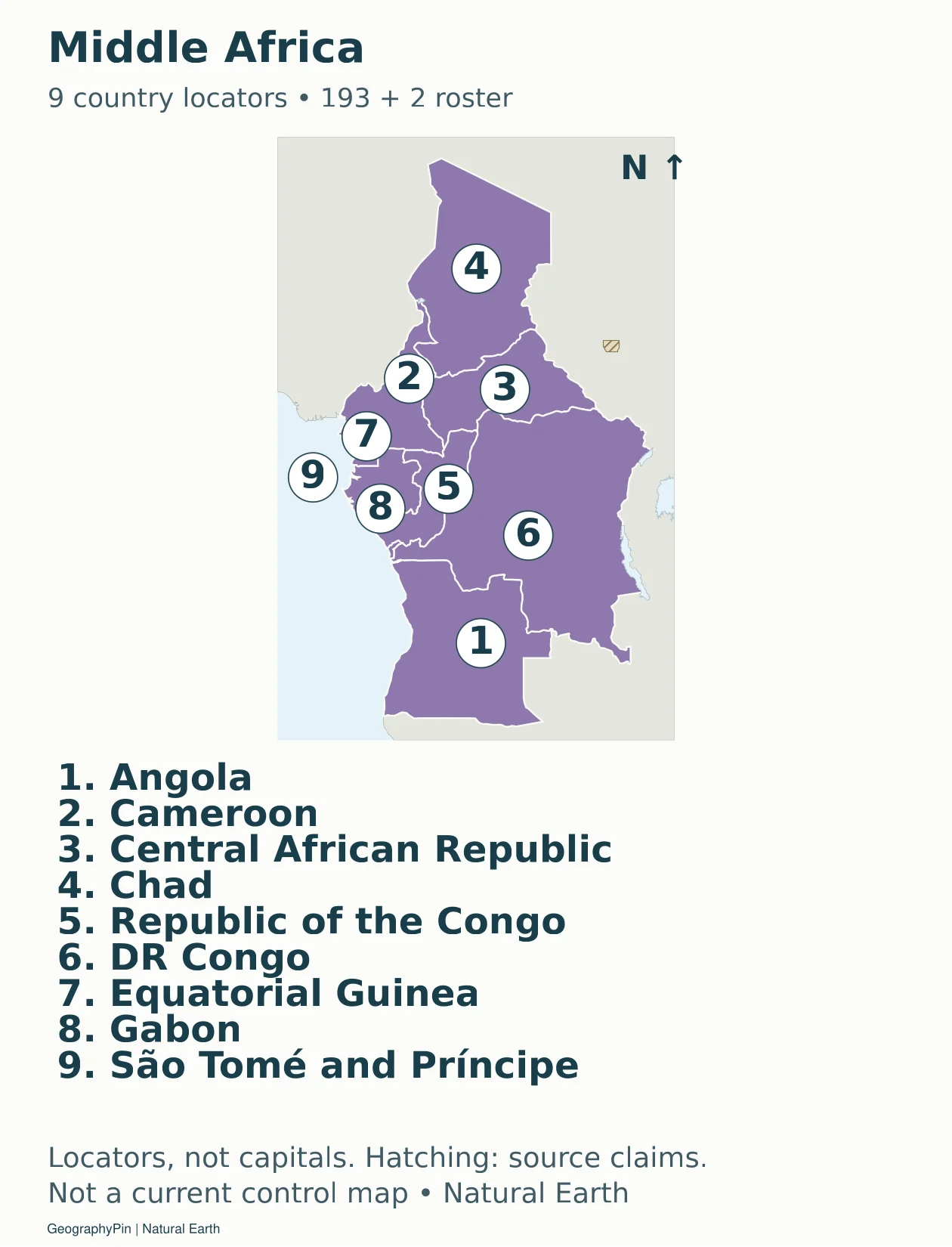
Download the Middle Africa sheet (PDF).
Accessible map key: 1. Angola; 2. Cameroon; 3. Central African Republic; 4. Chad; 5. Republic of the Congo; 6. DR Congo; 7. Equatorial Guinea; 8. Gabon; 9. São Tomé and Príncipe.
Eastern Africa: 18 country locators
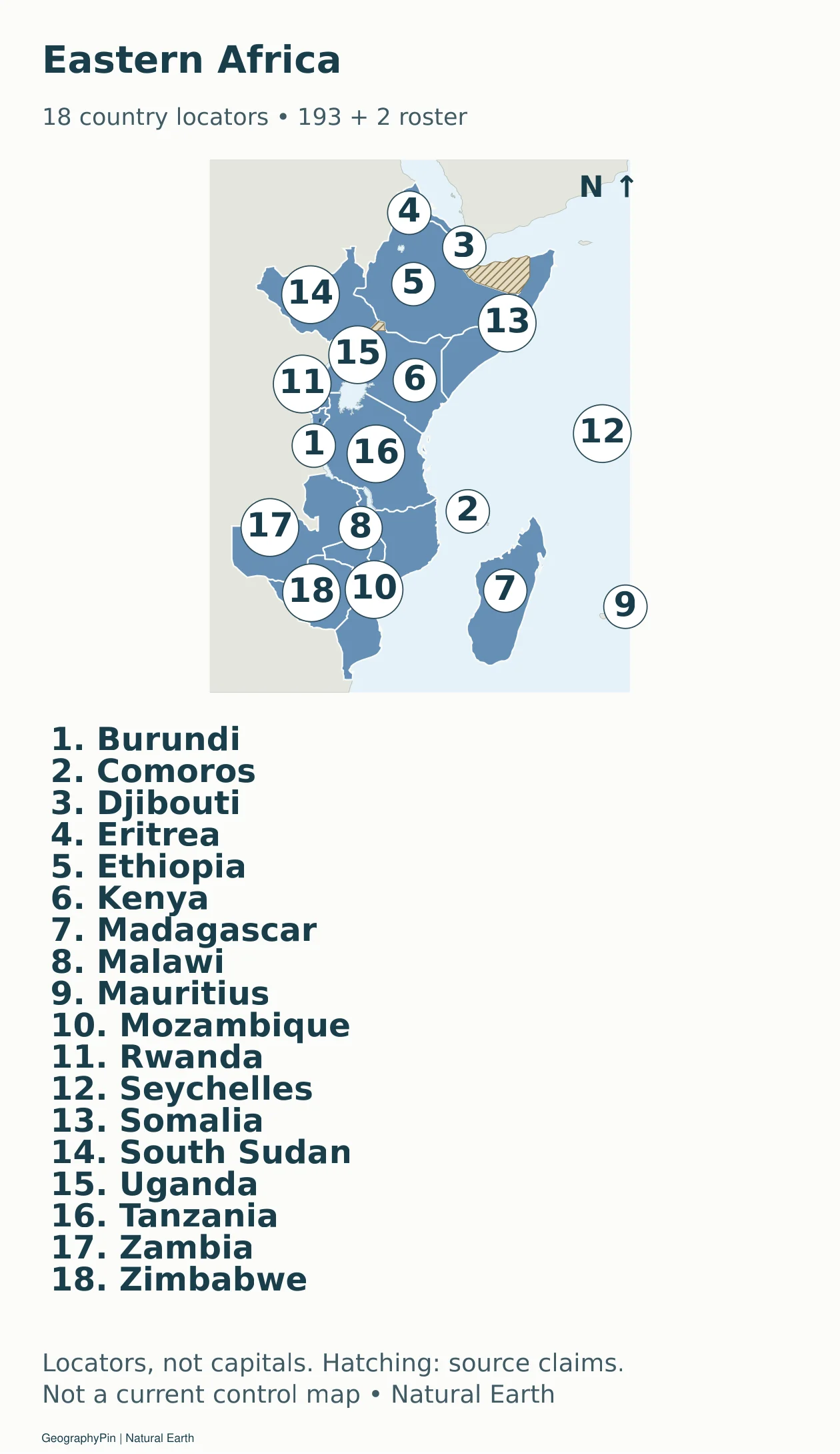
Download the Eastern Africa sheet (PDF).
Accessible map key: 1. Burundi; 2. Comoros; 3. Djibouti; 4. Eritrea; 5. Ethiopia; 6. Kenya; 7. Madagascar; 8. Malawi; 9. Mauritius; 10. Mozambique; 11. Rwanda; 12. Seychelles; 13. Somalia; 14. South Sudan; 15. Uganda; 16. Tanzania; 17. Zambia; 18. Zimbabwe.
Southern Africa: 5 country locators
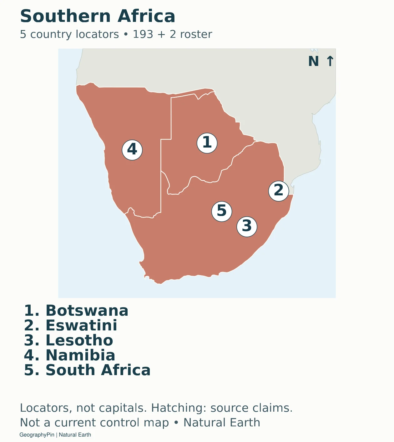
Download the Southern Africa sheet (PDF).
Accessible map key: 1. Botswana; 2. Eswatini; 3. Lesotho; 4. Namibia; 5. South Africa.
Northern Europe: 10 country locators
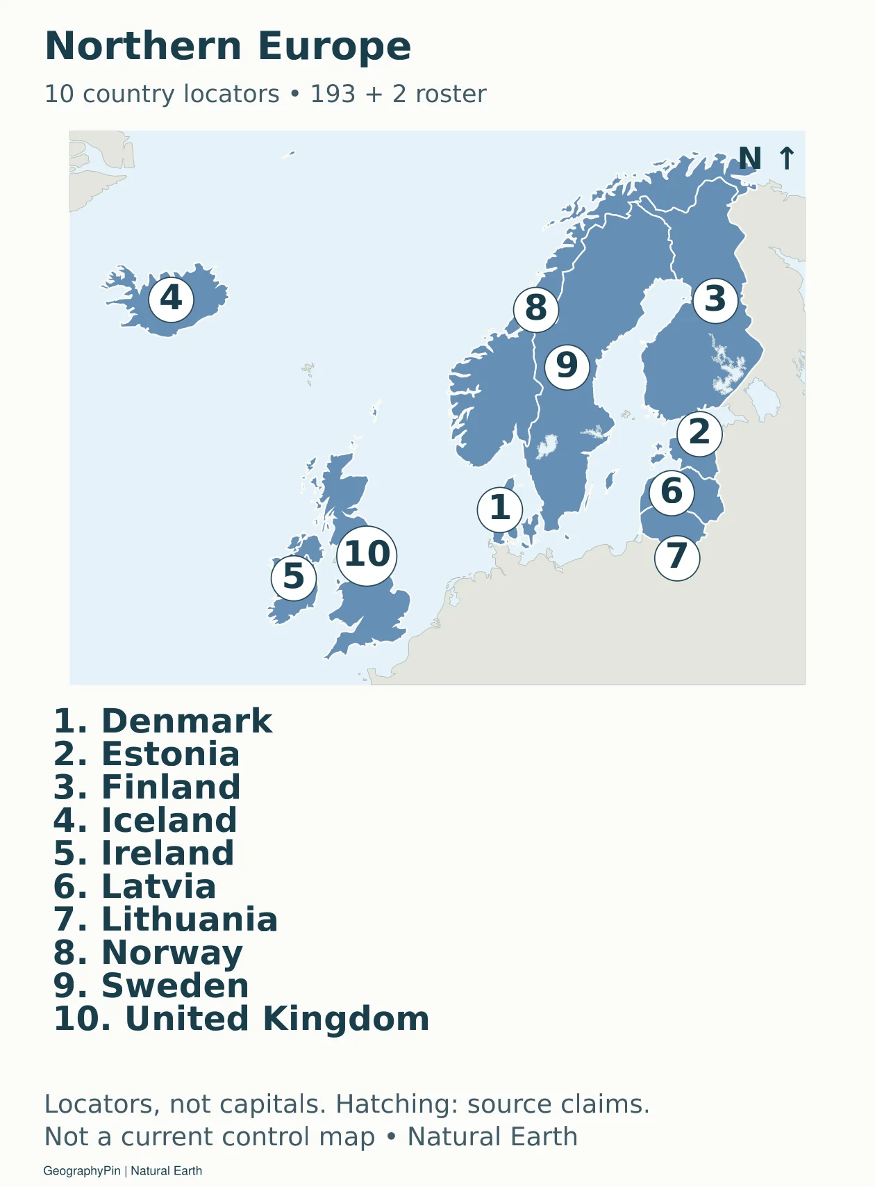
Download the Northern Europe sheet (PDF).
Accessible map key: 1. Denmark; 2. Estonia; 3. Finland; 4. Iceland; 5. Ireland; 6. Latvia; 7. Lithuania; 8. Norway; 9. Sweden; 10. United Kingdom.
Western Europe: 9 country locators
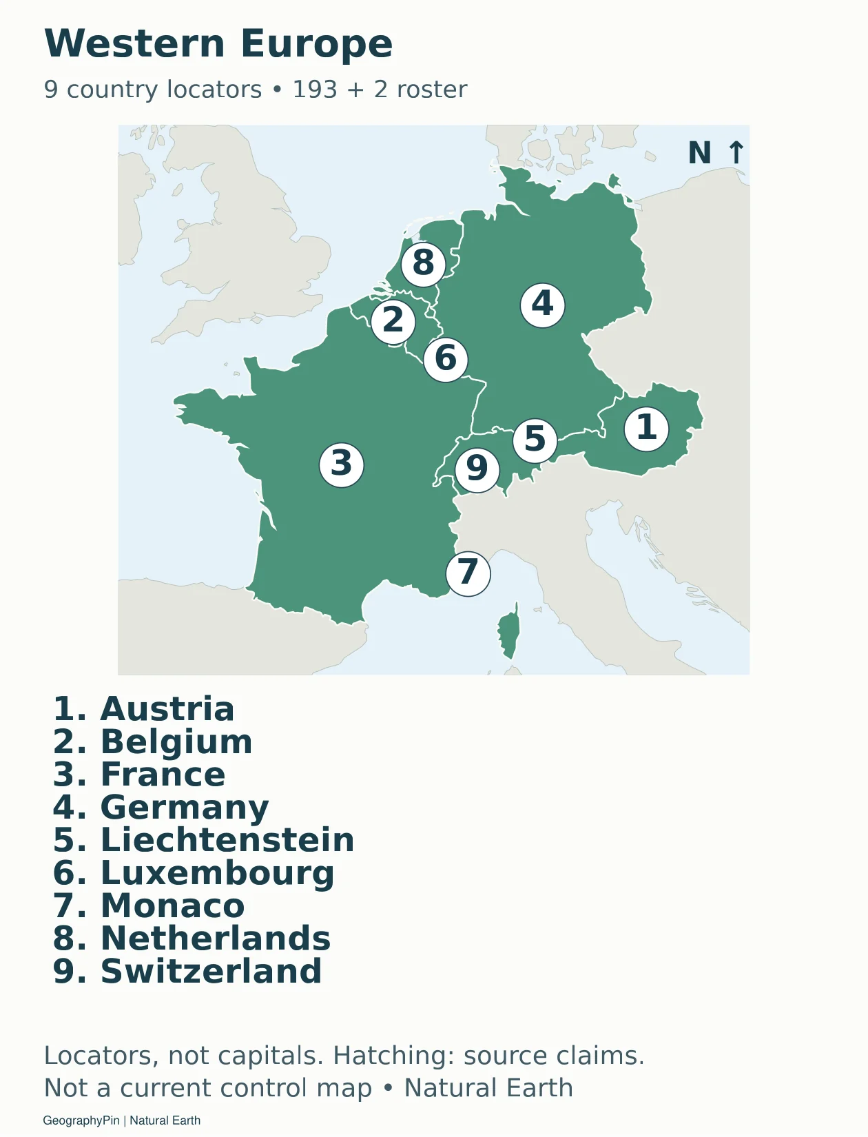
Download the Western Europe sheet (PDF).
Accessible map key: 1. Austria; 2. Belgium; 3. France; 4. Germany; 5. Liechtenstein; 6. Luxembourg; 7. Monaco; 8. Netherlands; 9. Switzerland.
Southern Europe: 15 country locators
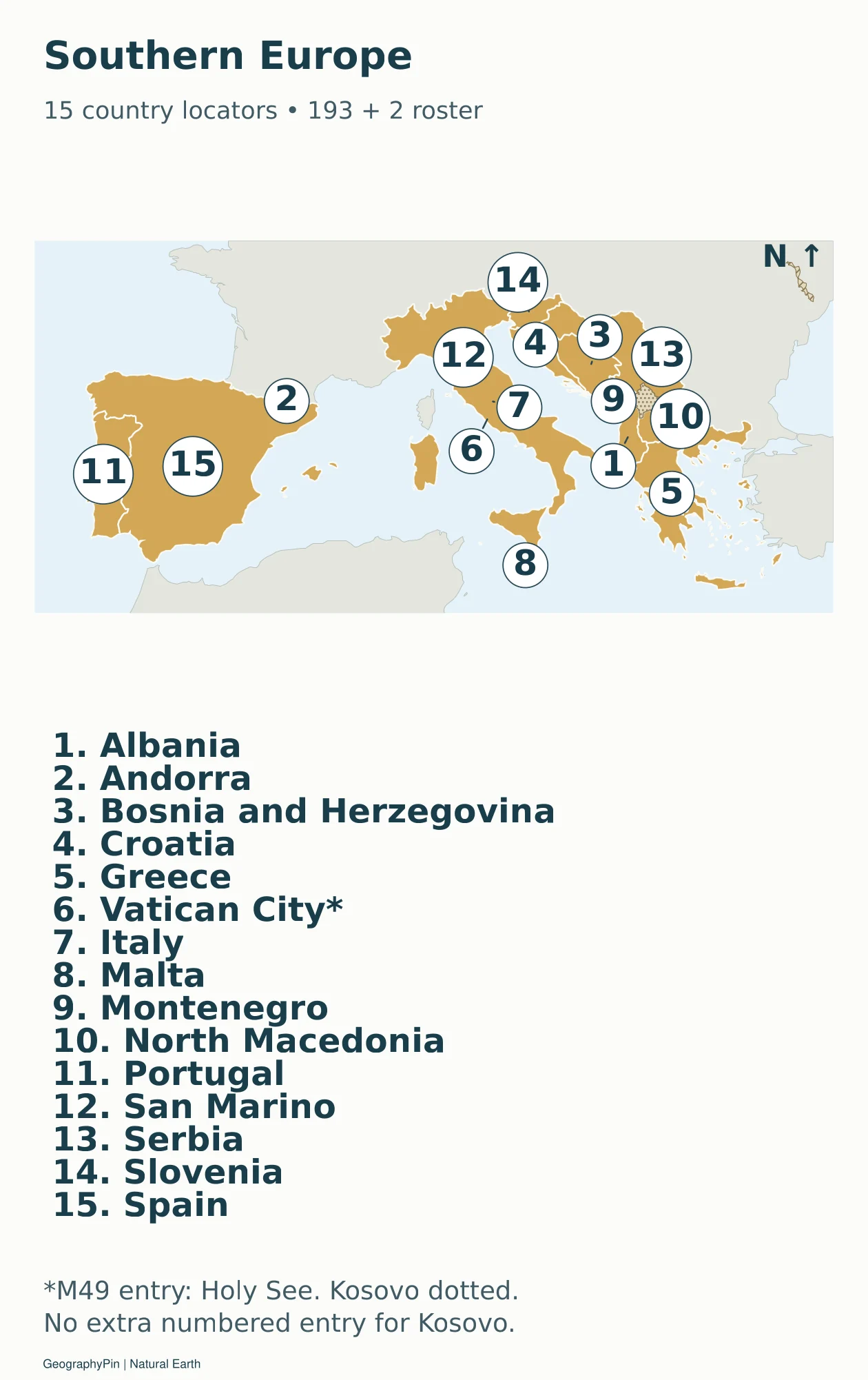
Download the Southern Europe sheet (PDF).
Accessible map key: 1. Albania; 2. Andorra; 3. Bosnia and Herzegovina; 4. Croatia; 5. Greece; 6. Vatican City / Holy See; 7. Italy; 8. Malta; 9. Montenegro; 10. North Macedonia; 11. Portugal; 12. San Marino; 13. Serbia; 14. Slovenia; 15. Spain.
Eastern Europe: 10 country locators
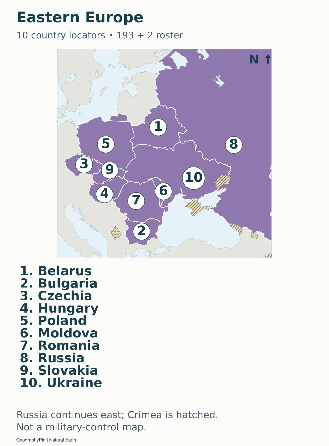
Download the Eastern Europe sheet (PDF).
Accessible map key: 1. Belarus; 2. Bulgaria; 3. Czechia; 4. Hungary; 5. Poland; 6. Moldova; 7. Romania; 8. Russia; 9. Slovakia; 10. Ukraine.
Northern America: 2 country locators
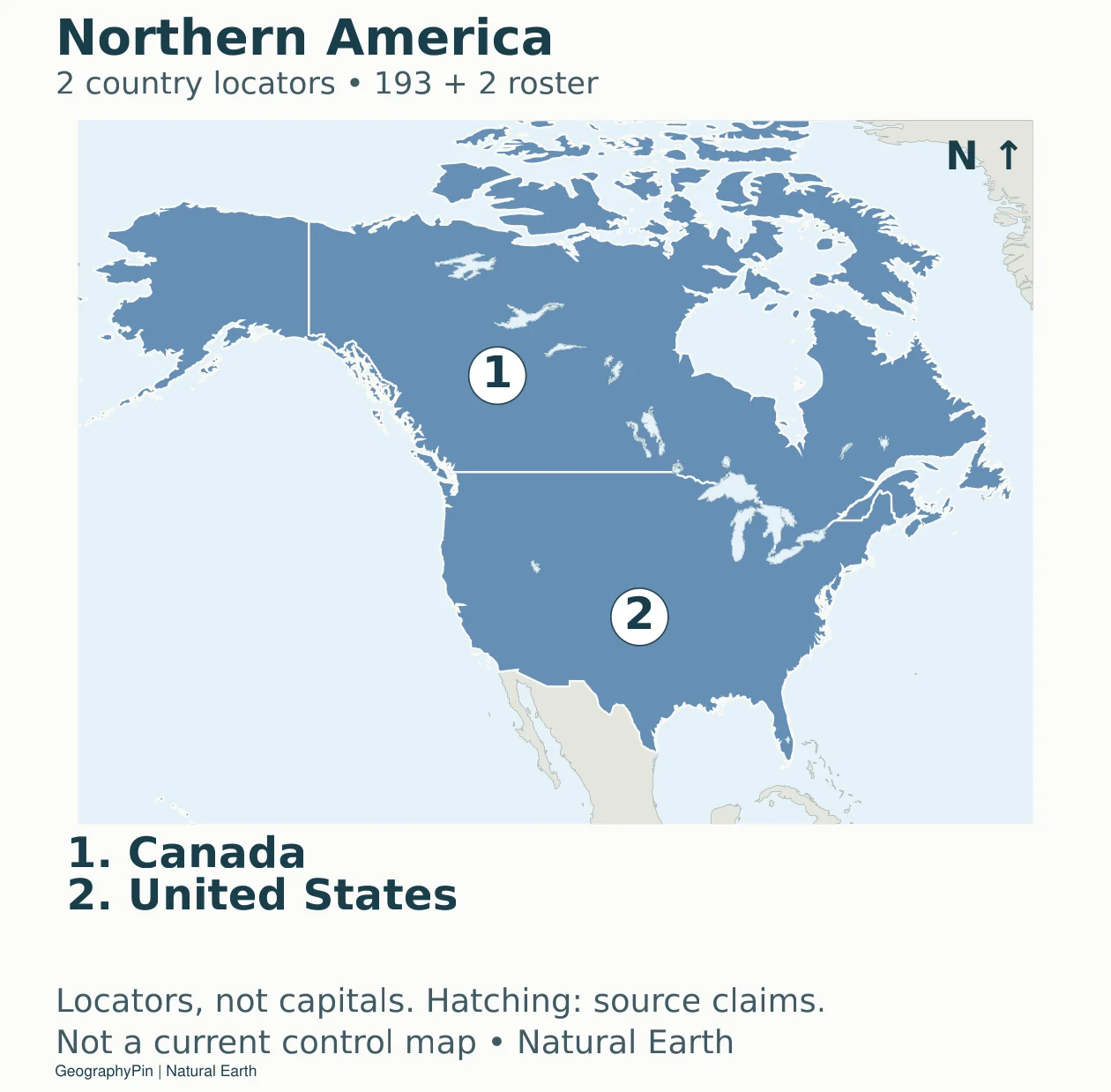
Download the Northern America sheet (PDF).
Accessible map key: 1. Canada; 2. United States.
Central America: 8 country locators
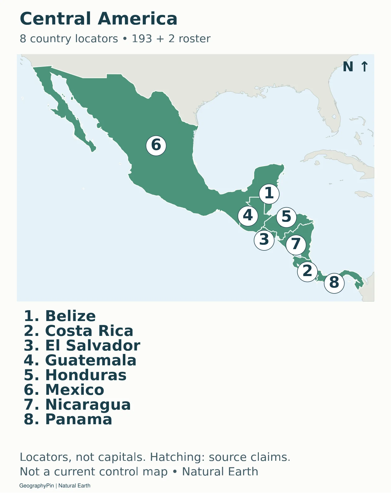
Download the Central America sheet (PDF).
Accessible map key: 1. Belize; 2. Costa Rica; 3. El Salvador; 4. Guatemala; 5. Honduras; 6. Mexico; 7. Nicaragua; 8. Panama.
Caribbean: 13 country locators
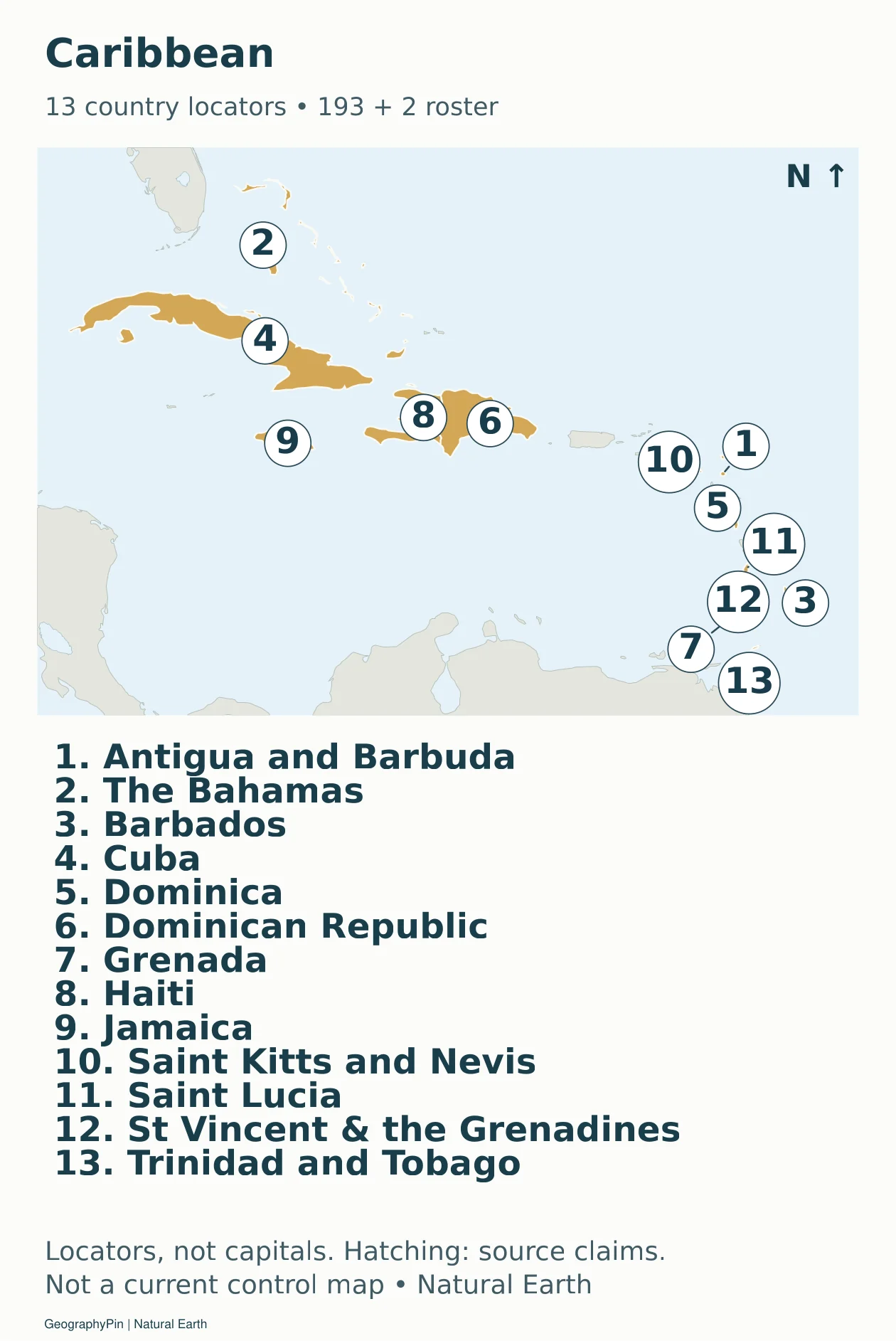
Download the Caribbean sheet (PDF).
Accessible map key: 1. Antigua and Barbuda; 2. The Bahamas; 3. Barbados; 4. Cuba; 5. Dominica; 6. Dominican Republic; 7. Grenada; 8. Haiti; 9. Jamaica; 10. Saint Kitts and Nevis; 11. Saint Lucia; 12. Saint Vincent and the Grenadines; 13. Trinidad and Tobago.
South America: 12 country locators
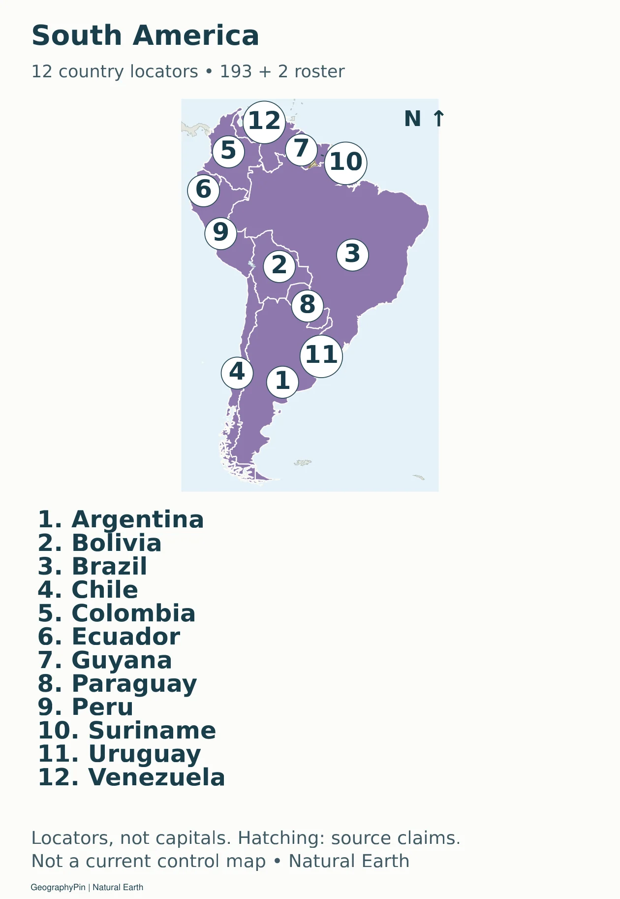
Download the South America sheet (PDF).
Accessible map key: 1. Argentina; 2. Bolivia; 3. Brazil; 4. Chile; 5. Colombia; 6. Ecuador; 7. Guyana; 8. Paraguay; 9. Peru; 10. Suriname; 11. Uruguay; 12. Venezuela.
Central Asia: 5 country locators
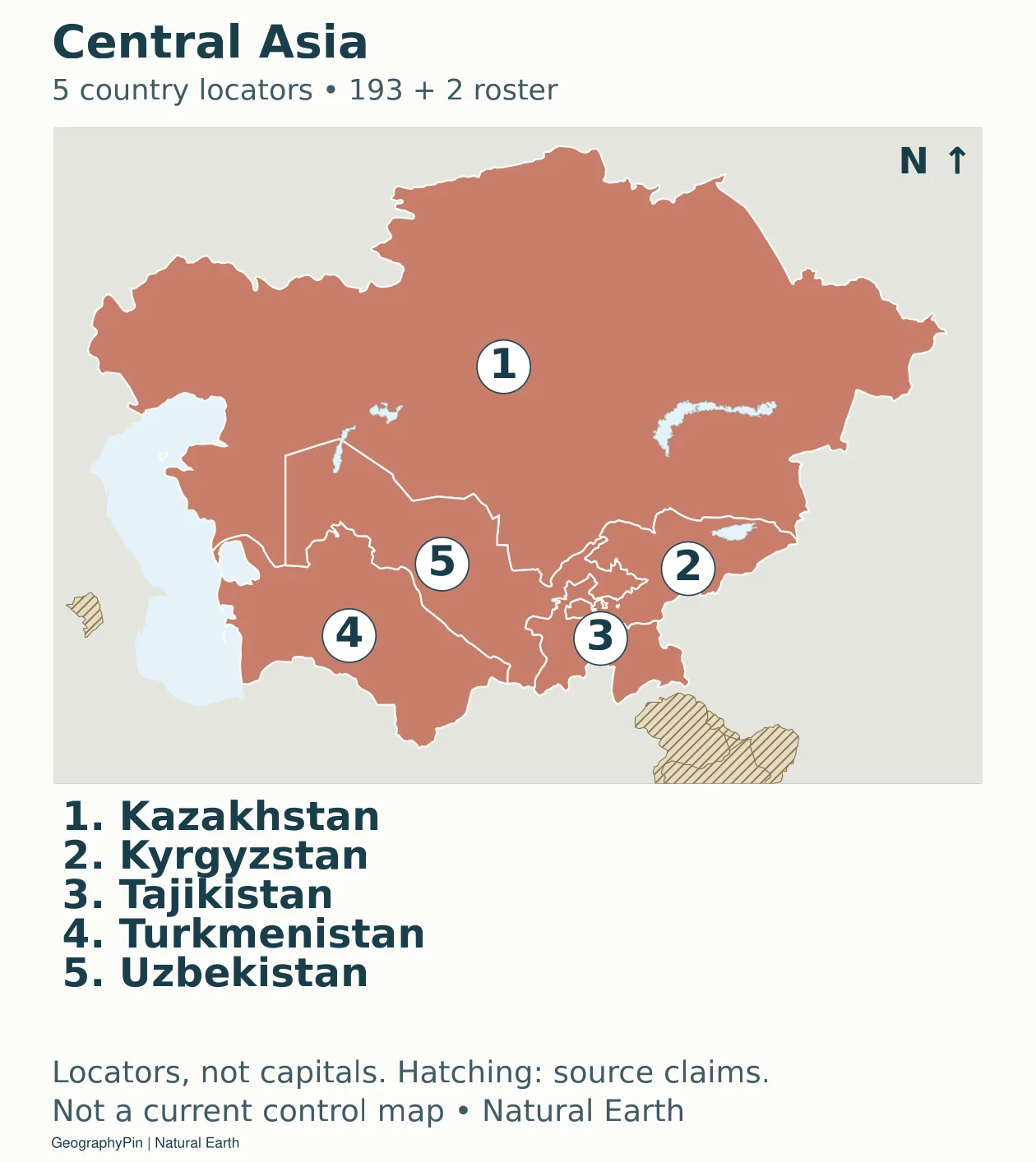
Download the Central Asia sheet (PDF).
Accessible map key: 1. Kazakhstan; 2. Kyrgyzstan; 3. Tajikistan; 4. Turkmenistan; 5. Uzbekistan.
Eastern Asia: 5 country locators
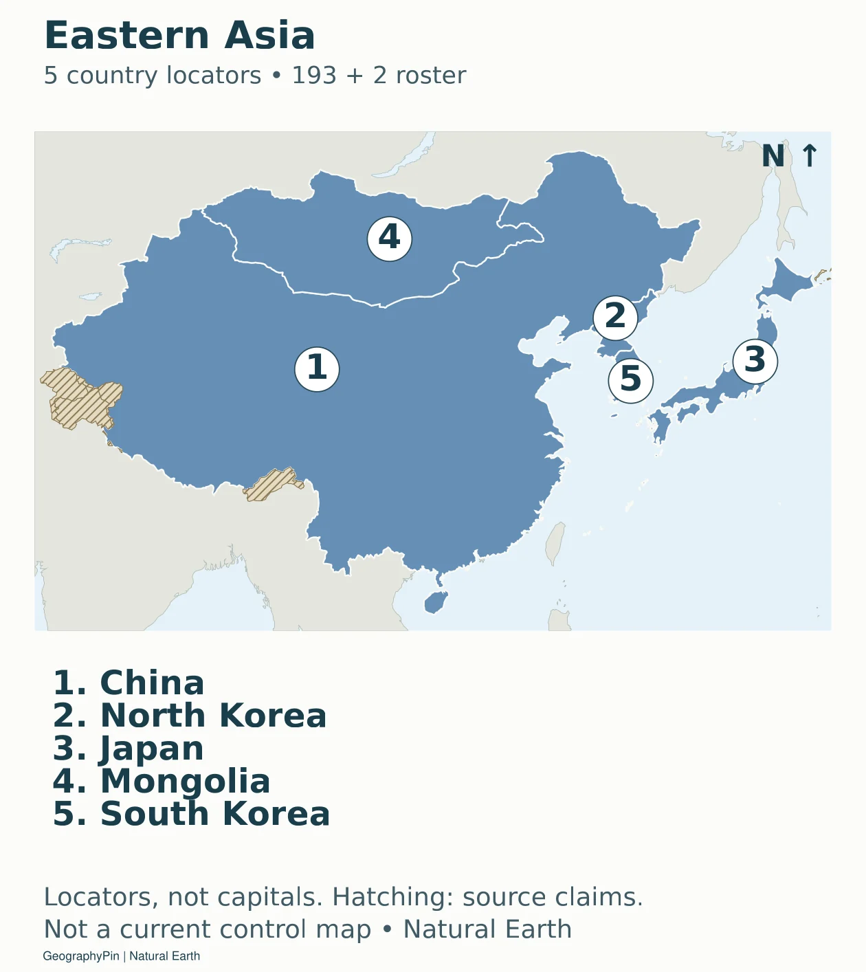
Download the Eastern Asia sheet (PDF).
Accessible map key: 1. China; 2. North Korea; 3. Japan; 4. Mongolia; 5. South Korea.
Southern Asia: 9 country locators
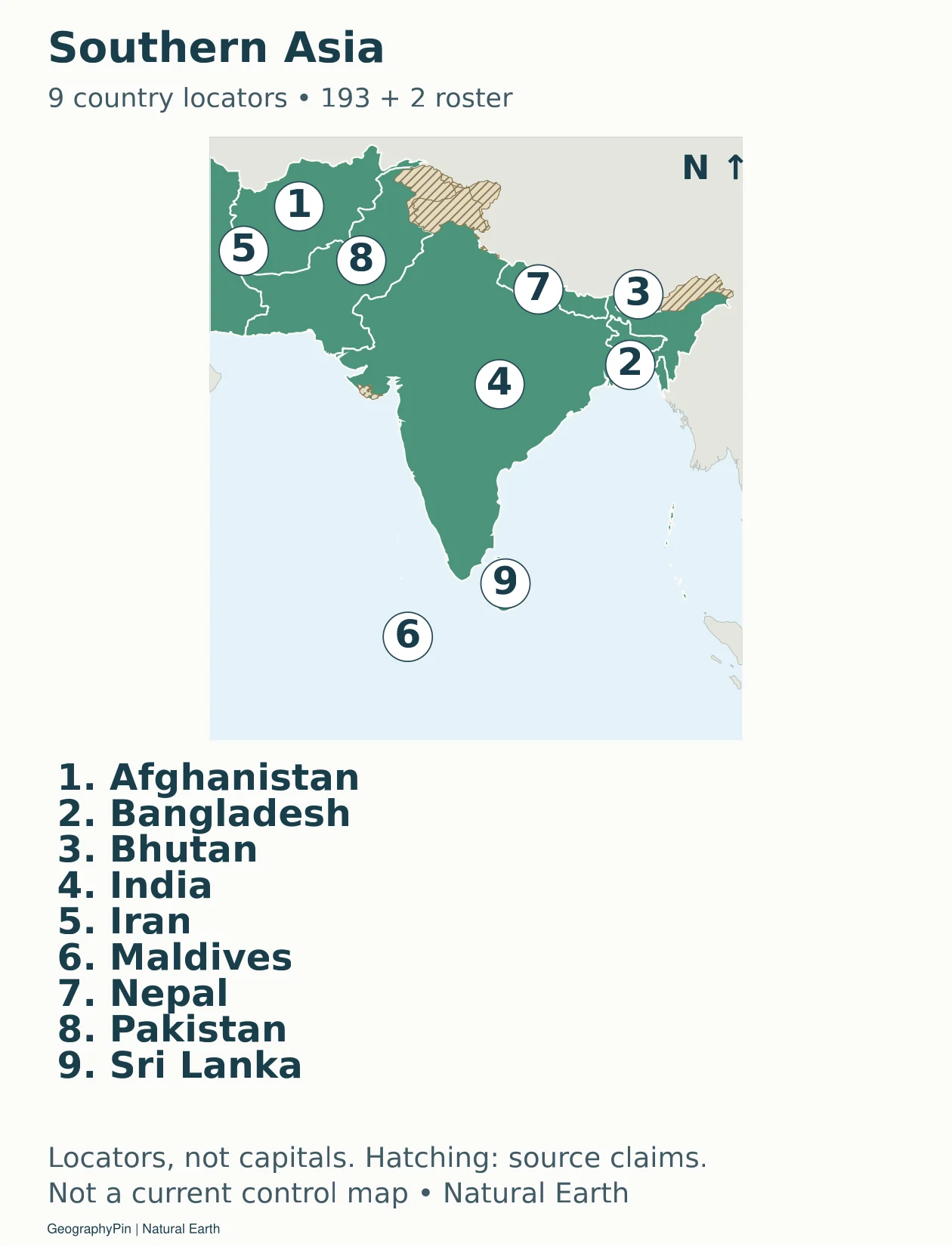
Download the Southern Asia sheet (PDF).
Accessible map key: 1. Afghanistan; 2. Bangladesh; 3. Bhutan; 4. India; 5. Iran; 6. Maldives; 7. Nepal; 8. Pakistan; 9. Sri Lanka.
South-eastern Asia: 11 country locators
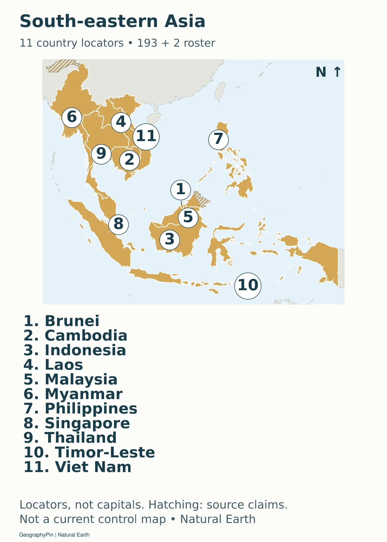
Download the South-eastern Asia sheet (PDF).
Accessible map key: 1. Brunei; 2. Cambodia; 3. Indonesia; 4. Laos; 5. Malaysia; 6. Myanmar; 7. Philippines; 8. Singapore; 9. Thailand; 10. Timor-Leste; 11. Viet Nam.
Caucasus and Türkiye: 5 country locators
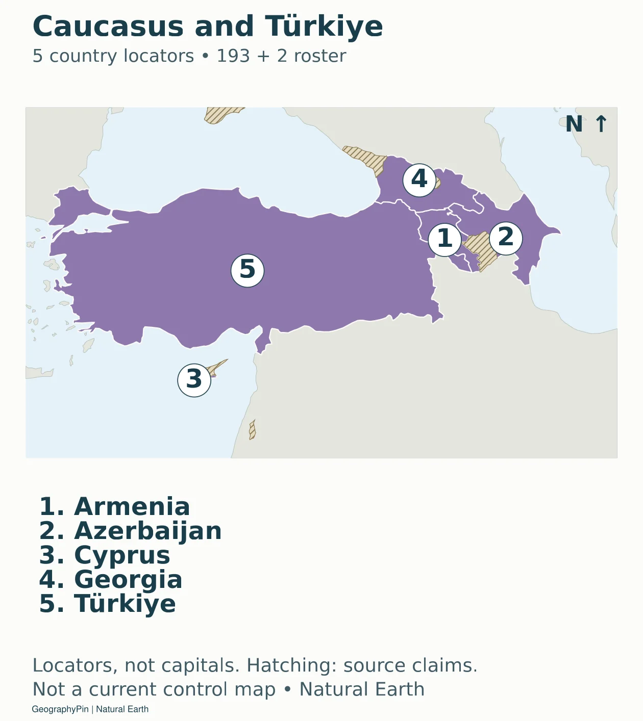
Download the Caucasus and Türkiye sheet (PDF).
Accessible map key: 1. Armenia; 2. Azerbaijan; 3. Cyprus; 4. Georgia; 5. Türkiye.
Levant and Iraq: 6 country locators
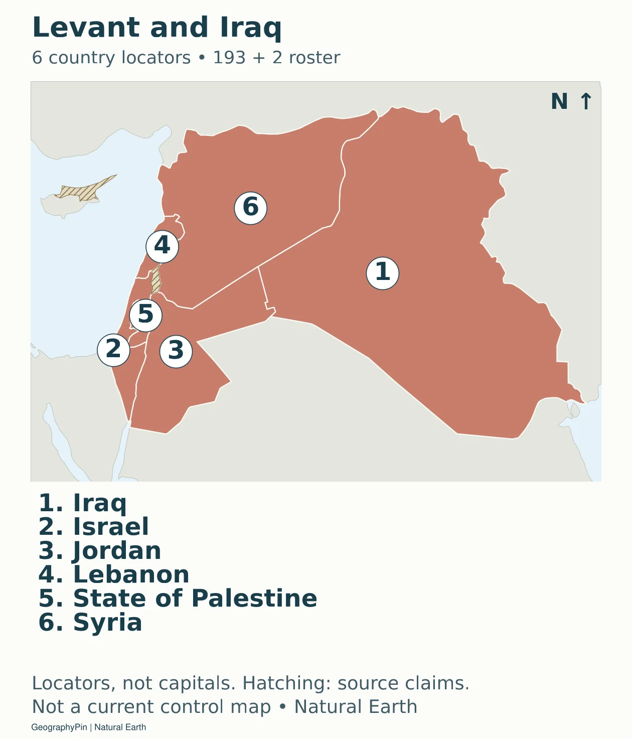
Download the Levant and Iraq sheet (PDF).
Accessible map key: 1. Iraq; 2. Israel; 3. Jordan; 4. Lebanon; 5. State of Palestine; 6. Syria.
Arabian Peninsula: 7 country locators
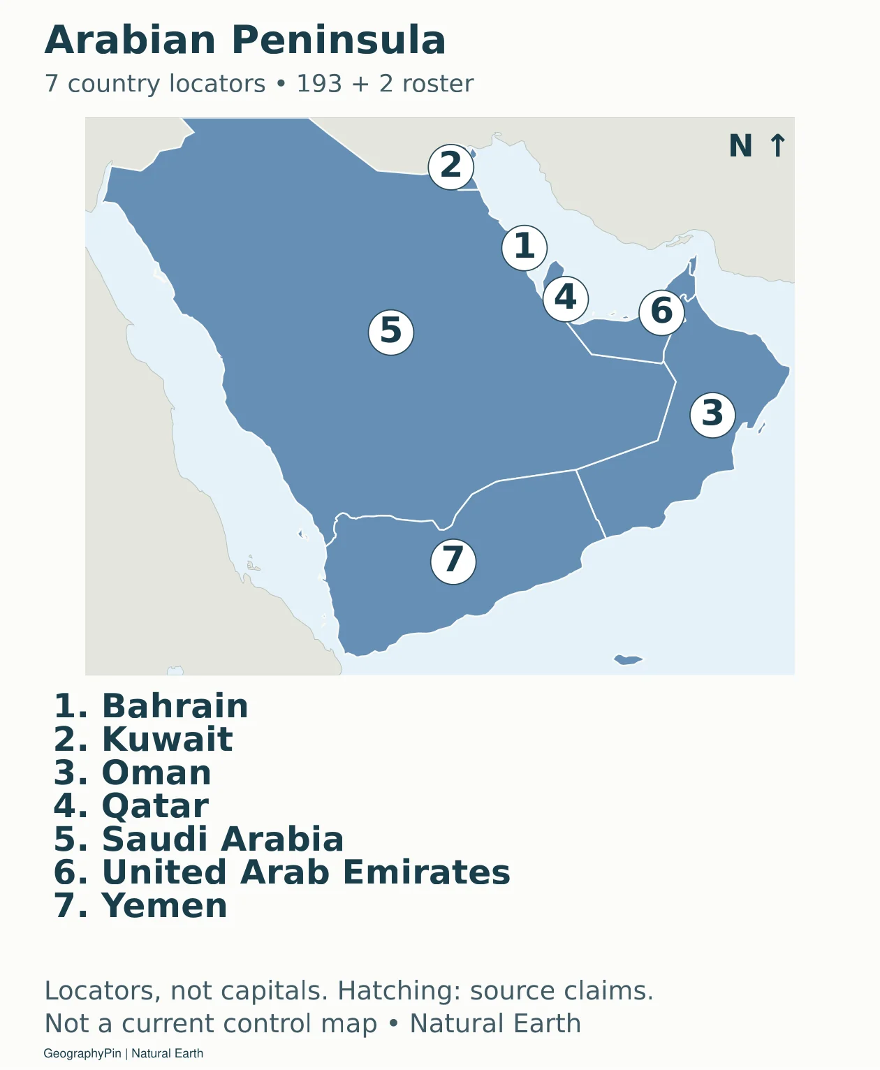
Download the Arabian Peninsula sheet (PDF).
Accessible map key: 1. Bahrain; 2. Kuwait; 3. Oman; 4. Qatar; 5. Saudi Arabia; 6. United Arab Emirates; 7. Yemen.
Southwest Pacific: 6 country locators
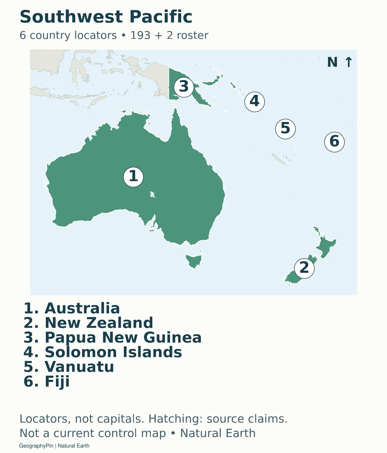
Download the Southwest Pacific sheet (PDF).
Accessible map key: 1. Australia; 2. New Zealand; 3. Papua New Guinea; 4. Solomon Islands; 5. Vanuatu; 6. Fiji.
Pacific island states: 8 country locators
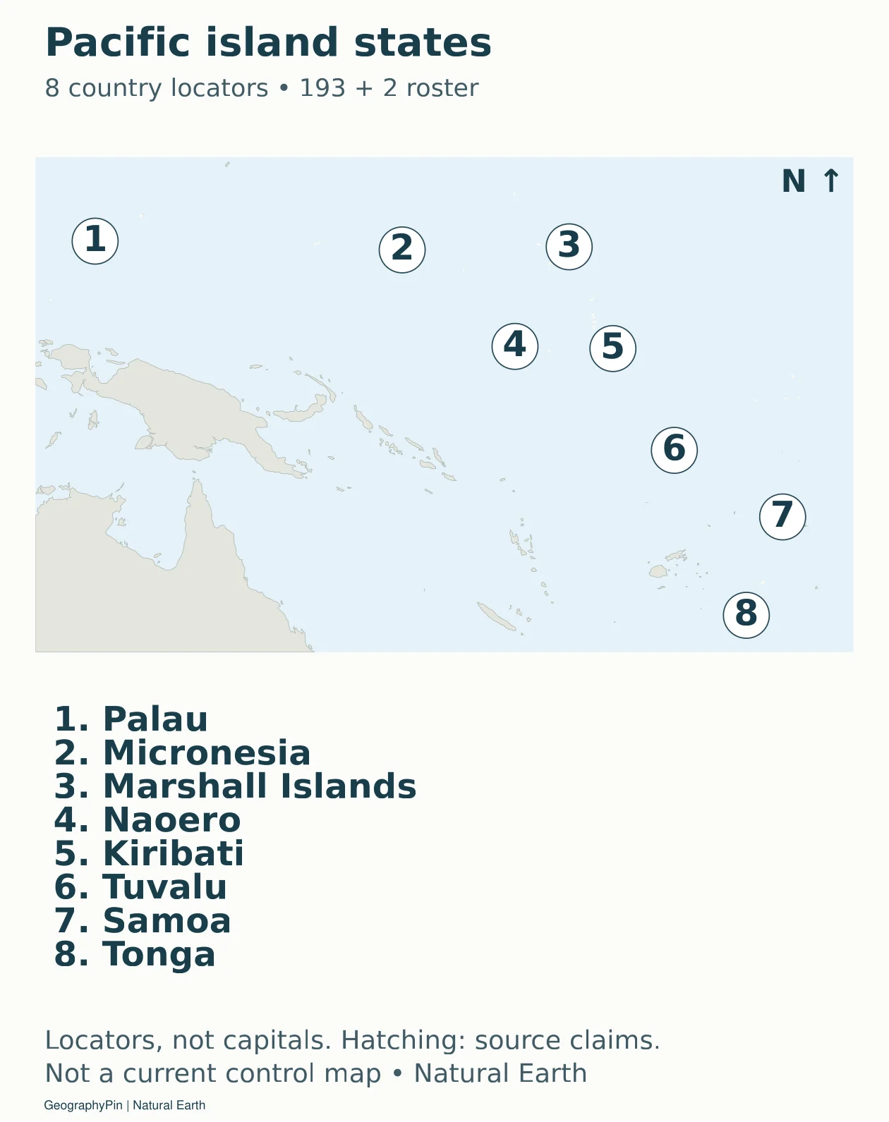
Download the Pacific island states sheet (PDF).
Accessible map key: 1. Palau; 2. Micronesia (Federated States of); 3. Marshall Islands; 4. Naoero; 5. Kiribati; 6. Tuvalu; 7. Samoa; 8. Tonga.
The numbered keys identify countries. For capitals, see our world capital cities reference. Do not place a capital at one of this atlas’s country-number anchors: the number marks a point inside a country, not its seat of government.
3. Read the Country and Boundary Conventions
What the 195-country scope includes
The roster is based on the United Nations Library’s current member-state resources, plus its two listed non-member observer states. It includes the Holy See, located on the map through Vatican City, and the State of Palestine. Dependent territories and additional disputed or partially recognized entities are not added to reach a different total. The wider question is explained in our country-count guide.
Each of the 195 entries appears once in the numbered sheets. A single number does not promise to show every part of a country’s territory: regional crops can omit remote possessions or islands. Russia is keyed on the Eastern Europe sheet following M49 classification, while the world overview shows its Asian extent. The Caucasus, Türkiye and Cyprus are placed on a shared readable sheet; that sheet is a layout choice, not a newly defined continent.
Current naming is taken from the retrieved UN roster rather than copied from an older map dataset. In particular, the UN now lists Naoero, formerly Nauru. The original Natural Earth geometry still uses the older label, so the country code links the current display name to the same island geometry. The CSV preserves current UN names alongside shorter map labels such as North Korea, South Korea and Micronesia.
How disputed areas and recognition are handled
Natural Earth’s generalized country and disputed-area layers provide the outlines. Their version is 5.1.1, and their default convention is generally de facto. This atlas does not treat that convention as a universal statement of sovereignty or claim that a source polygon is a current military front. Hatching is a warning to read the map with that limitation, not proof that every contemporary dispute has been independently mapped.
Several explicit reconciliations keep the roster and source geometry from contradicting each other. The source Crimea polygon is allocated to Ukraine and hatched, following the territorial-integrity position in UN General Assembly resolution 68/262. Western Sahara is removed from Morocco’s selected-state fill and shown separately with hatching. Somaliland is included in Somalia’s single roster entry. Kosovo is dotted and has no extra numbered entry. Taiwan remains an unnumbered contextual map unit rather than an additional UN-roster country.
Source claim areas are hatched on the broader maps, including areas outside those examples. The atlas is therefore suitable for learning where countries are, but not for settling a legal boundary, comparing territorial claims, or inferring present control. A neutral caption does not make old geometry current. Before using a disputed-area detail for a news or legal purpose, consult a current authoritative map for that specific issue.
4. Download and Use the Printable Maps
Atlas, blank map and country-key downloads
Download the complete 22-sheet country atlas (PDF) · Download the blank world map (PDF) · Download the 195-entry country key (CSV).
For a short exercise, choose one regional sheet and cover its name key. Match the numbered locations to the names, then check your answers against the adjacent text key. For a global exercise, use the blank overview to locate broad regions first. Tiny islands and microstates are better marked with numbered dots and leader lines than squeezed-in names.
The full-size map links make the original image available without forcing every phone reader to download the whole atlas at once. PDFs preserve vector outlines and text for printing; use “fit to page” if your printer requires it. A larger print remains generalized at the source map scale and should not be mistaken for a survey map. Regional numbers restart on each page, so keep the sheet title with each answer.
A blank map is not free of assumptions. The supplied worksheet uses the same source boundary convention and disputed-area markings as the reference maps. Students comparing another atlas should identify differences in counting and boundary treatment before deciding that one map has simply forgotten a country.
Frequently Asked Questions
How many countries are shown on this world map?
The atlas has 195 numbered entries: 193 United Nations member states and the two UN non-member observer states, the Holy See and the State of Palestine. Each appears on one regional sheet.
Why do different world maps show different numbers of countries?
They may use different counting rules. Some include dependent territories or additional partially recognized states, while others count only UN members. Compare the roster and boundary notes rather than assuming the numbers measure the same thing.
Where can I find small countries that are hard to see on a world map?
Open the relevant regional sheet. Numbered locators and the nearby name key identify small island countries and microstates without enlarging their actual territory. The numbers mark country locations, not capitals.
Can I print a blank world map for practice?
Yes. The downloads section includes a blank world map and the complete regional atlas as PDFs. Print the blank map for broad-location practice and use regional sheets for small countries and islands.
What Did We Learn Today?
A readable world atlas needs both a clear counting rule and a practical labeling system. This version gives all 195 entries in the 193-plus-2 roster a country locator across 22 sheets, with islands and microstates included. The labels are complete for that roster; the maps are not a claim to resolve every boundary dispute or show current military control.
Sources & Data Notes
Membership and names come from the retrieved UN roster; M49 supplies codes and broad grouping. Natural Earth 1:50m version 5.1.1 supplies generalized country polygons under public-domain terms; its 1:10m major-lake layer distinguishes large inland waters from land. The country key contains 195 unique entries. Numbered points are locator symbols, not surveyed boundary or capital measurements. Country locators are not capital coordinates. This is a reference locator atlas, not a current conflict map. Disputed-area hatching follows the source dataset and may reflect historical classifications rather than present conditions.
- UN Library: current member-state roster
- UN Library: Holy See and State of Palestine observer status
- UN member-state profile: Naoero name change
- UN M49: codes and geographic groupings
- UN General Assembly resolution 68/262
- Natural Earth: boundary convention
- Natural Earth: public-domain terms
- Natural Earth: 1:10m lake geometry