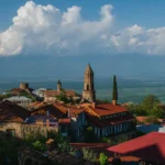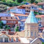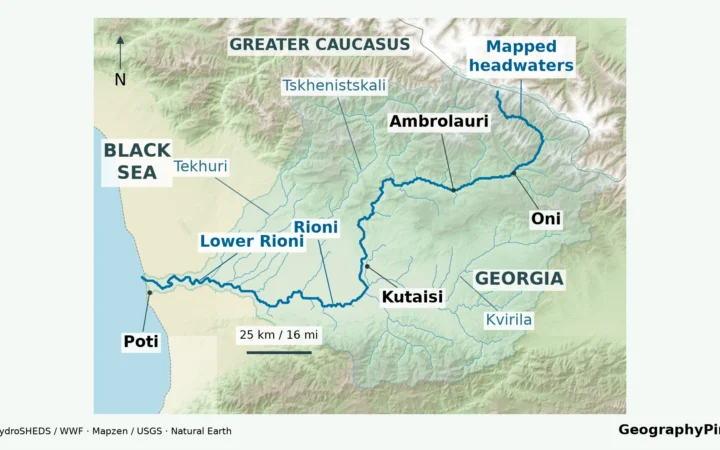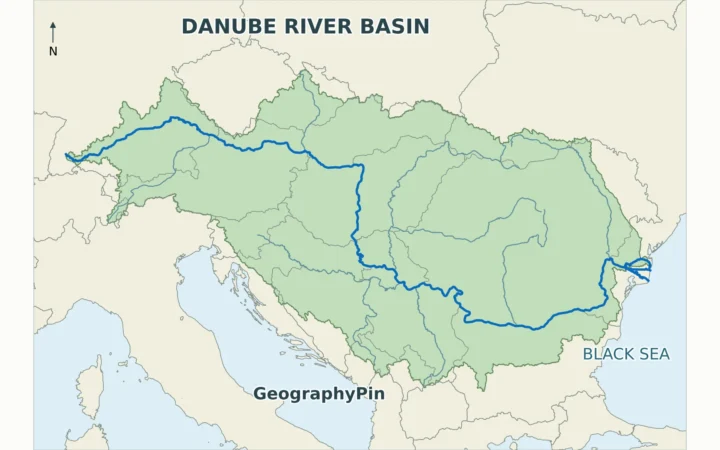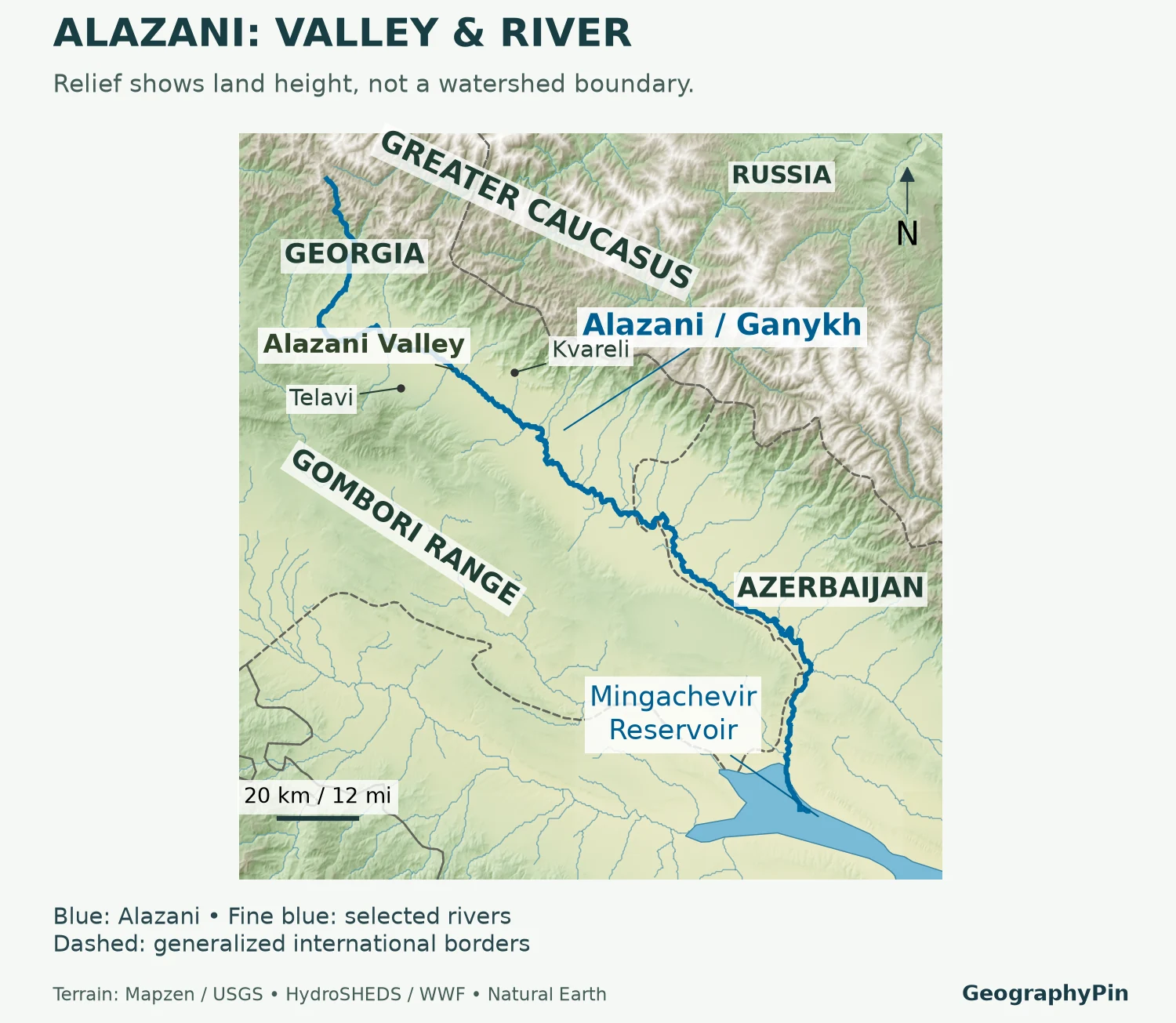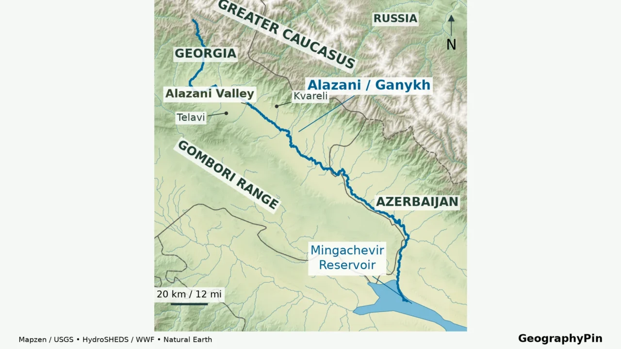
The familiar view across Kakheti is a broad lowland framed by mountains. A river map shows something larger: headwaters, tributary valleys, a cross-border river and a downstream reservoir. Confusing those two views can turn a useful Alazani Valley map into a misleading outline.
The Alazani Valley lies in eastern Georgia, between the Greater Caucasus and the Gombori side of Kakheti. Its river, also called Ganikh in Azerbaijan, flows toward Mingachevir Reservoir in the Kura system. The lowland valley, the wider drainage basin and legally defined wine-production areas have different boundaries.
How to use this article: Start with the map-reading sequence, check left and right tributaries, or compare river-length conventions.
1. Read the Alazani Valley Map
Begin in Kakheti, east of Tbilisi. Across the central valley, the Greater Caucasus rises to the north and northeast; the Gombori Range forms the opposite, southwestern side. Telavi and Gurjaani help identify that side of the landscape, while Kvareli and Lagodekhi orient the Caucasus foothill side. These towns are reference points, not corners of a rectangular valley.

Three things to follow on the map
- Follow the main river first. Its course is not the straight centerline of the visible lowland, and it continues beyond the best-known vineyard landscape.
- Look outward to the tributaries. Their mountain valleys belong to the water system even where the terrain no longer resembles the broad Alazani plain.
- Keep the national border in view. The downstream geography links Georgia and Azerbaijan. A map cropped at Georgia’s edge cannot explain the whole river.
The municipal Sighnaghi geography description treats the Alazani plain as an accumulation landscape, formed from sediments, sloping southeast. Its settlement pattern follows the margins as well as the lowland. This is why a panoramic photograph and a watershed map can show the same region while emphasizing very different shapes.
For places to stay, monasteries and trip planning, use the Kakheti travel guide. The map here answers where the land and water fit together; it is not a road, walking-route or border-crossing map.
2. Follow the River from Mountains to Reservoir
The Alazani begins in the Greater Caucasus. Georgia’s National Environmental Agency describes its upper headwater system near Mount Borbalo, followed by the Pankisi reach and the confluence with the Ilto. It then runs generally southeast through the lowland before turning toward Mingachevir Reservoir in Azerbaijan.
The reservoir belongs to the Kura, also called Mtkvari, drainage system. That is the connection to the Caspian Sea: the Alazani does not independently reach the sea. On a modern map, use the reservoir as the downstream receiving water rather than assuming that a historic river confluence still appears as an unchanged meeting of two narrow channels.
Left and right mean looking downstream
River banks are named while facing the direction of flow. On the central Alazani’s southeast-trending reach, the Caucasus side is generally the left-bank side and the Gombori side the right-bank side. The rule follows the river through its bends; it does not mean “left side of the page.”
| Side | Examples | How to read them |
|---|---|---|
| Left bank | Stori, Lopota, Chelti, Duruji | Streams descending from the Greater Caucasus side. |
| Right bank | Ilto, Turdo, Kisiskhevi, Chermiskhevi | Tributaries joining from the opposite side of the main river. |
| Downstream cross-border system | Agrichay/Ayrichay | A named tributary connection in Azerbaijan, not another name for the Alazani. |
The bank assignments follow the Telavi water-supply environmental examination. The 2023 Azerbaijan–Georgia survey also identifies the Alazani–Agrichay confluence among its monitoring locations. Transliterations vary between sources, so spelling differences alone do not establish that two river names refer to different streams.
3. Why the Valley Is Not the Watershed
A valley is a landform. A watershed, or drainage basin, is the land contributing surface water to a specified outlet. The outlet matters: a basin measured above an upstream monitoring station excludes land draining into the river farther downstream.
As the USGS explains, a drainage divide separates neighboring catchments. It is normally traced through the surrounding high ground, not along the edge of a field, a province or the visually flat part of a valley. A valley map and a watershed map therefore answer different questions.
| Area | What defines it? |
|---|---|
| Alazani Valley or plain | The lowland landscape and surrounding landforms. |
| Alazani/Ganikh drainage basin | Water flowing toward an identified outlet, including tributary catchments. |
| Kakheti | A Georgian administrative and historical regional context, not a hydrologic boundary. |
| Wine microzone | The production-area definition for a particular protected wine name. |
The broader water-management label Alazani–Iori introduces another distinction. A planning document can group the Alazani and neighboring Iori within one management unit. That grouping does not make the Iori part of the Alazani’s tributary network, nor does it turn the whole management district into the Alazani Valley.
For a map-based comparison, first identify the outlet and the kind of boundary. Then compare like with like: whole basin with whole basin, or valley floor with valley floor. Comparing a national management district with a transboundary catchment can produce a convincing-looking but meaningless size difference.
4. Read the Landscape Across the Valley
A cross-valley view explains why the terrain is more complicated than “mountains, then a flat plain.” Streams emerging from steep valleys carry sediment onto gentler ground. Their deposits form fans that spread outward from valley mouths. The main river and its floodplain occupy another part of the landscape.
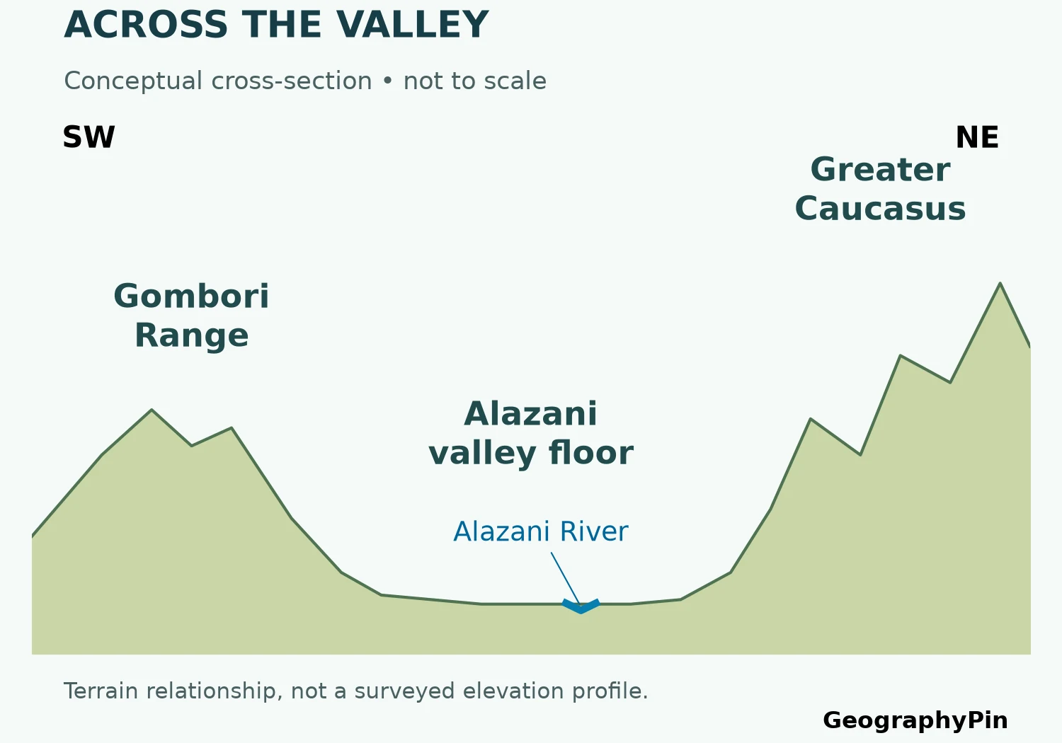
Alluvium is material deposited by flowing water: gravel, sand, silt and clay. It is not one uniform soil. The USGS hydrology glossary distinguishes these deposits from the water itself and defines an alluvial aquifer as water-bearing sediment. A surface that looks dry can still overlie groundwater.
The Telavi environmental examination describes the plain as complicated by tributary fans and erosion. Its local observations should not be stretched into a claim that the entire valley has the same sediment thickness, groundwater depth or flood exposure. A regional diagram teaches the arrangement; a site investigation is needed to describe a particular parcel.
Water also changes through the year. The NEA account in the transboundary survey identifies rainfall, snowmelt and groundwater as inputs, with lower winter flows and spring–summer flood episodes. A river line on a map is consequently neither the edge of every flood nor a guarantee that the surrounding ground is dry.
The practical distinction is between the channel, where water commonly flows; the floodplain, which can receive overflow; and the wider valley, which includes other surfaces and slopes. Coloring all three as one “river area” would erase information instead of explaining it.
5. How to Read the Published River Lengths
A total length is not a national section
Published institutional sources do not give one consistent Alazani length. The figures below preserve what the sources actually report rather than averaging them into a new, unsupported answer.
| Source | Reported river length |
|---|---|
| Telavi water-supply environmental examination, 2020 version | About 218 miles (351 kilometers) |
| NEA description in the Azerbaijan–Georgia 2023 survey, published 2024 | About 242 miles (390 kilometers) |
| EUWI+ Alazani/Ganikh sub-basin description | About 257 miles (413 kilometers) |
Different headwater choices, map scales and river-course definitions can affect a river-length measurement. However, the consulted descriptions do not reconcile these particular totals. It would be speculation to say that one difference represents exactly the Azerbaijani section, or that one figure is simply the Georgian section.
A river that follows a national boundary creates a further accounting problem. “Within Georgia” may be used differently from “along Georgia’s border.” Unless a source states how shared reaches are counted, subtracting a national figure from a total cannot reliably determine the length in the other country.
The basin-area figures also vary between the consulted reports. This article therefore does not print one unqualified catchment total beside the map. A precise number is useful only when its outlet, boundary dataset and scope are clear. The defensible geographic conclusion is unchanged: the river and its drainage system are transboundary, while the familiar Kakheti valley view shows only part of that system.
6. Keep Wine Boundaries Separate
The Alazani landscape is central to Georgian wine geography, but it is not the whole of Kakheti’s wine country. The National Wine Agency’s Kakheti description includes both the Alazani and Iori basins. A wine map covering the wider region should not be labeled as the boundary of this one valley.
A protected wine name works at a different scale again. For example, the agency’s Mukuzani specification places its production microzone on the Alazani’s right-bank side and describes a detailed perimeter using slopes, gorges, roads and other features. That legal production area is neither the entire valley nor the entire right bank.
To combine the layers correctly, retain the river and terrain as geographic context, then add an appellation boundary only from its actual specification or verified boundary data. Give it its own legend. A shaded catchment cannot double as a wine zone merely because vineyards occur within it.
No wine-production polygons are inferred on this map. For grape varieties, regional wines and styles, the separate Georgian wine regions guide provides that context. Keeping those subjects separate makes both maps more useful: one explains where water travels, the other where a particular production definition applies.
Frequently Asked Questions
Is Mingachevir a natural lake?
No. It is a reservoir associated with a hydroelectric scheme. Azerenerji’s power-plant inventory classifies Mingachevir as an impoundment hydropower facility. On the river map, the broad water body therefore represents stored water, not a natural lake occupying an unchanged river junction.
What Did We Learn Today?
The Alazani is easiest to understand by separating the landform from the water system. The valley is the familiar lowland; the watershed extends into tributary mountains and across the national border; wine microzones follow their own definitions. Following the river toward Mingachevir, reading banks downstream and checking the scope of measurements prevent those different geographies from being confused.
Sources & Data Notes
River-length figures are reported as source-specific values, with rounded mile conversions; they are not reconciled measurements or national-section totals. The cross-section is conceptual, not a measured elevation profile. The map does not delineate wine microzones or flood-hazard zones. Historical monitoring reports describe observations at their own dates, not present-day forecasts.
- Azerenerji: operational power-plant inventory, 2022, Mingachevir impoundment hydropower
- United Water Supply Company of Georgia: Telavi water-supply environmental examination, 2020 version, physical setting and tributaries
- EU4Environment: Transboundary Surface Water Survey Azerbaijan–Georgia 2023, published November 2024
- EUWI+: Kura–Aras and Alazani/Ganikh basin descriptions
- Sighnaghi municipal tourism: Alazani Valley
- USGS: drainage areas and divides
- USGS: Water Basics Glossary
- National Wine Agency: Kakheti wine region
- National Wine Agency: Mukuzani production specification
Map data and method: Original GeographyPin composition using Mapzen Terrain Tiles, HydroRIVERS, Natural Earth and GeoNames town locators. Relief is source-derived elevation tint and hillshade, not a catchment delineation. The river is traced through connected HydroRIVERS reaches; selected fine-blue regional rivers are context, not a complete tributary inventory. Borders and reservoir shores are generalized; source-resolution offsets are possible. Town points are approximate. GeoNames data are CC BY 4.0. SRTM and GMTED2010 terrain courtesy of USGS, with Mapzen delivery; composite terrain credits include NOAA ETOPO1 and EU-funded Copernicus EU-DEM. Data providers do not endorse this map.
River-data credit and license note
This product GeographyPin Alazani Relief Map incorporates data from the HydroSHEDS version 1 database which is © World Wildlife Fund, Inc. (2006–2022) and has been used herein under license. WWF has not evaluated the data as altered and incorporated within GeographyPin Alazani Relief Map, and therefore gives no warranty regarding its accuracy, completeness, currency or suitability for any particular purpose. Portions of the HydroSHEDS v1 database incorporate data which are the intellectual property rights of © USGS (2006–2008), NASA (2000–2005), ESRI (1992–1998), CIAT (2004–2006), UNEP-WCMC (1993), WWF (2004), Commonwealth of Australia (2007), and Her Royal Majesty and the British Crown and are used under license. The HydroSHEDS v1 database and more information are available at HydroSHEDS. River-network methodology: Lehner and Grill (2013).