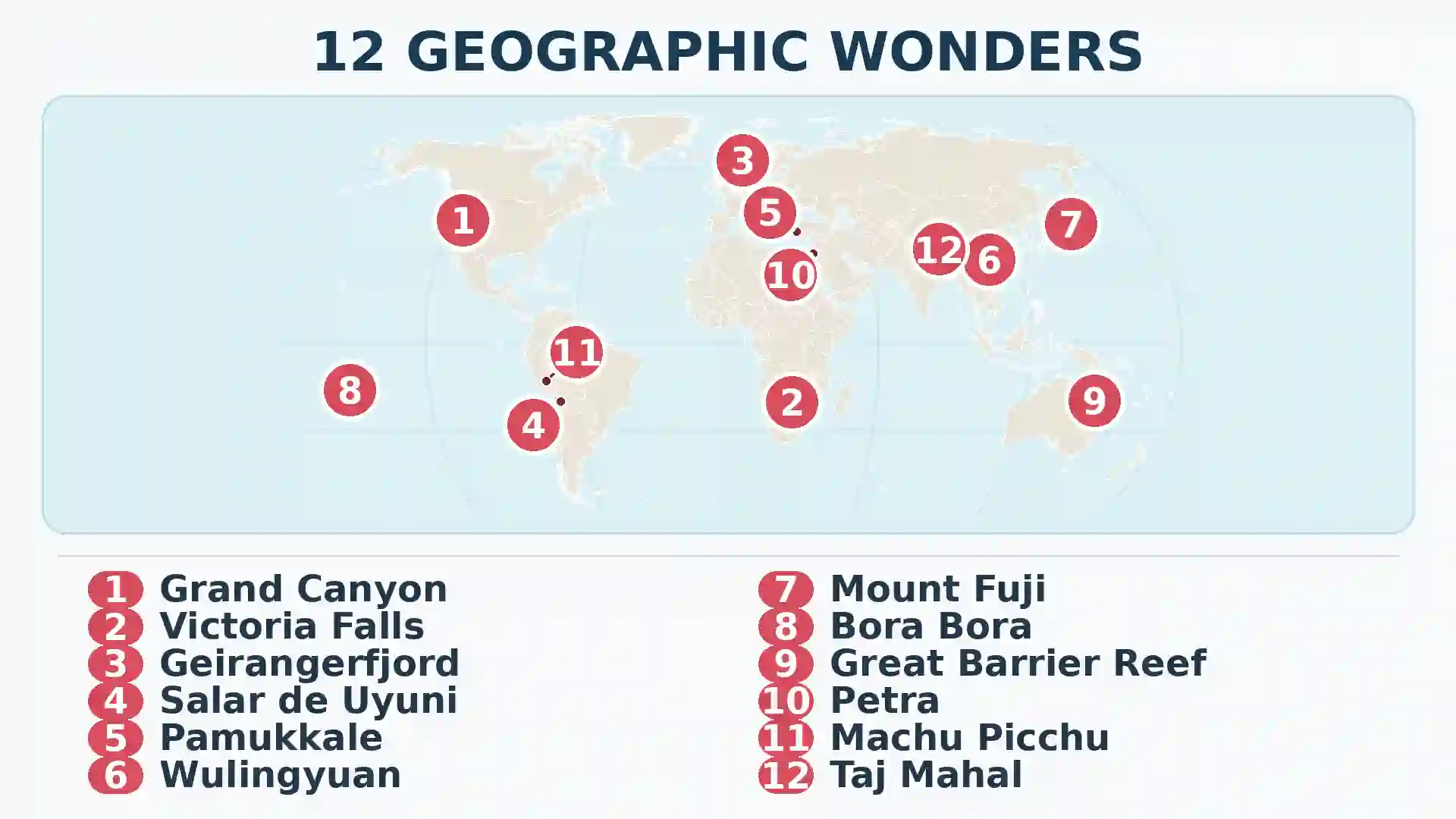
Among the world’s most beautiful places are the Grand Canyon, Victoria Falls, Geirangerfjord, Salar de Uyuni, Pamukkale, Wulingyuan, Mount Fuji, Bora Bora, the Great Barrier Reef, Petra, Machu Picchu and the Taj Mahal. This non-ranked selection spans major geographic processes and human settings.
How to use this article: Read how the places were chosen, scan the quick comparison, explore the natural processes, or jump to the human landmarks shaped by geography.
How the Twelve Places Were Chosen
Beauty is not a measurable geographic variable. There is no accepted scientific list of the most beautiful places on Earth, and this article is not another version of the ancient, natural or New Seven Wonders lists. UNESCO recognition was useful evidence of significance and conservation responsibility, but it was not treated as a beauty award. For context, our guide to what UNESCO does explains how World Heritage decisions actually work.
The selection used five editorial tests:
- A visible geographic story: the place had to show a process that readers can understand from the landscape itself.
- Global distribution: the group had to reach every inhabited continent and include inland, coastal, mountain and marine environments.
- Natural and human range: canyons and reefs belong beside cities and monuments when the surrounding geography is essential to their form.
- Reliable documentation: location, scale, history and current pressures had to be supportable through authoritative sources.
- No false precision: a subjective list should not disguise personal judgment as a universal score.
The numbers below organize the article; they do not rank the places from best to worst. A reader choosing a destination may prefer desert space, tropical water, monumental architecture or mountain relief. For a country-level comparison built around travel and photography rather than individual sites, see our separate guide to the most beautiful countries to travel to.
Twelve Places at a Glance
Each selection represents a different combination of process, setting and human meaning. The table uses ordinary geographic categories rather than forcing incompatible places into one ranking.
On a phone: swipe sideways to view all columns.
| Place | Location | Landscape type | What creates the view |
|---|---|---|---|
| Grand Canyon | United States | Canyon | River incision, uplift and layered rock |
| Mosi-oa-Tunya / Victoria Falls | Zambia–Zimbabwe border | Waterfall and gorges | Zambezi River flowing across fractured basalt |
| Geirangerfjord | Norway | Fjord | Glacial erosion followed by marine flooding |
| Salar de Uyuni | Bolivia | Salt flat | Repeated lake cycles and evaporation in a closed basin |
| Hierapolis–Pamukkale | Türkiye | Travertine terraces and ancient city | Mineral springs depositing calcium carbonate |
| Wulingyuan | China | Sandstone pillars | Weathering and erosion along fractures |
| Mount Fuji | Japan | Stratovolcano and cultural landscape | Repeated eruptions, pilgrimage and art |
| Bora Bora | French Polynesia | Volcanic island, lagoon and barrier reef | Volcanic construction, erosion and coral growth |
| Great Barrier Reef | Australia | Coral reef ecosystem | Living reef builders across a continental shelf |
| Petra | Jordan | Rock-cut desert city | Sandstone, trade routes and water engineering |
| Machu Picchu | Peru | Andean settlement | Terracing and stone construction fitted to a mountain ridge |
| Taj Mahal | India | Riverfront mausoleum and garden | Mughal planning, marble craftsmanship and the Yamuna setting |
Landscapes Cut by Water and Ice
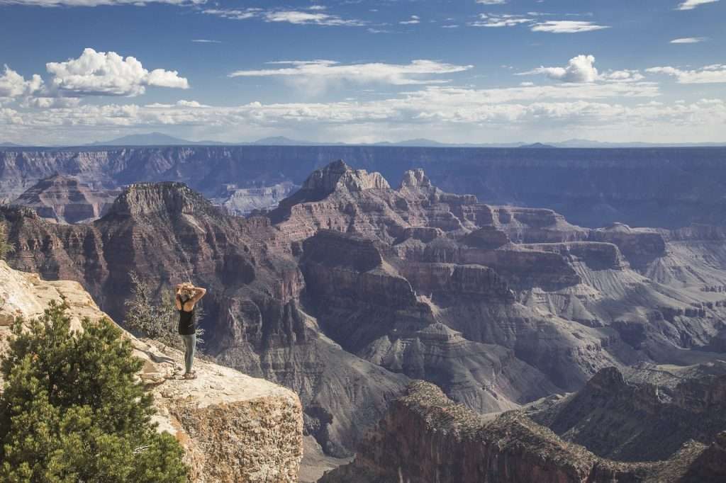
1. Grand Canyon, United States
The Grand Canyon cuts through northern Arizona for about 277 miles (446 kilometers), from Lees Ferry to the Grand Wash Cliffs. It is not the world’s deepest canyon. Its visual power comes from the combination of scale, branching side canyons and nearly horizontal rock layers that form alternating cliffs, terraces and slopes. Some rocks exposed near the river are about 1.8 billion years old, although the canyon itself is far younger.
Uplift raised the plateau while preserving much of its layered structure. The Colorado River drove the main downcutting, but tributary floods, weathering, freeze-thaw action, rockfall and the different resistance of sandstone, limestone and shale produced the stepped walls visible today. The modern canyon and river system largely developed during the past several million years, but the exact drainage history remains an active research question.
The landscape is neither empty nor untouched. It lies within the ancestral homelands of, and remains culturally connected to, 11 associated federally recognized Tribes. Glen Canyon Dam has also altered the river’s flow, temperature and sediment, while millions of annual visits add another layer of management pressure.
2. Mosi-oa-Tunya / Victoria Falls, Zambia and Zimbabwe
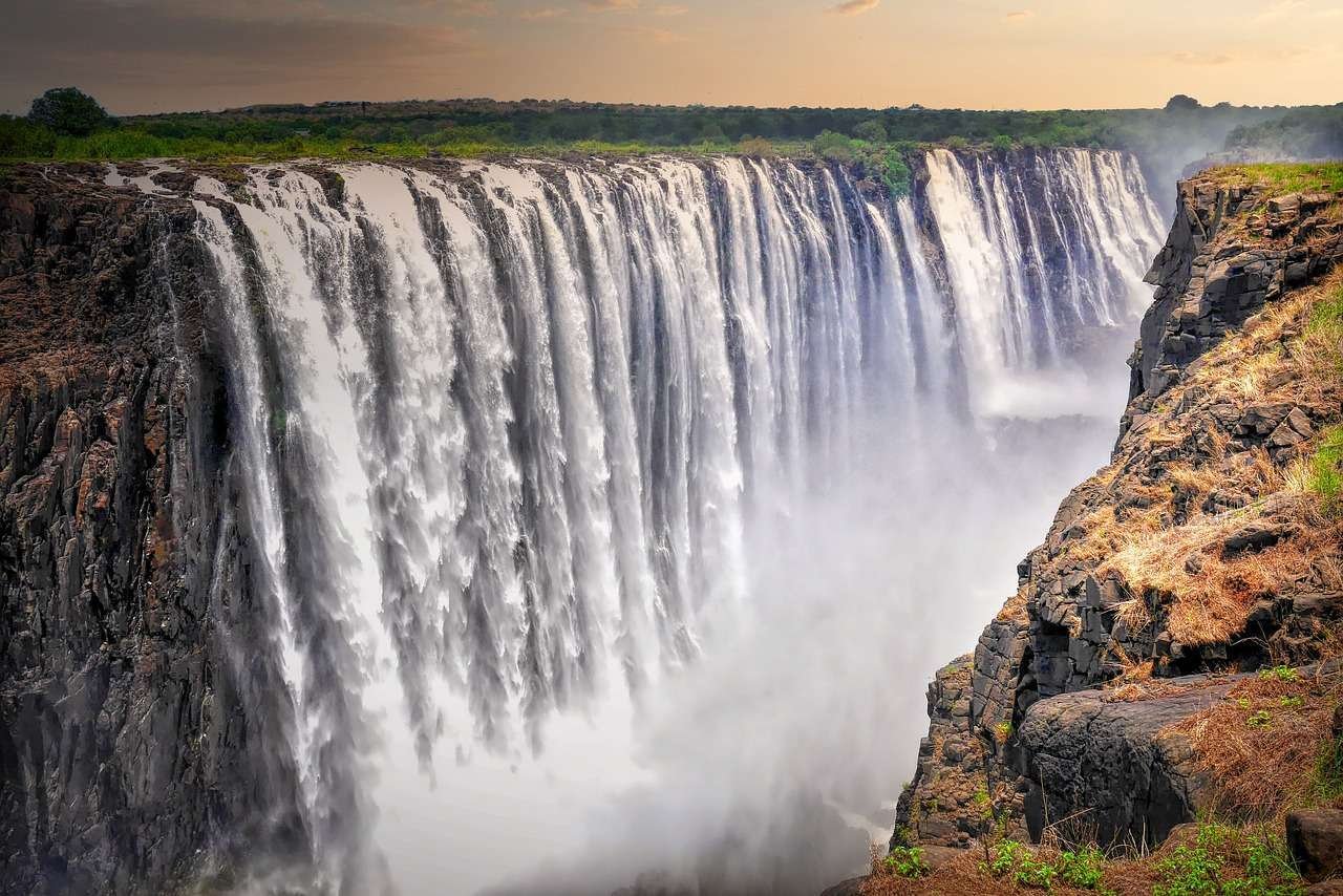
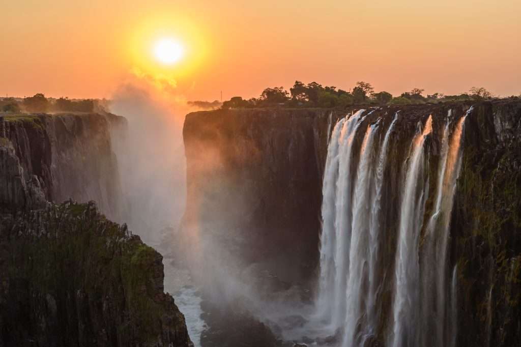
Mosi-oa-Tunya / Victoria Falls spans the Zambezi River boundary between Zambia and Zimbabwe—not South Africa. The waterfall extends about 1.06 miles (1.7 kilometers) across a broad reach of the river before dropping into a narrow chasm. The opposing wall gives visitors a near-frontal view of the curtain, while spray sustains a narrow band of riverine forest and often creates rainbows.
Water exploits intersecting fractures in the basalt. As erosion shifts the fall line upstream, it leaves a zigzag sequence of abandoned gorges downstream. The chasm reaches about 354 feet (108 meters) at its deepest, although the named falls have different drop heights. The correct superlative is not “the world’s biggest waterfall”: UNESCO describes it as the world’s largest curtain of falling water, a more specific comparison of width and height.
The appearance changes sharply with the Zambezi’s seasonal flow. High water produces a continuous curtain and dense spray; late dry-season conditions expose much more rock and can leave some sections thin. Zambia and Zimbabwe jointly protect the World Heritage property, where cumulative tourism development and the proposed Batoka Gorge hydropower project remain subjects of UNESCO monitoring.
3. Geirangerfjord, Norway
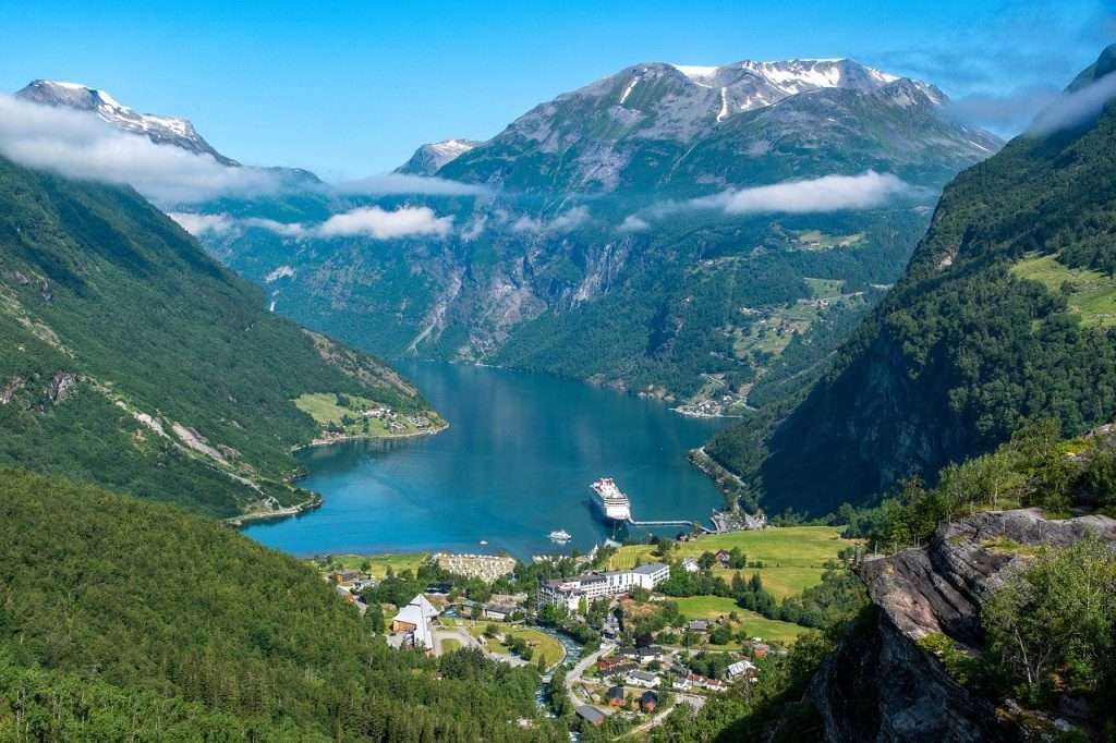
Geirangerfjord is a roughly 10-mile (16-kilometer) inner branch of the Storfjorden system in western Norway. Dark seawater, steep crystalline walls, hanging valleys and waterfalls create its familiar vertical composition. Historic farms occupy small shelves high above the water, making the scale of the slopes easier to read.
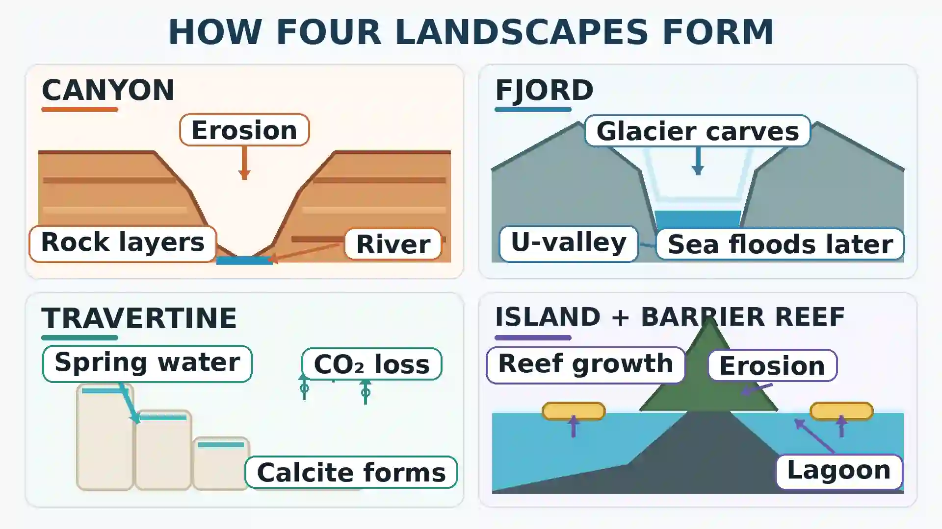
A fjord is not simply a narrow bay. Repeated Ice Age glaciers deepened and widened an earlier valley, cutting parts of its floor below sea level. After the ice retreated, seawater entered the over-deepened trough. Tributary valleys left high above the main floor now feed waterfalls such as the Seven Sisters. Geirangerfjord forms one component of the larger West Norwegian Fjords World Heritage property with Nærøyfjord.
The scene includes working settlements, roads and heavy seasonal cruise traffic; it is not an untouched wilderness. Norway’s World Heritage fjord rules took effect in January 2026 for passenger ships below 10,000 gross tonnage and extend to larger ships in 2032. The regulation also permits qualifying biogas and requires shore power where it is available.
Salt, Stone, Springs and Volcanoes
4. Salar de Uyuni, Bolivia
Salar de Uyuni covers about 3,900 square miles (10,000 square kilometers) of Bolivia’s high Altiplano at roughly 12,000 feet (3,650 meters) above sea level. In dry conditions, its salt crust resembles an immense white pavement patterned with polygons. During parts of the rainy season, a water layer only a few centimeters deep can create a mirror-like surface when the air is calm.
The salar occupies an internally drained basin where water has no route to the ocean. Repeated ancient-lake cycles deposited sediments and dissolved minerals; evaporation then concentrated salts at the surface and brine below it. Remote-sensing scientists have used the salar’s exceptional levelness and brightness to calibrate satellite instruments.
The famous mirror is seasonal, partial and weather-dependent—not a permanent lake or a guaranteed condition across the whole flat. Tourism, traditional salt collection and lithium development now overlap in the same closed high-altitude basin, making water, waste and industrial management central to its future.
5. Hierapolis–Pamukkale, Türkiye
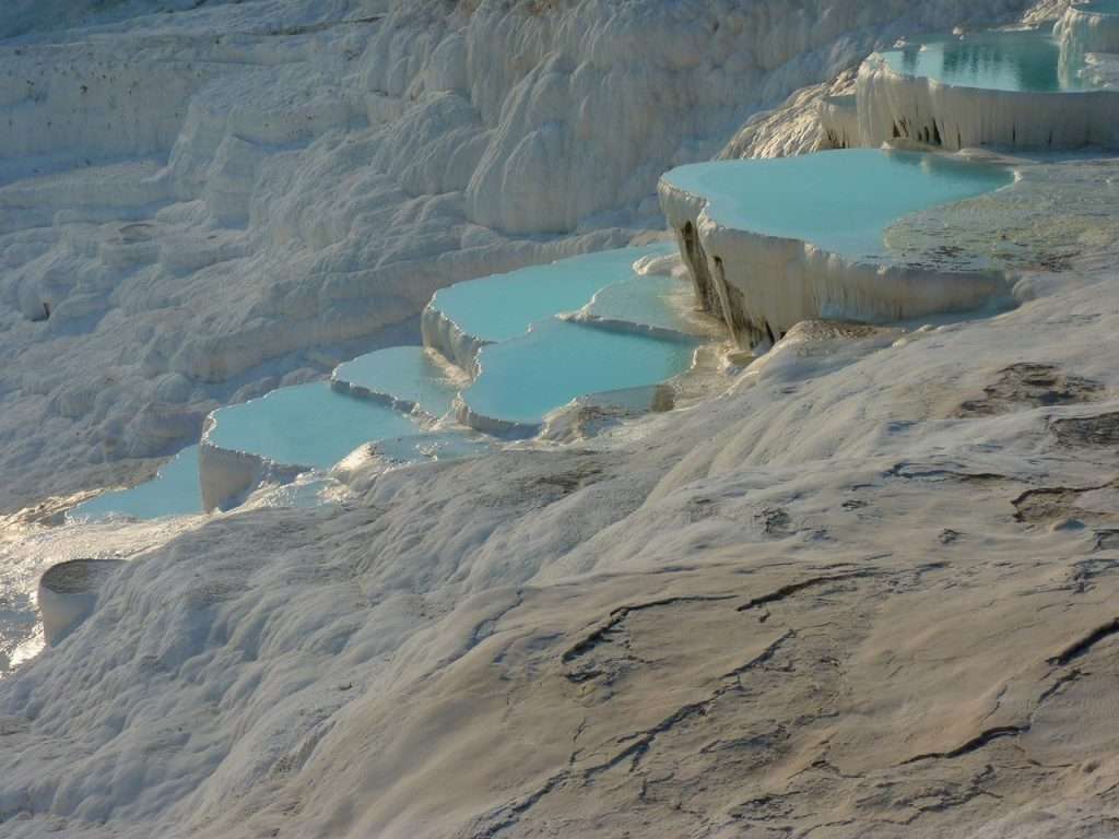
Pamukkale’s white terraces descend above the Cürüksu plain in southwestern Türkiye. They are neither snow nor salt. Warm groundwater dissolves carbonate minerals underground; when it reaches the surface, cooling and loss of carbon dioxide cause calcium carbonate to precipitate. The fresh material begins soft and gradually hardens into travertine rims, pools and curtain-like deposits.
The same springs explain why the ancient city of Hierapolis developed beside the terraces. Founded as a spa settlement in the late second century BCE, it later expanded under Roman and Byzantine rule. UNESCO therefore lists Hierapolis–Pamukkale as one mixed natural-cultural property, while the two names still identify different things: Pamukkale is the landform and Hierapolis is the adjacent city.
Water is rotated across different terrace sectors, and visitors are directed to designated access areas. Constant flow can encourage algae and discoloration, while uncontrolled walking damages carbonate that has not yet hardened. These controls help explain why every terrace does not appear blue and water-filled at the same time.
6. Wulingyuan, China
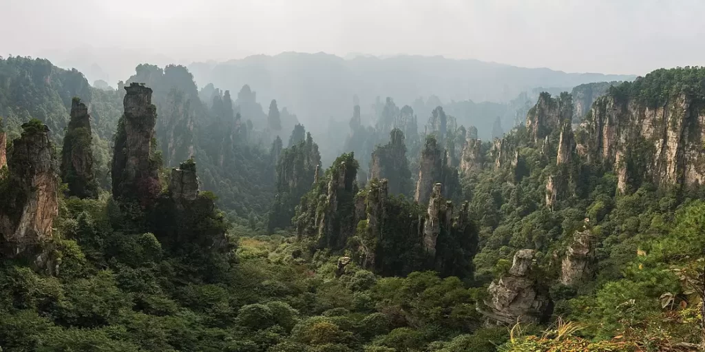
Wulingyuan in Hunan Province contains more than 3,000 narrow quartz-sandstone pillars and peaks across about 102 square miles (264 square kilometers). Many rise more than 656 feet (200 meters), with forest clinging to ledges and mist repeatedly filling the ravines. The effect resembles a stone skyline rather than one continuous mountain wall.
The towers look like limestone karst, but most are quartz-rich sandstone. Uplift and fracturing created weaknesses that water, temperature changes, plants and long-term erosion enlarged, separating resistant rock into increasingly narrow columns. The wider landscape also includes streams, waterfalls, caves and two large natural bridges.
Wulingyuan is frequently marketed through comparisons with the floating mountains in Avatar, but a fictional composite should not replace the site’s real geography. The pillars are the result of fractures, resistant sandstone and long-term erosion. Managing concentrated visitor use while protecting that landscape is the more important present-day story.
7. Mount Fuji, Japan
Mount Fuji rises 12,388 feet (3,776 meters) between Yamanashi and Shizuoka prefectures, about 62 miles (100 kilometers) southwest of Tokyo. Its broad, nearly symmetrical cone is easy to isolate against the skyline, but it is not geometrically perfect: flank vents and the Hōei craters interrupt the form.
Fuji is a basalt-dominated active stratovolcano built by repeated lava flows and explosive eruptions. Its latest eruption was the Hōei event of 1707, which opened craters on the southeastern flank and sent ash toward present-day Tokyo. “Currently quiet but active” is more accurate than calling it extinct. The wider tectonic setting also helps explain why Japan appears so prominently in our guide to countries with the most volcanoes.
Fuji’s importance cannot be reduced to geology. Pilgrimage routes, Sengen shrines, lakes and artistic viewpoints form the reason UNESCO inscribed Fujisan as a cultural property in 2013. Modern crowd controls and climbing fees are attempts to protect both the mountain environment and that cultural landscape.
Islands and Living Reefs
8. Bora Bora, French Polynesia
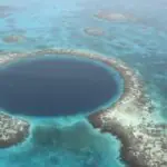
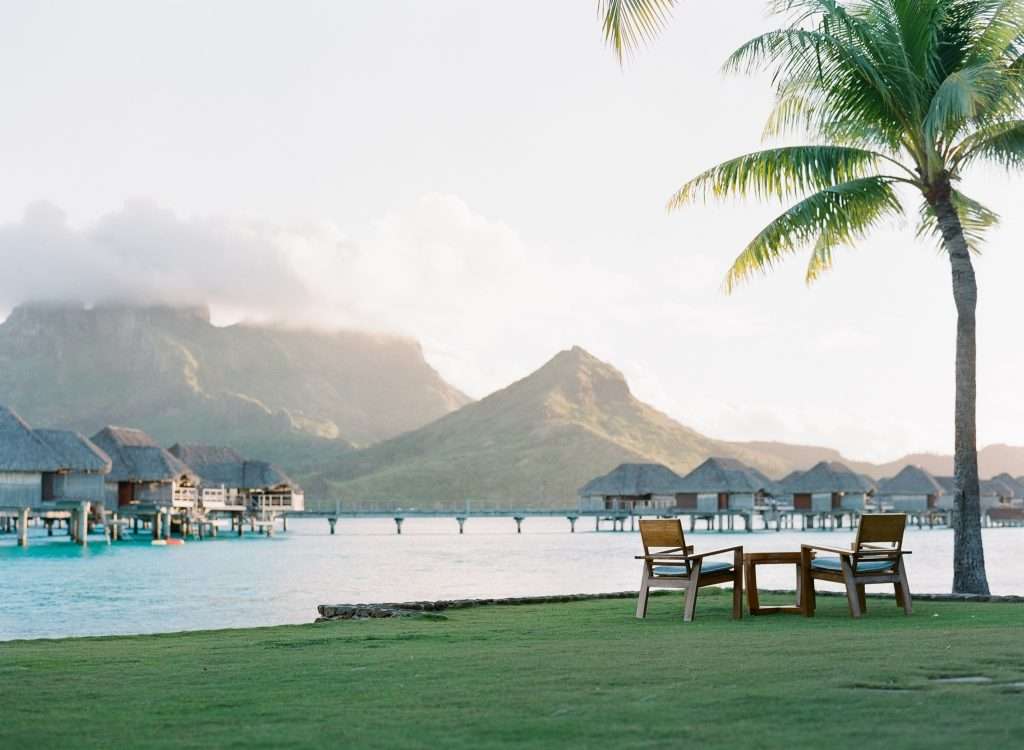
Bora Bora is a high volcanic island in the Society Islands of French Polynesia, roughly 160 miles (260 kilometers) northwest of Papeete. An eroded central volcano rises inside a turquoise lagoon, while a barrier reef and low coral islets form an outer ring. The contrast between steep dark rock, shallow bright water and a thin ocean-facing rim creates the island’s recognizable shape.
The scene records two linked processes. Volcanic eruptions first built the island above the Pacific seafloor. Erosion then lowered and dissected the cone while reef-building organisms grew around its margins. NASA describes Bora Bora as the exposed, heavily eroded remnant of an extinct volcano surrounded by an extensive coral reef and lagoon.
The lagoon is also infrastructure, livelihood and habitat—not an empty blue backdrop. Bora Bora’s heavy dependence on tourism makes wastewater treatment, solid-waste management, boat anchoring and reef health essential to the island economy. It is one small example of how volcanic and coral islands fit within the much larger geography of the Pacific Ocean.
9. Great Barrier Reef, Australia
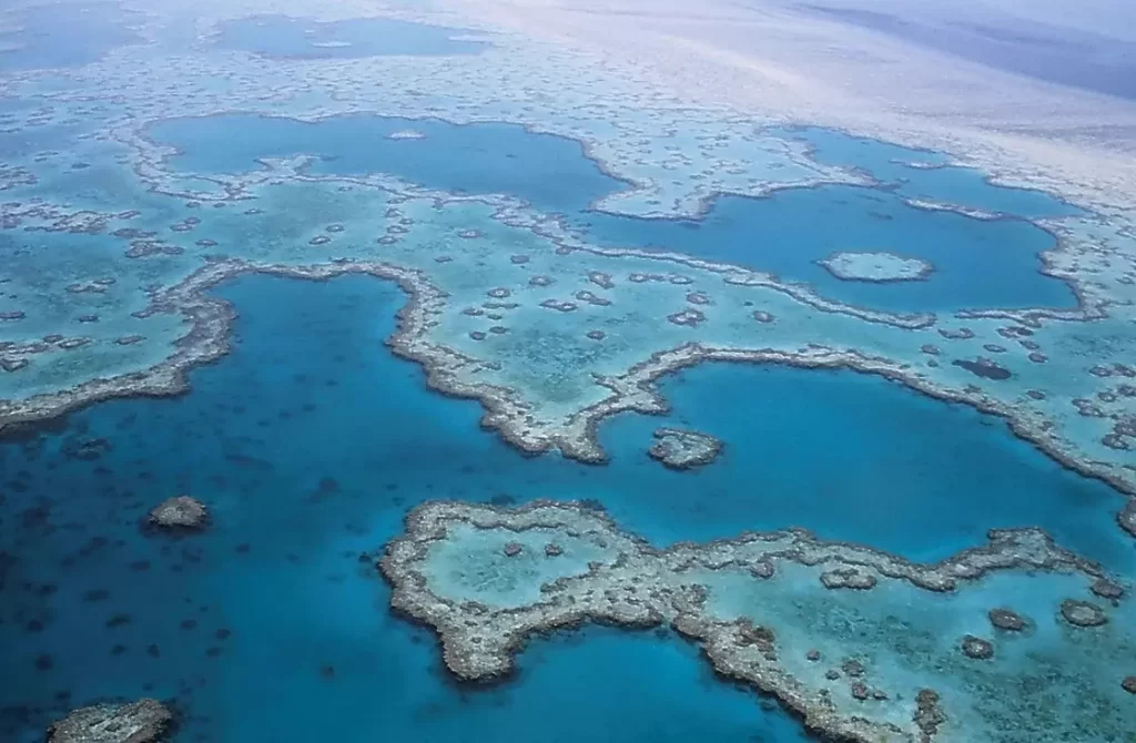
The Great Barrier Reef extends for about 1,430 miles (2,300 kilometers) along northeastern Australia and covers roughly 133,000 square miles (344,400 square kilometers). It is a mosaic rather than one unbroken wall or giant organism: the system includes about 3,000 coral reefs alongside continental islands, coral cays, mangroves, seagrass areas and deep-water habitats.
Coral polyps build calcium-carbonate skeletons, but the reef’s current shape also reflects sea-level change, waves, currents and the shallow continental shelf. Only about seven percent of the Marine Park and World Heritage Area consists of coral reefs; the rest of the protected seascape is equally important to the ecosystem.
Parts of the reef can be photographed from satellites and by astronauts using suitable lenses. The stronger claim that it is “the only living thing visible from space with the naked eye” is not a useful scientific fact. More important is its changing condition: AIMS reported in August 2026 that coral cover had begun a modest recovery from the 2024 mass-bleaching losses, while heat stress, cyclones and crown-of-thorns starfish remained continuing pressures.
Human Landmarks Shaped by Geography
10. Petra, Jordan
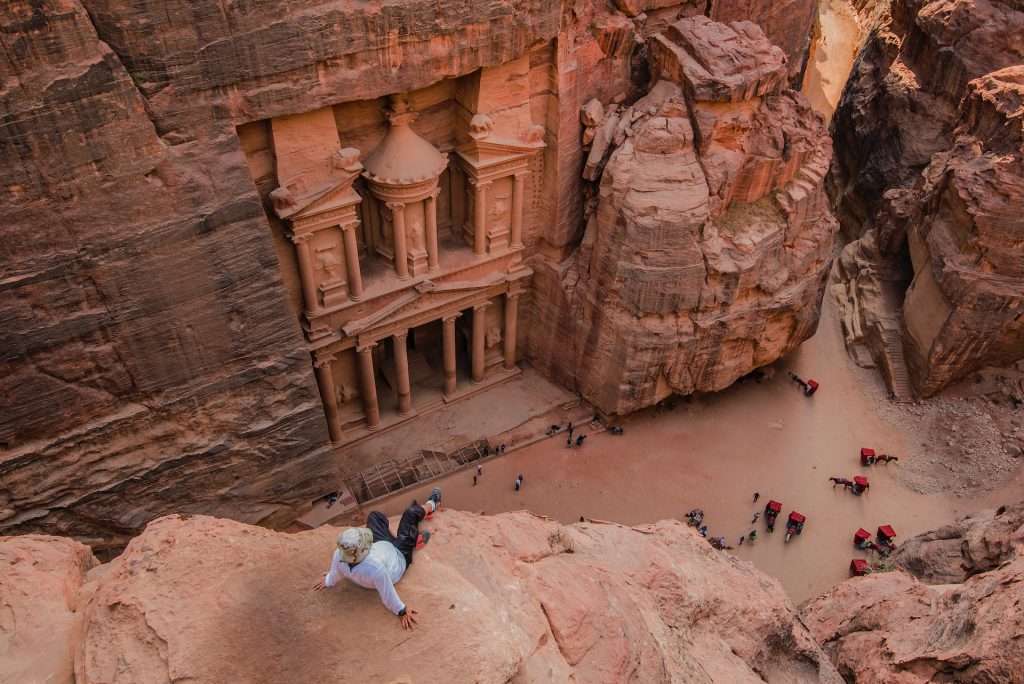
Petra occupies an arid mountain basin in southern Jordan between the Dead Sea and Red Sea regions. Its best-known façades were cut into red sandstone, but Petra is not an entirely rock-carved city. Freestanding buildings, streets, tombs and waterworks once spread through a much larger urban landscape.
The location helped the Nabataeans participate in trade routes linking Arabia with Egypt and the Mediterranean world. It also created a severe water problem. Dams, channels, tunnels, cisterns and reservoirs captured seasonal rain, supplied the settlement and diverted flash floods from the narrow Siq. The Siq itself is a natural fault-and-erosion passage about 0.75 miles (1.2 kilometers) long.
Petra was never “lost to the sands” in the simple way popular accounts suggest. Local communities knew the site; Johann Ludwig Burckhardt’s 1812 visit renewed European attention. Today, sandstone erosion, flash floods, concentrated tourism and the relationship with Bedu and Bdul communities all belong to the conservation story.
11. Machu Picchu, Peru
Machu Picchu sits at about 7,972 feet (2,430 meters) on a steep ridge where the eastern Andes descend toward the upper Amazon basin. Stone walls, ramps and agricultural terraces follow the slope closely enough that the planned settlement appears to continue the natural escarpment. Forested peaks and the deeply incised Urubamba Valley complete the setting.
Inca builders transformed difficult terrain during the 15th century through terracing, drainage, irrigation, roads and careful stone construction. Roughly 200 structures are arranged across agricultural and built sectors, but the site’s exact historical function remains unresolved. It should not be reduced to one confident label such as “fortress” or “lost royal city”.
Hiram Bingham did not discover a place unknown to local residents. Local residents knew the ruins and helped guide Bingham to them in 1911, after which Machu Picchu became widely known internationally. Peru’s 2026 World Heritage report describes controlled daily capacity and alternative routes outside the monumental area—measures intended to reduce pressure on a fragile mountain site.
12. Taj Mahal, India
The Taj Mahal is a mausoleum complex on the right bank of the Yamuna River in Agra, not an isolated marble palace. The mausoleum stands at the river end of a formal Mughal garden covering nearly 42 acres (17 hectares). Its white dome, flanking buildings, reflecting water and riverfront position were designed as one composition.
Shah Jahan commissioned the complex following Mumtaz Mahal’s death in 1631. Construction began in 1632; the main mausoleum was completed in 1648, while other parts followed through 1653. Marble came from Rajasthan, red sandstone from regional quarries and specialist craftspeople from across the Mughal Empire and beyond, making the monument a product of imperial transport and labor networks.
The familiar romance has accumulated unsupported stories, including the claim that builders’ hands were cut off and the claim that Shah Jahan planned a matching black mausoleum. Neither should be presented as fact. Current conservation focuses instead on air pollution, dust, visitor pressure and protection of the wider riverfront setting.
What Beauty Lists Usually Leave Out
The famous view may be seasonal
Salar de Uyuni does not reflect the sky every day. Victoria Falls can shift from an immense curtain to separated channels as the Zambezi rises and falls. Pamukkale’s water is deliberately rotated between terrace sections, Geirangerfjord’s waterfalls respond to snowmelt and rain, and Mount Fuji may lose its snow cover in warm months. A photograph records conditions at one moment, not the permanent identity of a place.
“Largest” depends on what is measured
The Great Barrier Reef is the largest coral reef ecosystem, Salar de Uyuni is the largest salt flat, and Mosi-oa-Tunya / Victoria Falls forms the largest curtain of falling water. None of those measurements makes one place universally larger or more impressive than the others. Height, width, area, volume, continuity and ecosystem extent answer different questions.
Famous places are not empty scenery
The Grand Canyon remains an Indigenous cultural landscape. Petra is connected to surrounding Bedu and Bdul communities. Geirangerfjord includes farms and a living village. Bora Bora’s lagoon supports settlement and an economy. Machu Picchu and the Taj Mahal sit inside wider regional systems rather than floating outside modern life. Treating these places as uninhabited backdrops removes the human geography that helps explain them.
Protection does not freeze a place in time
World Heritage status, national parks and local regulations create responsibilities; they do not stop erosion, warming, floods, tourism, pollution or nearby development. The Great Barrier Reef can recover in some measured sectors while remaining exposed to future marine heat. A protected monument can still depend on the health of its river, water system or surrounding community.
Frequently Asked Questions
What is the most beautiful place in the world?
There is no objective winner. Beauty depends on personal taste, season, weather, cultural meaning and the type of landscape being compared. The twelve places in this article are an editorial selection chosen for geographic range, visual distinctiveness and the quality of the evidence explaining them.
Are these the official twelve wonders of the world?
No. No international authority maintains an official list of twelve geographic wonders. Ancient, modern and natural “wonders” lists use different criteria and often come from particular writers, organizations or public polls.
Are all twelve places UNESCO World Heritage Sites?
No. Ten selections are part of World Heritage properties, while Salar de Uyuni and Bora Bora are not. UNESCO status was not used as a beauty ranking; it documents recognized cultural or natural significance and creates a framework for protection and monitoring.
Can the Great Barrier Reef really be seen from space?
Satellites and astronauts using suitable cameras and lenses can photograph parts of the reef because shallow water contrasts with the deeper ocean. The repeated claim that it is the only living thing visible from space with the naked eye is an oversimplification, and the reef is a large ecosystem rather than one organism.
Which places combine natural and human geography most clearly?
Hierapolis–Pamukkale and Machu Picchu are formally recognized as mixed cultural-natural World Heritage properties. Petra, Mount Fuji, Bora Bora, Geirangerfjord and the Taj Mahal also make little sense without considering both their physical setting and the societies that used or interpreted it.
What Did We Learn Today?
The world’s most beautiful places cannot be reduced to one official ranking. Their value becomes clearer when the view is connected to process: rivers expose rock, glaciers excavate fjords, closed basins collect salt, springs build travertine, volcanoes create islands, coral organisms construct reefs and societies reshape difficult terrain. The strongest explanations also recognize seasonal change, local communities and the conservation pressures that a perfect photograph can hide.
Sources & Data Notes
Core sources: Place-specific records from the UNESCO World Heritage Centre, plus the U.S. National Park Service, NASA Earth Observatory, USGS, the Geological Survey of Japan, the Norwegian Maritime Authority, the Great Barrier Reef Marine Park Authority, the Australian Institute of Marine Science and current national or site-management reports linked in the relevant sections.
Measurements: Miles and feet appear first for GeographyPin’s main audience, followed by metric equivalents. Figures are rounded where official sources use different boundaries or methods. Seasonal appearance, visitor rules and management conditions can change after August 2026.
Editorial review: Research was reviewed and the final article edited by Zurab Koniashvili (Z.K. Atlas). AI tools assisted with research organization, language refinement and visual planning; factual claims and source links received human editorial review.