The continents are Earth’s large, continuous landmasses used to organize geography and history. In the common seven-continent model—Asia, Africa, North America, South America, Antarctica, Europe, and Australia/Oceania—these landmasses together cover about 148 million km² (57 million sq mi), almost 30% of Earth’s surface, with Asia the largest by far.
What Do We Mean by “Continents”?
A practical definition: a continent is one of Earth’s main continuous landmasses, treated as a distinct region in geography. In the widely used seven-continent model, they are listed from largest to smallest by area as Asia, Africa, North America, South America, Antarctica, Europe, and Australia (often grouped as “Oceania” when nearby islands are included). This is a convention, not a law of nature.
Continents include their continental shelves—the shallow submarine fringes attached to their coasts—so a continent’s “edge” is not simply its beach. The total land area of all continents together is ~148 million square kilometers (57 million square miles). Asia alone is ~44.6 million km² (17.23 million sq mi), more than five times Australia’s area.
Where Europe Ends and Asia Begins
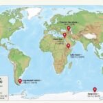
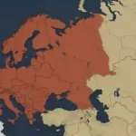
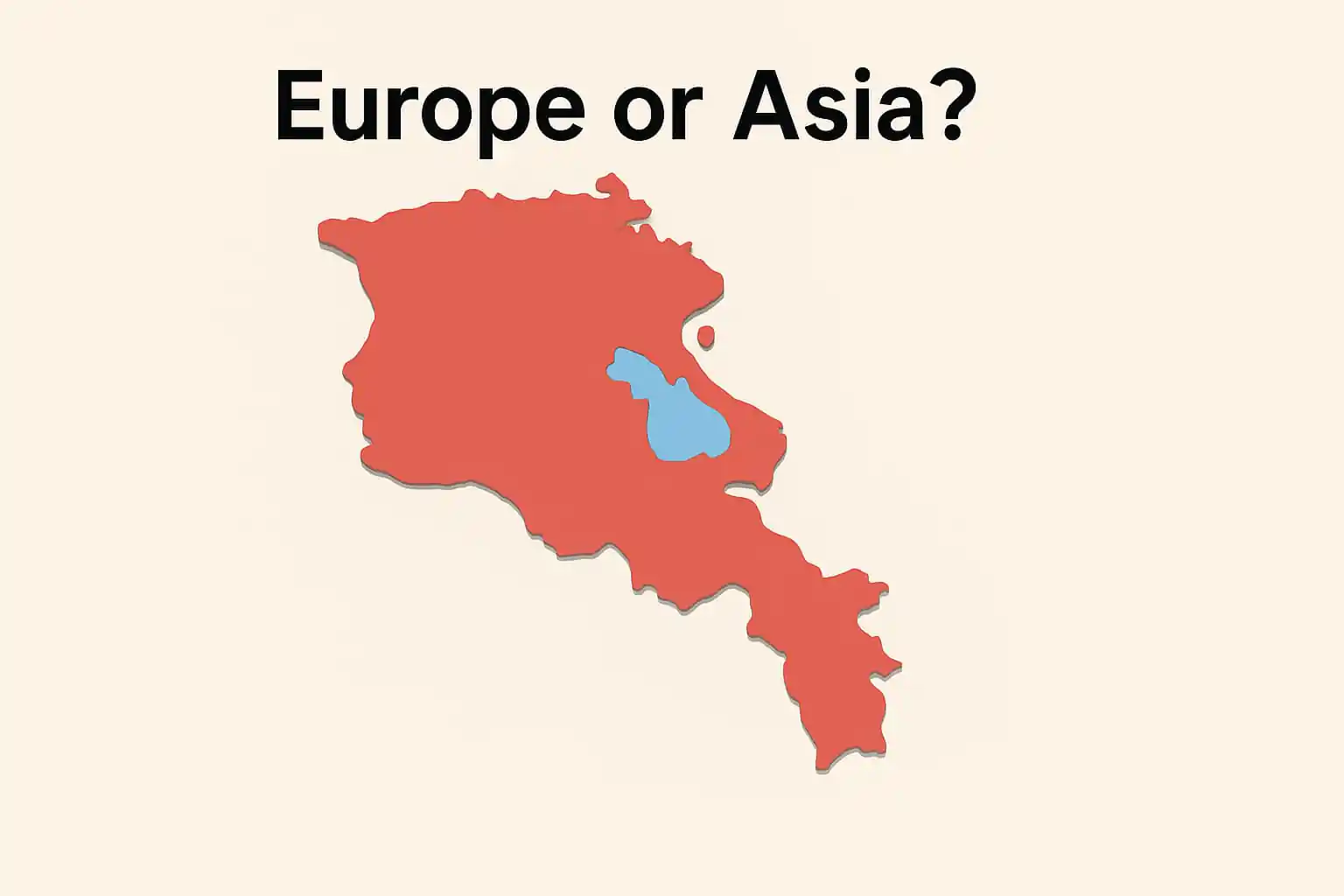
Because definitions are cultural as well as physical, boundaries can be debated. A common textbook line between Europe and Asia runs along Russia’s Ural Mountains, south via the Caspian Sea to the Black Sea. This convention helps explain why Europe and Asia are sometimes combined as “Eurasia” in six-continent models.
| Metric | Value |
|---|---|
| Total continental land area | ≈148 million km² (≈57 million sq mi) |
| Largest continent (by area) | Asia — ≈44.6 million km² (≈17.23 million sq mi) |
| Typical Europe–Asia boundary | Urals → Caspian → Black Sea (conventional) |
Continents vs. Tectonic Plates
Continents sit atop thick, buoyant continental crust. Tectonic plates are larger slabs of lithosphere that carry both continents and ocean basins. That’s why a continent doesn’t always match one plate perfectly. Continental crust averages ~30 kilometers (about 19 miles) thick and can reach ~100 kilometers (about 62 miles) beneath big mountain belts like the Alps—far thicker than typical oceanic crust (~5–10 km).
Plates move slowly as heat within Earth drives convection. Over time, this motion rearranges continents. Today, for example, North America and Europe are drifting apart at roughly 2.5 centimeters (about 1 inch) per year across the Atlantic. This motion helps explain earthquakes, mountain building, and why ancient fossils and rocks “match” on coasts now separated by oceans. For a clear primer, see the USGS “This Dynamic Earth” resources and National Geographic’s educational overview.
Why Continental Crust Is Old and Buoyant
Oceanic crust is recycled at subduction zones, but continental crust—being thicker and less dense—resists sinking and survives for billions of years. This is why continents preserve very ancient rocks while most oceanic crust is comparatively young.
The Seven Continents at a Glance
Asia is the largest by area and population, spanning from the Mediterranean and Ural Mountains to the Pacific. It holds the Himalaya and the vast Siberian plains.
Africa is a compact, equator-straddling mass with deserts (Sahara), rainforests (Congo Basin), and rift valleys hinting at future plate splits.
North America includes Greenland and stretches from the Arctic to the tropics, with the Rockies in the west and broad interior plains. (contextual overview)
South America is anchored by the Andes—the world’s longest continental mountain chain—and the Amazon Basin, the largest tropical rainforest.
Antarctica is a polar plateau buried under ice, encircled by the Southern Ocean, and largely uninhabited except for research stations.
Europe is small in area yet densely settled and historically influential; geographers often use the Urals–Caspian–Black Sea line as its eastern limit.
Australia/Oceania groups Australia with Melanesia, Micronesia, and Polynesia. Many curricula call the continent “Australia,” while others use “Oceania” to emphasize the wider region of islands.
Different Models: Five, Six, or Seven Continents?
Textbooks don’t always agree. The seven-continent system is common in the U.S. and much of Europe. Some regions teach six by combining Europe + Asia into Eurasia. Others teach six by combining North + South America into one “America.” A few older or regional traditions teach five (usually leaving out Antarctica in general, non-scientific contexts). All of these are conventions designed to make sense of a complicated planet.
| Model | Landmasses Counted | Notes |
|---|---|---|
| 7-continent | Asia, Africa, North America, South America, Antarctica, Europe, Australia/Oceania | Most common internationally; Asia largest by area. |
| 6-continent (Eurasia) | Eurasia, Africa, North America, South America, Antarctica, Australia/Oceania | Emphasizes continuous land between Europe and Asia. |
| 6-continent (the Americas) | Asia, Africa, America, Antarctica, Europe, Australia/Oceania | Combines North + South America as a single unit. |
| 5-continent (traditional/cultural) | Often Eurasia, Africa, America, Oceania, and (sometimes) Antarctica excluded | A cultural shorthand; not common in scientific usage. |
People, Area, and Scale
Scale helps the idea click. Together, the continents account for roughly 148 million km² (57 million sq mi) of land. Asia alone covers ~44.6 million km² (17.23 million sq mi). In population terms, Asia is home to about 60% of humanity, Africa roughly 18–19%, with Europe under 10%—figures that shift slowly year to year. These shares track UN estimates as summarized by Our World in Data.
Numbers also explain why “Oceania vs. Australia” can be confusing. “Australia” strictly names one continental landmass; “Oceania” widens the lens to include island groups across the Pacific (Melanesia, Micronesia, Polynesia). Many educators prefer “Oceania” in global lessons to avoid implying those islands are an afterthought. For an introductory, classroom-friendly explainer, see National Geographic’s continent guide.
Supercontinents—Past and Future
Continents have not always been arranged like today. Geologists reconstruct a supercontinent called Pangaea that assembled during the late Paleozoic and began breaking apart in the early Mesozoic, giving rise to today’s continents. Evidence includes matching fossils and rock belts across now-distant coasts, and the jigsaw fit of South America and Africa.
Because plates continue to move (centimeters per year), the map will keep changing. Some models imagine a future supercontinent—sometimes nicknamed “Amasia” or “Pangaea Proxima”—though precise outcomes are speculative. The big idea is solid: slow plate motion reconfigures continents over tens to hundreds of millions of years.
FAQ
Is there an official, globally agreed number of continents?
No single world body sets an “official” number. Seven is most common, but six-continent variants (Eurasia, or the Americas combined) are taught in many places. The choice reflects historical and cultural conventions as well as physical geography.
Are continents the same as tectonic plates?
Not exactly. Continents are thick pieces of buoyant crust; tectonic plates are bigger slabs of lithosphere that can include both continents and oceans. Continental crust averages ~30 km (19 mi) thick and can exceed ~100 km (62 mi) under mountains.
Why do some maps label “Australia,” while others say “Oceania”?
“Australia” refers to the continental landmass; “Oceania” is a broader regional term that includes Australia plus Pacific island groups (Melanesia, Micronesia, Polynesia). Educators often use “Oceania” to center those islands.
What Did We Learn Today?
- “Continent” is a geographic convention: most teach seven, but six- and five-continent models exist.
- All continents together cover ~148 million km² (57 million sq mi) of land; Asia alone is ~44.6 million km² (17.23 million sq mi).
- Continents ride on plates; continental crust is thicker (≈30–100 km / 19–62 mi) and older than oceanic crust.
- Asia hosts the largest share of the world’s population; Africa’s share is growing fastest this century.
- Over geologic time, continents merge into supercontinents and split again—Pangaea is the latest well-known example.