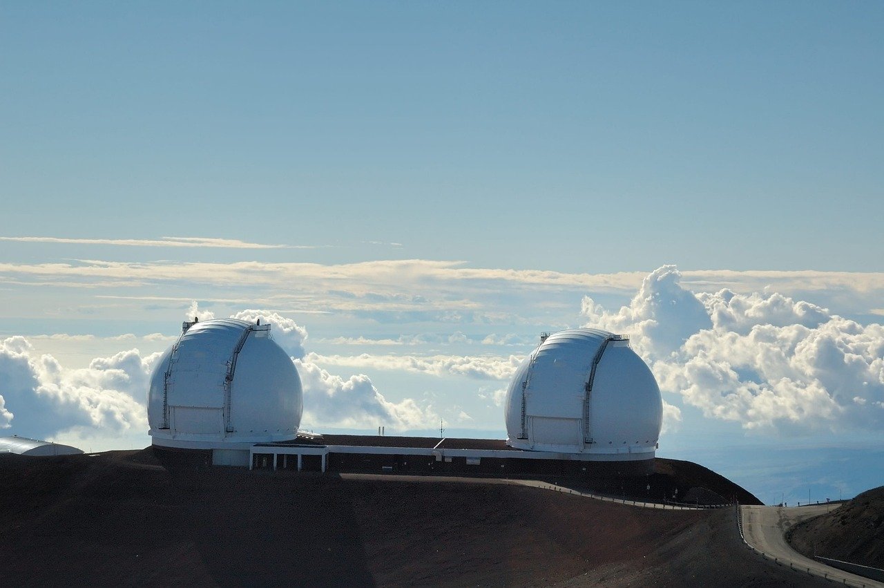
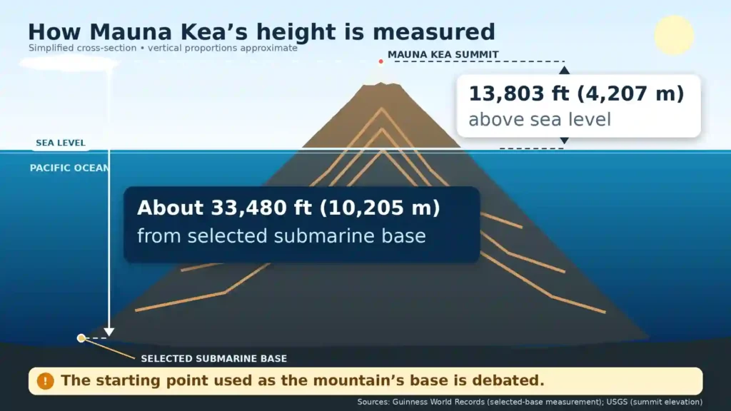
Mauna Kea rises 13,803 feet (4,207 m) above sea level, but about 33,480–33,500 feet (10,205–10,210 m) from a selected submarine base. It is taller than Everest only under that base-to-summit convention; Everest remains highest above mean sea level, and Mauna Kea’s exact underwater starting point is debated.
How to use this article: Go directly to the height measurement, volcanic status, dated observatory counts or visitor planning.
Mauna Kea at a Glance
Mauna Kea occupies north-central Hawaiʻi Island, commonly called the Big Island, in the U.S. state of Hawaiʻi. Its broad flanks meet neighboring volcanoes, while its summit is the highest point anywhere in the Hawaiian Islands.
Mauna Kea, Maunakea and Mauna a Wākea
Mauna Kea is the familiar two-word English form used by the USGS and in many maps. It is commonly translated as “White Mountain,” a reference associated with winter snow. The University of Hawaiʻi at Hilo’s College of Hawaiian Language recommends Maunakea as one word for the proper Hawaiian place-name.
In Native Hawaiian traditions and prayers, the mountain is also known as Mauna a Wākea, “the mountain of Wākea.” This page uses “Mauna Kea” where it helps readers recognize the common geographic name and “Maunakea” in cultural and institutional contexts that use the Hawaiian spelling.
| Fact | Verified value |
|---|---|
| Location | Hawaiʻi Island, State of Hawaiʻi, United States |
| Coordinates | 19.82° N, 155.47° W |
| Summit elevation | 13,803 ft (4,207.3 m) above sea level, USGS |
| Approximate base-to-summit height | 33,480 ft (10,205 m) from the submarine base selected by Guinness; often rounded to 33,500 ft (10,210 m) |
| Volcano type | Basaltic shield volcano in an advanced post-shield stage |
| Current eruption status | USGS Alert Level NORMAL and Aviation Color Code GREEN; no activity of concern on August 7, 2026 |
| Most recent eruption | Between about 6,000 and 4,000 years ago |
| Visitor Information Station elevation | 9,200 ft (2,804 m) |
How Tall Is Mauna Kea?
Why the starting point changes the answer
Elevation uses a shared reference surface: mean sea level, represented more precisely by a geoid in modern surveying. By that consistent method, Mauna Kea’s summit is 13,803 feet (4,207.3 m) high. Mount Everest is much higher at 29,032 feet (8,848.86 m).
Mauna Kea’s other figure measures the volcanic edifice upward from an identified place on the seafloor. Guinness World Records selects a base in the Hawaiian Trough and reports approximately 33,480 feet (10,205 m). The rounded figure of 33,500 feet (about 10,210 m) is also widely used.
The difficulty is that a mountain’s “base” is not a universal line like sea level. Mauna Kea merges with the seafloor, neighboring volcanic structures and the depressed oceanic crust beneath Hawaiʻi. Guinness itself acknowledges debate over where the base begins. The submarine portion rises through the Pacific Ocean, but choosing one deep point does not create an identical measurement that can simply be applied to every land mountain.
There is also a small source difference above sea level. Guinness’s record page uses 13,796 feet (4,205 m), while the current USGS figure is 13,803 feet (4,207.3 m). These reflect different source figures, datums or rounding conventions. The defensible approach is to report Guinness’s published total and the current USGS summit elevation separately, not silently add seven feet to the record.
Three different mountain records
| Record | Mountain | What is measured |
|---|---|---|
| Highest above mean sea level | Mount Everest | 29,032 ft (8,848.86 m) from the global elevation reference |
| Tallest from an identified submarine base | Mauna Kea | About 33,480 ft (10,205 m) from the base selected by Guinness to the summit |
| Farthest summit from Earth’s center | Chimborazo | Earth’s equatorial bulge places its summit farther from the planet’s center than Everest |
These are three valid answers to three different questions. Everest’s elevation must not be relabeled as its base-to-summit height, and Mauna Kea’s selected submarine-base measurement must not be presented as an undisputed universal standard.
How Mauna Kea Formed and Whether It Is Active
Mauna Kea began as a shield volcano over the Hawaiian hotspot. Repeated eruptions of fluid basaltic lava built a broad edifice from the ocean floor. USGS estimates that shield-stage eruptions lasted about 800,000 years, produced more than 90% of the volcano’s estimated volume and make Mauna Kea at least one million years old.
From shield building to the post-shield stage
The Pacific Plate has carried Mauna Kea away from the hotspot’s main magma supply. It is now in an advanced post-shield stage, when eruptions are much less frequent and the magma chemistry differs from the earlier shield-building phase.
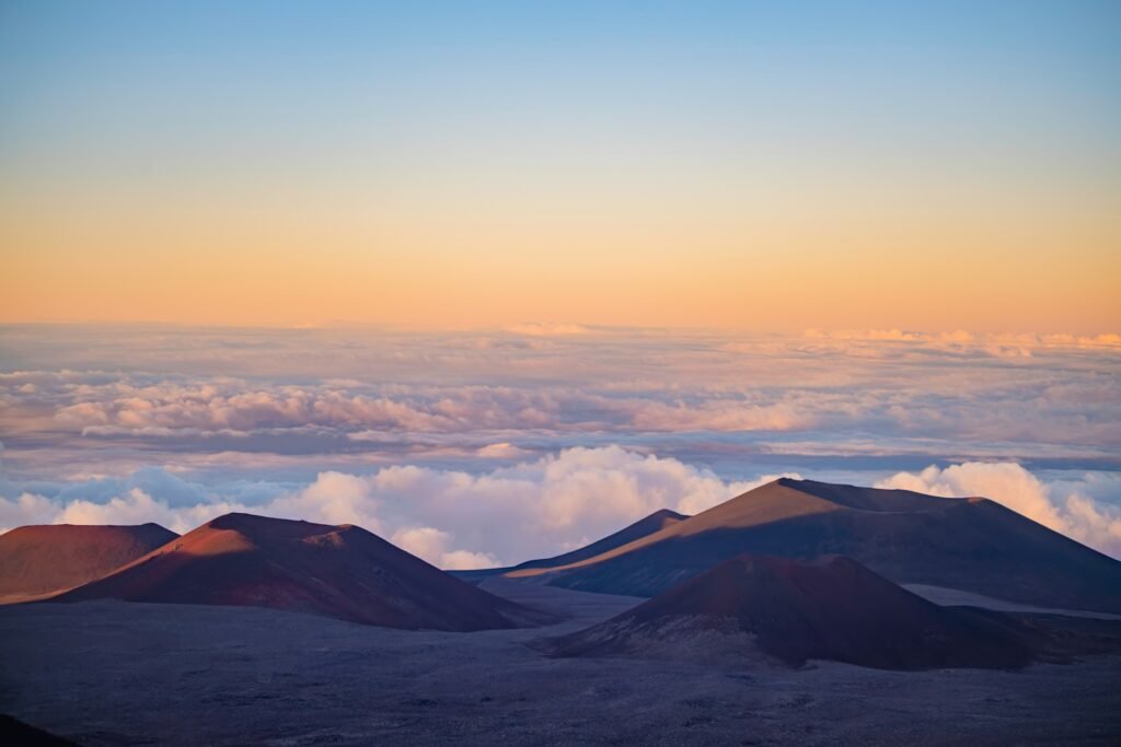
Post-shield lavas tend to be more viscous. They produced shorter, rougher flows, tephra and the prominent cinder cones that make Mauna Kea’s summit more irregular than the smooth profile expected from a young shield volcano. Mauna Kea is one of the Hawaiian shield volcanoes that contribute to the United States’ large total of Holocene volcanoes.
Evidence of former glaciers
High elevation made the summit cold enough to support glaciers during recent ice ages. USGS identifies glacial deposits and moraines from repeated episodes during roughly the past 150,000–200,000 years. Those landforms are evidence of former ice; they do not mean that Mauna Kea has a glacier today.
Is Mauna Kea active, dormant or extinct?
“Dormant” is a reasonable everyday description because Mauna Kea has not erupted for thousands of years. In formal hazard work, however, USGS includes it among Hawaiʻi’s active volcanoes. Its youngest eruptions occurred about 6,000–4,000 years ago, with some USGS summaries using approximately 4,500 or 4,600 years as a midpoint.
USGS assigns Mauna Kea Moderate Threat Potential under the National Volcanic Threat Assessment and says it is likely to erupt again on a geological timescale. That category combines volcanic hazards with potential exposure; it does not mean an eruption is imminent. The August 7, 2026 update reported no activity of concern, a NORMAL alert level and a GREEN aviation code.
Cultural Significance of Maunakea
Maunakea is sacred to many Native Hawaiians and is part of a living cultural landscape rather than an empty high-altitude site. The University of Hawaiʻi cultural guide, drawing on Native Hawaiian traditions, describes Mauna a Wākea as the mountain of Wākea and associates Maunakea with the piko that connects the island of Hawaiʻi with the heavens.
The summit region contains archaeological places, trails, shrines and locations connected to continuing cultural practice. Meanings and practices vary among families and practitioners, so it is more accurate to attribute them than to claim one universal Native Hawaiian view.
Older summaries often state that summit access was historically restricted to chiefs and priests. The evidence is more complicated than that simple rule, and this article does not rely on it. What is clear today is that many Native Hawaiian cultural practitioners and community members regard further disturbance of the summit landscape as a serious concern.
That cultural importance is inseparable from debates over astronomy, access and stewardship. Respectful coverage should neither treat culture as a decorative addition to telescope history nor imply that all Native Hawaiians hold the same position on every observatory project.
Observatories, Decommissioning and Stewardship
Why the summit is important for astronomy
At 13,803 feet, the summit sits above much of the atmosphere’s water vapor and often above the cloud-forming inversion layer. The air is dry, airflow over the broad shield is comparatively stable and the remote oceanic setting limits nearby light pollution. The latitude also gives telescopes access to large parts of both the northern and southern skies.
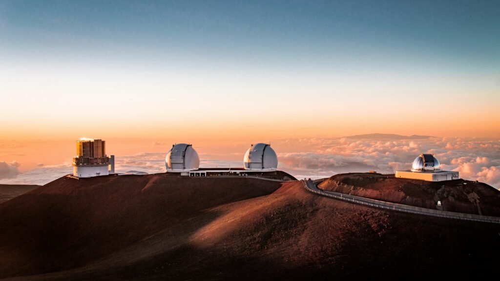
Major examples include the twin 10-meter telescopes of W. M. Keck Observatory, the 8.2-meter Subaru Telescope, Gemini North and the 3.6-meter Canada-France-Hawaii Telescope. Other instruments work at infrared, submillimeter and radio wavelengths. Most summit observatory buildings are working research facilities and are not routinely open to casual visitors.
How many telescopes and observatories are there?
There is no responsible single number without a noun and a date. A telescope is an instrument, a facility is a physical site or building and an observatory may mean an independently operated institution. Arrays and organizations that operate more than one telescope make those totals diverge.
| Unit counted | Count and date | Meaning |
|---|---|---|
| Physical astronomy facilities | 11, August 18, 2026 | Method-based count: the official 2022 baseline listed 13 installed facilities; two sites were completely removed in 2024 |
| Working telescopes near the summit | 11, CMS page checked August 18, 2026 | Instrument count used by the Center for Maunakea Stewardship; UKIRT was still operating on the check date |
| Independent observatory institutions | 10, Maunakea Observatories page checked August 18, 2026 | Organizations in the official nonprofit observatories group, not a country count or telescope count |
Table downloads (3)
- Mauna Kea key facts; changing status checked August 18, 2026 (9 × 2)View tableDownload CSV
- Highest, tallest and farthest from Earth’s center use different reference points (4 × 3)View tableDownload CSV
- Dated Maunakea astronomy counts and what each one measures (4 × 3)View tableDownload CSV
The old statement “13 facilities operated by 11 countries” should therefore not be reused. It combines an obsolete facility total with an organizational description that the current official group does not use.
Decommissioning and the changing governance system
Two former sites were physically removed and restored in 2024: the University of Hawaiʻi at Hilo’s Hōkū Keʻa Observatory in May and the Caltech Submillimeter Observatory in July. UKIRT is next. University of Hawaiʻi says its science operations will end on September 15, 2026, while physical decommissioning is targeted for completion by 2030. Ending observations does not instantly remove a facility, so telescope and site totals will differ during that process.
Stewardship is also in transition. The University of Hawaiʻi and the Mauna Kea Stewardship and Oversight Authority currently manage the lands jointly, while the Center for Maunakea Stewardship carries out day-to-day operations. Older pages cite July 1, 2028 as the transfer date, but Hawaiʻi’s Act 53, enacted May 27, 2026, extended the transition. Transfer of the relevant UH rights, powers, functions and duties is now scheduled for December 1, 2029, subject to the law’s management-plan and rulemaking deadlines.
The Thirty Meter Telescope remains a proposed project and is not included in the operating totals above. As checked August 18, 2026, its organization still described Maunakea as its preferred site, while its members were considering a Spanish-backed financing proposal for construction on La Palma announced July 29. Separately, the U.S. National Science Foundation had extended its environmental review of a potential federal investment through 2026. No final site outcome should be inferred or predicted.
How to Visit Mauna Kea Safely
A visit to the 9,200-foot Visitor Information Station and a drive to the 13,803-foot summit are not the same trip. Weather, altitude and road status can change quickly, and official instructions should be checked again on the day of travel.
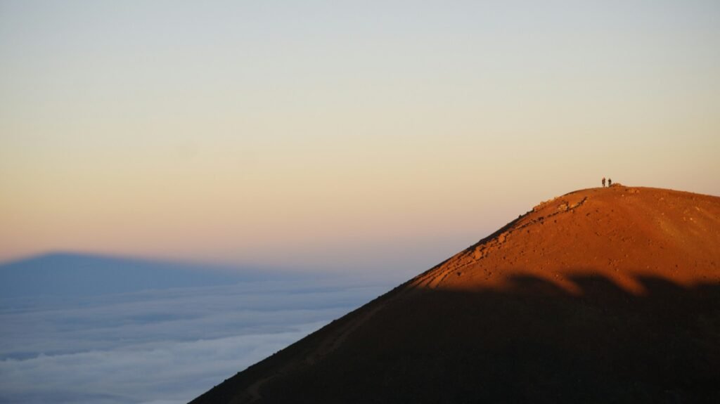
Start at the Visitor Information Station
The Onizuka Center for International Astronomy Visitor Information Station, or VIS, stands on Maunakea Access Road at 9,200 feet (2,804 m). Its normal posted hours are 9 a.m.–9 p.m. daily, and ordinary access has no entrance, registration or parking fee. A standard 2WD vehicle may reach the VIS when the lower road is open.
Before going higher, stop for at least 30 minutes to acclimatize and obtain current safety information. Do not continue if altitude symptoms begin. Official guidance says children under 13 are discouraged from traveling above the VIS; pregnant visitors, people with relevant heart, blood-pressure or respiratory conditions, and anyone who has scuba-dived within the previous 24 hours should not ascend farther.
Vehicle rules, altitude and closing time
2WD vehicles are prohibited above the VIS. UH’s public-safety page requires a dependable, fully operable 4WD or AWD vehicle, while the VIS instructions specifically direct summit drivers to use 4WD Low Range. Because low range is required to control speed and reduce brake overheating on descent, do not assume that an ordinary AWD crossover qualifies. Ask the ranger when uncertain.
Rental companies set their own restrictions, and a vehicle capable of reaching the summit may still be prohibited by its rental contract. Check the agreement before travel. Carry adequate fuel; there is no public gas station on the mountain, and UH recommends at least half a tank before proceeding upward.
At high altitude, headache, nausea, shortness of breath, poor coordination, confusion and unusual fatigue can signal altitude illness. Descend immediately when symptoms appear or worsen. Bring warm layers, water, sun protection and a vehicle prepared for steep, rough conditions.
The summit area closes to visitors from 30 minutes after sunset until 30 minutes before sunrise. Road, trail and summit closures may occur earlier because of ice, snow, wind or other hazards. Check the live official visitor page and current Maunakea Weather Center road information immediately before leaving.
Stargazing does not require the summit
Ordinary naked-eye stargazing around the VIS is available on any night when weather permits. The dedicated official page says there is no formal nightly telescope program; staff may offer a laser-guided sky presentation after twilight depending on staffing and conditions.
Public telescope viewing is a separate, limited-capacity Telescope Experience at the VIS. It is offered on selected dates, generally about once a month when possible, and requires advance reservations. Do not expect public telescopes every night. After the summit closes, visitors who remain for stargazing must descend to Park 2 or lower and follow current ranger directions.
Respect cultural and environmental rules
- Stay on designated roads and trails, and use marked parking.
- Do not move or stack rocks, disturb shrines or offerings, or remove natural material.
- Keep vehicles, footwear and gear clean to avoid spreading invasive species; visibly muddy vehicles may be turned away.
- Pack out or properly dispose of all waste, including food waste.
- Do not fly drones, camp, sleep overnight or light fires on UH-managed lands.
- Limit radio, cellular, Bluetooth and Wi-Fi use above the VIS to emergencies because transmissions can interfere with radio astronomy.
The true summit, Puʻu Wēkiu, is culturally and environmentally sensitive. Appreciate it from a respectful distance rather than treating every high point as a recreational objective.
Frequently Asked Questions
How tall is Mauna Kea, and is it taller than Mount Everest?
Mauna Kea is 13,803 feet (4,207.3 m) above sea level. Guinness reports about 33,480 feet (10,205 m) from a selected submarine base, often rounded to 33,500 feet. That base-to-summit figure exceeds Everest’s elevation, but the bases are not defined by an identical universal method. Everest remains highest above mean sea level.
Is Mauna Kea an active volcano?
USGS treats Mauna Kea as an active Hawaiian volcano that is likely to erupt again, although it is often called dormant in everyday language. Its most recent eruptions occurred about 6,000–4,000 years ago. The USGS alert was NORMAL, with no activity of concern, on August 7, 2026.
Should it be written Mauna Kea or Maunakea?
Both forms are widely encountered. Mauna Kea is the familiar English and USGS spelling; the University of Hawaiʻi at Hilo’s College of Hawaiian Language recommends Maunakea as the proper Hawaiian place-name. Mauna a Wākea is a traditional name meaning “the mountain of Wākea.”
Can I visit the summit, and what vehicle is required?
Yes, when the road is open and current rules are met. A 2WD car can reach the 9,200-foot VIS but cannot travel above it. Summit travel requires a suitable 4WD or AWD vehicle under UH guidance, with 4WD Low Range directed for the steep road and descent. Check rental restrictions, weather, ranger advice and altitude risks first.
How many observatories are on Mauna Kea, and can visitors enter them?
On August 18, 2026, the official Maunakea Observatories group described ten independent institutions, while the Center for Maunakea Stewardship listed eleven working telescopes. The terms count different things. Most summit facilities are not open to casual visitors; limited telescope experiences and special tours use separate schedules and reservations.
What Did We Learn Today?
Mauna Kea’s celebrated height record depends on a selected submarine base, while its 13,803-foot summit elevation is a different, standardized measurement. The mountain is an advanced post-shield volcano likely to erupt again on a geological timescale, a sacred landscape for many Native Hawaiians, a changing complex of astronomy facilities and a high-altitude place where safe, respectful access depends on current official rules.
Sources & Data Notes
Stable geology and elevation figures were checked against USGS; base-to-summit height follows Guinness’s selected-base method and remains approximate. Observatory, governance, road and visitor information was checked August 18, 2026. Counts are labeled by unit because telescopes, physical facilities and operating institutions are not interchangeable. Rules, road status and program schedules can change before the next annual review.