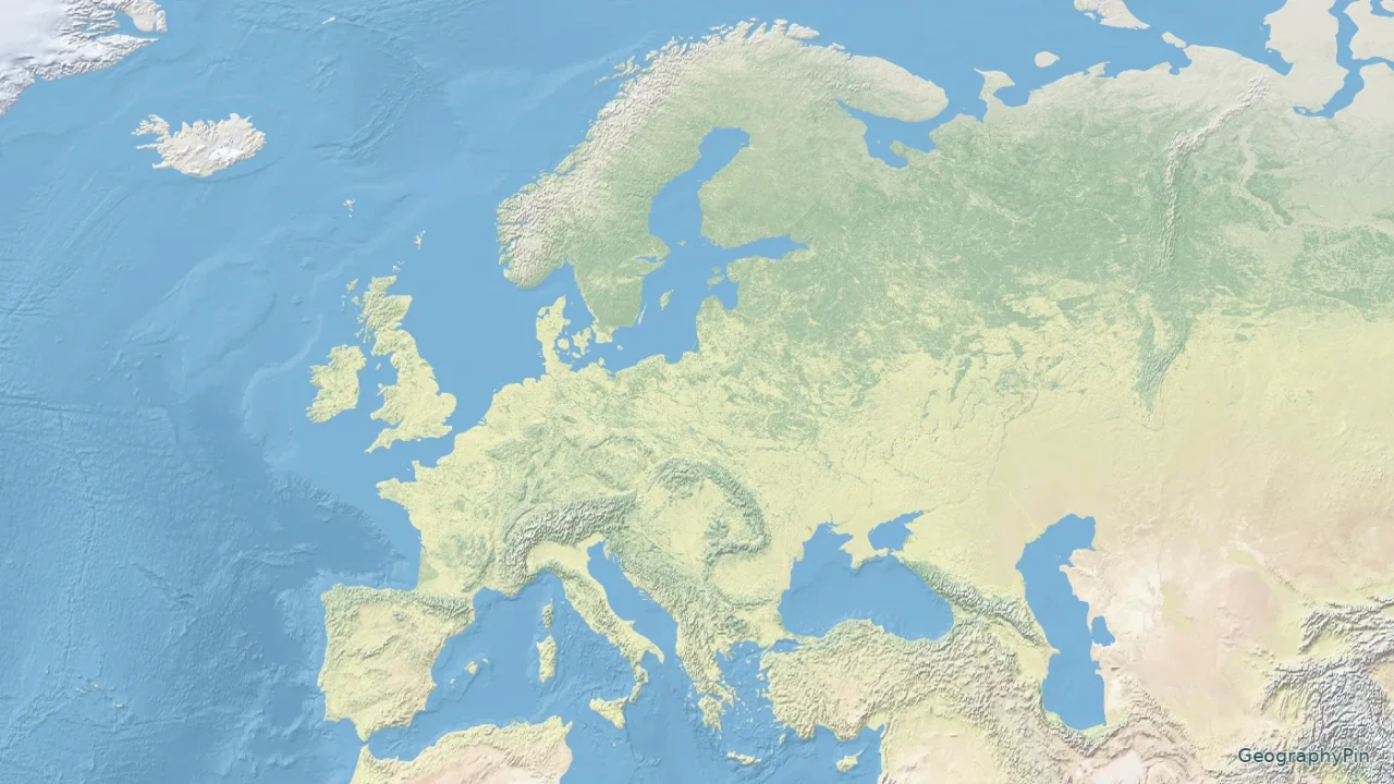
Europe’s mountains and drainage systems do not stop at national borders. This map emphasizes the terrain from the Atlantic to the Urals, with selected rivers and broad landform labels rather than a country-coloring scheme.
A physical map of Europe shows terrain and water features, including mountain ranges, plains, rivers and coastlines. The Alps, Pyrenees and Carpathians contrast with the broad North European Plain. The Urals are a conventional eastern reference for Europe, but Europe and Asia share the Eurasian landmass; the map does not imply a universally fixed natural dividing line.
How to use this article: read the relief map, interpret the main features, use the key and scale.
Maps fit the screen by default. Select 2× or 4× for details, swipe or scroll within the map, and choose Fit / Reset for the full view.
1. European Relief Map
Read the relief map
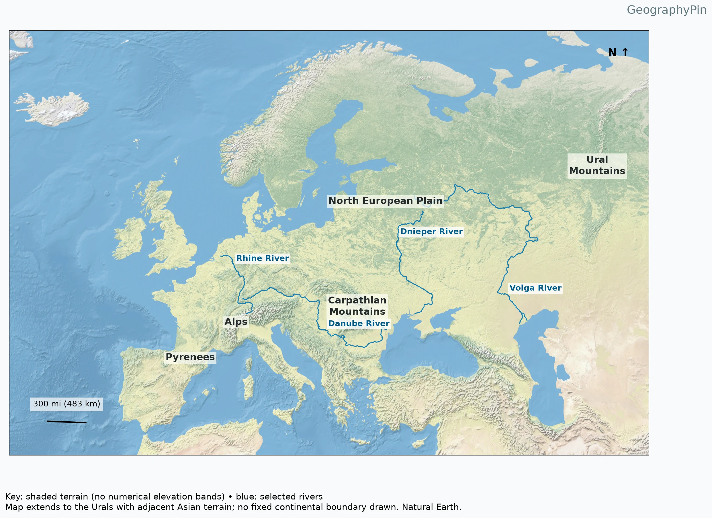
The relief layer supplies the physical information; it is not a political map renamed as a terrain map. Raised and dissected terrain contrasts with smoother lowland areas, while blue river overlays provide a separate reference. Open the printable PDF or full image for the detailed view rather than trying to read every label in a phone-width thumbnail.
Coverage is intentionally regional. Iceland appears in the west, and the map extends beyond the Urals enough to show surrounding context. Parts of North Africa and western Asia also fall inside the rectangular frame. Their inclusion is a cartographic layout choice, not a claim that every visible land area belongs to Europe.
2. Mountains and Plains: What the Labels Locate
| Landform | Broad map location | What not to assume |
|---|---|---|
| Pyrenees | Between the Iberian Peninsula and the rest of mainland Europe | Not the only mountains in Iberia |
| Alps | Arc north of the Italian peninsula | Not a single peak or a political unit |
| Carpathians | Central and eastern Europe | Not identical to a country boundary |
| North European Plain | Broad lowland belt north of central mountain and upland areas | Not perfectly flat everywhere |
| Ural Mountains | Toward the map’s eastern side | Not an ocean separation between continents |
The European Environment Agency’s biodiversity framework and EU mountain-region material identify multiple separate ranges. “The mountains of Europe” therefore does not mean the Alps alone. The map labels a useful selection, not every range, massif, upland or local name.
The plain and mountain labels indicate general locations. They do not trace measured edges. A mountain system can contain valleys and settlements, while a lowland belt can contain hills and locally higher ground. Map scale smooths those differences; it does not make them disappear on the ground.
3. Major Rivers Follow Different Outlets
Interpret the main features
The Rhine connects Alpine and western-central European settings with the North Sea. The Danube flows toward the Black Sea. The International Commission for the Protection of the Danube River documents that river as a transboundary basin rather than a feature belonging to one country alone.
The Volga flows into the Caspian Sea, while the Dnieper (Dnipro) flows toward the Black Sea. These different destinations show why Europe cannot be described as one drainage basin. Follow the selected channels separately before looking for a common downstream connection.
River names can change across languages. The data include local names such as Rhein and Donau alongside English names. The map joins segments using the English-name field so a language change does not leave a misleading gap in the displayed Rhine or Danube. The lines remain generalized and omit many tributaries.
4. Physical Europe Is Not the European Union
The European Union is a political institution; Europe is a geographic concept with conventional limits. Physical geography focuses instead on natural features and processes. A mountain range, river basin or plain may cross several national borders and can extend beyond the EU. This physical map intentionally omits political coloring so those relationships remain visible.
The Urals provide a widely used reference for Europe’s eastern edge. That does not mean Europe is physically detached from Asia, or that every section of the conventional boundary follows an unmistakable mountain wall. The southeastern boundary is especially convention-dependent. No supposedly official universal Europe–Asia line is invented here.
When comparing a physical map with a country list, check which purpose and boundary convention each uses. A list based on a statistical region, a political organization or geographic convention can answer a different question without changing the underlying terrain.
5. Legend, Scale and Limits
Use the key and scale
The key separates illustrative shaded terrain from blue river overlays. There is no numerical elevation scale because the supplied Natural Earth raster does not assign a verified height interval to each color. A color patch cannot establish a summit elevation or prove that one mountain is higher than another.
The distance bar represents 300 miles (483 kilometers) at its own position. Distortion varies across the broad latitude–longitude view, so the bar is not a universal ruler for the whole continent. The north arrow shows orientation. For exact elevations, gradients or route distances, use a suitably projected, higher-resolution dataset rather than this overview.
Frequently Asked Questions
Is this map a map of the European Union?
No. It shows physical geography rather than EU membership. Rivers, mountains and plains cross national and institutional boundaries, and the rectangular map frame includes adjacent terrain outside Europe.
What Did We Learn Today?
Europe’s relief is a pattern of distinct ranges, broad plains and rivers with different destinations. These features cross political borders, and a physical view is not an EU membership map. The Atlantic-to-Urals frame provides orientation without inventing a universal continental boundary or numerical elevations from illustrative colors.
Sources & Data Notes
The maps combine Natural Earth shaded relief with actual river centerlines, lake polygons and geographic-region label anchors. Region polygons are used only to locate labels; their edges are not presented as exact mountain or plain boundaries. This is a selected-feature reference, not an exhaustive inventory. Terrain colors are illustrative and do not encode numerical elevation intervals. Distance bars are geodesically calculated on WGS84 and apply locally; scale varies elsewhere in these latitude–longitude views.