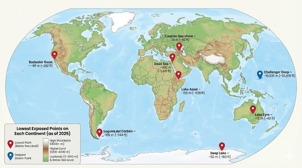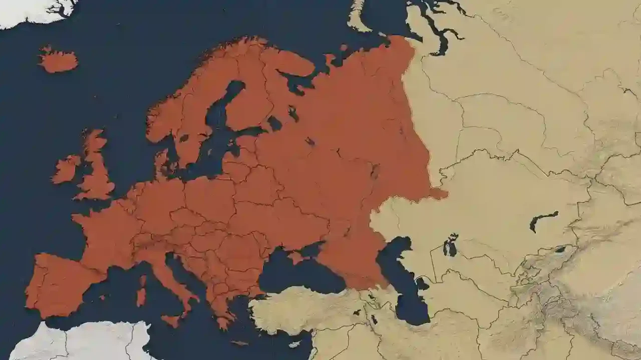
Yes, Europe is conventionally considered a continent in the seven-continent model widely used in the United States and many English-language atlases. Physically, however, Europe and Asia form one continuous landmass, Eurasia. Europe’s separate status therefore rests on a geographic and historical convention, not on a complete ocean boundary or its own tectonic plate.
How to use this article: Get the fast classroom answer, trace the Europe–Asia line, compare the main models, or separate Europe from the European Union.
Why Europe Is Considered a Continent
In ordinary geographic usage, Europe qualifies as a continent because continents are partly conventional divisions of the world. The National Geographic Society lists Europe among the seven continents while also explaining that Europe and Asia belong to one continuous landmass called Eurasia.
Those descriptions are not mutually exclusive. “Europe” names a recognized continental division, while “Eurasia” describes the larger connected landmass containing both Europe and Asia.
The answer to use in school and general reference
For a standard geography question in the United States, the expected answer is yes, Europe is a continent. The seven-continent model lists Africa, Antarctica, Asia, Australia, Europe, North America, and South America.
If a question specifically asks about uninterrupted landmasses or uses a six-continent model that combines Europe and Asia, Europe becomes a region within Eurasia. GeographyPin’s explanation of the seven-, six-, and five-continent models shows why different systems can produce different lists without changing the underlying geography.
There is no single continent model used in every classroom, atlas, or dataset. A reliable answer identifies the model instead of presenting one convention as a universal physical law.
Where Is the Boundary Between Europe and Asia?
Europe has recognizable water boundaries along the Arctic Ocean, Atlantic Ocean, and Mediterranean Sea. Its eastern edge is different: Europe merges directly into Asia across the Eurasian landmass, so mapmakers use a chain of mountains, rivers, seas, and straits as a conventional dividing line.
The commonly used Europe–Asia line
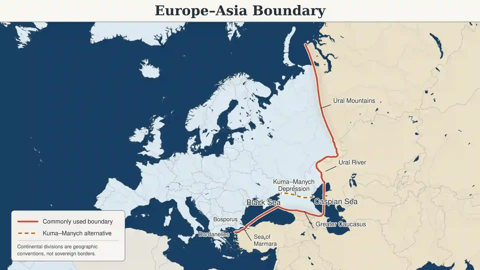
Starting in northern Russia, the usual boundary follows the Ural Mountains and then the Ural River toward the Caspian Sea. From the Caspian, a widely used version follows the watershed of the Greater Caucasus to the Black Sea before continuing through the Bosporus, Sea of Marmara, and Dardanelles. National Geographic presents the Urals, Caspian Sea, Caucasus, and Black Sea as the main components of Asia’s western boundary.
This line divides several countries between continents. Russia and Kazakhstan cross the boundary around the Urals, while Türkiye has territory on both sides of the Turkish Straits. Continental classification does not divide their sovereignty or create an international border.
The Caucasus is the least settled segment
Not every geographic tradition places the southeastern boundary in the same location. Many modern maps use the crest or watershed of the Greater Caucasus, but another established convention follows the Kuma–Manych Depression north of the mountains.
The choice affects whether the Greater Caucasus—and therefore Mount Elbrus—is placed in Europe or Asia. GeographyPin’s closer examination of whether the Caucasus are in Europe or Asia compares the two boundary systems and their consequences.
Why the Europe–Asia Split Is Conventional
Europe and Asia were treated as separate parts of the known world long before modern geology or precise continental mapping. As those names expanded beyond the Mediterranean world, geographers repeatedly changed the line between them. The current boundary is inherited from that long history rather than revealed by one decisive physical break.
Definitions of Europe also developed through politics, religion, culture, and historical identity. The University of North Carolina’s Center for European Studies describes Europe as something that can be defined geographically, politically, culturally, or historically, with each method producing its own difficulties.
Connected land does not automatically mean one continent
Europe and Asia are not the only continents connected by land. Africa and Asia meet at the Isthmus of Suez, while North and South America meet at the Isthmus of Panama. The seven-continent model still separates those pairs.
Other models combine North and South America into one America, or Europe and Asia into Eurasia. This variation shows that neither an ocean boundary nor a land connection supplies a universal rule.
A conventional boundary can still be useful
Calling the line conventional does not make it meaningless. Atlases, schools, researchers, and statistical organizations need consistent regional groupings. Problems arise only when one chosen grouping is presented as if it were the sole possible result of physical geography.
The boundary also does not mark a clean cultural divide. Languages, religions, trade routes, migration, and political institutions cross the Urals, Caucasus, and Turkish Straits. The line classifies geographic space; it does not divide people into two uniform civilizations.
Europe, Eurasia and Tectonic Plates
Eurasia is the continuous landmass containing Europe and Asia. National Geographic describes Europe physically as a peninsula of the Eurasian supercontinent, bordered by the Arctic Ocean, Atlantic Ocean, and several southern seas.
Calling Europe part of Eurasia does not prevent it from being a continent under the seven-continent model. “Landmass” and “continent” are related terms, but they do not always describe the same level of geographic classification.
A tectonic plate is not a continent
Most of Europe and a large part of Asia lie on the Eurasian Plate. Europe therefore does not have its own tectonic plate. A U.S. Geological Survey comparison of Earth’s plates and continents shows that continental outlines and plate boundaries are different systems.
Tectonic plates are moving sections of Earth’s lithosphere. They may carry both continental and oceanic crust, and their edges do not consistently match the continents shown in atlases. A continent’s conventional status cannot be confirmed or rejected simply by looking for a plate with the same name.
Eurasia and the Eurasian Plate are also not interchangeable. Eurasia is a connected area of land; the Eurasian Plate is a geological structure whose boundary does not precisely follow the coastline or the conventional Europe–Asia division.
Is Europe better described as a peninsula or subcontinent?
“Peninsula” describes Europe’s physical form at the western end of Eurasia. “Subcontinent” can be used when Europe is treated as a major subdivision of that landmass. “Continent” remains the normal label under the seven-continent system.
These terms answer different questions. Europe can be a peninsula in physical form, part of Eurasia as a continuous landmass, and a continent within a widely used geographic convention.
Which Definition Should You Use?
The most useful label depends on what is being classified. A school atlas, geological map, statistical database, and political organization may all use “Europe” differently without referring to different land.
The main continent models compared
| Context | Treatment of Europe | What the label means |
|---|---|---|
| Seven-continent geography | A separate continent | Europe and Asia are divided by an accepted historical-geographic boundary. |
| Six-continent Eurasia model | A region within Eurasia | The uninterrupted European and Asian land areas are grouped as one continent. |
| Physical landform | The western peninsula of Eurasia | The description emphasizes shape and connection rather than a continent list. |
| Plate tectonics | Mostly on the Eurasian Plate | The classification concerns Earth’s lithosphere, not atlas continents. |
| United Nations statistics | A macro-geographical region | Countries and areas are assigned once to support consistent statistical reporting. |
The United Nations M49 system includes Europe as a macro-geographical region, but it explicitly states that country assignments are made for statistical convenience and do not imply a position on political affiliation. A statistical category should therefore not be mistaken for a universal ruling on continental identity.
Europe is not the European Union
Europe is a continent or geographic region; the European Union is a political and economic organization with defined membership. Many European countries are outside the EU, and EU membership does not determine where the geographic boundary between Europe and Asia is drawn.
For an ordinary question with no special criteria, “Europe is a continent” is the expected answer. For greater precision, add that Europe shares the Eurasian landmass with Asia and that their boundary is conventional.
Frequently Asked Questions
Can Europe and Eurasia both be correct?
Yes. Europe is a continent under the seven-continent model, while Eurasia is the continuous landmass containing Europe and Asia. The terms apply different grouping rules to the same geography.
Is Russia in Europe or Asia?
Russia is transcontinental. The conventional Europe–Asia boundary crosses Russia along the Urals, leaving territory on both sides. The United Nations M49 system assigns Russia wholly to Eastern Europe for statistical consistency, which is a data convention rather than a physical claim.
Is Türkiye in both Europe and Asia?
Yes. East Thrace, including the European side of Istanbul, lies west of the Bosporus in Europe. Anatolia lies east of the straits in Asia. Türkiye is therefore geographically transcontinental under the commonly used boundary.
Why is India called a subcontinent while Europe is called a continent?
The labels come from different geographic traditions rather than one automatic test of size or geology. India is conventionally classified as a subcontinent within Asia, while Europe retained separate continental status in the widely used seven-continent model.
Does the United Nations decide continent boundaries?
No. The United Nations maintains regional groupings for consistent statistics, but those classifications are not a worldwide legal ruling on how many continents exist or where every continental boundary must be drawn.
What Did We Learn Today?
Europe is a continent under the seven-continent convention used in ordinary U.S. geography, while Europe and Asia also form the single landmass of Eurasia. The Europe–Asia boundary is a mapping convention with important variants around the Caucasus, and the Eurasian Plate is a separate geological concept. The most precise answer names the model being used.
Sources & Data Notes
The principal references consulted were National Geographic Society education materials on continents, Europe, and Asia; United Nations Statistics Division M49 classifications; the U.S. Geological Survey comparison of plates and continents; and the University of North Carolina Center for European Studies overview of Europe’s geographic definitions. No population or area estimate is used here; boundary and regional labels depend on the stated convention, especially around the Caucasus. Zurab Koniashvili (Z.K. Atlas) completed the final factual and editorial review and approved publication. AI tools assisted with language refinement and may also have assisted with the creation or editing of visual materials.