United States · Borders
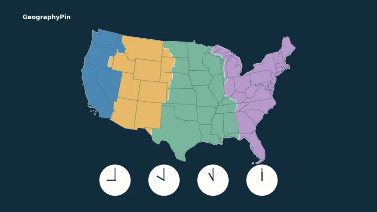
US Time Zones Map: States, UTC Offsets and DST Exceptions
A US time zones map answers one question: which geographic time zone is a place in? To know its clock time, you also need…
Read articleChoose a destination
Start with the overview, choose an interest, or explore the articles below.
United States · Borders
A US time zones map answers one question: which geographic time zone is a place in? To know its clock time, you also need…
Read article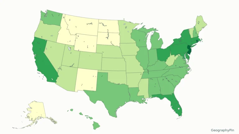
United States · Geography basics
A population-density map compares residents with land area, not just the number of people in each state. Consistent inputs make the state ranking meaningful.
Read article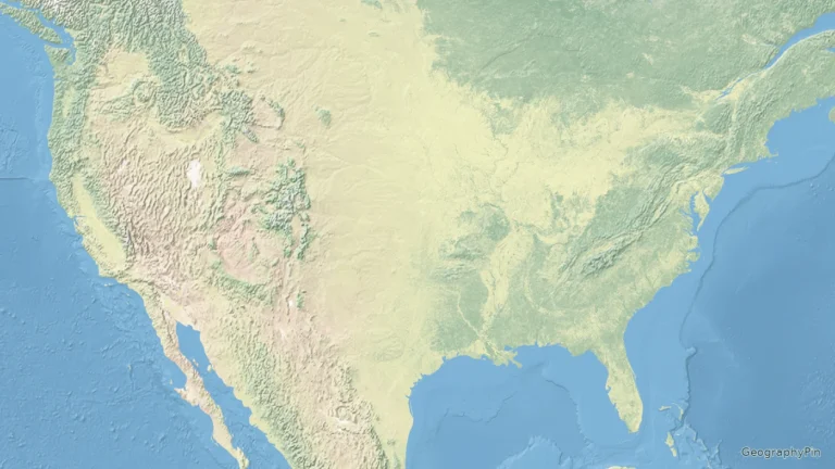
United States · Landforms
Follow terrain and water rather than state lines. The shaded-relief map shows selected mountain systems, plains, rivers and lakes, with separate views for Alaska…
Read article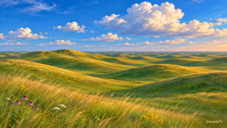
Nebraska · Borders
The letters NE can name a state in an address or abbreviate a compass direction or region elsewhere. Nebraska and the northeastern United States…
Read article
Maryland · Borders
Maryland’s narrow western extension and Chesapeake coastline can make it harder to recognize than a compact state outline. Its proximity to Washington, DC creates…
Read article
Oregon · Borders
In an address, OR identifies Oregon rather than the everyday connecting word “or.” A map reveals another distinction: the state’s Pacific coast and mountain…
Read article
New Mexico · Borders
New Mexico is a US state, not another name for the country of Mexico. Its location combines an international border, a four-state corner and…
Read article
Colorado · Borders
Colorado is often pictured as a wall of snowy peaks, but that image leaves out its eastern plains and western plateaus. The postal code…
Read article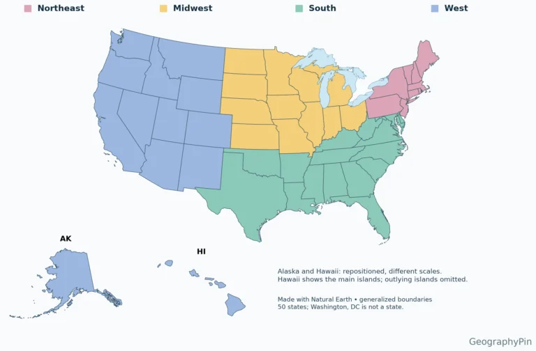
United States · Borders
A regional label is useful only when its definition is clear. This reference uses the Census Bureau’s statistical framework, rather than mixing it with…
Read articleUnited States · Borders
Use the labeled map to locate a state, the alphabetical table to identify its capital, or the blank PDF for a geography exercise. Two-letter…
Read article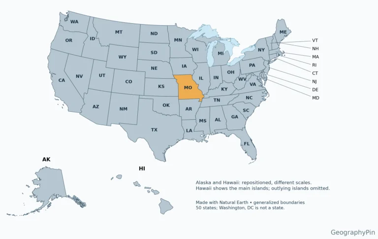
Missouri · Borders
A two-letter address code can identify a state without explaining where it is. Missouri is easiest to place by its neighbors and the two…
Read article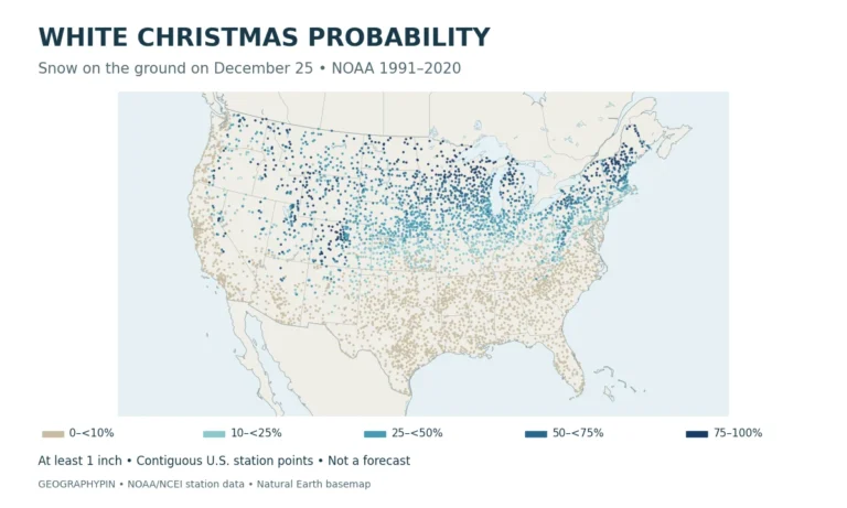
United States · Climate
Explore a White Christmas probability map based on NOAA data, with historical snow-cover odds for 24 U.S. stations. Learn what the numbers mean, not…
Read article