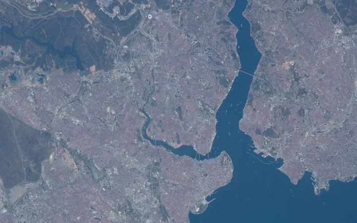
Cairo is often introduced through a pyramid photograph, but that can leave the geography muddled. The historic city, the west-bank city of Giza, the Nile Delta and Egypt’s new government seat are related places, not interchangeable names. Start with the river and the shape of the land around it.
Cairo is in northern Egypt, in northeastern Africa, beside the Nile near the southern apex of its delta. The historic urban core is on the east bank, opposite Giza on the west. Cairo is inland, not on the Mediterranean coast, and the Giza pyramids stand west of the river outside the historic Cairo core.
Orient yourself: Start with the valley-to-delta transition, compare Cairo and Giza, or distinguish the New Capital.
1. Find Cairo Where the Nile Valley Opens Toward the Delta
A narrow valley becomes a wider plain
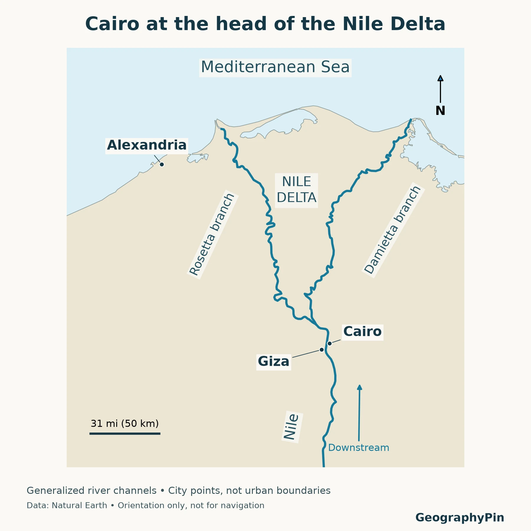
Follow the Nile northward through Egypt. South of Cairo, cultivated land follows a comparatively narrow corridor beside the river, bordered by desert. North of the metropolitan area, the cultivated plain broadens into the Nile Delta toward the Mediterranean Sea. Cairo sits near the transition between these two landscape patterns.
The delta’s southern tip is its upstream apex, not its mouth at the sea. This distinction explains why a source can describe Cairo as being “at the head of the delta” even though the city is well inland. The river continues north through delta channels before reaching the Mediterranean.
The Nile’s main modern distributary branches are the Rosetta branch to the west and the Damietta branch to the east. Distributaries carry water away from a branching river; tributaries bring water into one. A diagram with arrows pointing toward Cairo from both delta mouths would therefore reverse the broad downstream relationship.
North is downstream here
The Nile flows generally south to north through Egypt. “Upper Egypt” refers to the upstream country farther south, while “Lower Egypt” refers to the downstream north, including the delta. These are river-relative terms, not references to the top and bottom of a north-up page.
Cairo’s location helps make the terminology memorable: travel north from the city toward the Mediterranean and you move farther downstream into Lower Egypt. Travel south along the Nile and you move upstream toward the valley. A north arrow and a flow arrow tell different things, even when both point in the same general direction on this map.
The same distinction between landform and water system appears in GeographyPin’s delta versus estuary explanation. A place can be described in several valid ways, but each description needs a clear purpose and scale.
2. Separate Cairo, Giza and Greater Cairo
The river helps, but it is not the whole administrative story
The historic Cairo core developed on the east bank of the Nile. Giza lies across the river on the west bank. On a metropolitan map they form part of a connected urban region, but the names still matter: a location in Giza is not automatically a location in Cairo Governorate.
The river is a useful first orientation line, not a substitute for an administrative map. Islands, districts and the extent of modern development complicate any slogan that divides every urban address into a simple east-bank/west-bank pair. Use the actual governorate and district when an address or statistical boundary matters.
| Name | What it describes | What it should not be confused with |
|---|---|---|
| Cairo’s historic urban core | The older city on the Nile’s east side | The entire modern metropolitan area |
| Cairo Governorate | An administrative territory | Every place commonly marketed as being in Cairo |
| Giza | The west-bank city and, at a different scale, its governorate | The historic Cairo core |
| Greater Cairo | A broader metropolitan or planning region | One universally fixed city-limit boundary |
| Nile Delta | A physical landscape north of the metropolitan area | Cairo’s administrative area |
UN-Habitat’s Greater Cairo planning material defines its study area as the urban mass of Cairo Governorate, parts of Giza and Qalyubia governorates, and several new urban communities. That is a useful warning against using “Cairo” as if it always referred to the same outline. Other statistical studies may apply their own urban-agglomeration or built-up-area definitions, so their totals should be read with the accompanying methodology.
Why population figures differ
Cairo Governorate and Greater Cairo cover different territories, so their population totals are not interchangeable. Compare figures only when their year, boundary and status as census counts or estimates are clear.
3. Locate the Pyramids on the Giza Side
West of the Nile, not in the historic Cairo core
The famous pyramids of Khufu, Khafre and Menkaure stand on the Giza Plateau west of the Nile. They are associated with the wider Cairo metropolitan destination, but their physical location is on the Giza side, not among the historic streets east of the river.
A photograph that places pyramids in the foreground and dense urban development nearby is not necessarily misleading: the plateau is close to the edge of the modern urban area. The mistake is to assume that the pyramid complex marks the center of historic Cairo or that every Cairo landmark lies within one compact district.
Two different World Heritage properties
UNESCO’s Historic Cairo property concerns the city’s historic urban heritage. The pyramids belong to the separate property Memphis and its Necropolis – the Pyramid Fields from Giza to Dahshur. These names identify different heritage geographies.
The second property extends beyond the Giza pyramid group. It should not be reduced to one photograph of the Great Pyramid, just as Historic Cairo should not be treated as a label for every modern neighborhood in the metropolitan area. Check a property’s actual mapped boundaries when the question concerns heritage designation rather than general sightseeing.
4. Read the Satellite Image Without Mistaking Color for Geography
Vegetation, urban land and desert
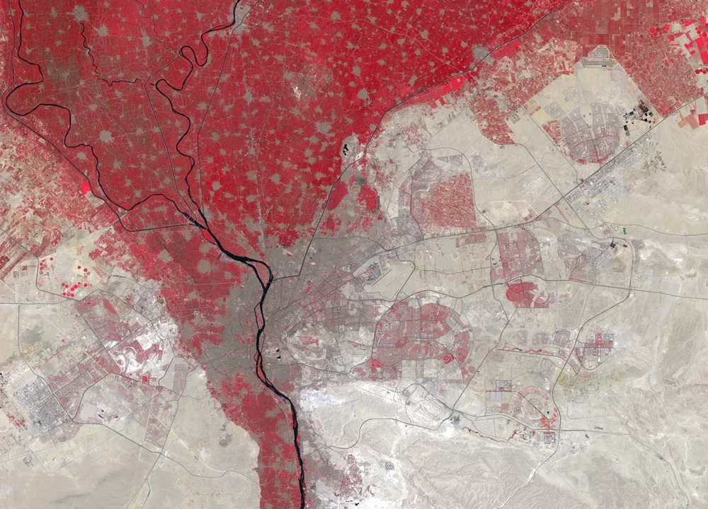
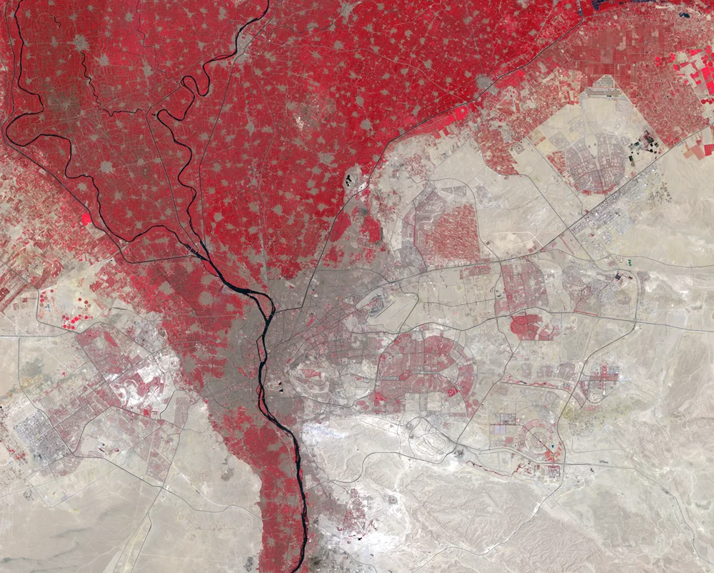
The accompanying USGS Landsat composite uses false color: vegetation appears red, while built-up areas and bare ground appear in contrasting gray, tan and pale tones. Red here does not mean fire, extreme heat or a political boundary. The image combines observations from August 8 and 9, 2024, so it is a dated view of the landscape rather than a live map.
The contrast reveals the geographic structure particularly well. Irrigated land follows the river and spreads through the delta, while extensive desert lies beyond it. Cairo’s urban area occupies part of that transition and extends beyond the older riverbank core.
Urban growth is not one simple outward circle
USGS’s Cairo Earthshots sequence documents urban expansion over several decades. The single image shown here illustrates the landscape; calculating a growth rate would require comparable dates, a defined study area and a consistent classification method.
River corridors, agricultural land, older settlements and newer development give Cairo a more complex pattern than a circular city surrounded by desert.
5. Keep Cairo Separate from the New Capital
A new government seat east of the older metropolis
Egypt’s New Capital is a distinct development east of Cairo. Government relocation does not move the Nile, the historic city or the pyramids, and it does not make the two place names synonyms.
The UK Permanent Committee on Geographical Names’ 2026 Egypt factfile lists Cairo and the New Capital and describes the latter as the seat of the Egyptian government. Egyptian presidential releases also document government meetings in the New Capital in 2026. Older sources often use “New Administrative Capital” for the same development.
For location questions, the important distinction is straightforward: Cairo’s historic core is beside the Nile, while the New Capital is farther east. For a legal or political question about capital status, name the source and date rather than assuming that moving offices automatically settles every constitutional term.
This is also why an older satellite caption calling Cairo the capital and a current government announcement mentioning the New Capital need not be read as maps of the same place. They may describe different functions and different moments in an ongoing administrative transition.
Frequently Asked Questions
Is Cairo on the Mediterranean Sea?
No. Cairo is inland beside the Nile near the southern apex of the delta. The Mediterranean coast is farther north, beyond the delta plain.
Are the pyramids in Cairo or Giza?
The famous Giza pyramid complex is on the Giza Plateau west of the Nile. It is part of the wider Cairo-area visitor destination, but it is not in the historic Cairo core on the east bank.
Does the Nile flow south from Cairo?
Its general downstream direction through Cairo and northern Egypt is northward toward the delta and Mediterranean Sea. Local bends do not change that overall direction.
Are Cairo and the New Capital the same city?
No. The New Capital is a separate development east of Cairo and serves as the government seat described in current official sources. The older Nile-side city remains a distinct place.
What Did We Learn Today?
Cairo sits near the transition from the narrow Nile Valley to the broader delta in northern Egypt. The historic core, west-bank Giza, the metropolitan region and the New Capital are different geographic references. Following the river north, distinguishing administrative boundaries from visible urban land and locating the pyramids on the Giza side makes the whole region easier to understand.
Sources & Data Notes
The regional map uses Natural Earth 1:10 million land, rivers and populated-place reference points, projected to UTM zone 36N. It is not a city street map, survey of riverbanks or administrative boundary map. Blue lines are generalized centerlines; the broad delta label does not define a measured boundary. Cairo and Giza points identify settlements, not the pyramid complex. No pyramid coordinate or urban footprint has been inferred from this dataset.
The satellite image is a USGS EROS false-color Landsat composite from August 8–9, 2024. It is credited to USGS, converted to a lightweight format, and not presented as current imagery. Population numbers are deliberately not compared across incompatible boundaries. The New Capital discussion uses dated 2026 government and geographical-names sources; it does not infer a constitutional amendment from the relocation of offices.
- USGS EROS: Cairo’s Urban Growth
- USGS EROS: Nile River Delta, Egypt
- Harvard Digital Giza: geographic terminology
- Egypt State Information Service: Giza Pyramids
- Egypt Ministry of Tourism and Antiquities: Giza Plateau
- UNESCO: Historic Cairo
- UNESCO: Memphis and its Necropolis
- UN-Habitat: Greater Cairo Urban Development Strategy
- UK PCGN: Egypt Toponymic Factfile, 2026
- Egyptian Presidency: meeting in the New Capital, September 29, 2026
- Natural Earth: public-domain data terms
- USGS EROS: data citation and reuse