What Makes the Nile the Longest River?
Have you ever wondered how experts decide which river truly earns the title of “longest”? For the Nile, it hinges on tracing its most distant headwaters and summing the reaches of its two mighty tributaries: the White Nile and the Blue Nile.
The White Nile begins with the Ruvyironza River in Burundi—one of the river’s farthest sources—flowing north through Lake Victoria and Uganda before meeting the Blue Nile at Khartoum. The Blue Nile, in turn, springs from Lake Tana in Ethiopia, carving deep gorges on its journey north. When combined, these tributaries stretch roughly 4,132 miles (6,650 km), according to the latest satellite-based mapping and field surveys (Britannica). This rigorous measurement method, endorsed by hydrologists and geographers, edges the Nile just ahead of other contenders like the Amazon.
Geography & Course
Tracing the Nile’s path is like reading chapters of a river’s life story—each segment reflects unique landscapes, cultures, and hydrological patterns. We can break its journey into four main reaches:
- Upper Nile: From headwaters in Burundi/Rwanda through Lake Victoria, across Uganda to Jinja Falls.
- Middle Nile: Northward through South Sudan’s vast swamps (the Sudd), joined by the Blue Nile at Khartoum.
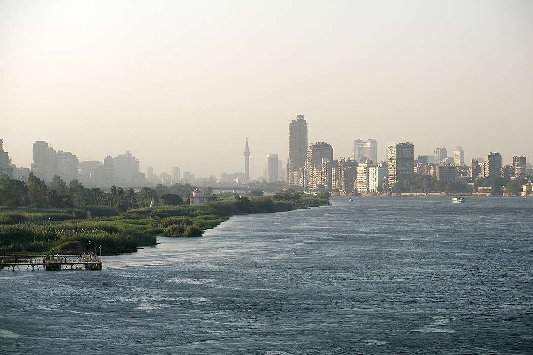
- Lower Nile: Carves through Sudanese deserts, then Egypt’s ancient cities—Aswan, Luxor, Cairo.
- Delta & Mouth: Fans out over Egypt’s fertile floodplains before emptying into the Mediterranean Sea.
In total, these segments span some 4,132 miles (6,650 km), touching eleven countries and crossing vast elevation changes—from over 5,400 ft in Ethiopia’s highlands to sea level at the Delta.
Key countries along the way include:
- Burundi & Rwanda (headwaters)
- Tanzania & Uganda (Lake Victoria)
- South Sudan & Sudan (Khartoum confluence)
- Ethiopia (Blue Nile tributaries)
- Egypt (Lower Nile & Delta)
| Segment | Length | Elevation Change |
|---|---|---|
| Upper Nile | ~1,600 mi (2,575 km) | ~5,400 ft → 3,100 ft |
| Middle Nile | ~1,000 mi (1,610 km) | ~3,100 ft → 1,000 ft |
| Lower Nile | ~1,100 mi (1,770 km) | ~1,000 ft → 100 ft |
| Delta & Mouth | ~432 mi (695 km) | 100 ft → 0 ft |
The steep drop in Ethiopia contrasts sharply with the Nile’s gentle gradient through Egypt’s floodplains, highlighting the river’s dramatic shifts in flow energy and sediment transport.
Hydrology & Seasonal Flows
What drives the Nile’s heartbeat? Its flow regime is defined by two complementary systems: the dependable, steady supply of the White Nile and the dramatic flood pulses of the Blue Nile.
- Annual Discharge: Averages 84 km³ annually—enough to fill over 33,000 Olympic pools—supporting irrigation and ecosystems.
- White Nile Flow: Provides a year-round base flow, thanks to equatorial rains, ensuring navigability even in the dry season.
- Blue Nile Flood Pulse: Contributes over 60% of total flow during peak floods (July–September), depositing fertile silt along the banks.
- Dammed Regulation: The Aswan High Dam stores up floodwaters and releases them steadily, transforming traditional flood-recession agriculture into perennial irrigation.
- Seasonal Variability: Downstream of the dam, monthly flows vary by less than 20%, a stark contrast to historical swings of over 300% pre-dam.
Historically, the annual inundation sculpted Egypt’s floodplains, but modern management balances water supply, hydroelectric power, and flood risk—all while grappling with sediment loss and ecological change.
Cultural & Historical Significance
Few rivers have shaped human destiny like the Nile. For over 5,000 years, its rhythms dictated the rise and fall of empires, inspired mythologies, and fostered trade across continents. Today, its legacy continues to bind diverse societies along its banks.
- Pharaonic Era: The Nile’s annual floods were seen as divine blessings—an event celebrated in ancient texts and temple reliefs, and personified by the god Hapi. Flood cycles synchronized agriculture, enabling the construction of monumental pyramids and temples.
- Greco-Roman Period: Alexandria emerged as a hub of learning and commerce, with the Nile’s Delta ports fueling trade between Africa, the Mediterranean, and Asia.
- Medieval Kingdoms: Nubian and Ethiopian kingdoms leveraged cataracts as natural defenses, while pilgrimage and trade routes along the Nile connected sub-Saharan Africa to the wider world.
- Colonial & Modern Times: 19th-century explorers like John Hanning Speke mapped its sources; British and French interests clashed over irrigation and navigation rights. Post-independence, Nile treaties remain central to regional geopolitics, reflecting both cooperation and contention.
- Cultural Fabric: Folk songs, poems, and modern literature—from Egyptian folk tales to contemporary novels—celebrate the Nile as a symbol of life and continuity.
Across eras, the Nile has been more than a waterway—it’s a cultural artery, fueling imagination and livelihoods. Its waters continue to sustain rituals, festivals, and daily life along its verdant banks.
Environmental Challenges & Management
Can modern treaties and technologies protect this ancient lifeline? Competing needs and changing climates raise tough questions.
- Water-Sharing Treaties: Historic deals (1959 Egypt–Sudan; 2010 Cooperative Framework) remain contested.
- Pollution: Urban runoff and agrochemicals threaten river health and human well-being.
- Climate Change: Shifting rainfall patterns risk extreme droughts or floods across the basin.
Comparisons & Debate
At first glance, the Amazon appears a close rival, but the contest over “longest” turns on headwater definitions, measurement methods, and seasonal dynamics. Here’s what experts weigh:
- Headwater Controversy: Nile’s most distant source traced to Burundi’s Ruvyironza vs. Amazon’s Apurímac River in Peru.
- Measurement Techniques: Field surveys, satellite GIS, and LiDAR mapping can shift results by ±100 miles.
- Seasonal Dynamics: Floodplain inundation extends the Amazon’s channels during wet months—less so for the regulated Nile.
- Institutional Estimates: USGS, Britannica, and Brazilian National Water Agency report lengths ranging from 4,000 to 4,345 miles for the Amazon.
- Consensus: Most hydrologists uphold the Nile at 4,132 miles, but ongoing research may refine these figures further.
| River | Length (mi/km) | Measurement Basis | Debate Point |
|---|---|---|---|
| Nile | 4,132 mi / 6,650 km | Satellite + field surveys | Choosing true headwater tributary |
| Amazon | 4,000–4,345 mi / 6,400–7,000 km | LiDAR, GIS, expedition journals | Floodplain channel changes & headwater definition |
FAQ
How many countries does the Nile flow through?
Eleven—from its headwaters in Burundi/Rwanda through Uganda, South Sudan, Sudan, and Egypt to the Mediterranean.
What are the Nile’s main tributaries?
The White Nile (Lake Victoria) and Blue Nile (Lake Tana), plus the Atbara.
Why is the Aswan High Dam important?
It controls floods, powers communities, and stores water, though it limits downstream silt flow.
Does the Nile still flood naturally?
No—dams now regulate peak flows, preventing natural inundations that once enriched fields.
What threats face the Nile today?
Water disputes, pollution, and climate shifts challenge its future role as Africa’s lifeline.
What Did We Learn Today?
- The Nile’s 4,132 mi length secures its title as Earth’s longest river.
- Its waters sustain eleven countries, feeding agriculture and communities.
- Seasonal floods once sculpted ancient civilizations; today, dams control its flow.
- Ongoing environmental pressures—from treaties to climate change—will chart the Nile’s future.