Baku is easy to recognize in a skyline photograph, but harder to understand from a single city pin. Azerbaijan’s capital occupies the southern side of a peninsula, faces an inland sea, and belongs to a much larger administrative area than its waterfront center. Those three scales explain many apparently conflicting descriptions of the city.
Baku is the capital of Azerbaijan, on the western coast of the Caspian Sea in the South Caucasus. Its central urban area lies on the southern side of the Absheron Peninsula, around Baku Bay. The wider administrative city includes outlying settlements; it is not the same area as the historic center or the entire peninsula.
How to use this guide: Locate the coast first, then compare the satellite colors, understand the population boundary, and separate the modern port from the downtown waterfront.
1. Where is Baku?
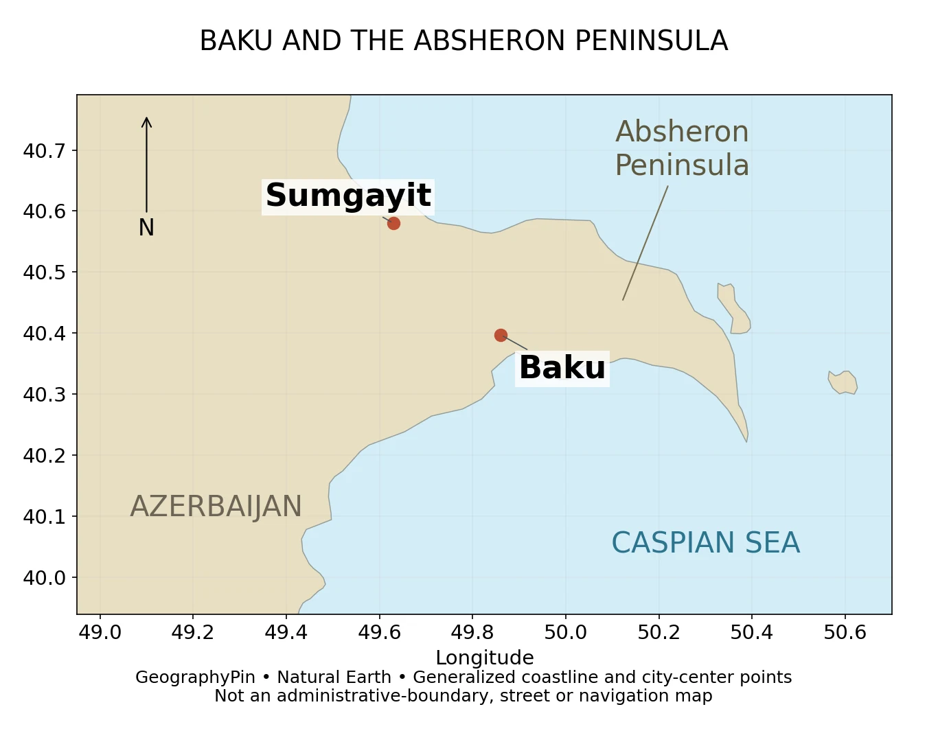
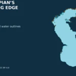
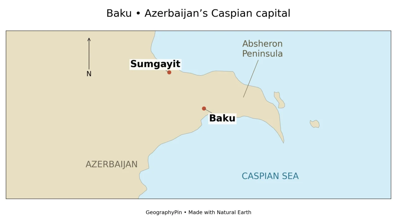
On a regional map, find Azerbaijan on the Caspian’s western shore, then look for the eastward-projecting Absheron Peninsula. Baku’s central waterfront is on its southern side. Sumgayit, another city shown for orientation, lies farther northwest along the coast.
Baku is on the Caspian Sea, not the Black Sea. That distinction matters when tracing routes across the Caucasus. Our Azerbaijan country profile places the capital in its national setting; the map here zooms in on the peninsula and nearby coast.
Three names describe different kinds of place. Baku names the capital and its administrative territory. Absheron Peninsula describes a landform. Absheron district names a separate administrative unit. They overlap in everyday regional descriptions, but they are not interchangeable boundaries.
2. Read the Absheron Peninsula from space
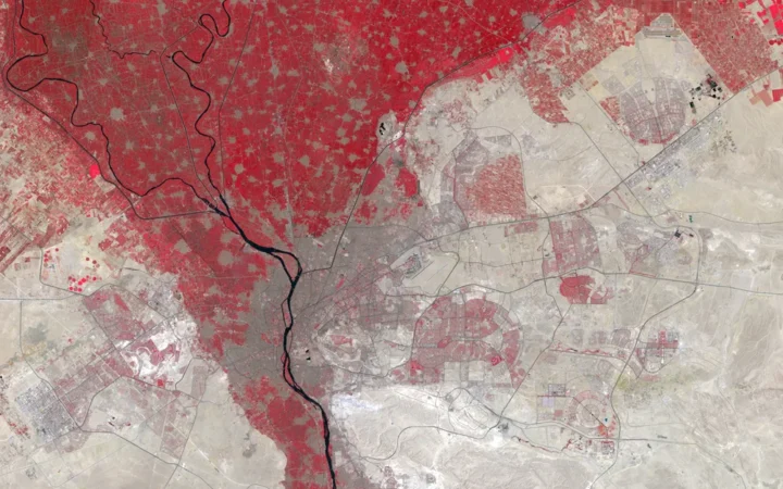
A real satellite view, not a natural-color photograph
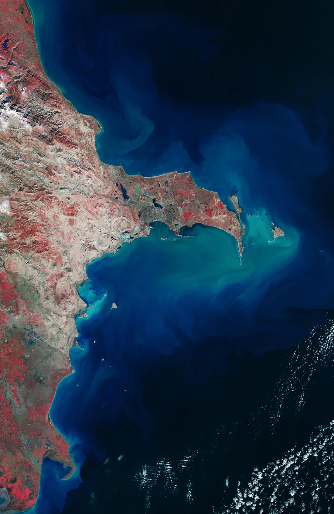
The peninsula’s shape is clearer from above than from a skyline. The land projects eastward into the Caspian, while the dense urban fabric around Baku occupies part of the southern coast and spreads inland. The locator and satellite view answer different questions: one simplifies positions, while the other shows the texture of the landscape.
ESA processed this January 2026 Sentinel-2 image using near-infrared information. Vegetation appears red, rather than the green expected in an ordinary photograph. Built-up areas appear in gray tones, and water is predominantly dark blue. Red represents vegetation, not fire.
The concentrated urban texture around the southern bay contrasts with scattered settlements and open land elsewhere on the peninsula.
3. Baku’s population depends on the boundary
About 2.36 million in the administrative city
Azerbaijan’s State Statistical Committee reports 1,201.5 thousand women and 1,154.7 thousand men for “Baku city – total” as of January 1, 2026. Adding the published rounded components gives approximately 2,356,200 residents, or 2.36 million, for that administrative unit.
The statistics office updates population estimates from census results using births, deaths and permanent-residence migration.
| Term | What it describes | Use in this article |
|---|---|---|
| Administrative Baku | The official city territorial unit, including its constituent districts and settlements. | About 2.36 million residents on January 1, 2026. |
| Built-up urban area | A continuous or consistently defined concentration of buildings and urban land. | No separate population estimate supplied here. |
| Metropolitan region | A wider functional area, often defined using commuting and economic links. | Not treated as identical to administrative Baku. |
| Absheron Peninsula | A physical landform, not a census unit by itself. | Used for geographic orientation. |
The same official table lists Sumgayit city and Absheron district separately from Baku.
Baku’s city authority identifies 12 administrative districts, encompassing a much wider territory than the downtown waterfront.
4. The Old City is not the whole city
Icherisheher, the walled Inner City, is the historic core within the modern capital. UNESCO inscribed the Walled City of Baku with the Shirvanshah’s Palace and Maiden Tower on the World Heritage List in 2000. The listed property covers about 53 acres (21.5 hectares), a very different scale from the administrative city.
The walls, palace, tower and surrounding historic urban fabric record the city’s long relationship with trade, settlement and the sea.
UNESCO’s conservation guidance emphasizes preserving the historic city’s wider setting and its relationship with the sea. That is a geographic issue as well as an architectural one: new construction outside a monument’s walls can change how the monument relates to the surrounding skyline and waterfront.
For a map reader, the useful distinction is historic core versus modern capital. The Old City is an essential part of Baku, but neither its area nor its resident population can stand in for the whole city.
5. Why the port and energy geography matter
The Port of Baku is not simply the downtown bay
The modern Port of Baku complex is at Alat, roughly 43 miles (70 km) from the capital’s central area. Azerbaijan’s transit authorities place it at the intersection of major rail and road connections. A search for “Baku port” can therefore lead to a location well outside the familiar boulevard-and-Old-City waterfront.
The port’s importance comes from connecting transport modes. Goods can cross the Caspian by ship and continue overland by rail or road. The official description identifies ferry, roll-on/roll-off and general-cargo functions.
The region’s oil and gas geography adds another layer. NASA explains that the sedimentary basins around Baku and the southern Caspian contain trapped hydrocarbons and pressurized fluids. Mud volcanoes and gas seeps are surface expressions of some of those geological conditions. Mud volcanoes typically expel mud, water and gases, not molten lava.
The commercial port, offshore energy sites and geological features connect Baku to the wider Caspian region in different ways.
6. A changing coast and a growing city
Baku’s waterfront belongs to an enclosed inland water body. The Caspian’s water level can change, so a coastline is not a timeless line. A generalized atlas layer and a recent satellite image may also differ because of their dates, resolution and treatment of small coastal features. Our Caspian Sea explainer covers the basin’s wider hydrology.
Parts of Baku’s coastal setting lie below global sea level, but one often-quoted elevation should not be applied to every neighborhood. The city extends inland across varying terrain. “Below sea level” is a reference to elevation, not proof that a street lies underwater: the Caspian itself occupies a basin below the level of the world ocean.
The Baku Master Plan through 2040 was approved in December 2023. The planning authority describes a shift toward multiple urban centers, together with transport improvements, environmental restoration and heritage protection. These are planning objectives, not evidence that every proposed project has already been built.
Its published scope covers about 820 square miles (2,123 km²) of administrative territory. That planning-area figure helps illustrate the contrast with the compact historic core; it should not be read as the area of uninterrupted buildings.
Frequently Asked Questions
Is Baku in Azerbaijan or Russia?
Baku is the capital of Azerbaijan. References to its history within the Russian Empire or Soviet Union do not describe its present national location.
Is Baku on the Black Sea?
No. It is on the western coast of the Caspian Sea, on the southern side of the Absheron Peninsula.
Is Absheron another name for Baku?
No. The Absheron Peninsula is a landform, while Baku is a city and administrative territory. Absheron district is also a separate administrative unit. The terms should not be used as equivalent boundaries.
How many people live in Baku?
The official administrative city total is about 2.36 million as of January 1, 2026, calculated from the State Statistical Committee’s published female and male totals. Estimates for a wider metropolitan area may use a different boundary.
What Did We Learn Today?
Baku is a Caspian capital on the Absheron Peninsula, but its historic center, built-up footprint and administrative territory are not the same place. The official population belongs to a stated boundary and date, the Old City occupies only a small part of the capital, and the modern port operates at Alat rather than simply along the downtown waterfront. Keeping those scales separate makes both maps and statistics easier to understand.
Sources & Data Notes
Population refers to the administrative city on January 1, 2026. The 2,356.2-thousand total is the sum of the official rounded female and male values; no metropolitan total is inferred. The 2,123 km² figure describes the administrative scope quoted when the 2040 plan was approved in 2023. Approximate customary-unit conversions are rounded.
GeographyPin’s locator and featured map use Natural Earth 1:10-million country/coastline and populated-place data. They show approximate city reference points, not district boundaries, buildings or present harbor geometry. The satellite image is a separate ESA rendering of January 2026 Copernicus Sentinel data, reproduced under CC BY-SA 3.0 IGO with credit. Its colors are deliberately non-natural; it is not a live view.
- Baku city authority: geographical position and administrative districts
- State Statistical Committee: Women and Men in Azerbaijan 2026, Table 1.4, printed page 40
- State Statistical Committee: population-estimate methodology
- UNESCO: Walled City of Baku
- ESA: Earth from Space, Baku, Azerbaijan
- Azerbaijan Transit Coordination Council: maritime transport and ports
- NASA Earth Observatory: mud volcano islands in Azerbaijan
- State Urban Planning and Architecture Committee: Baku Master Plan approval and scope
- Natural Earth: public-domain map data