Two maps can give very different answers to “How close is Alaska to Russia?” without showing different countries. One measures between the continental mainlands; the other includes two islands in the middle of the Bering Strait. Choosing the endpoints is the first step toward a useful answer.
U.S. agencies describe the mainland gap between Alaska and Russia as approximately 53–55 miles (85–89 km). Their territories come much closer at the Diomede Islands: about 2.4–2.5 miles (3.8–4 km) separates the facing shores. The map calculations below use explicitly identified shoreline points; none of these distances describes an unrestricted travel route.
How to use this article: Find the mainland–island distinction, inspect the measurement method, or separate the border from the calendar line.
1. Find the Bering Strait on the map
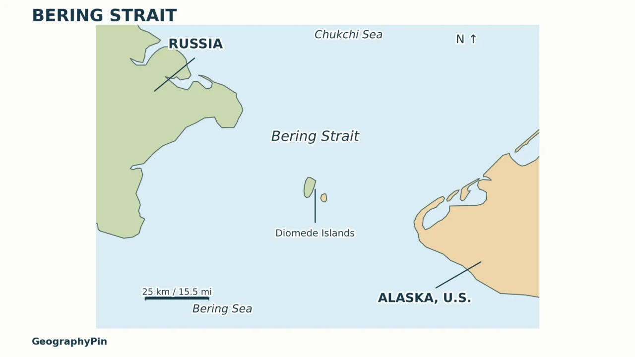
The Bering Strait lies between the Chukchi Peninsula of far eastern Russia and the Seward Peninsula of western Alaska. The Bering Sea is to the south; the Chukchi Sea, part of the Arctic Ocean, is to the north. This is where Asia and North America approach one another across a narrow marine passage, not where they share a land border.

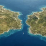
On an ordinary north-up map, Russia is on the left and Alaska on the right. Cape Dezhnev is the Russian cape at the eastern tip of mainland Asia; Cape Prince of Wales is the Alaskan cape across the water. The Diomede Islands lie offshore between the mainlands: Big Diomede to the west, Little Diomede to the east.
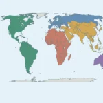
A world map cut near the Pacific can place Alaska and Russia on opposite edges of the sheet. That is a choice about where to cut the globe, not an ocean-wide separation. A local map centered on the strait restores their actual neighborhood.
The waterway also illustrates what makes a strait a strait: it connects larger waters while separating land. The Diomedes divide the passage into western and eastern channels. A line across the entire mainland gap therefore measures something different from the width of either individual channel.
2. Why Alaska–Russia distances differ
Mainland coasts and island shores are different endpoints
The National Park Service gives approximately 55 miles (89 km) between mainland Russia and mainland Alaska. NOAA Fisheries uses around 53 miles (85 km). These are rounded descriptions of a coastal gap, not interchangeable survey coordinates. A map with explicit endpoints lets readers see exactly which comparison is being made.
| Comparison | Useful scale | What it includes |
|---|---|---|
| Mainland Russia to mainland Alaska | Agency summaries: around 53–55 miles (85–89 km) | The continental coasts around Cape Dezhnev and Cape Prince of Wales; offshore islands excluded. |
| Big Diomede to Little Diomede | About 2.4–2.5 miles (3.8–4 km) | The gap between the facing island shores; Russian and U.S. territory included. |
| One settlement or airport to another | Requires its own endpoints | A transport or community-to-community question, not the minimum separation of countries. |
NASA Earth Observatory reports 2.4 miles (3.8 km) between the Diomedes, while the National Park Service gives about 2.5 miles (4 km). The useful conclusion is that the island gap is only a few miles wide. Quoting many decimal places would imply a fixed definition of shoreline and a level of accuracy that those broad descriptions do not supply.

How to read the measured lines
A reproducible distance needs two stated endpoints and a stated method. A geodesic is the shortest path between two points on a chosen model of Earth’s surface. It is more appropriate here than measuring a line in screen pixels or treating a degree of longitude as a fixed distance everywhere.
The original maps use Natural Earth’s generalized 1:10 million coastline geometry. Nearest points on the selected facing shorelines are found in a local projected coordinate system; their separation is then calculated geodesically on the WGS84 ellipsoid. That produces a mapped mainland example of about 51 miles (81 km) and a Diomede example of about 2.5 miles (4 km). These are not surveyed or tide-independent minimum distances. The difference from broader agency figures should not be mistaken for proof that those agencies are wrong.
| Mapped line | Western endpoint | Eastern endpoint |
|---|---|---|
| Mainland: about 51 miles (81 km) | Russia: 66.02197° N, 169.69521° W | Alaska: 65.68598° N, 168.11543° W |
| Diomedes: about 2.5 miles (4 km) | Big Diomede: 65.77721° N, 169.02455° W | Little Diomede: 65.76472° N, 168.94298° W |
Coordinates retain extra digits only so the calculation can be reproduced; they do not imply survey-level coastal accuracy. The mainland endpoints lie on the mapped coasts around the named capes, rather than at arbitrary cape-label or settlement centers. Generalized coastlines are sufficient for a regional comparison but cannot establish the exact real-world narrowest gap.
Changing from shores to island centers increases the separation because each endpoint moves inland. Choosing a settlement, cape label or airport also changes the question. Always keep the number attached to its endpoints rather than shortening every version to “Russia is this far from America.” For the notation used in a coordinate table, see how to read latitude and longitude.
3. The border and International Date Line
A political boundary is not a clock rule
The maritime boundary between Russia and the United States passes between Big and Little Diomede. The International Date Line also passes between the islands. Their proximity makes the distinction especially memorable: a short physical gap separates territories whose calendars lie on opposite sides of the date-line convention.
These lines do different jobs. The international boundary distinguishes national territories and jurisdictions. The date line concerns the change of calendar date across the Pacific. One does not authorize travel across the other, and neither can be identified merely by looking for a visible mark on the sea.
The date line is often simplified to the 180th meridian on a classroom globe, but it does not follow that meridian everywhere. Its route through the Bering Strait keeps the Russian and Alaskan sides on their respective sides of the calendar divide. The Diomedes are therefore a good counterexample to the idea that the date line must be a perfectly straight longitude line.
Big Diomede is sometimes nicknamed “Tomorrow Island” and Little Diomede “Yesterday Island.” Those nicknames should not be turned into an automatic claim that their clocks are always exactly 24 hours apart. Civil time zones and seasonal clock rules are a separate calculation. For the general eastward and westward rule, see the International Date Line explanation.
4. A sea passage is not a walking route
A short gap on a map is not evidence of a safe crossing. Sea ice can form between the Diomedes, but ice conditions, currents and weather are not fixed. A photograph showing connected ice records conditions at that moment; it does not establish a dependable pedestrian surface or a legal border crossing.
Research presented by the National Park Service and Kawerak describes currents that vary by place, tide, wind and season. It emphasizes the detailed knowledge that Indigenous hunters, boat captains and other local experts use to understand sea-ice movement and travel conditions. Treating the strait as a simple frozen footpath erases precisely the environmental complexity that matters most.
NOAA describes the strait as a passage through which Pacific water generally flows northward toward the Arctic. This exchange helps explain why a geographically small opening matters well beyond the two coasts. It also reminds readers that the water between the islands is part of an active ocean system, not an enclosed, still lake.
Use these maps for geographic understanding, not trip planning. They do not establish permission to enter either country, identify an authorized crossing, show a safe ice route or replace navigation charts. Anyone assessing an actual journey would need current official entry requirements, specialist local advice and appropriate marine information rather than a straight-line distance.
5. Bering Strait versus the Bering Land Bridge
The modern sea passage and the ancient Bering Land Bridge are not the same kind of connection. During colder periods of the Ice Age, more water was held in continental ice sheets and global sea level was lower. Land now beneath the Bering and Chukchi seas was exposed, linking Asia and North America.
The National Park Service describes that exposed connection as a broad landscape rather than a narrow engineered bridge. Beringia is also a wider regional concept: it includes surrounding parts of northeastern Asia and northwestern North America, not just the patch of sea between today’s capes.
As sea level rose, the land connection flooded. Seasonal sea ice today is frozen seawater over an existing marine passage; it does not recreate the former dry-land landscape. This distinction prevents a common mix-up between an ancient land bridge, a present-day ice cover and a proposed transport bridge.
Reading the maps in that order resolves the main question: first identify the modern continental shores, then zoom in on the islands, and finally keep the deeper history separate. The small island gap is real, but it does not mean the continental mainlands are only two or three miles apart.
Frequently Asked Questions
Can you see Russia from Alaska?
Yes, from suitable locations and in clear conditions. NASA describes Big Diomede as visible from the community on Little Diomede. That is a specific island-to-island view, not a claim that Russia is visible from anywhere in Alaska.
Why do some maps label Russia with a west longitude?
Longitude is measured east or west of the prime meridian, not according to a country’s name or position on a page. Far eastern Russia extends across the 180th meridian, so places around the Bering Strait can have west longitudes even though they are in eastern Russia.
What Did We Learn Today?
An Alaska–Russia distance only makes sense when its endpoints are clear. Mainland coasts are tens of miles apart, while the facing Diomede shores are only a few miles apart. A map’s scale and measurement method explain the difference; the political boundary, date line and former land bridge explain different aspects of the same region. None makes the strait an unrestricted or reliably walkable crossing.
Sources & Data Notes
Published agency distances are rounded comparisons, not survey guarantees: NPS gives about 55 miles for the mainland gap and 2.5 miles for the islands; NOAA gives around 53 miles and roughly 4 km; NASA gives 2.4 miles (3.8 km) for the islands. The map’s source geometry and selected endpoints are listed in the measurement section above so its calculated lines are not confused with an official minimum distance. This is an educational locator, not a nautical chart or legal boundary survey.
- National Park Service: How Close Is Alaska to Russia?
- NOAA Fisheries: Bering Strait measurements, channels and ocean exchange
- NASA Earth Observatory: Yesterday and Tomorrow Islands
- National Park Service / Kawerak: Ocean Currents and Food Security
- National Park Service: About Beringia
- Natural Earth: public-domain basemap terms