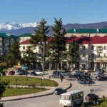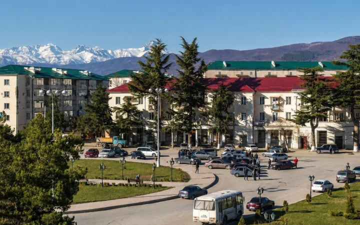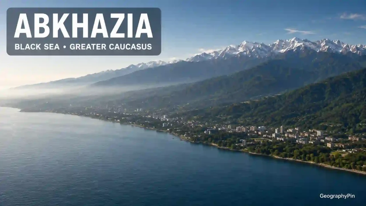
Abkhazia is a mountainous Black Sea region of about 3,340 square miles (8,660 square kilometers), internationally recognized by most states as part of Georgia but governed by de facto Abkhaz authorities. Its distinct Abkhaz homeland also contains centuries-old Georgian, especially Mingrelian, settlement, making its geography inseparable from both identity and conflict.
How to use this article: Start with the fast map check, clarify the political status, see how to read the population figures, or compare the region’s connectors and barriers.
Where Abkhazia Is and What Its Map Shows
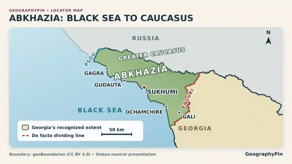
Abkhazia runs northwest to southeast along the northeastern Black Sea coast. Russia lies beyond the Psou and Greater Caucasus to the north; much of the southeastern de facto dividing line follows the Enguri. It is part of the western South Caucasus, whose placement in Europe or Asia depends on the continental convention.
Fast map check
| Feature | Geographic answer |
|---|---|
| Location | Eastern Black Sea coast in the western South Caucasus |
| Area | About 3,340 square miles (8,660 square kilometers) |
| Main city | Sukhumi, also commonly rendered Sukhum; Aqwa is the Abkhaz name |
| Physical frame | Coastal lowland, forested foothills, deep river valleys, and high Greater Caucasus ranges |
| Population baseline | The latest de facto census, in 2011, reported 240,705 residents; later official estimates approach 244,000, but independent estimates can be lower and most displaced people are not included |
| Main languages | Abkhaz, Russian, Georgian, Mingrelian, and Armenian |
| Political status | De facto Abkhaz administration; recognized by almost all UN member states as part of Georgia; recognized as independent by Russia, Nicaragua, Venezuela, and Syria |
Why the map needs two kinds of boundary
One line describes international law; another describes control. Almost all UN member states recognize Abkhazia within Georgia. As of August 2026, Russia, Nicaragua, Venezuela, and Syria recognize its claimed independence. Georgia and European institutions call the region Russian-occupied; Abkhaz authorities reject that description and call it independent. Abkhaz institutions administer it, while Russian forces and border guards have a decisive security presence.
A neutral map should show Georgia’s internationally recognized border and label Abkhazia’s line of effective control as disputed. For the national frame, see Georgia’s wider physical and political geography.
From Subtropical Coast to High Caucasus
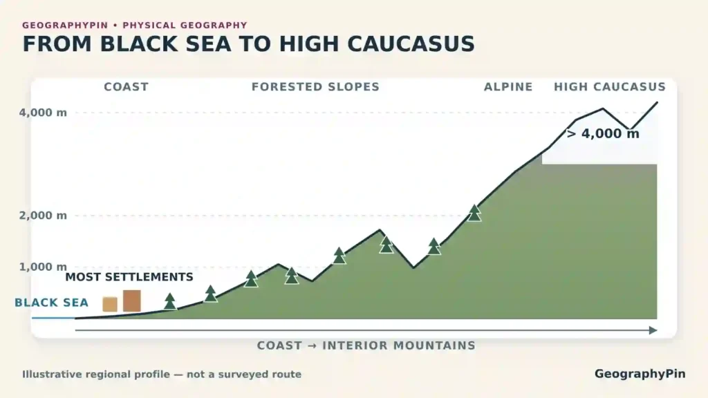
Abkhazia’s defining physical fact is how quickly the land rises. A narrow, humid coastal zone faces the Black Sea; behind it, foothills climb into the Gagra, Bzyb, and Kodori ranges. Several peaks in the northeast and east exceed 13,000 feet (4,000 meters), even though the sea is never far away.
Coast, foothills, and high mountains
The coast has a humid subtropical climate, with mild winters, warm summers, and enough moisture for citrus, tea, vineyards, and dense vegetation. Elevation changes the climate sharply. Forested slopes give way to alpine grasslands, long-lasting snow, and glaciers in the highest parts of the Greater Caucasus.
This vertical pattern shapes settlement. Most people, farms, roads, and towns occupy the coast or lower valleys; the high interior is thinly populated. Mountains helped local cultures endure, while the coast connected the region to Mingrelia, the wider Black Sea, and routes toward Russia.
Rivers, lakes, forests, and caves
Short, fast rivers descend from the mountains to the Black Sea. The Psou marks much of the northwestern edge; the Bzyb drains the Lake Ritsa area; the Gumista reaches the sea near Sukhumi; the Kodori cuts one of the region’s deepest valleys; and the Enguri has become both a river system and a political dividing line.
Lake Ritsa is the best-known mountain lake, set among steep forested slopes. The limestone massifs of Arabika and Bzyb contain Krubera, Veryovkina, and other cave systems counted among the deepest known on Earth. Broadleaf and conifer forests cover much of the uplands, while the coastal plain carries the heaviest imprint of agriculture, resorts, roads, and urban growth.
Cities, Districts, and the Coastal Settlement Axis
Abkhazia’s main settlements form a chain between mountain and sea, linked by the coastal road and railway. Names vary by language: Sukhumi also appears as Sukhum, Ochamchire as Ochamchira, and Gali as Gal.
A northwest-to-southeast chain of places
- Gagra lies near the Russian border and developed as a major Black Sea resort. Its position makes it the northern gateway to the coastal corridor.
- Pitsunda occupies a projecting cape known for its pine landscape, beaches, and Soviet-era resort development.
- Gudauta sits on the central northwestern coast and has major political and cultural importance in modern Abkhaz public life.
- New Athos is associated with its monastery, historic Anakopia, and a large karst cave.
- Sukhumi is the principal city, port, educational center, and administrative capital. Before the war it was a particularly mixed urban space.
- Ochamchire serves the southeastern coastal plain, while inland Tkvarcheli developed around coal mining and industry.
- Gali, close to the Enguri, is the center of a predominantly Georgian and Mingrelian-speaking borderland whose daily geography extends toward Zugdidi and Samegrelo.
Transport follows the coast
The main highway and railway occupy the same narrow coastal corridor as most settlements. In the Soviet period, that line carried tourists, agricultural produce, students, and workers through Abkhazia toward western Georgia and the rest of the union. Since the war, regular external connections have increasingly faced north toward Russia, while movement south across the Enguri has been restricted.
Regular passenger flights from Russia began using Sukhumi’s airport in May 2025 after roughly three decades, strengthening the northward orientation and shortening journeys for residents. Georgia and the European Union objected because the service began without Georgian authorization or a necessary international aviation code.
Peoples, Languages, and the Human Map
The Abkhaz are a distinct Northwest Caucasian people whose language is related to Abaza and the Circassian languages, not Georgian. Georgian and Mingrelian belong to the Kartvelian family. Mingrelians generally identify within the wider Georgian nation while maintaining a regional language and identity.
Armenians, Russians, Greeks, and others also shaped the region. Russian became the main cross-community language in the Soviet era and remains dominant in much public life. Abkhaz religious life includes Orthodox Christian, Sunni Muslim, and indigenous traditions.
How to read the population figures
The censuses are not directly comparable. The 1897 count recorded language, the 1926 census separated some Kartvelian groups, and later Soviet counts usually included Mingrelians within the Georgian category. Samurzakanians also shifted between classifications, a problem examined in Daniel Müller’s demographic history.
| Census | Selected result | What it establishes | Main caution |
|---|---|---|---|
| 1897 | 58,697 Abkhaz-language speakers; 23,810 Mingrelian speakers; 1,971 Georgian and Imeretian speakers | A substantial Mingrelian presence existed decades before Stalin, while Abkhaz speakers were the largest recorded group | It measured mother tongue in the Sukhumi district, not modern ethnicity |
| 1926 | 67,494 people in Georgian and related Kartvelian categories, including 40,989 Mingrelians; 55,918 Abkhaz; 201,016 total | Georgian and Mingrelian settlement plainly did not begin with Stalin’s later resettlement program | Mingrelians and other groups were classified differently from later censuses |
| 1989 | 525,061 total: 239,872 Georgians, 93,267 Abkhaz, 76,541 Armenians, and 74,913 Russians | Georgians were 45.7% and Abkhaz 17.8%, a balance central to both communities’ political fears | The war soon made this prewar snapshot incomparable with later counts |
The latest de facto census, held in 2011, reported 240,705 residents and an Abkhaz majority. Later de facto statistics put the population near 244,000, while independent estimates can be substantially lower. The numbers describe the postwar resident population, exclude most displaced people, and lack full independent verification; they cannot decide who historically belonged.
Samurzakano was a contact zone, not a timeless ethnic wall
Historical Samurzakano covered much of the southeast around present-day Gali, though its boundaries changed. It was an Abkhaz–Mingrelian transition zone where language, marriage, local loyalty, and census identity could differ. Some residents were bilingual, and imperial officials sometimes classified Samurzakanians separately.
Not every district was equally mixed. Abkhaz settlement was strong in several central and northwestern rural areas, while Georgian and Mingrelian settlement was densest in the southeast. The pattern was layered.
How Geography Connected Communities
Before the war, Abkhaz, Georgians, Armenians, Russians, and others shared schools, workplaces, neighborhoods, Russian-language public life, and mixed families. National identity remained real, as did political grievances.
Two distinct peoples in one social world
Research on mixed families records intermarriage and shared institutions while showing that surname, paternal line, and community expectations still mattered. It supports a shared society, not one ethnicity.
Calling the Abkhaz Georgian denies a separate identity. Calling all Georgian residents Stalinist outsiders denies older roots and generations born in the region.
The same features became connectors and barriers
| Geographic feature | Earlier connective role | Effect of conflict and separation |
|---|---|---|
| Coastal road and railway | Linked resorts, farms, cities, and markets with western Georgia and the wider Soviet network | Through movement was broken or restricted, while regular routes became more strongly oriented toward Russia |
| Sukhumi | Mixed port city, university center, workplace, and meeting point | War and displacement transformed its population and separated it from much of its former social hinterland |
| Samurzakano and Gali | Transition zone of Mingrelian and Abkhaz settlement, kinship, language, and trade | Became a securitized borderland where documentation and crossing rules shape daily life |
| Enguri River and bridge | Connected neighboring communities within one economic and family space | Now carries much of the de facto dividing line and funnels movement through controlled crossings |
| Enguri power system | Built as one integrated regional electricity network | Still requires cross-line technical coordination even while electricity use and control remain politically disputed |
Table downloads (3)
- Abkhazia at a glance (8 × 2)View tableDownload CSV
- Selected demographic snapshots and their limits (4 × 4)View tableDownload CSV
- How conflict changed the function of Abkhazia’s geography (6 × 3)View tableDownload CSV
The Enguri power system still crosses the divide
The Enguri complex contradicts total separation. Its dam and reservoir are on the Georgian-controlled side; the powerhouse and part of the cascade lie under de facto Abkhaz control. Technical operation therefore crosses the divide.
Electricity allocation causes disputes and shortages, yet water, tunnels, turbines, and transmission lines still impose practical interdependence.
The History Behind the Map
Political arguments often become contests over who came first, although ancient and medieval labels did not carry today’s fixed national meanings. The region passed through Colchis, Lazica, Abasgia, western Georgian kingdoms, local principalities, Ottoman influence, Russian rule, and the Soviet Union.
The Kingdom of Abkhazia belongs to both histories
The Kingdom of Abkhazia emerged in the late eighth century and expanded across western Georgia, with its center at Kutaisi. Georgian replaced Greek as the principal church and literary language, and the kingdom helped drive the unification completed under Bagrat III around 1008.
It was a medieval, multiethnic polity—not a modern Abkhaz nation-state or proof that Abkhaz are Georgians. Its name and ruling tradition belong to Abkhaz history; its language, territory, and unifying role belong centrally to Georgian history.
Principality, Russian conquest, and demographic change
After Georgian political unity fragmented, Abkhazia became a locally ruled principality under the Shervashidze, or Chachba, dynasty, with shifting ties to Mingrelia and growing Ottoman influence. Russian protection began in 1810 and direct rule in 1864.
Russian conquest and later revolts brought mass Abkhaz exile, or muhajirism, to the Ottoman Empire. Tens of thousands were uprooted, creating a large diaspora and transforming the homeland.
Migration from Mingrelia then increased alongside Armenian, Greek, Russian, and other settlement. Georgian presence was old but also enlarged over time—neither created wholly by Stalin nor unchanged since antiquity.
From negotiated autonomy to the Soviet treaty republic
In 1918, Georgia and the Abkhaz People’s Council agreed on internal Abkhaz self-government under a still-unfinished framework. Georgia’s 1921 Constitution called Abkhazia integral and promised autonomy. Georgian accounts stress negotiated inclusion; Abkhaz accounts also remember Georgian military intervention, wartime rule, and an autonomy never fully settled.
Soviet Abkhazia then held an unusual treaty-republic status. The 1921 union treaty joined major functions with Soviet Georgia and placed Abkhazia in the Transcaucasian federation through it. In 1931 Abkhazia became an autonomous republic within Soviet Georgia—a status demotion central to Abkhaz memory, but not the beginning of the political link.
Stalinism, Nationalism, and the War
Stalin did not create Georgian–Abkhaz contact, but his rule associated it in Abkhaz memory with coercion, repression, and demographic engineering.
What Stalin-era Georgianization actually changed
From the late 1930s, Soviet authorities imposed a Georgian-based Abkhaz script, changed place names, repressed Abkhaz elites, and accelerated organized Georgian settlement. In 1945–1946, Abkhaz schools were converted to Georgian-language instruction until after Stalin’s death.
These coercive policies explain Abkhaz fears of assimilation. They do not erase the large pre-Stalin Georgian and Mingrelian population. After 1953, Abkhaz schooling and a Cyrillic alphabet returned, but neither Abkhaz grievances nor Georgian complaints about political representation disappeared.
Why late Soviet politics became a security struggle
By 1989, Abkhaz leaders feared demographic and cultural marginalization in an independent Georgia. Georgians feared Moscow would use Abkhaz autonomy to detach a historically and legally Georgian region. Nationalist rhetoric turned mixed places into rival exclusive homelands.
Soviet collapse, Georgia’s civil conflict, Abkhaz demands for higher status, and armed mobilization made compromise look like surrender. Russia did not invent the fears, but its military power strongly affected the balance.
The war redrew the human map
Georgian forces entered on August 14, 1992, amid disputes over authority, hostages, and the railway. Georgian units committed looting, assault, killing, and forced removal. Abkhaz forces, joined by North Caucasian fighters and aided by Russian military elements, later retook the territory and committed extensive atrocities and forced removal against Georgians.
Human Rights Watch concluded that both sides gravely violated the laws of war. It found that ethnically based population removal was used first by Georgian forces and later far more effectively by the Abkhaz side. Roughly 200,000 people were displaced, overwhelmingly Georgians, and most were prevented from returning.
The OSCE called the mass destruction and expulsion of the predominantly Georgian population ethnic cleansing. “Genocide” is not an uncontested legal finding. The demographic outcome was not symmetrical, although both sides committed serious crimes.
Two conclusions can stand together. Stalinist Georgianization explains an Abkhaz historical trauma, but it does not turn every Georgian resident into a foreign settler or justify their expulsion. Abkhazia’s long place in Georgian statehood explains Georgian belonging, but it does not erase the Abkhaz as a distinct people or justify assimilation.
Abkhazia Today: Isolation, Dependence, and Unfinished Connections
Since Russia recognized Abkhazia after the 2008 war, its security, trade, currency, transport, and tourism have become closely tied to Russia. Outside Russia, only Nicaragua, Venezuela, and Syria currently recognize its claimed independence; almost all states still recognize Georgian sovereignty.
A stronger northward orientation does not erase local agency
Russian tourism, Psou commerce, financial support, passports, flights, and rail links pull the economy northward. Electricity shortages have also required Russian supply.
Yet Abkhaz politics retains local agency. Protests have challenged proposals seen as giving Russian investors excessive property or economic power. Many Abkhaz seek separation from Georgian rule without economic or cultural absorption by Russia.
Gali and the Enguri remain the closest points of contact
Many Georgian and Mingrelian residents around Gali cross the Enguri for family, education, health care, work, and trade. The bridge cuts through a lived social region.
Documentation, selective permits, closures, and Georgian-language education restrictions still affect the area, although cross-line contacts bring practical benefits (Council of Europe, 2026).
The UN continues to affirm voluntary, safe, and dignified return for displaced people and descendants. Any workable return also needs credible security for Abkhaz residents who fear political marginalization.
What shared geography does—and does not—prove
Geography cannot settle sovereignty. It shows that Abkhazia was never socially sealed from western Georgia, while those connections never dissolved the Abkhaz into a Georgian subgroup.
The question is not whether Georgians and Abkhaz must become one people. It is whether two distinct peoples can again share cities, infrastructure, institutions, and family links without either fearing disappearance.
Readers comparing how terrain, identity, and disputed authority interact elsewhere in Georgia can continue with GeographyPin’s profile of South Ossetia.
Frequently Asked Questions
What is Abkhazia called in Abkhaz?
The Abkhaz name is Apsny. The main city is Aqwa in Abkhaz, Sukhumi in Georgian and common English, and Sukhum in Russian. Neutral writing can acknowledge the variants.
Is the Abkhaz language related to Georgian?
No. Abkhaz is Northwest Caucasian; Georgian and Mingrelian are Kartvelian. Long contact produced multilingual communities, not a shared language origin.
Is the Enguri River an international border?
Most states do not recognize it as an international border. The lower river functions as much of the de facto dividing line, with controlled crossings.
Why is Abkhazia’s current population uncertain?
Independent verification is limited, de facto censuses are disputed, displaced people are usually excluded, and historical categories changed—especially for Mingrelians and Samurzakanians.
Is Abkhazia geographically isolated from the rest of Georgia?
No. The coast, Enguri valley, roads, power system, and families connect it to western Georgia. Its strongest isolation is political, while transport and trade point mainly toward Russia.
What Did We Learn Today?
Abkhazia is a Black Sea and Caucasus region whose physical geography preserved a distinct Abkhaz homeland while its coast, valleys, cities, and infrastructure connected it deeply with Georgian and especially Mingrelian communities. Georgian presence predates Stalin, Stalinist Georgianization was nevertheless coercive, and the war transformed a mixed social space into a divided human map. The most accurate view recognizes two distinct peoples with legitimate attachments to the same interconnected place.
Sources & Data Notes
Principal sources consulted include Council of Europe and United Nations records, OSCE documents, Human Rights Watch’s 1995 investigation, Encyclopaedia Iranica, the 1918 agreement and 1921 constitutional and union texts, imperial and Soviet censuses, World Bank and European Union material, Conciliation Resources, Reuters, OC Media, and research by Andrea Peinhopf, Timothy Blauvelt, Daniel Müller, and Giorgi Meladze. Area and population figures are rounded; current demographics are disputed and census categories changed. This article was prepared and editorially reviewed by Zurab Koniashvili (Z.K. Atlas), who completed the final factual checks and publication approval. AI tools may have assisted with language refinement and the creation or editing of visual materials.