The Caucasus are in both—depending on the rule you use. Most modern atlases trace the Europe–Asia boundary along the crest of the Greater Caucasus, placing Russia’s North Caucasus in Europe and the South Caucasus (Georgia, Armenia, Azerbaijan) in Asia. Other traditions run the line farther north along the Kuma–Manych.
Why This Question Matters
The “which continent?” debate affects how we label mountains (Is Mount Elbrus Europe’s highest?), read history (Greco-Roman vs. Persian spheres), and even group countries in statistics and sports. Because continents are cultural ideas layered on real geography, different fields use different cut lines. That’s why answers vary across textbooks, UN datasets, and guidebooks.
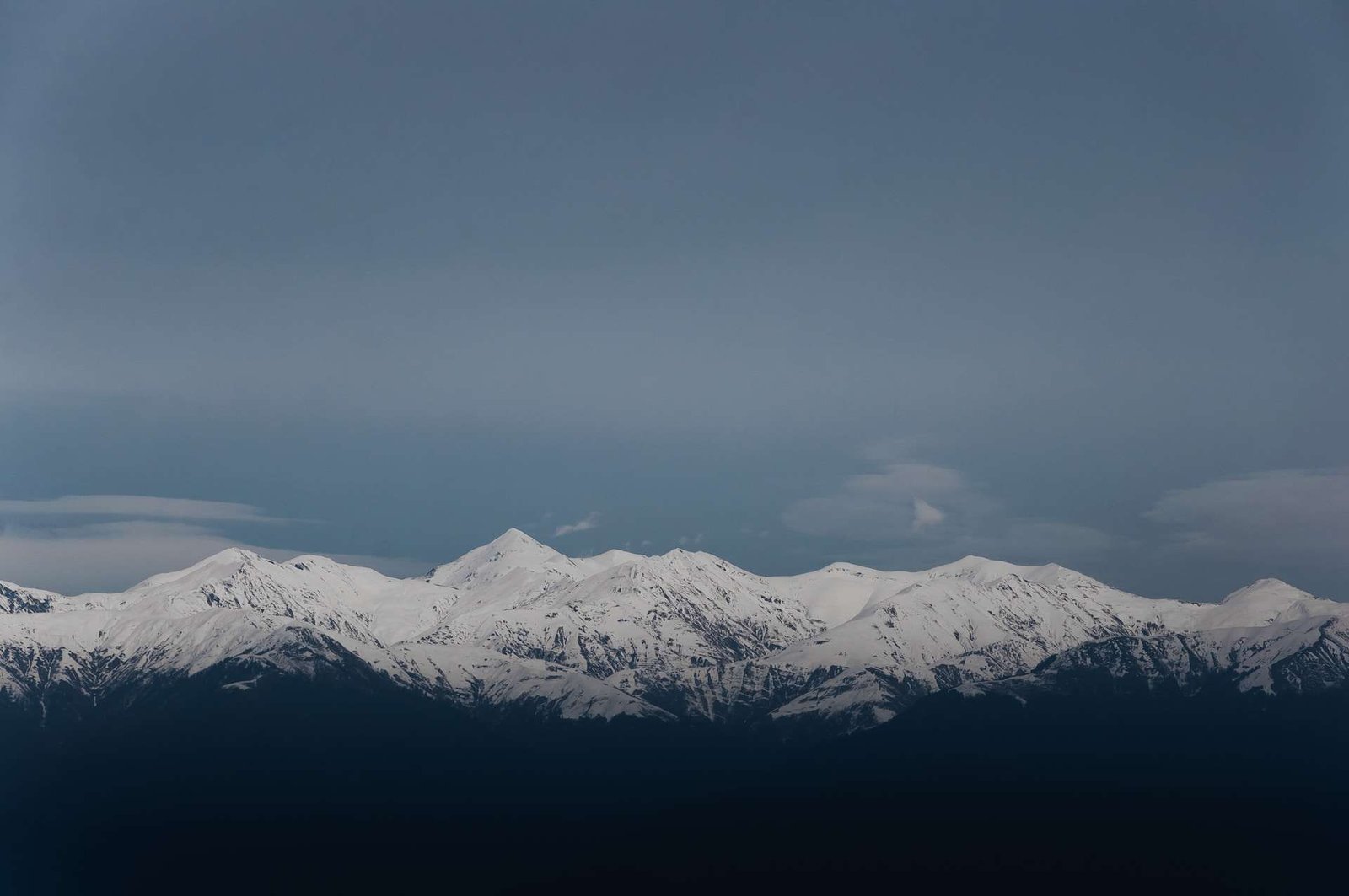
Physically, the region is dominated by the Greater Caucasus in the north and the Lesser Caucasus in the south. The Greater range runs for about 750 miles (1,200 kilometers) from the Taman Peninsula on the Black Sea to the Absheron Peninsula near Baku on the Caspian—an obvious candidate for a boundary.
The Short Answer — How People Draw the Europe–Asia Line Today
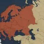
Most modern reference works split Europe and Asia along the watershed of the Greater Caucasus. This puts everything north of the crest (Ciscaucasia) in Europe and everything south (Transcaucasia/South Caucasus) in Asia. You’ll see this in standard encyclopedias and in school resources used around the world. For example, Encyclopaedia Britannica describes the crest as the widely accepted divider, and National Geographic similarly includes the Caucasus Mountains in Asia’s western border description.
Greater Caucasus Watershed Model
Using the main-divide (watershed) model, Russia’s North Caucasus republics (e.g., Dagestan, Chechnya, Kabardino-Balkaria) are in Europe, while Georgia, Armenia, and most of Azerbaijan lie in Asia. This is also the convention behind calling Mount Elbrus (18,510 feet / 5,642 meters) the highest mountain in Europe.
Kuma–Manych Depression Model
An alternative—common in older Russian geography and still referenced today—runs the boundary north of the mountains along the Kuma–Manych Depression, a lowland between the Don basin and the Caspian. Under this model, the entire Caucasus region sits in Asia. Britannica notes it is “often regarded as the natural boundary between Europe and Asia.”
Ancient Greek Lines
Classical authors such as Anaximander and Herodotus sometimes placed the boundary along rivers—most famously the Phasis (modern Rioni in Georgia) and then via the Kura to the Caspian. These historical lines show that the idea of a crisp, natural Europe–Asia border is much younger than the mountains themselves.
| Boundary Model | Line Used | What Counts as “Europe” in the Caucasus? | Key Implication |
|---|---|---|---|
| Greater Caucasus watershed (modern standard) | Crest of the Greater Caucasus | North Caucasus (in Russia) | Mount Elbrus is Europe’s highest peak at 18,510 ft (5,642 m). |
| Kuma–Manych Depression (alternative) | Lowland north of the ranges | Everything south of the depression—including all of the Caucasus—is Asia | Europe’s highest would revert to Mont Blanc if strictly applied. |
| Ancient Greek (Phasis–Kura) | Rioni (Phasis) → Surami Pass → Kura → Caspian | Northwest Transcaucasia could be counted as Europe | Shows historically shifting, idea-driven borders. |
Geology Isn’t a Continent Border
Geologically, the Caucasus are part of the Arabia–Eurasia collision zone. The mountains grow where the Arabian Plate pushes into the Eurasian Plate along complex thrusts and faults. That means the Europe–Asia question is not a plate-tectonics question: both “Europe” and “Asia” ride the same super-plate (Eurasia) here.
This collision has produced high seismicity and rapid relief. The Greater Caucasus host glaciers and Europe-class elevations, including Elbrus at 18,510 feet (5,642 meters). But geology tells us about mountain-building and earthquakes—not about cultural continents. In other words, rocks don’t vote on where Europe ends.
Culture & Institutions: How Organizations Classify the South Caucasus
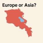
For statistics, the United Nations M49 geoscheme classifies Armenia, Azerbaijan, and Georgia as “Western Asia.” That is a pragmatic coding choice for global comparability, not a statement about identity. Still, it means many international datasets will bucket the South Caucasus with Asia.
Politically and culturally, however, the region has deep European linkages. All three South Caucasus states are members of the Council of Europe; in football they compete in UEFA tournaments—another signal of belonging to Europe’s institutional space. These memberships coexist with the UN’s Asian statistical code, which is why different reputable sources can disagree.
For readers, a useful rule of thumb is: maps (physical geography) often use the watershed model; datasets (statistics) often use UN M49; cultural institutions pick what fits their mission. That’s why your atlas, a UN report, and a match schedule might each tell a different “continent” story.
Verdict — Are the Caucasus in Europe or Asia?
If you’re asking as a geographer using modern atlases: the Europe–Asia line usually follows the Greater Caucasus crest. That places the North Caucasus (within Russia) in Europe, and the South Caucasus—Georgia, Armenia, and most of Azerbaijan—in Asia. This is also why Elbrus is widely listed as Europe’s highest mountain.
If you’re coding data to UN standards: Armenia, Azerbaijan, and Georgia are “Western Asia.” If you prefer an older Russian-school boundary (Kuma–Manych), then the entire Caucasus is in Asia. None of these lines is “more true”; each serves a different purpose. The key is to state which model you’re using.
FAQ
Is Mount Elbrus really the highest mountain in Europe?
Yes—under the standard watershed boundary, Elbrus (18,510 ft / 5,642 m) lies on the European side of the Greater Caucasus and tops the Seven Summits for Europe. If you move the boundary to Kuma–Manych, Elbrus becomes Asian and Mont Blanc (15,774 ft / 4,808 m) retakes Europe’s crown.
What do schools and kids’ atlases usually teach?
Most English-language resources (encyclopedias, school sites) show Asia’s western edge running along the Caucasus Mountains, alongside the Urals and the Bosporus–Dardanelles straits. Check National Geographic’s education page for a common wording.
How did the ancients draw the line?
Greek thinkers often used rivers—the Phasis (Rioni) and the Kura—plus mountain passes to sketch the boundary. Those ideas underline that “continents” were cultural categories long before GPS and modern mapping.
How big are the Caucasus Mountains?
The Greater Caucasus run about 750 miles (1,200 kilometers) across the isthmus; widths vary roughly 60–100 miles (100–160 kilometers).
What Did We Learn Today?
- The most used modern border puts the Europe–Asia line on the Greater Caucasus watershed.
- An alternative runs along the Kuma–Manych Depression, moving the entire Caucasus into Asia.
- UN statistics classify Armenia, Azerbaijan, and Georgia in Western Asia (for data, not identity).
- Geology explains mountain-building (Arabia–Eurasia collision) but not continental labels.
- Mount Elbrus is Europe’s highest peak under the watershed model: 18,510 ft (5,642 m).