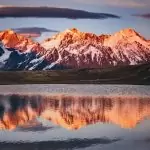
The Caucasus Mountains lie between the Black Sea and the Caspian Sea, forming a mountain system associated mainly with Russia, Georgia, Azerbaijan, and Armenia. The highest peak is Mount Elbrus in the Greater Caucasus at 18,510 feet (5,642 meters), while the broader system is best understood as two linked ranges rather than one single wall.
How to use this article: If you want the shortest version first, jump to the one-line map check; if you want the naming cleared up, use what counts as the Caucasus; for summit comparisons go straight to the peaks table; and for the continent question see the Europe-Asia line.
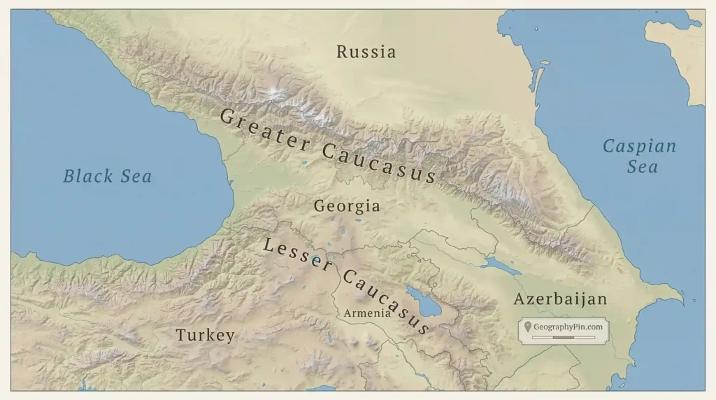
Where are the Caucasus Mountains on the map?
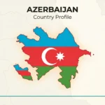
The Caucasus mountain system sits on the isthmus between the Black Sea to the west and the Caspian Sea to the east. In standard reference geography, the broader Caucasus region is associated with Russia, Georgia, Azerbaijan, and Armenia, though the main high wall most people picture is the Greater Caucasus crest running across the northern part of the region.
The one-line map check
If you open a physical map, find the Black Sea first, then move east toward the Caspian Sea: the long snow-bearing spine between them is the Greater Caucasus. NASA’s satellite material uses exactly that broad frame, describing the Caucasus Mountains as lying between those two seas and separating Russia to the north from Georgia and Azerbaijan to the south.
That matters because people often use “the Caucasus Mountains” in two different ways. Sometimes they mean the main Greater Caucasus crest only. Other times they mean the wider two-range mountain system, which includes the Lesser Caucasus farther south and the lower basins between them.
Greater Caucasus vs Lesser Caucasus
The Greater Caucasus is the dominant northern range and contains the system’s loftiest summits, including Elbrus. Britannica describes it as the backbone of the mountain system and notes that its watershed has traditionally been used in one of the better-known Europe-Asia dividing schemes. The Lesser Caucasus lies to the south, spread across parts of Georgia, Armenia, and Azerbaijan, and connects into the Armenian Highland.
What counts as the Caucasus?
For most readers, the safest way to think about the Caucasus is as a mountain system with two principal ranges. The Greater Caucasus is the high northern barrier; the Lesser Caucasus is the lower southern range system. Between them lies a belt of valleys and depressions, including the Kura-Aras lowland zone that helps separate the two on many regional maps.
| Part of system | Position on map | Countries commonly associated | Highest well-known point |
|---|---|---|---|
| Greater Caucasus | Northern main spine between the seas | Russia, Georgia, Azerbaijan | Mount Elbrus — 18,510 ft (5,642 m) |
| Lesser Caucasus | South of the main crest, tied into uplands and volcanic plateaus | Georgia, Armenia, Azerbaijan | Mount Aragats — 13,418 ft (4,090 m) |
The comparison above follows standard Britannica regional framing for the two ranges and the commonly cited high points most readers are actually looking for when they search this topic.
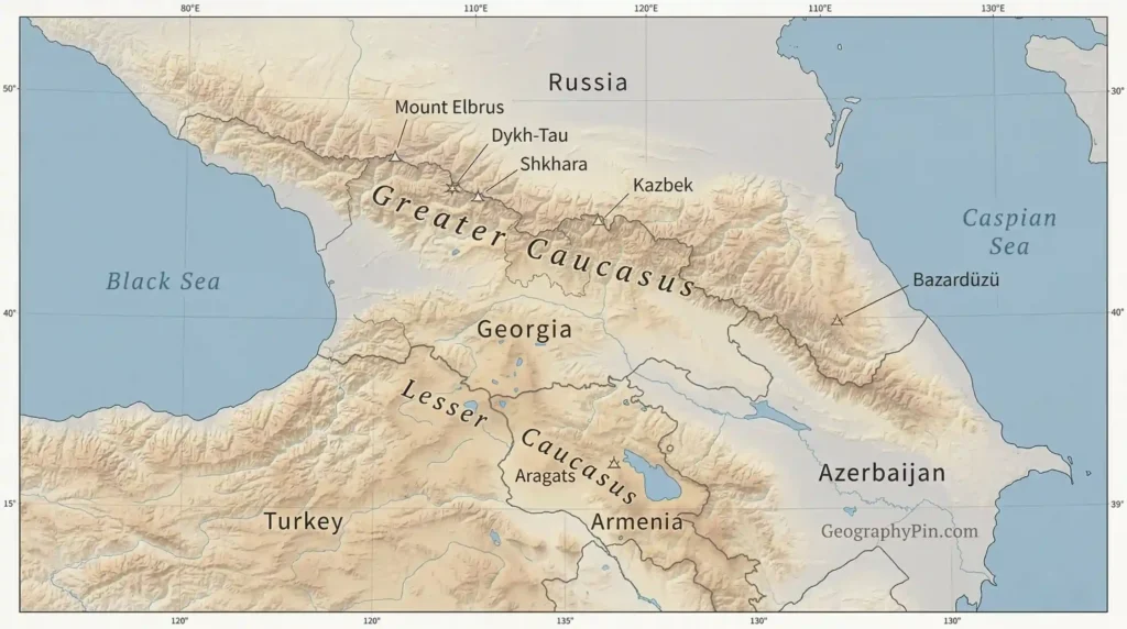
Highest peaks of the Caucasus
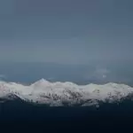
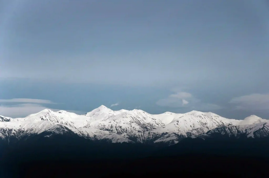
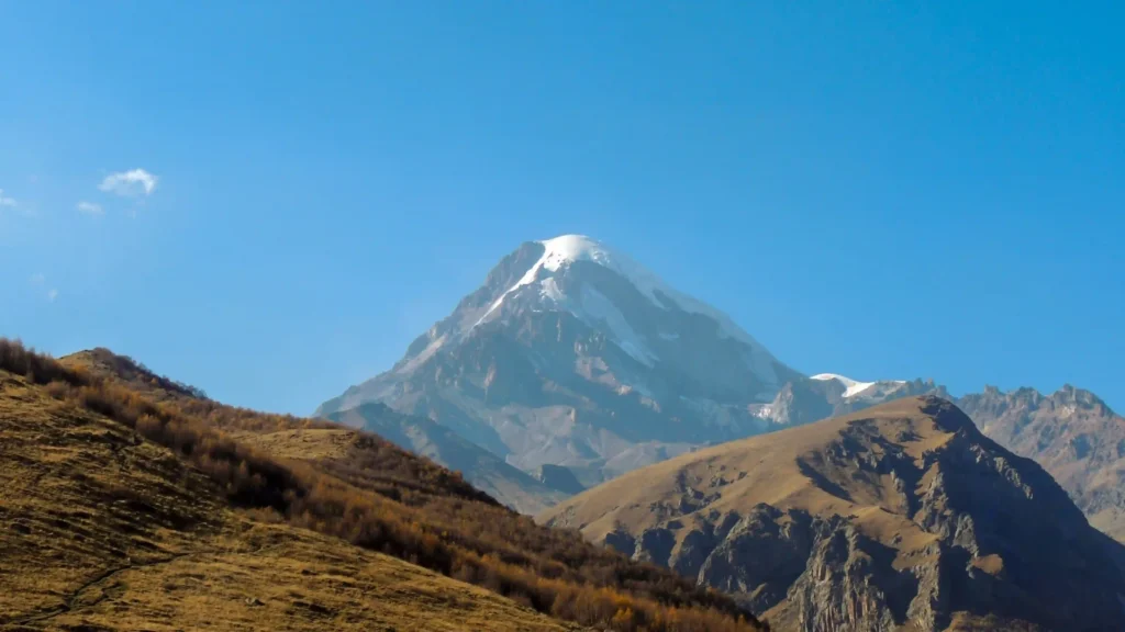
The highest peak in the entire Caucasus is Mount Elbrus, a glaciated volcanic massif in southwestern Russia that reaches 18,510 feet (5,642 meters). After Elbrus, the central Greater Caucasus includes several other very high summits, such as Dykh-Tau, Shkhara, and Kazbek.
Peaks table
Readers often mix three different questions together here: the highest peak in the whole Caucasus system, the highest peaks on the main Greater Caucasus crest, and the highest peak in the Lesser Caucasus. The table below separates those without pretending they are all the same category.
| Peak | Part of system | Location | Elevation | Why it matters |
|---|---|---|---|---|
| Mount Elbrus | Greater Caucasus | Southwestern Russia | 18,510 ft (5,642 m) | Highest peak in the Caucasus; often counted as Europe’s highest point |
| Mount Dykh-Tau | Greater Caucasus | Kabardino-Balkariya, Russia | 17,073 ft (5,204 m) | One of the loftiest central Caucasus summits |
| Mount Shkhara | Greater Caucasus | Georgia | 16,627 ft (5,068 m) | Highest point in Georgia |
| Mount Kazbek | Greater Caucasus | Northern Georgia | 16,512 ft (5,033 m) | Major volcanic peak and one of the best-known Caucasus mountains |
| Mount Bazardüzü | Greater Caucasus | Azerbaijan sector of the range | 14,652 ft (4,466 m) | Highest peak associated with Azerbaijan |
| Mount Aragats | Lesser Caucasus | Armenia | 13,418 ft (4,090 m) | Highest peak of the Lesser Caucasus |
One more useful marker for the eastern Greater Caucasus is Tebulosmta, which Britannica gives as 14,741 feet (4,493 meters) in the Chechnya sector. So if a map shifts your attention eastward away from Elbrus and Kazbek, that does not mean you have left the Greater Caucasus; it means you are following the same long crest into a different sector.
Are the Caucasus in Europe or Asia?
This is one of the main hidden questions behind the title. Britannica notes that the region is where Europe and Asia converge, and it adds that one widely accepted scheme places the dividing line along the crest of the Greater Caucasus. That is why the same mountain system appears in both European and Asian discussions, depending on what exactly is being classified.
The Europe-Asia line
The practical takeaway is simple: if a source follows the Greater Caucasus crest as part of the Europe-Asia boundary, Mount Elbrus is counted as Europe’s highest mountain. If a source uses a different continental boundary convention, the framing changes. So the “Europe or Asia?” argument is not really about moving the mountain; it is about which boundary rule the mapmaker uses.
What the landscape is like
The Caucasus is not just a single pretty skyline. Geologically, the Greater Caucasus has played a central role in absorbing convergence between the Arabian and Eurasian plates, which helps explain the region’s active tectonic setting, sharp relief, and earthquake significance. In plain language, this is a young and still dynamic mountain belt.
On the ground, conditions vary strongly from west to east and with elevation. Britannica notes especially heavy precipitation on south- and southwest-facing slopes, with some areas receiving more than 160 inches annually, while lowland and eastern sectors are much drier. Higher up, alpine conditions and long-lasting snow cover dominate the main crest.
That climate contrast is one reason the region combines glaciers, forested slopes, steppe margins, and major river headwaters in a relatively compact space. South of the mountains, the Kura and Aras system drains toward the Caspian, while rivers such as the Rioni and Inguri flow toward the Black Sea. NASA imagery and Britannica both highlight the glaciated high belt around peaks such as Elbrus and Kazbek.
How to read a Caucasus map quickly
A lot of map confusion disappears once you read the region in the right order. The useful habit is to orient yourself by the seas first, then by the main crest, and only after that by country borders. That keeps you from mistaking the whole Caucasus system for one country’s mountains alone.
A fast way to read the map
- Find the Black Sea on the west and the Caspian Sea on the east.
- Trace the long northern spine between them: that is the Greater Caucasus.
- Move south into the lower basin and upland belt: that is where the Lesser Caucasus comes in.
- Use Elbrus, Kazbek, and Shkhara as anchor names for the high Greater Caucasus.
- Remember that Armenia is tied more closely to the Lesser Caucasus and Armenian Highland setting than to the main Greater Caucasus crest.
That sequence matches standard reference mapping: a northern Greater Caucasus wall, a southern Lesser Caucasus range zone, and a broader regional frame shared mainly by Russia, Georgia, Azerbaijan, and Armenia.
FAQ
What is the highest mountain in the Caucasus?
Mount Elbrus is the highest mountain in the Caucasus at 18,510 feet (5,642 meters). It sits in the Greater Caucasus in southwestern Russia.
What is the highest mountain in Georgia?
Britannica identifies Mount Shkhara as the highest point in Georgia, at 16,627 feet (5,068 meters). It is part of the Greater Caucasus crest zone.
What is the highest peak in the Lesser Caucasus?
The highest peak in the Lesser Caucasus is Mount Aragats in Armenia, at 13,418 feet (4,090 meters). That makes it an important marker when a map is covering the southern range rather than the main northern crest.
Are the Caucasus Mountains only in Georgia?
No. The broader Caucasus mountain system is associated with Russia, Georgia, Azerbaijan, and Armenia. Georgia is central to the region, but it is only one part of the overall system.
Why is Mount Elbrus sometimes called Europe’s highest mountain?
Because one widely accepted boundary convention places part of the Europe-Asia divide along the crest of the Greater Caucasus. Under that convention, Elbrus counts as Europe’s highest mountain.
What Did We Learn Today?
- The Caucasus Mountains lie between the Black Sea and the Caspian Sea.
- The system is best understood as two main ranges: the Greater Caucasus in the north and the Lesser Caucasus in the south.
- Mount Elbrus is the highest peak in the whole Caucasus, while Mount Aragats is the highest in the Lesser Caucasus.
- The Europe-versus-Asia debate is really a boundary-convention issue, not a disagreement about where the mountains physically are.
Sources & Data Notes
For this piece, I relied on standard reference material for regional geography, mountain systems, peak elevations, and physical mapping, including major encyclopedia entries, satellite-based reference material, and geological background sources where they helped clarify the landscape. Some figures are rounded for readability, and small details can shift as reference databases are updated. Some maps or illustrative visuals on GeographyPin may also be AI-assisted during the design process, but the research, framing, and final written editorial judgment behind the article remain human.