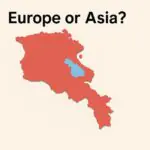
The phrase typically refers to Armenia, Azerbaijan, Georgia, and Russia (specifically its North Caucasus region). The Greater Caucasus watershed is often used as the Europe–Asia boundary, placing the North Caucasus in Europe and the South Caucasus—Armenia, Azerbaijan, and Georgia—in Asia, though usage varies across sources and institutions.
What Do We Mean by the “4 Countries of Caucasus”?
Most readers using the term “4 Countries of Caucasus” expect: (1) Armenia, (2) Azerbaijan, (3) Georgia, and (4) Russia via its North Caucasus. That’s because the mountains define a natural block, and the region’s shared history and geography make these four core to any discussion. However, some academic and policy texts speak of a wider “Caucasus region” that also considers adjacent states (Türkiye and Iran) due to deep cultural and economic ties. For clarity, this article focuses on the common four-country frame.
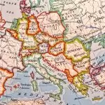
A key reason lists differ is how we draw the Europe–Asia line. Many atlases trace it along the crest (watershed) of the Greater Caucasus. Land north of that crest—including Russia’s North Caucasus republics—counts as Europe, while land to the south—Armenia, Azerbaijan, and most of Georgia—counts as Asia. Encyclopædia Britannica explains both the twin ranges (Greater/Lesser Caucasus) and the watershed convention clearly; it’s a reliable primer on the region’s physical geography.
The Europe–Asia Line Across the Greater Caucasus
The Greater Caucasus runs roughly northwest–southeast for ~750 miles (about 1,200 kilometers) with the Lesser Caucasus paralleling it to the south. Using the watershed as a boundary means most of Georgia sits south (Asia) but some valleys and peaks lie on the European side. International bodies also use statistical regions: under the UN M49 geoscheme, Armenia (051), Azerbaijan (031), and Georgia (268) are grouped in “Western Asia,” while the Russian Federation (643) is in “Eastern Europe.” See the UN Statistics Division for how those groupings work (UN M49 geoscheme).
| Country / Region | Capital (Admin Center) | Area — sq mi (km²) | Population (2024 est.) | Official language(s) | Subregion |
|---|---|---|---|---|---|
| Armenia (Հայաստան) | Yerevan | 11,484 sq mi (29,743 km²) | ≈2,973,840 | Armenian | South Caucasus (Asia) |
| Azerbaijan (Azərbaycan) | Baku | 33,436 sq mi (86,600 km²) | ≈10,336,577 | Azerbaijani | South Caucasus (Asia) |
| Georgia (საქართველო) | Tbilisi | 26,911 sq mi (69,700 km²) | ≈3,807,670 | Georgian | South Caucasus (Asia) |
| Russia — North Caucasus Federal District | Pyatigorsk (admin); largest city: Makhachkala | ~65,800 sq mi (≈170,400 km²) | ≈10,307,600 | Russian (+ regional languages) | North Caucasus (Europe) |
Country Profiles at a Glance
Armenia (Հայաստան / Hayastan)
A landlocked, mountainous republic centered on the Ararat plain, Armenia’s average elevations make summers warm and winters cold. The capital, Yerevan, is among the world’s oldest continuously inhabited cities. Armenia’s total area is about 11,484 square miles (29,743 km²). World population series put 2024 mid-year population near 2.97 million.
Armenian (an independent branch of the Indo-European family) is the official language, and the Armenian Apostolic Church is historically prominent. Since 1991 independence, the economy has moved from heavy industry toward services and tech, with diaspora links shaping investment and remittances.
Azerbaijan (Azərbaycan)
Azerbaijan stretches from the Greater Caucasus foothills to the Caspian shore, including the Nakhchivan exclave. Its total area is about 33,436 square miles (86,600 km²), and 2024 mid-year population estimates cluster near 10.34 million. Hydrocarbons drive the economy; the Baku–Tbilisi–Ceyhan pipeline and South Caucasus Gas Pipeline connect the Caspian basin to global markets (CIA Factbook: Azerbaijan). Azerbaijani (a Turkic language) is official; Islam (predominantly Shia) is the largest faith.
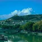
Georgia (საქართველო / Sakartvelo)
Bridging the Black Sea coast and the Greater/Lesser Caucasus, Georgia spans wine valleys, alpine zones, and subtropics. Area totals about 26,911 square miles (69,700 km²). Mid-2024 population estimates are near 3.81 million (Worldometer/UN series; the World Bank overview cites “over 3.6 million”). The Kartvelian language Georgian is official, with its own unique script. Corridor projects like the Baku–Tbilisi–Kars railway make Georgia central to Trans-Caspian trade (World Bank: Georgia overview).
Russia’s North Caucasus (North Caucasus Federal District)
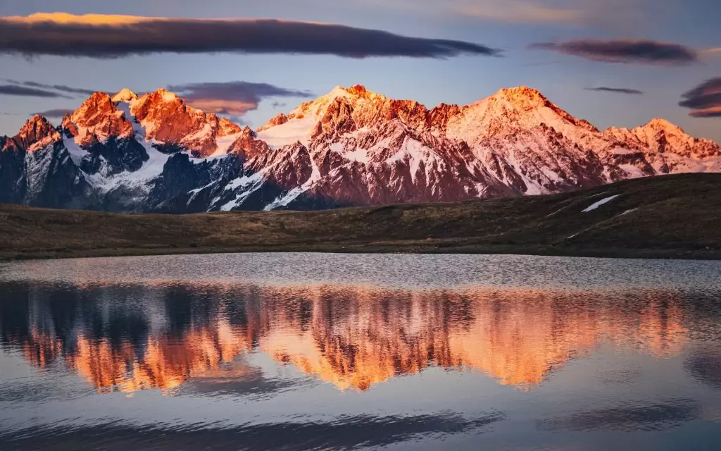
Russia’s North Caucasus—Dagestan, Chechnya, Ingushetia, North Ossetia–Alania, Kabardino-Balkaria, Karachay-Cherkessia, and Stavropol Krai—covers about 65,800 square miles (≈170,400 km²). Its population surpassed 10.25 million in 2023 and ~10.31 million in 2024, with Pyatigorsk as administrative center and Makhachkala (Dagestan) the largest city. The area is Europe by the watershed convention, and hosts Mount Elbrus, Europe’s highest summit at 18,510 feet (5,642 meters), a dormant stratovolcano.
The Geography That Binds Them: Ranges, Peaks, Seas
Two parallel systems define the map: the Greater Caucasus to the north and the Lesser Caucasus to the south. Between them lie high basins and plateaus, with rivers draining west to the Black Sea and east to the Caspian. The range’s overall length is about 750 miles (1,200 kilometers), and its width varies from roughly 30–180 miles (50–300 kilometers). This tightness of space explains why climates change sharply over short drives.
Mount Elbrus dominates at 18,510 feet (5,642 meters), edging out Mont Blanc in the Alps. Its twin cones and extensive glaciers make it a classic high-altitude climb, typically via the southern routes with cableway support to about 12,630 feet (3,850 meters). The high passes and stepped valleys also channeled human movement: today’s road and rail corridors often trace old caravan lines along the Kura–Aras lowlands and the coastal plains.
People, Languages, and Faiths
This is one of Earth’s most linguistically diverse corners. Armenian stands alone within Indo-European; Georgian anchors the Kartvelian family with related Mingrelian, Laz, and Svan. Azerbaijani is Turkic and mutually intelligible to varying degrees with Turkish. North Caucasus languages include Nakh (Chechen, Ingush), Northeast Caucasian (Avar, Dargwa, Lezgi, etc.), and Northwest Caucasian (Kabardian, Adyghe). Russian serves as a lingua franca across the northern slope.
Religious maps overlay the language mosaic. Armenia’s historical majority is Armenian Apostolic Christian; Georgia’s is Georgian Orthodox; Azerbaijan’s is predominantly Muslim (mostly Shia, with Sunni communities). The North Caucasus is majority Muslim overall but mixed at the republic level (for example, Stavropol Krai is mainly Russian Orthodox). This cultural complexity shapes holidays, architecture, cuisine, and daily etiquette across short distances.
Politics, Corridors, and Cooperation
Borders here were redrawn in the 19th–20th centuries and again with the Soviet breakup in 1991. Since then, local conflicts and peace efforts have influenced trade, transit, and demographics. Energy and transport links—like the Baku–Tbilisi–Ceyhan oil pipeline, the South Caucasus Gas Pipeline, and the Baku–Tbilisi–Kars railway—tie the Caspian basin to the Mediterranean and Europe. International organizations and partners (EU, UN agencies, IFIs) engage on reconstruction, connectivity, and governance programs, while national policies aim to diversify economies beyond raw commodities.
For basic country data and classifications used by many researchers, the UN M49 framework is helpful. It groups Armenia, Azerbaijan, and Georgia in “Western Asia” for statistics, and places the Russian Federation in “Eastern Europe”—a reminder that “continent” labels depend on context, not just mountains.
Visiting the Caucasus: Practical Orientation
Distances are deceptively short but often slow because roads thread valleys and passes. A Tbilisi–Yerevan trip is about 180 miles (290 kilometers) by road, but can take 5–6 hours; Baku–Tbilisi is ~350 miles (560 kilometers) by rail via the modernized corridor. Summer brings alpine trekking; winter opens ski areas like Gudauri (Georgia) and Elbrus (Russia). Spring and early autumn offer pleasant temperatures and clearer air.
Etiquette matters. Dress modestly at religious sites, learn simple local phrases (even “gamarjoba” in Georgian or “barev” in Armenian goes far), and ask before photographing people. In mountain areas, weather shifts fast—always carry layers and water. Check current entry rules, permits (some border zones require passes), and travel advisories before you go. For background geography and route planning, start with an objective encyclopedia overview of the ranges and watershed convention.
FAQ
Are the 4 countries of the Caucasus in Europe or Asia?
By the watershed convention, the North Caucasus (Russia) is in Europe and the South Caucasus (Armenia, Azerbaijan, Georgia) is in Asia. Some sources treat the three South Caucasus states as “transcontinental” in culture and institutions; the UN M49 geoscheme places them in Western Asia for statistics.
What is the highest point of the Caucasus?
Mount Elbrus at 18,510 feet (5,642 meters) in Russia’s North Caucasus. It is commonly listed as Europe’s highest mountain and one of the Seven Summits.
Why do some lists include Türkiye or Iran?
Broader “Caucasus region” discussions sometimes include adjacent countries because major trade routes, ethnic groups, and historical states cross modern borders. But in the strict mountain-based sense, the core four are Armenia, Azerbaijan, Georgia, and Russia’s North Caucasus.
What Did We Learn Today?
- The phrase “4 Countries of Caucasus” most often means Armenia, Azerbaijan, Georgia, and Russia’s North Caucasus.
- The Greater Caucasus watershed is a common Europe–Asia line; north = Europe, south = Asia.
- The range spans ~750 miles (1,200 kilometers) with sharp climate and culture shifts over short distances.
- Elbrus is the region’s and Europe’s high point at 18,510 feet (5,642 meters).
- UN statistics group Armenia, Azerbaijan, and Georgia in Western Asia; Russia is classed in Eastern Europe.