What Makes Yerevan Armenia’s Capital?
With nearly 2,800 years of unbroken urban life, Yerevan is one of the world’s oldest continuously inhabited capitals. Its enduring role as Armenia’s seat of power stems from a unique combination of historical legacy, geographic advantage, and modern administrative prominence.
- Historical Continuity: Founded as the Urartian fortress of Erebuni in 782 BCE, Yerevan has remained the political heart of Armenian kingdoms, empires, and republics.
- Strategic Crossroads: Nestled in the fertile Ararat plain near ancient trade routes, it links the Caucasus with Anatolia and Iran, reinforcing its geopolitical importance.
- Administrative Nexus: The Presidential Palace, National Assembly, Supreme Court, and all key ministries are based here—centralizing executive, legislative, and judicial functions.
- Cultural Epicenter: Iconic institutions like the Matenadaran manuscript repository, Armenian National Gallery, and State Opera House anchor the nation’s cultural identity.
- Symbolic Landscape: Monumental architecture—from Republic Square’s cascade to Tsitsernakaberd Memorial—imbues the cityscape with national memory and pride.
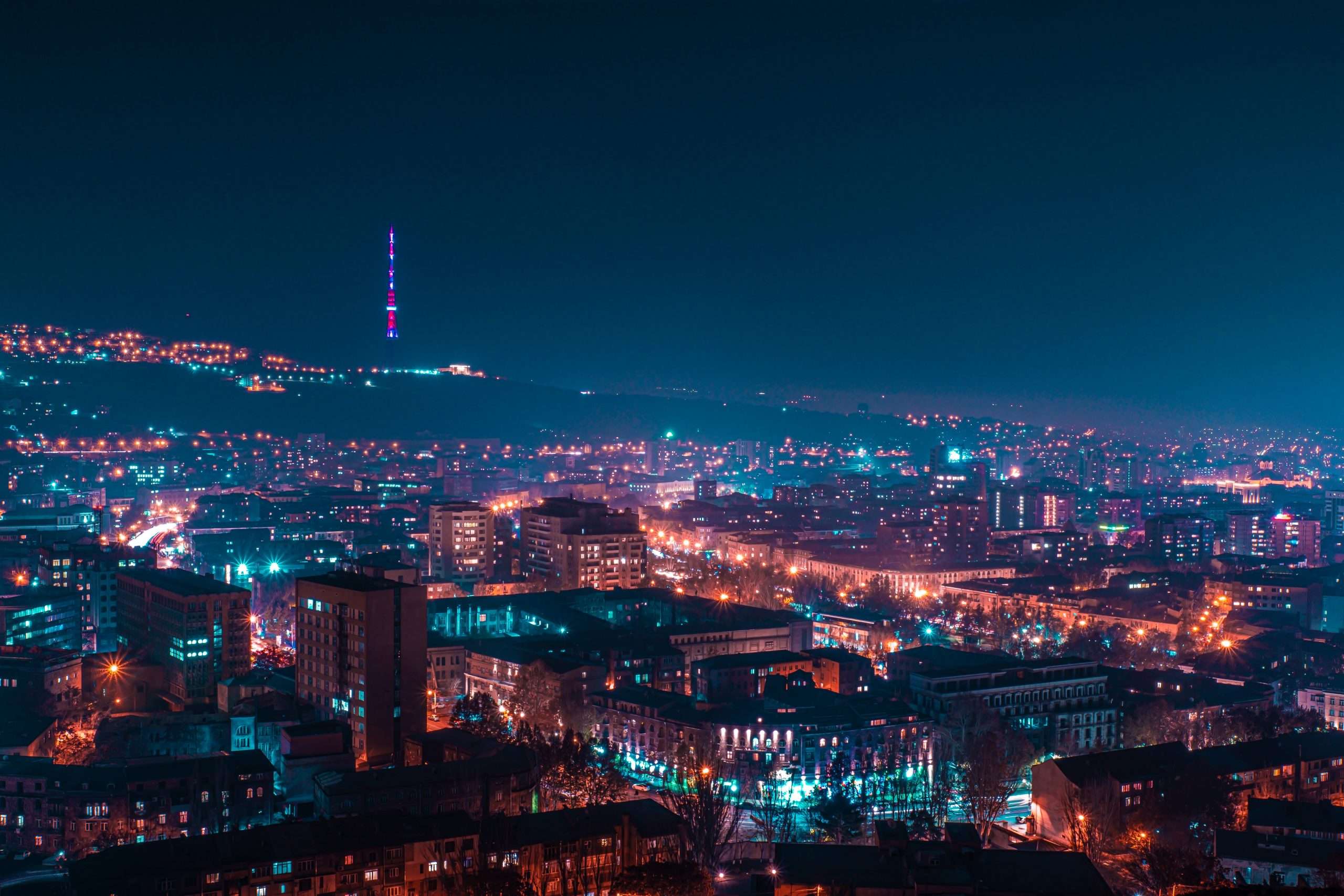
Geographic Setting & Climate
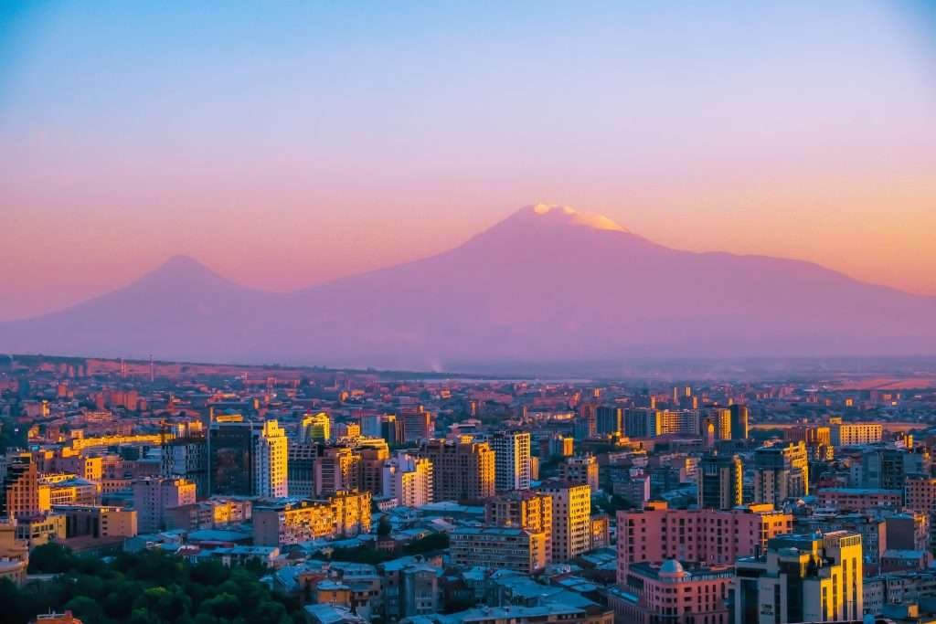
Located at 40.1872° N, 44.5152° E, Yerevan sits in the fertile Ararat Valley, framed by Mount Ararat just 16 km to the south and the Geghama hills to the east. At an elevation of 3,248 ft (990 m), the city experiences a Dfb (humid continental) climate, with significant daily and seasonal temperature swings.
- Sunny Days: Over 300 days of sunshine per year, giving neon-orange apricot blossoms in spring.
- Temperature Range: Summer highs average 85–95 °F (29–35 °C), while winter lows can dip to 20 °F (–6 °C) overnight.
- Precipitation: Annual rainfall totals around 16 in (410 mm), mostly between March and May.
- Microclimates: Hillside neighborhoods like Davtashen and Kanaker are 2–5 °F cooler in summer than the central plateau.
| Season | Avg High (°F) | Avg Low (°F) | Rainfall (in) |
|---|---|---|---|
| Spring (Mar–May) | 64 | 46 | 6.5 |
| Summer (Jun–Aug) | 90 | 64 | 1.2 |
| Autumn (Sep–Nov) | 71 | 49 | 4.8 |
| Winter (Dec–Feb) | 48 | 28 | 3.5 |
These climate patterns—sourced from the National Statistical Service of Armenia and local meteorological surveys—shape Yerevan’s agricultural ring and inform city planning for water conservation and green space expansion.
Yerevan vs. Other Caucasus Capitals
While Tbilisi and Baku stand as vibrant regional centers, Yerevan’s millennia‑long heritage, elevation, and urban continuity set it apart:
- Age & Continuity: Yerevan (782 BCE) predates Tbilisi (5th century CE) and Baku (12th century CE) by over a millennium, making it the oldest continuously inhabited capital in the Caucasus.
- Elevation: At 3,248 ft, Yerevan sits over 2,000 ft higher than Tbilisi and 3,100 ft above Baku’s Caspian Sea level, lending cooler summers and distinct air quality.
- Cultural Legacy: Yerevan’s Urartian ruins, Soviet‑era grand avenues, and modern art scene contrast with Tbilisi’s eclectic balconies and Baku’s fusion of medieval walled city and flame towers.
- Population & Density: Home to 1.1 M residents within 90 mi², Yerevan is denser than Tbilisi’s 1.2 M over 150 mi² but less crowded than Baku’s 2.3 M in 130 mi².
- UNESCO Recognition: While Tbilisi and Baku feature UNESCO World Heritage Sites, Yerevan’s Erebuni Fortress and the Araqs citadel await full inscription—reflecting both its depth of history and ongoing heritage efforts.
| Metric | Yerevan | Tbilisi | Baku |
|---|---|---|---|
| Founded | 782 BCE | 5th century CE | 12th century CE |
| Elevation | 3,248 ft | 1,217 ft | 92 ft |
| Population (2025) | 1.1 M | 1.2 M | 2.3 M |
| Area | 90 mi² | 150 mi² | 130 mi² |
| UNESCO Sites | Pending inscription | 2 (Historic District, Monastery) | 2 (Old City, Cultural Landscape) |
| Climate Type | Humid continental | Humid subtropical | Desert |
Historical Evolution
Yerevan’s journey from an ancient frontier fortress to a modern capital weaves together dynastic shifts, imperial contests, and visionary urban planning. Each era layered new identities onto the city’s enduring core.
- Urartian Foundation (782 BCE): King Argishti I erects the Erebuni fortress atop Arin Berd, planting the seeds of a settlement that would become Yerevan’s historic nucleus.
- Medieval Resilience (4th–15th c.): Under the Arsacid and Bagratid kingdoms, Yerevan evolves as a trade stop; survives Seljuk raids, Mongol incursions, and Persian-Ottoman skirmishes, continually rebuilding around caravanserais and churches.
- Persian-Ottoman Era (16th–18th c.): Strategic location makes Yerevan a pawn between Safavid Persia and Ottoman forces; periodic destruction gives way to mercantile revival as Armenian merchants foster silk and textile trades.
- Russian Annexation (1828): The Treaty of Turkmenchay transfers Yerevan to the Russian Empire. Russian engineers draft a grid plan; Armenian civic leaders fund schools, printing presses, and the first modern bank, propelling population growth from 7,000 to nearly 30,000 by 1873.
- Soviet Capital (1920–1991): Declared capital of the Armenian SSR, Yerevan undergoes a grand transformation under architect Alexander Tamanyan. Broad avenues, Republic Square, and prefabricated housing reflect Soviet ideals fused with Armenian motifs, boosting industrial output and urban population to over 800,000 by 1989.
- Post‑Independence Revival (1991–2000s): The 1988 earthquake’s aftermath and economic blockades test the city’s resilience. Diaspora donations fund restoration of Matenadaran and Noyan Tapan, while small private enterprises spur coffeehouses and art studios.
- 21st‑Century Renaissance: Yerevan embraces globalization—restoration of historic districts, rise of the Cascade arts complex, and tech incubators in Armenia Tech Park. Contemporary architecture punctuates pink-stone facades, symbolizing a forward-looking capital rooted in antiquity.
Political & Administrative Role
The Presidential Palace and Government House dominate Baghramyan Avenue. Over 90 embassies and international bodies—OSCE, UNDP—line the capital, underlining its diplomatic importance. Yerevan hosts regular sessions of the Eurasian Economic Union’s committees and sits on the UNESCO World Heritage Tentative List for its historic fortress (source: UNESCO).
Economic & Cultural Hub
According to the National Statistical Service of Armenia, Yerevan contributes over half of Armenia’s GDP. Key drivers include:
- High-Tech & IT: Rapidly growing clusters in Nork-Marash and Kentron districts.
- Manufacturing: Food processing, chemicals, and light industry in the Erebuni and Malatia-Sebastia zones.
- Tourism & Hospitality: 2 million annual visitors exploring Old Town, cafes, and the Cascade complex.
- Arts & Education: Home to the National Gallery, Matenadaran, and Yerevan State University.
Urban Landscape & Infrastructure

Spanning the Hrazdan River gorge and radiating from Republic Square, Yerevan’s urban fabric blends Soviet‑era planning with post‑independence expansions. Key infrastructure highlights include:
- Metro & Public Transit: A single-line metro system covers 21 km (13 mi) with 10 stations, handling over 70 million riders annually. A fleet of 800+ buses, minibuses (marshrutka), and 10 tram routes complement rail transit.
- Road Network: Four major radial avenues (Baghramyan, Tigran Mets, Marshal Bagramyan, and Mashtots) converge on Kentron, linked by the 29 km Yerevan Ring Road, which encircles residential and industrial districts.
- Air Connectivity: Zvartnots International Airport, 13 mi (21 km) west of the city center, serves 25+ airlines with direct flights to Europe, Russia, and the Middle East, handling 3 million passengers annually.
- Green & Public Spaces: Over 100 parks and gardens—Lovers’ Park, Botanical Garden, and the sprawling Victory Park—cover nearly 12% of the city, providing urban lungs amid concrete.
- Water & Energy: The Sevan–Hrazdan tunnel system delivers 50 million m³ of freshwater yearly; three Hrazdan hydroelectric plants generate over 300 MW, powering streetlights and metro trains.
- Telecommunications: Citywide fiber‑optic backbone and 4G coverage enable 2 million mobile subscriptions; pilot 5G trials began in 2024, targeting smart‑city applications (traffic management, public safety).
- Cycling & Pedestrian Initiatives: A growing network of 20 km bike lanes and the Yerevan Velobike share program encourage eco‑friendly mobility, while pedestrianization of Northern Avenue and Abovyan Street enhances walkability.
Demographics & Society
With 98% Armenians, the capital also hosts small Yazidi, Russian, and Assyrian communities. Annual rural‑to‑urban migration keeps growth steady at ~0.3%. Indicators for healthcare, literacy (99%), and safety consistently outpace regional peers.
Challenges & Future Outlook
- Seismic Risk: Retrofitting 20th‑century concrete blocks remains urgent.
- Traffic Congestion: New ring roads and BRT lines aim to ease city‑center gridlock.
- Water Management: Upgrading Soviet‑era reservoirs and pipelines to secure supply.
- Sustainable Growth: Expanding parks and solar‑energy adoption under the “Green Yerevan” plan.
Top 8 Facts You Need to Know About Yerevan
- Founded in 782 BCE as the Urartian fortress Erebuni—predating Rome by nearly two decades.
- Pink City: Nearly every building is clad in local salmon-hued tufa stone.
- Sunniest Capital: Boasts over 300 sunny days per year.
- Metro Milestone: Home to one of the world’s longest metro escalators (23.5 m).
- Cultural Treasures: Houses the Matenadaran with over 17,000 manuscripts.
- Cascade Complex: A 572-step stairway featuring contemporary art galleries.
- UNESCO Tentative: Erebuni Fortress and Arin Berd are on Armenia’s UNESCO tentative list.
- Apricot Capital: Celebrates an annual harvest festival honoring its national fruit.
FAQ
How old is Yerevan?
Established in 782 BCE, it is one of the world’s oldest continuously inhabited capitals.
What is the population of Yerevan in 2025?
Approximately 1,100,000 residents.
Where is Yerevan located?
On the Hrazdan River in the Ararat Valley, at 990 m (3,248 ft) elevation.
Why is Yerevan the capital, not Gyumri or Vanadzor?
Its ancient roots, central plain location, and role as political and cultural hub have made it the enduring seat of power.
What Did We Learn Today?
- Yerevan has served as Armenia’s capital since 782 BCE.
- It remains the country’s political, economic, and cultural core.
- Strategic geography and continuous settlement cement its status.
- Modern challenges—seismic safety, traffic, sustainability—drive urban planning today.